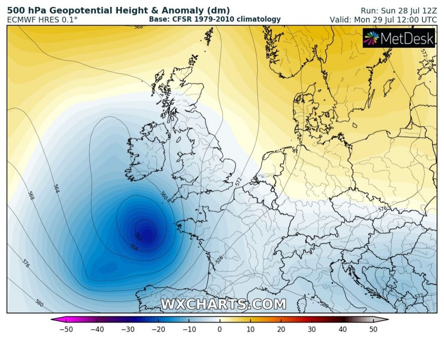
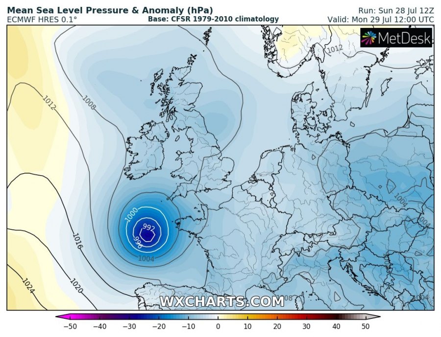
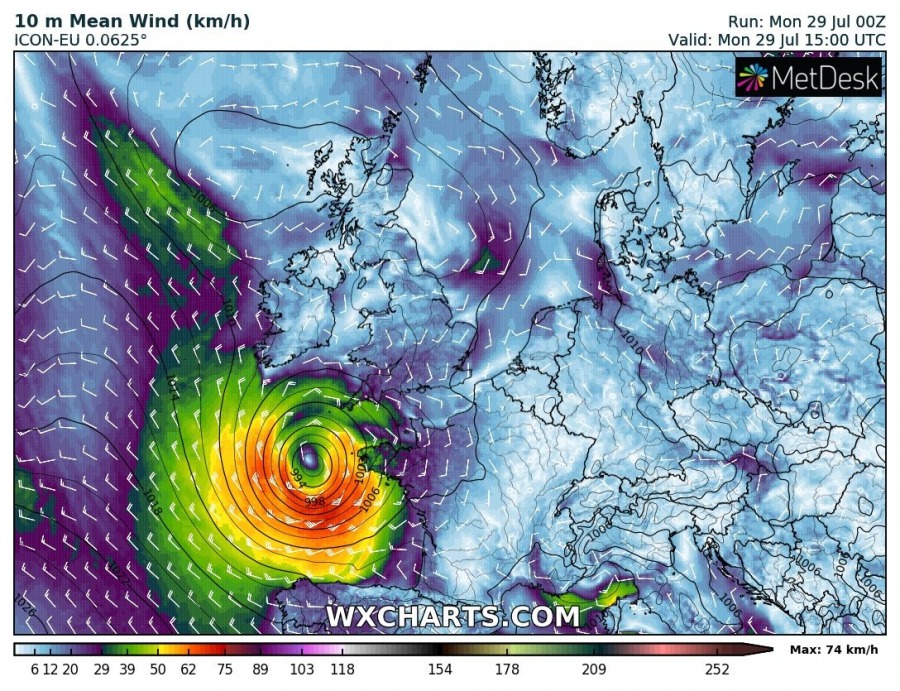
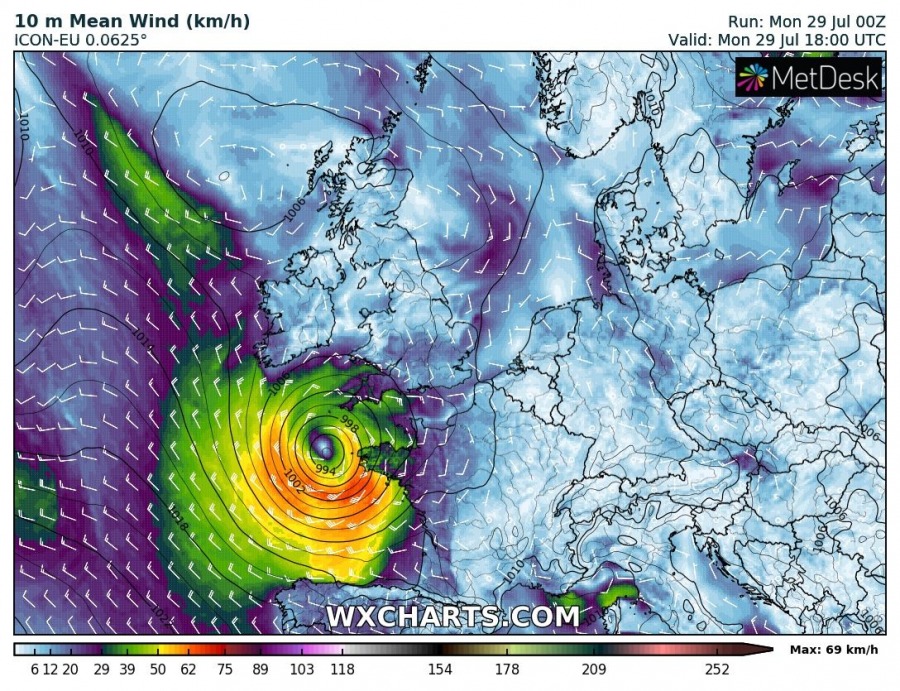
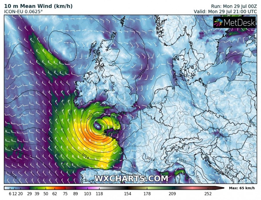
A quite unusual event is expected today as a rather deep cyclone (central pressure this morning was around 987 mbar, July 29th) has developed over the Bay of Biscay and will bring severe winds into NW France and SW England this evening. High waves are also likely along the coastal areas of Brittany.
The pattern over Europe indicates a ridge over the Arctic region while a deep trough / low is over the Bay of Biscay. An associated deep surface cyclone is moving towards NW France and S England.
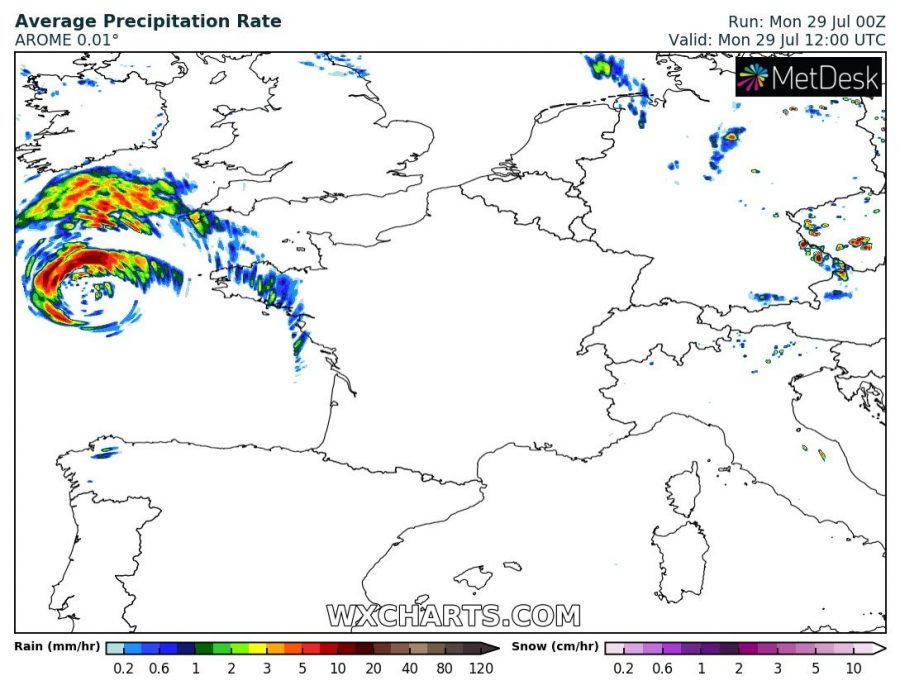
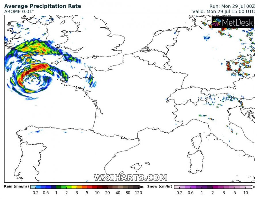
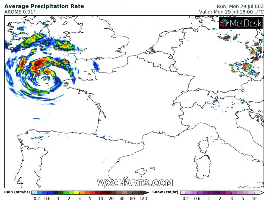
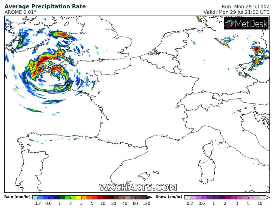
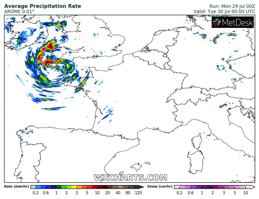
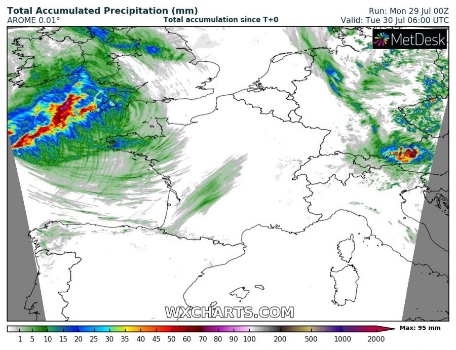
A high-resolution AROME model forecast of rainfall rate, indicating an impressive structure of the cloud/rain bands surrounding the core of the cyclone. Some storms will be possible and therefore torrential rainfall with gusty winds.
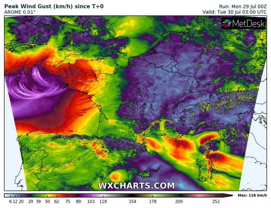
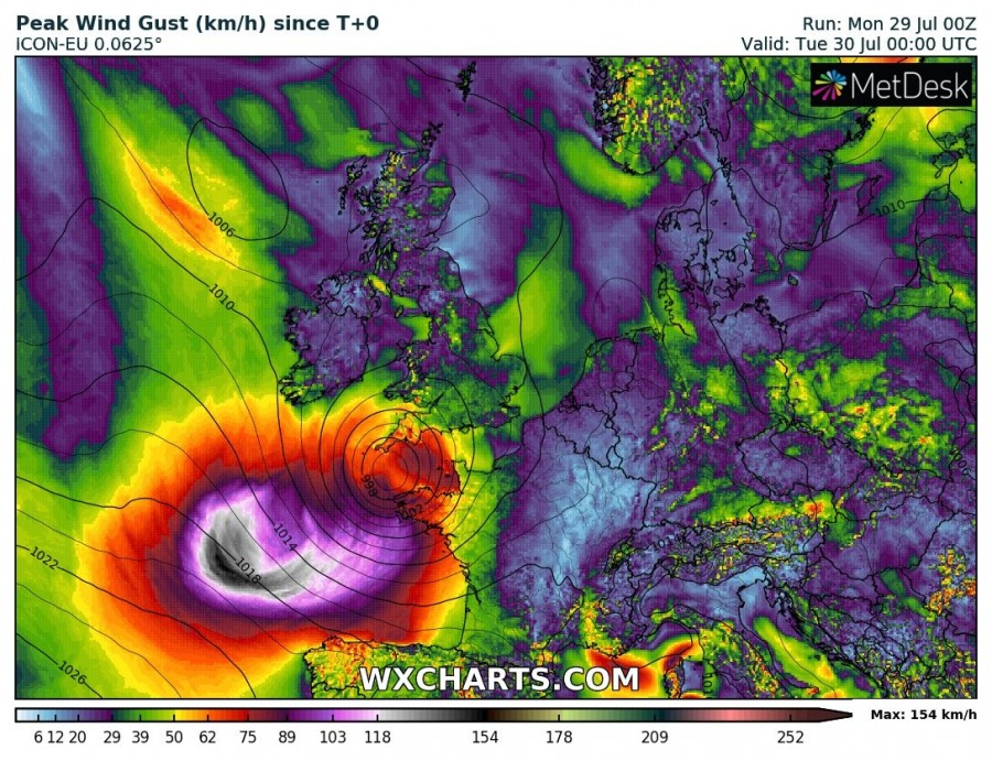
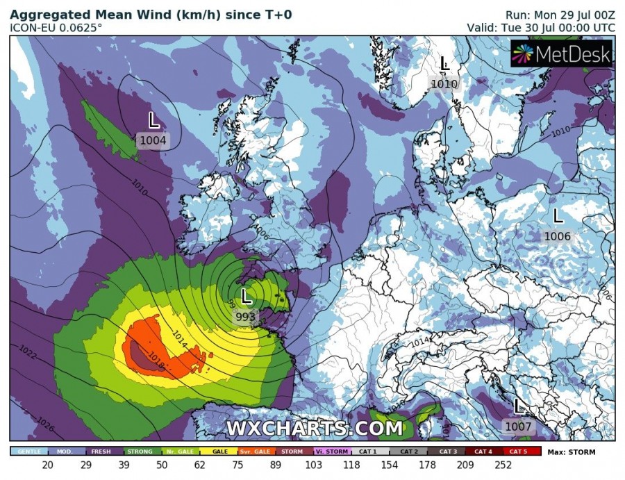
Peak wind gusts per AROME and ICON-EU models. Both are indicating severe to extremely severe gusts locally possible, reaching 100-120 km/h!
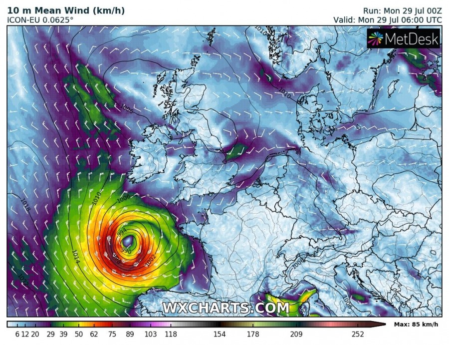
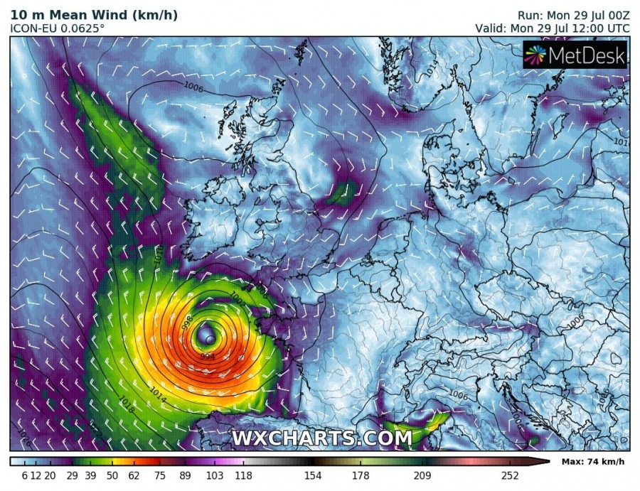
The cyclone will track northeastwards across the Bay of Biscay today, reaching NW France (Brittany) early this evening and then continue into the English channel and SSW England overnight with a gradual weakening trend. Attached are 10m winds from the ICON-EU model.
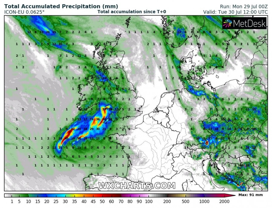
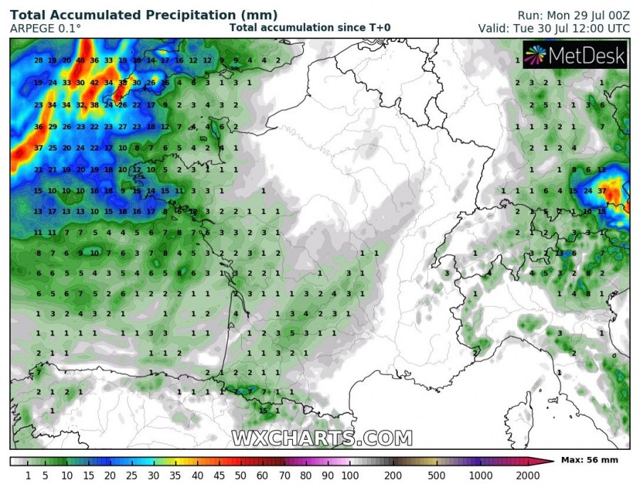
Total rainfall amount will not be extreme, but a good amount of rain (30-60 mm) is locally possible across SW England tonight.
Stay alert!
