SYNOPSIS
A large deep trough / low is located over NW Russia while ridge across N Europe ejects towards Greenland. A large trough over WSW Europe is gradually weakening while progressing east. Short-waves effect N Africa, E Iberia, S Balkans and Turkey.
DISCUSSION
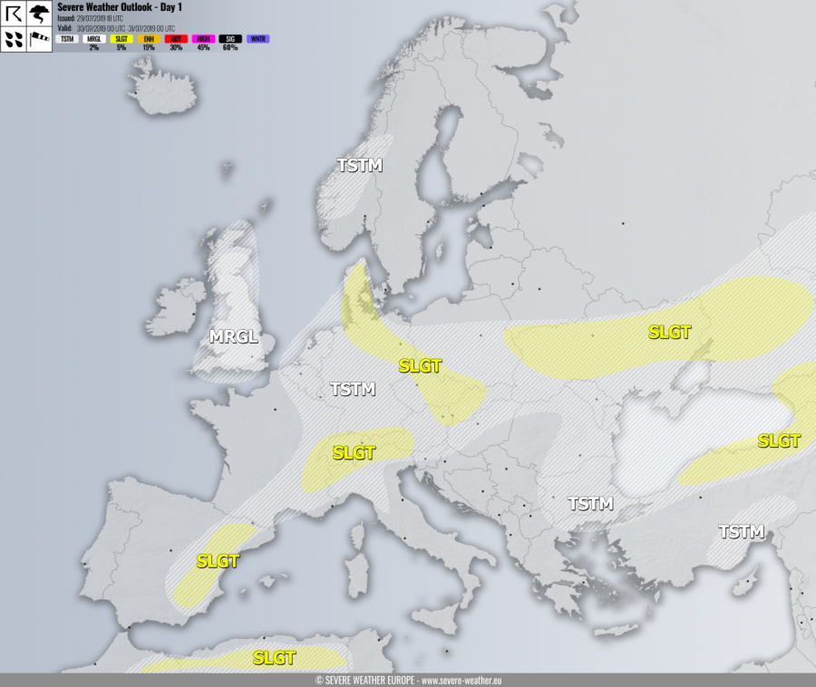
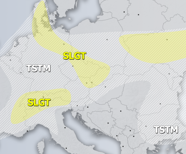
SLGT risk has been issued for Denmark, NE Germany, SW Poland, E Czechia, W Slovakia into NE Austria with threat for severe storms, capable of producing torrential / excessive rainfall and marginal hail. Almost uncapped moderate instability under very low shear should produce widespread slow-moving storms with flash floods threat.
SLGT risk has been issued for the Alpine region with threat for severe storms, capable of producing severe winds, large hail and torrential rainfall. Diurnal driven storms with flash floods threat are expected. A few supercells are also possible across the western parts of the risk area where better shear is present.
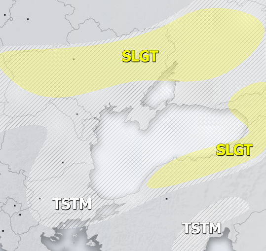
SLGT risk has been issued for Ukraine into W Russia with threat for severe storms, capable of producing severe winds, marginally large hail and torrential rainfall. Scattered organized storms are possible along the moving cold front under moderate shear but weak instability, including some supercells with large hail and severe winds.
SLGT risk has been issued for the NNE Turkey into Georgia with threat for severe storms, capable of producing severe winds, large hail and torrential rainfall. Organized storms are possible under moderate shear and MLCAPE, including some supercells with large to very hail as a primary threat.
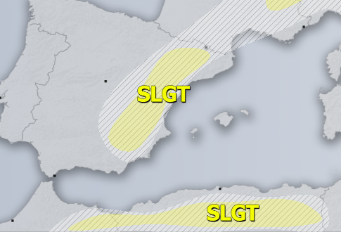
SLGT risk has been issued for the E Spain with isolated threat for severe storms, capable of producing severe winds and large hail. A few isolated supercells are possible under moderate shear and MLCAPE.
SLGT risk has been issued for the N Algeria into NE Morrocco with isolated threat for severe storms, capable of producing severe winds and large hail.
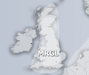
MRGL risk has been issued for England, Wales and S Scotland with isolated threat for severe storms, capable of producing severe winds and tornadoes. A strong LL shear associated with a decaying cyclone would spawn a tornado or two under the strongest cells this afternoon.
TSTM risk areas have been placed where convective storms are likely to occur but should remain sub-severe.
