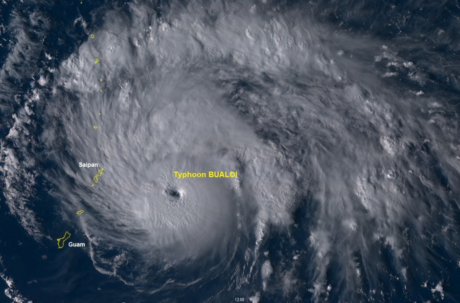
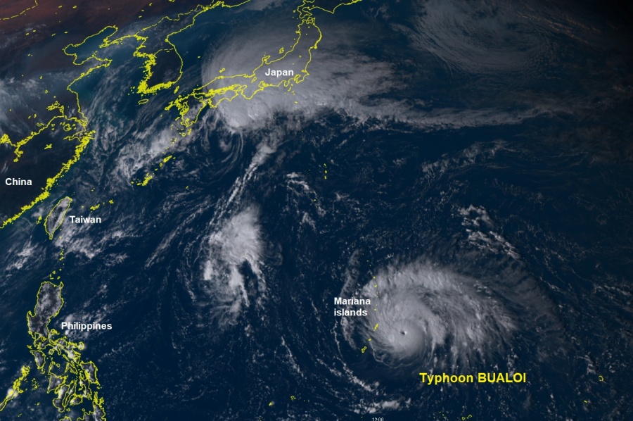
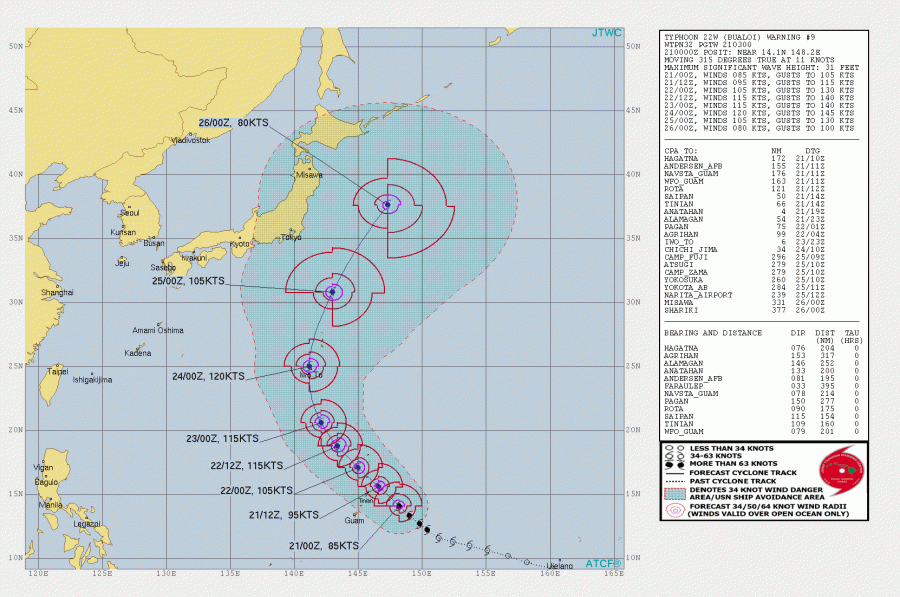
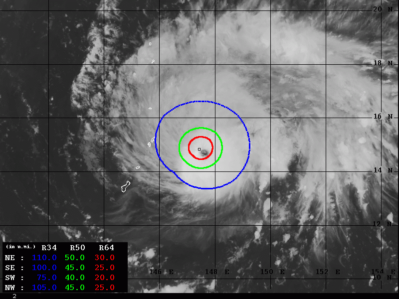
As more or less expected, typhoon Bualoi continued its gradual strengthening during the 24 hours, but it is now beginning its rapid intensification phase. It continues towards the northern Mariana islands and should pass north of the island Saipan later today. A direct hit of Japan’s Iwo Jima islands seems increasingly likely on Thursday, Oct 24th – with a Category 4 strength and sustained winds of 120 kt / 140 mph!
Latest satellite imagery reveal an impressive structure of the typhoon, with textbook outflow ventilation through the NE / NW quadrants with some drier mid-levels across SE / SW quadrants. However, upper-level outflow seems to be improving towards the south as well. Altogether this leads to a more rapid intensification in the last hours, the tiny eye has become visible with intense convection bands and a developing eyewall.
https://www.facebook.com/severeweatherEU/videos/683563468820719/
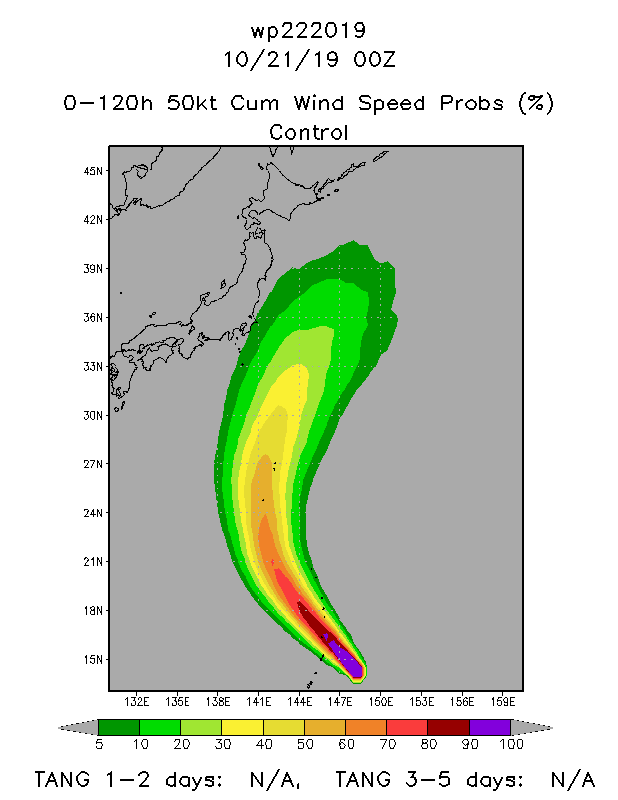
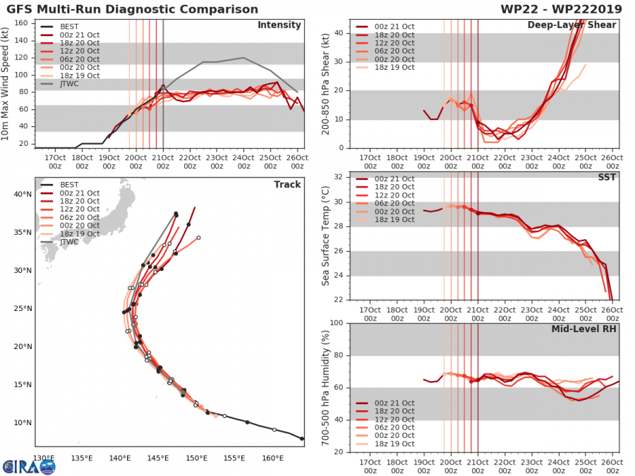
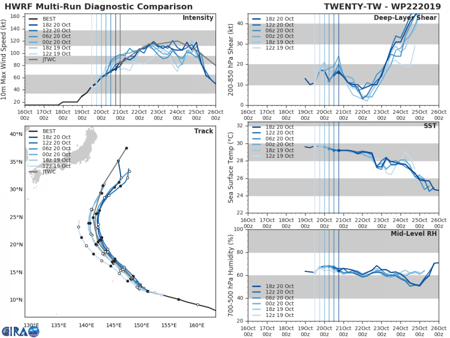
The future track will bring Bualoi across the northern Marianas later today, Bualoi’s eye will pass just north of the island Saipan. It will then continue towards NW for two more days before a classic N-NE turn begins after Thursday. Notice the Iwo Jima island at the “24/00z 120 kt” mark, a direct hit to this small island seems quite possible on Thursday afternoon local time!
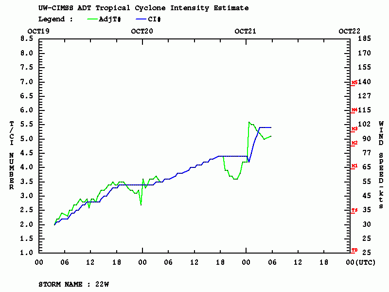
Latest ADT (Advanced Dvorak Technique) analysis reveals a more rapid strengthening of Bualoi has begun, Raw T numbers 5, packing winds of around 100 knots / 115 mph / 185 km/h and estimated central pressure around 961 mbar. Meanwhile, the latest 06 UTC analysis had Bualoi at 95 kt / 966 mbar – a borderline CAT 2/3 strength!
Both GFS and HWRF models are fairly good on the future track of Bualoi, supporting its further strengthening through the next 48 hours. Bualoi will likely reach Category 4 strength with sustained winds around 120 kt / 140 mph / 220 km/h by late Wednesday. What is important to note, is the very favorable sea surface temperature 29-30 °C ahead of Bualoi today, as well as even lower deep-layer shear. This should allow it to continue with rapid strengthening and further expanding upper-level outflow ventilation and wind field beneath.
Stay tuned for further updates!
Previous update:
