Tropical cyclone Kenneth has rapidly intensified to an equivalent of a Category 4 hurricane and is heading for landfall in northern Mozambique later today. Extreme winds, torrential rainfall and major flooding are expected.
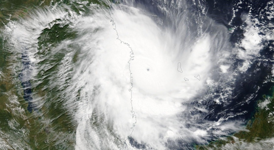
Tropical cyclone Kenneth around local noon today, as imaged by NASA Terra satellite. Note the pinhole eye! Image: NASA WorldView.
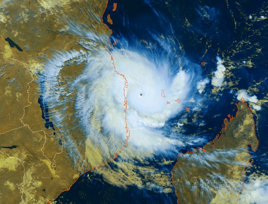
Tropical cyclone Kenneth has rapidly intensified in the past 24-36 hours: from peak winds of 113 km/h (70 mph) late on April 23, to an equivalent Category 4 hurricane on the Safir-Simpson scale, packing winds of 233 km/h (145 mph)! The rapid strengthening was accompanied by the formation of a very tight, pinhole eye.
Tropical cyclone Kenneth around local noon! Extremely tight, pinhole eye evident. Image: @WMO TW.
Kenneth is tracking for landfall, currently expected near Nagulue on the northern coast of Mozambique, this afternoon (UTC). It is expected to remain a powerful equivalent category 4 system with peak sustained winds of 200 km/h (125 mph) and gusts up to 249 km/h (155 mph)!
Cyclone #Kenneth 🌀an extremely dangerous and very solid category 4 hurricane strength tropical cyclone just off the coast of #Mozambique🇲🇿 as seen by Terra MODIS not long ago #CycloneKenneth pic.twitter.com/LT2WO3FBR9
— YouStorm (@YouStormorg) 25 April 2019
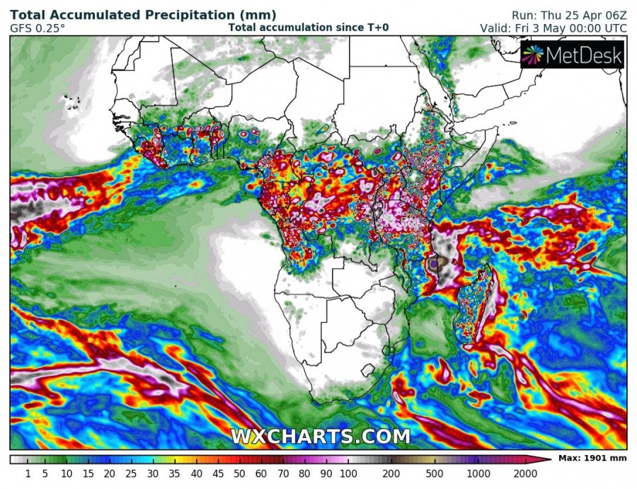
In addition to extremely severe winds, the area will also receive extreme amounts of rainfall as Kenneth stalls inland just after landfall. Between 1500 and 2000 mm of rainfall is expected by the end of Sunday! Expect extremely dangerous major floods in parts of northeastern Mozambique.
Accumulated total rainfall until late on Sunday. GFS model guidance. Map: Wxcharts.com
This is an extremely dangerous system. A very powerful tropical cyclone, expected to stall after landfall – in an area with no tropical cyclones over the past 50 years! All this is happening just weeks after the powerful tropical cyclone Idai devastated the coastal region further south in Mozambique.


