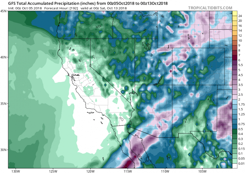
Yet another major hurricane is ongoing in the eastern Pacific right now – hurricane Sergio. It is a strong Category 3 hurricane and is expected to head towards the Baja California peninsula, similar track as hurricane Rosa last weekend. Sergio is likely going to result in renewed excessive rainfall threat for the deserts US Southwest.
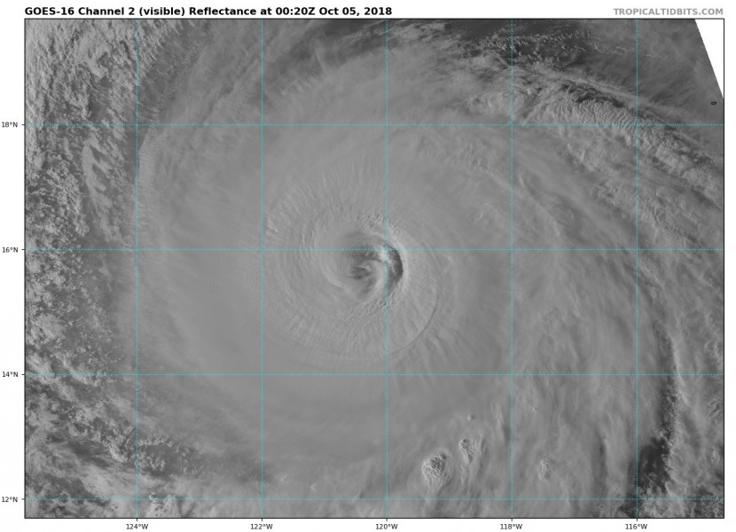
Here is last night’s visible spectrum and this morning’s water vapour satellite animation of Hurricane Sergio in the eastern Pacific. Notice the textbook upper-level outflow ventilation with gravity waves pushed from the centre.
Water vapour satellite animation of Hurricane #Sergio in the eastern Pacific. Notice the textbook upper level outflow ventilation with gravity waves pushed from the centre. Animation by @TropicalTidbits pic.twitter.com/6xSqQZms29
— severe-weather.EU (@severeweatherEU) October 5, 2018
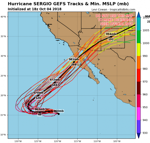
Ensemble GFS (GEFS) forecast tracks for hurricane Sergio next week, it crosses the Baja California peninsula and heads towards SE Arizona into New Mexico over the weekend.
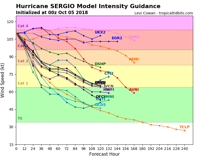
The intensity forecast suggests Sergio will remain a strong hurricane until the last two days prior to landfall. Should it maintain Category 2 or 3 strength until then, landfall in the Baja California peninsula would be severe.
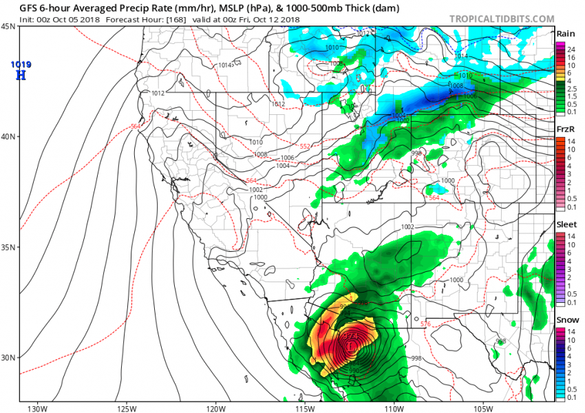
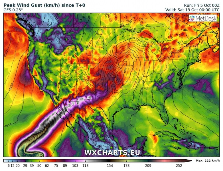
Peak wind gusts swath map indicates Sergio should make landfall in the northern Baja California peninsula and then, transformed into a post-tropical storm, head across SE Arizona and central New Mexico towards the Texas Panhandle.
Sergio should again bring a lot of rainfall into the deserts of the US Southwest and NW Mexico, so flash floods are to be expected.
We will have more updates about this potentially dangerous system in the coming days – stay tuned!
