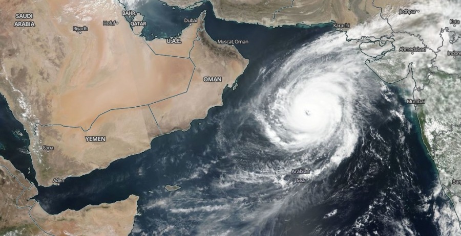
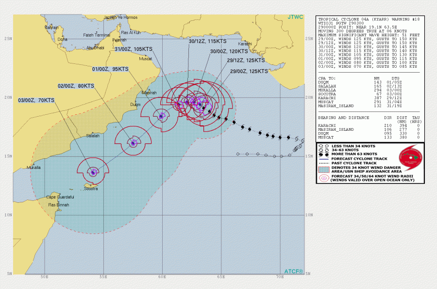
Tropical Cyclone KYARR has slightly weakened during the past 24 hours while it continues moving towards the Arabian peninsula. As of 06 UTC today, Oct 29th, Kyarr remains a powerful Category 4 cyclone, packing maximum sustained winds of 115 knots / 135 mph / 215 km/h with a central pressure around 942 mbar. Kyarr is expected to turn SW tomorrow and accelerate towards Gulf of Aden and island Socotra later this week.
Based on the satellite imagery, Kyarr continues its gradual weakening trend today. Cyclone went through an EWRC (eyewall replacement cycle) as well, the eye is now filled with cirrus clouds but the overall system indicates a still very impressive upper-level outflow and compact, intense convection surrounding the eye.
https://twitter.com/jnmet/status/1189080334182289408
Latest Dvorak analysis suggests the intensity is set near 5.9 ADT, meaning maximum sustained winds are near 110-115 knots and central pressure around 945 mbar. Graphics indicate a slow gradually weakening trend over the past 24-36 hours.
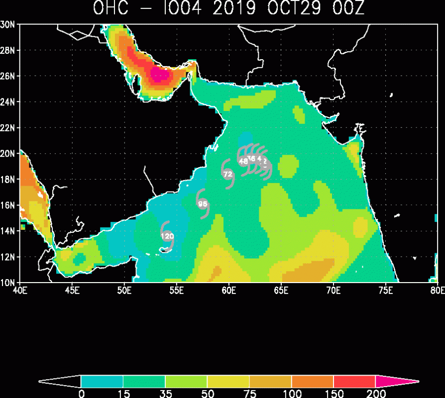
The future track of Kyarr should bring it further NW of its position today before it turns towards SW tomorrow, Oct 30th and accelerate towards Gulf of Aden and island Socotra later this week and weekend, while additionally losing its strength with time. Kyarr is now coming into less favorable Ocean Heat Content for fueling the storm.
The GFS intensity forecast indicates Kyarr has peaked yesterday and is now coming into some stronger shear. It should remain over still very warm sea surface temperatures of around 28 °C throughout the next few days.
Stay tuned for additional updates!


