The new Eastern Pacific Tropical Storm is born – Elida! The forecast models and observational data suggest this will a new powerful tropical system. We are expecting a formation of a hurricane Elida tonight.
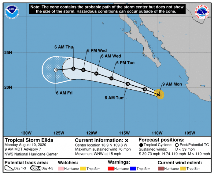
Tropical Storm Elida is currently packing maximum sustained winds of 60 knots (70 mph) with the minimum central pressure is around 993 mbar. Environmental conditions remain increasingly conducive for further (rapid) development of this system and we should be seeing a hurricane Elida forming within the next 12 hours.
Satellite analysis
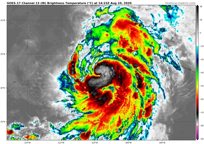
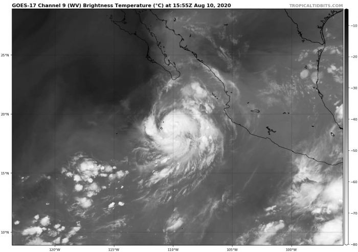
The latest IR/WV satellite imagery indicates a quite impressive compact cluster of explosive storms, with a visual appearance of the forming circulation. Tropical Storm Elida is soon becoming a hurricane!
Storm activity associated with Elida should maintain/strengthen and also gradually increase in size in the coming days. Further intensification is likely. Elida could reach a strong Category 1 hurricane strength on Tuesday.
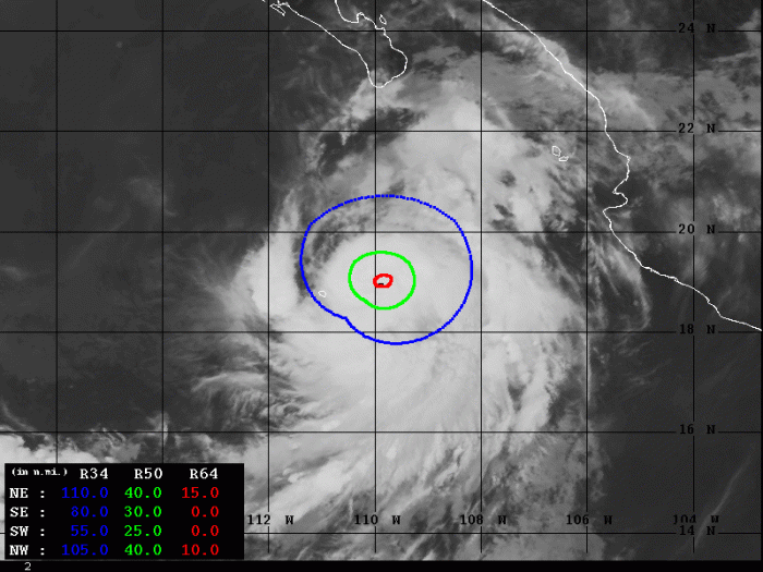
Advanced Dvorak Technique (ADT) analysis estimates indicate that Elida already has 25-40 miles of 50-knot wind radii. And it also has 15 miles wind radii of hurricane-force winds across NW and NE quadrants. Further strengthening and expanding of the wind field is expected.
Forecast track
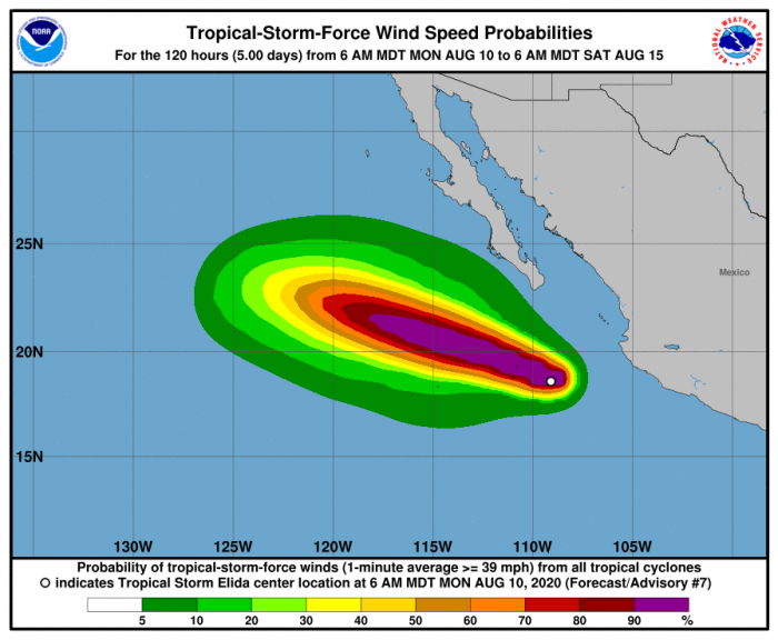
The National Hurricane Center (NHC) is forecasting that Elida will become a hurricane tonight. Maintaining its strength over the next two days. The forecast tracks it towards the west-northwest, to the southwest of the Baja peninsula. It will stay away from any land.
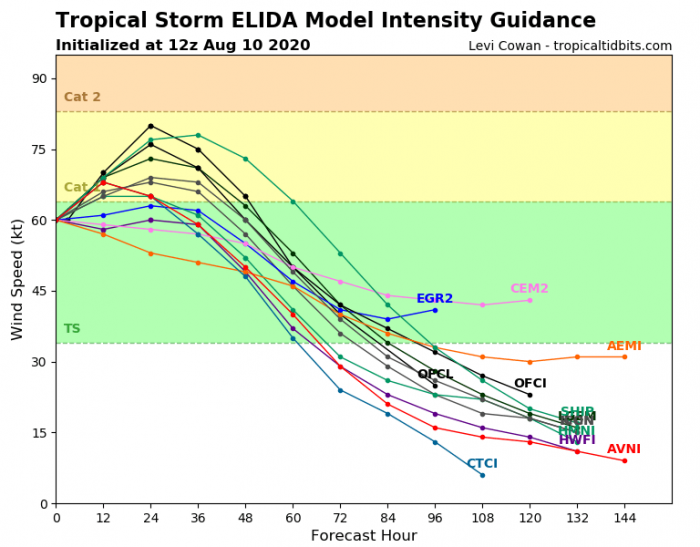
Attached is the intensity forecast model spread. Most of the models are in agreement with a Category 1 strength. A weakening trend is likely after Wednesday.
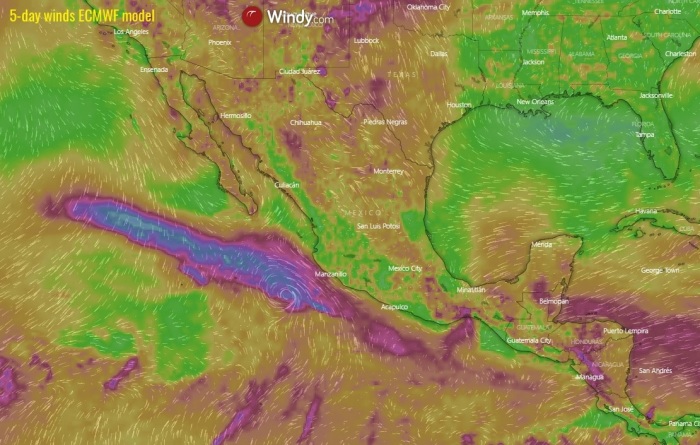
Wind swath across the Eastern Pacific
The main threat with the system is heavy rain and violent winds within then eyewall circulation. However, the forthcoming hurricane Elida is expected to move west-northwest away from any land areas. So the main threat will be for the ship traffic in the Eastern Pacific region. As for now, no threat to land areas is expected during its lifecycle.
Stay tuned for further updates, especially if we will be seeing that hurricane Elida will begin developing a more intense strength in the coming days.
Hurricane season 2020 prediction
Hurricane season 2020 could be very active – see details:
