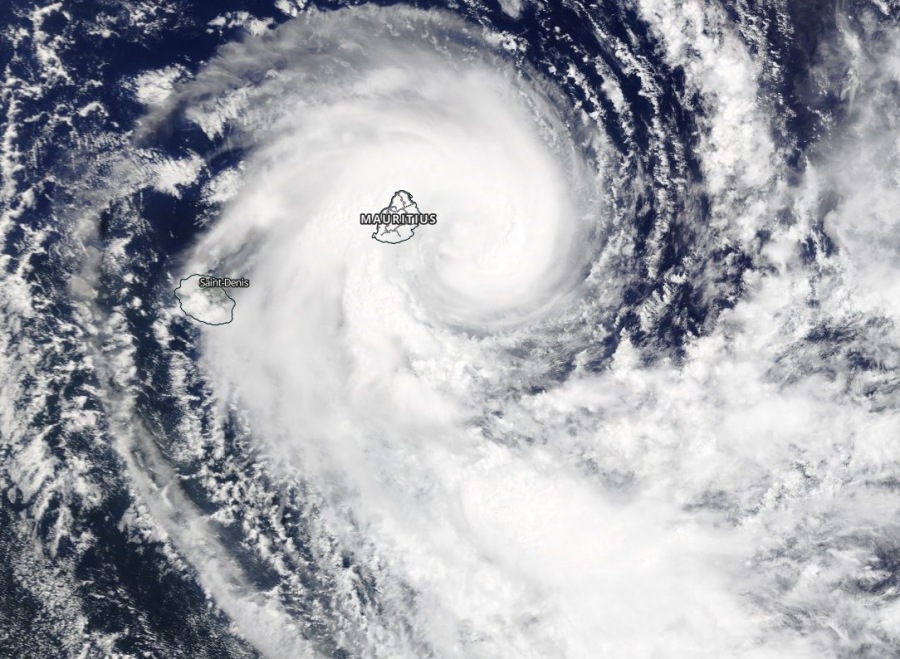
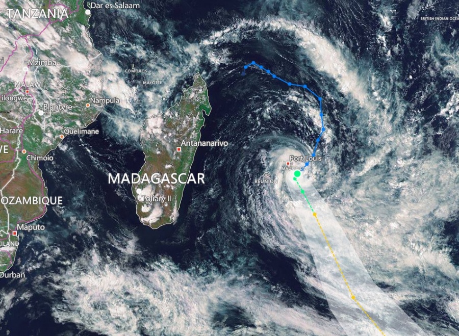
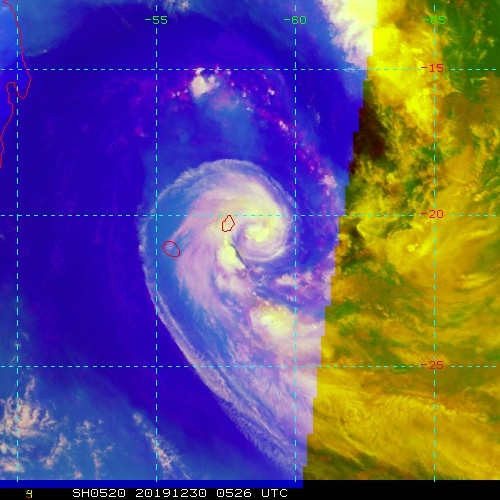
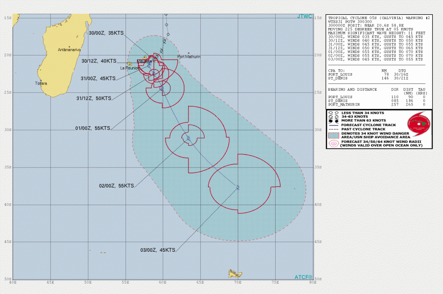
We have discussed about a new Tropical Storm #Calvinia near Mauritius yesterday, which is now very near the island and resulting in damage already. Rough weather is associated with the slowly approaching tropical storm, these conditions will worsen as the storm moves closer during the next 12-24 hours. Calvinia’s current intensity is equivalent to a North Hemisphere tropical storm strength. Soon as Calvinia moves away from Mauritius, it will turn sharp south and gradually accelerate towards the open waters of the SW Indian Ocean.
*********************************************
*********************************************
Some pretty impressive satellite presentation is found today, revealing spectacular upper-level outflow patterns and a quite intense explosive convection around the center of the cyclone. Its center was lately just shy east-southeast of Mauritius!
https://twitter.com/sawx_sa_weather/status/1211614323392548864
Animation images satellite Meteosat Eumetsat 11H UTC.
Tempête tropicale forte #Calvinia se dirige au sud de l'île #Maurice en se renforçant encore ou elle doit stationner proche de Maurice, puis partir vers le sud-est mardi soir.
Prev modèle Icon.https://t.co/oMAwoIQkBp pic.twitter.com/F9XudmF7jL— meteophile (@meteophile) December 30, 2019
First reports of severe winds and torrential rainfall damage in Mauritius:
https://twitter.com/sainedecrime/status/1211617056359010307
Des photos des dégâts fait par #Calvinia #Mauritius #Cyclones pic.twitter.com/PaDi1V2bNh
— l'EnversduDécor© ⭐⭐ (@sainedecrime) December 30, 2019
The ocean this morning as we’re being hit by cyclone #Calvinia. And we were swimming in the sea only yesterday afternoon…Stay safe, Mauritius! pic.twitter.com/LTZyvcx7ej
— Priya Hein (@PriyaHein) December 30, 2019
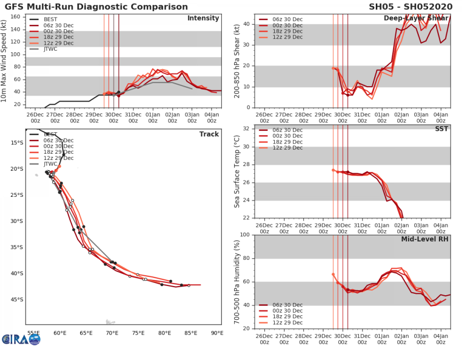
The Ocean Heat Content (OHC) map indicates Calvinia is currently in a rather good fuel for storms and should remain is similar conditions for another 36 hours, meaning it will maintain its current intensity or even slightly intensify with time. After 48 hours, Calvinia ejects out of the best ocean sea surface conditions and accelerate towards south-southeast.
The future track will bring Calvinia center close to landfall in Mauritius, probably will be traveling just south of the island over the next 24 hours, with similar intensity as it is now. Then, Calvinia turns sharp south and accelerates into the open waters of the SW Indian Ocean. It will then dissipate soon, coming into cooler waters and stronger shear.
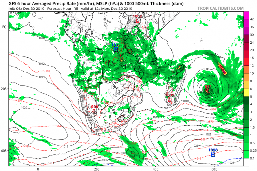
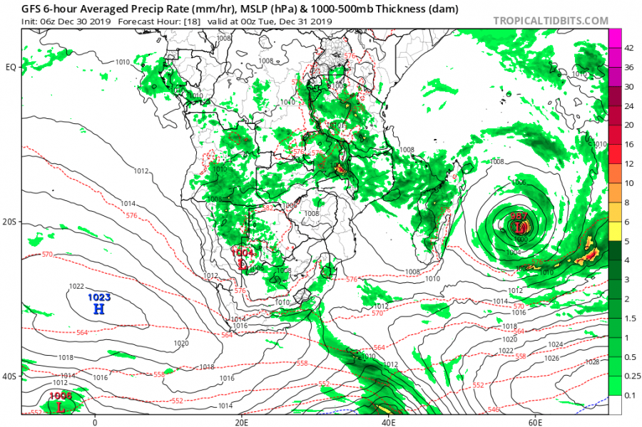
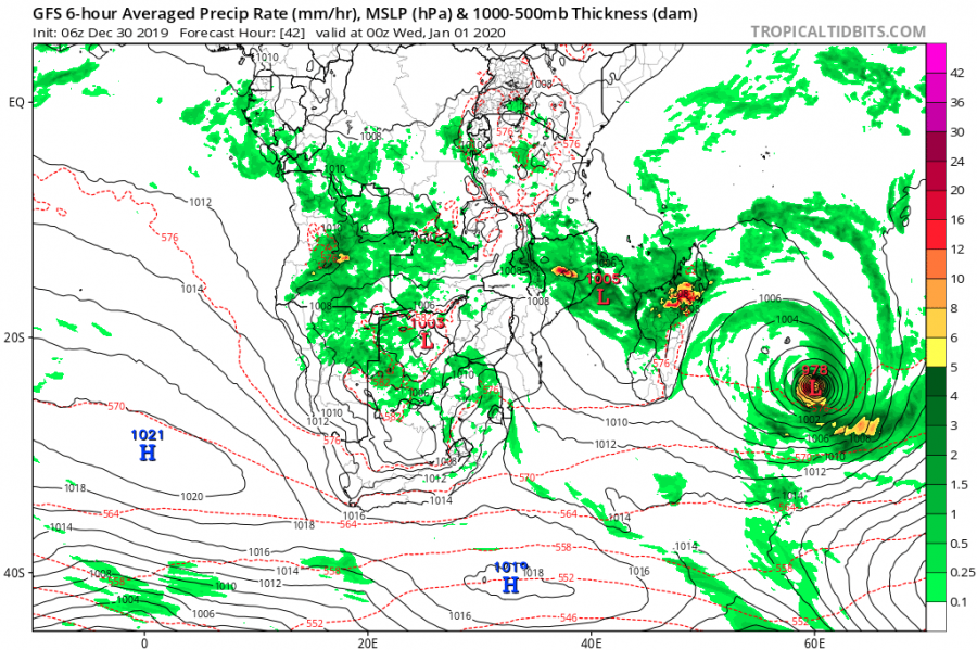
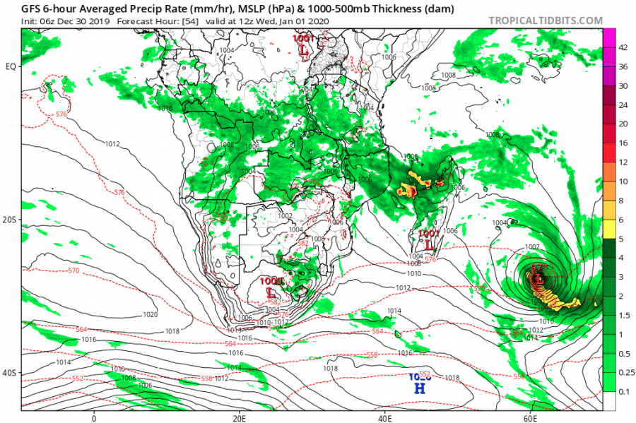
The GFS model guidance is quite interesting regarding Calvinia’s future intensity, as it indicates the cyclone will deepen over the next few days despite coming in more shear and cooler waters. However, it will already be away from any land areas at this time and moving over the open waters only.
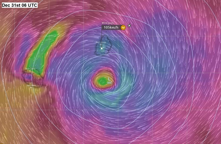
Close-up view of ECMWF model guidance over the Mauritius and La Reunion tonight (local time), Dec 31st 06 UTC. Severe winds are expected over Mauritius, easily gusting above 100 km/h!
Previous discussion:
Tropical activity of the SW Indian Ocean returns – Tropical Storm #Calvinia is born near Mauritius
Interested in our calendar? We are proud to present and promote the best weather photographers in Europe – see details:
