SYNOPSIS
A large long-wave trough is dominating WSW Europe while ridging persists across east, south and central Europe. In between, a surface frontal zone extends from NE Iberia across the Alps into the Baltic countries. An upper low remains over Turkey.
DISCUSSION
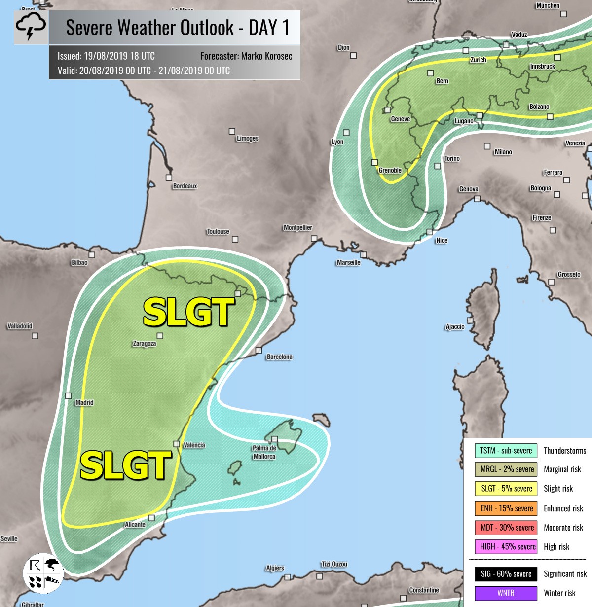
SLGT risk has been issued for ENE Spain with threat for severe storms, capable of producing severe winds, large hail and torrential / excessive rainfall. Northern parts of the SLGT will see excessive rainfall threat due to the night / early morning activity while additional isolated organized storms including supercells are expected to develop by mid/late-afternoon over SE parts as rapid moisture recovery takes place from the Mediterranean and moderately strong MLCAPE builds up.
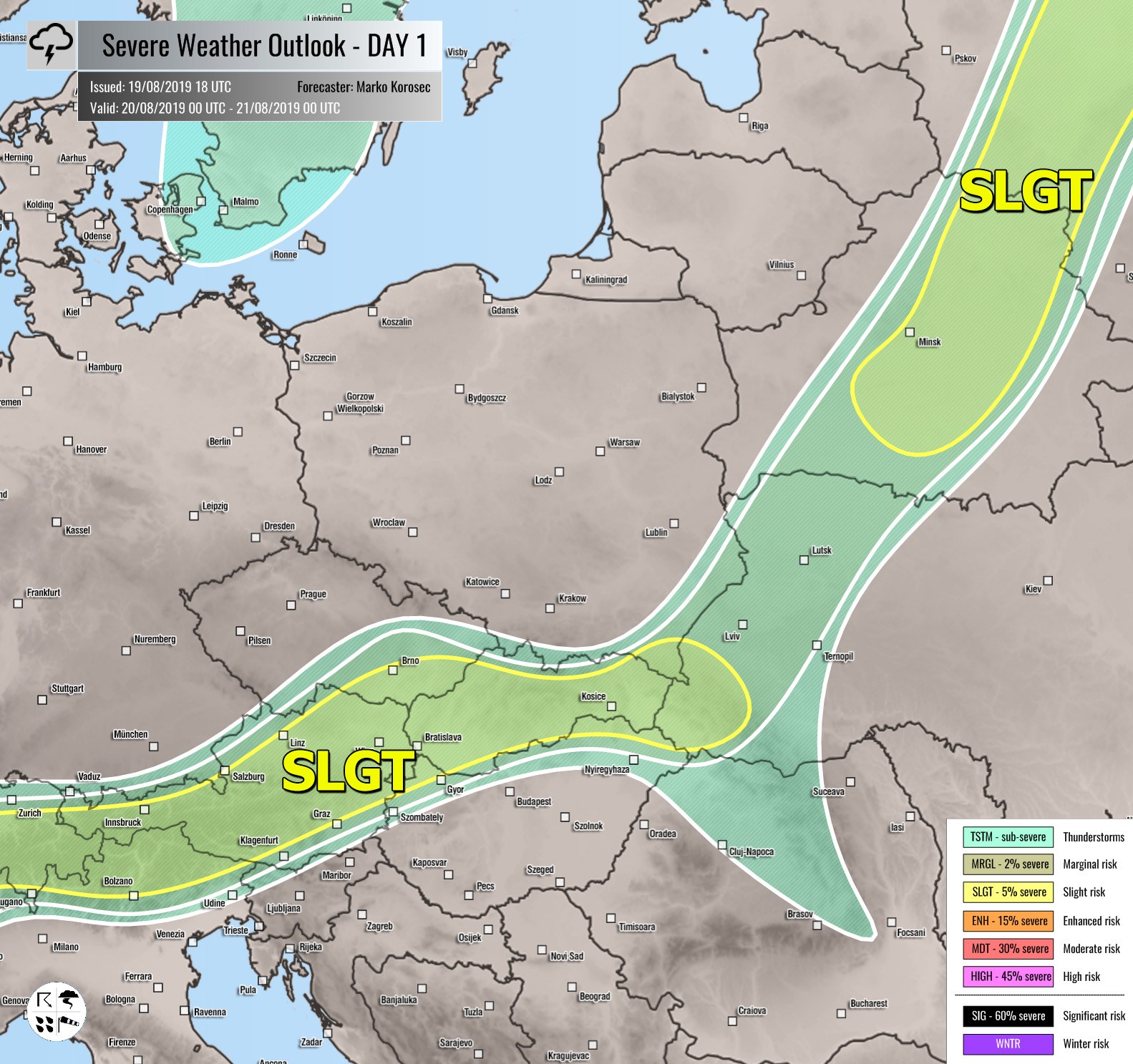
SLGT risk has been issued for the Alps into Slovakia and W Ukraine with threat for severe storms, capable of producing severe winds, large hail and torrential rainfall.
SLGT risk has been issued for E Belarus into NW Russia with threat for severe storms, capable of producing severe winds, large hail and torrential rainfall.
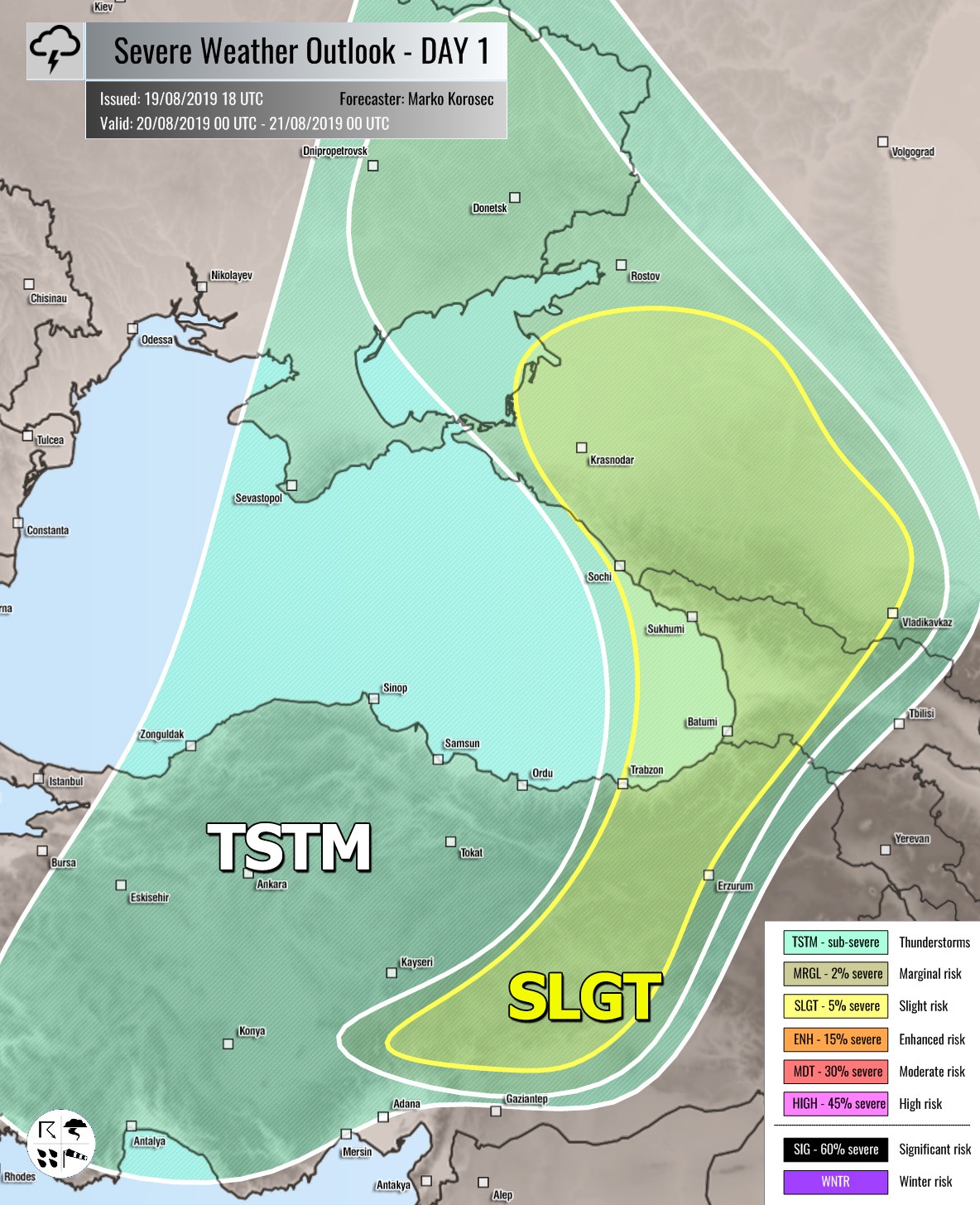
SLGT risks have been issued for Georgia into SW Russia and E Turkey with threat for isolated severe storms, capable of producing severe winds, large hail and torrential rainfall.
TSTM risk areas have been placed where convective storms are likely to occur but should remain sub-severe.


