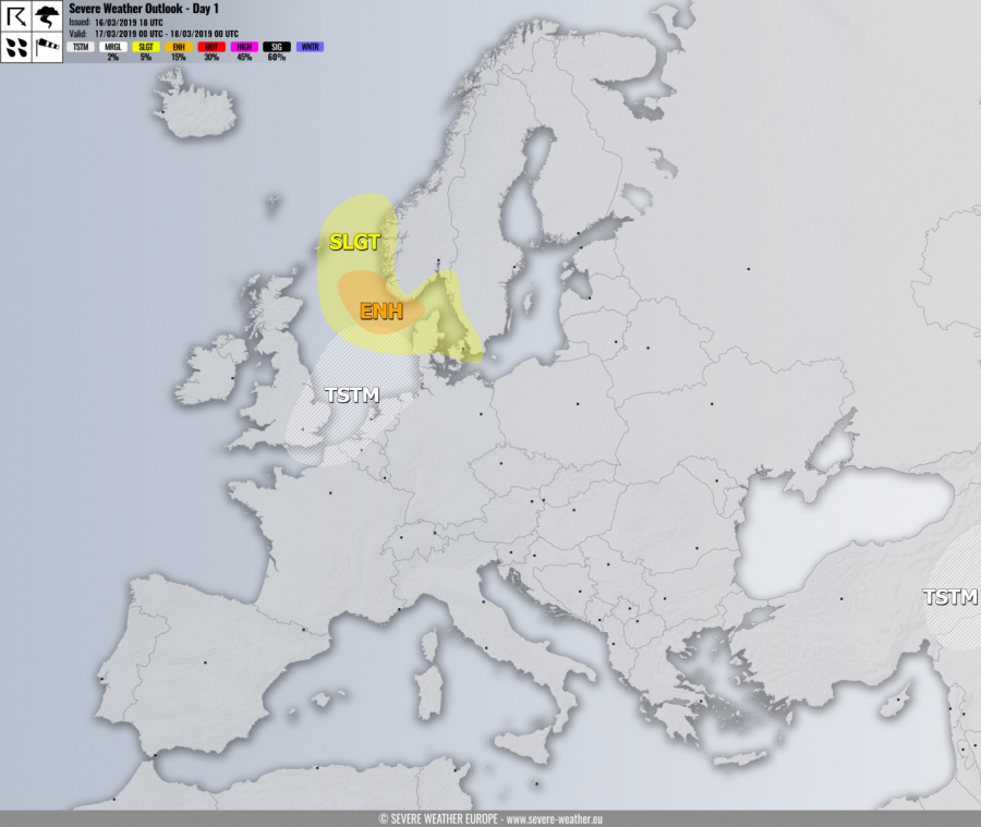
VALID FOR 17-03-2019
SYNOPSIS
A very deep trough with an intense surface cyclone crosses the North Sea and moves into south Scandinavia. An associated cold front continues towards the central Europe. Ahead of this trough, an upper ridge expands into the Balkan peninsula. An upper low finally ejects the Middle East.
DISCUSSION
ENH risk has been issued for part of North Sea into extreme SW Norway with threat for severe to extremely severe winds, locally in excess of 120 km/h.
SLGT risk has been issued for areas surrounding the ENH risk including SW Norway, Denmark, and SW Sweden with threat for severe winds, locally in excess of 110 km/h.
TSTM risk areas have been placed where convective storms are most likely to occur.
Mesoscale discussion:
