SYNOPSIS
A long-wave trough pushes across central Europe while strong ridge over the Balkans drifts into ESE Europe and SW Russia. Upper ridge also strengthens over the Azores. A pronounced short-wave crosses the Alps and N Mediterranean, resulting in large scale ascent for robust convective activity under a strong jet stream. Favorable forcing supports convective storms also over NE Europe.
DISCUSSION
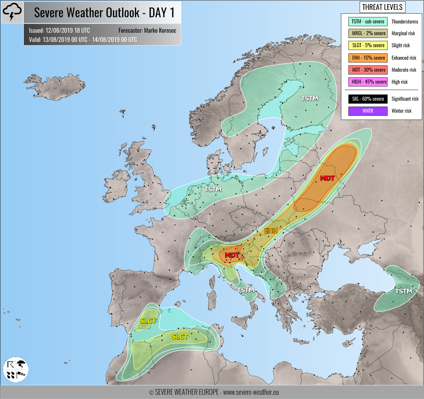
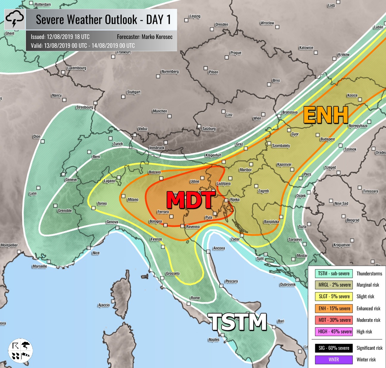
MDT risk has been issued for NE Italy across N Adriatic into W Slovenia and NW Croatia with threat for severe storms, capable of producing severe winds, large to very large hail, torrential / excessive rainfall and tornadoes. Discrete storms including supercells are expected to develop by mid to late afternoon near the cold front crossing the Alps from the NW. Strong to extreme instability (2500-3500 J/kg of MLCAPE) beneath a very strong 50-70 knots bulk shear will favor explosive storms development, organized into intense supercells with large to very large hail and severe damaging winds within line / bowing segments from N Italy plains towards east. However, rather high uncertainties exist how much intensity storms could develop as some models are hinting NE flow (downslope Bora winds) from N Balkans into the N Adriatic region by early afternoon onwards, mixing / washing out the extremely unstable airmass towards Italy. Mostly robust elevated severe storms are expected over the N Balkans with training cells effect across the S Alpine flank from the NE Italy across NW Slovenia into S Austria. Surface-based storms with enhanced LL helicity will also support tornadoes, especially from the E Po valley towards NW Croatia (Istra). Overall, storms will tend to cluster into an MCS or two towards the evening hours with a well-defined large-scale ascent associated with the wave pushing trough.
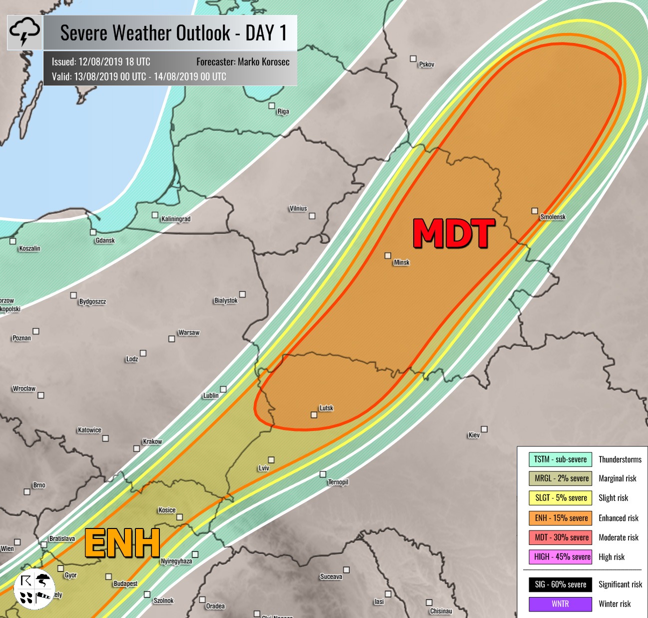
MDT risk has been issued for NW Ukraine into Belarus and NW Russia with threat for severe storms, capable of producing severe winds, large hail, torrential rainfall and tornadoes. Discrete organized storms are expected to develop along the diffuse front by mid-afternoon within moderately unstable and strongly sheared airmass. Long-lived supercells with bowing segments are likely as well. Enhanced SR helicity will also support tornadic potential with the strongest storms. Storms will merge into clusters while moving across Belarus and towards NW Russia through the evening hours.
ENH / SLGT risks have been issued for areas surrounding the MDT risks from N Italy across N Balkan into E Europe with more isolated threat for severe storms, capable of producing severe winds, large hail and torrential rainfall. Models are also hinting a possible development of discrete elevated supercells with damaging winds and large hail threat from NE Slovenia across Hungary into Slovakia overnight.
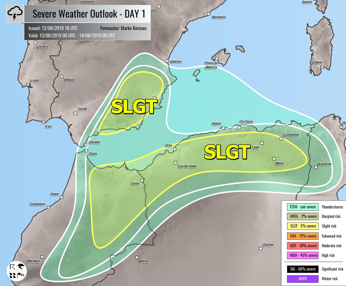
SLGT / MRGL risks have been issued for N Morrocco, N Algeria and SE Spain with threat for isolated severe storms, capable of producing severe winds, large hail and torrential rainfall.
TSTM risk areas have been placed where convective storms are likely to occur but should remain sub-severe.


