SYNOPSIS
A powerful ridge is located over western Europe while a large deep upper low is rotating over the south-central Mediterranean. Strong ridge also persists over NW Russia. A deep trough remains over the NW Atlantic.
DISCUSSION
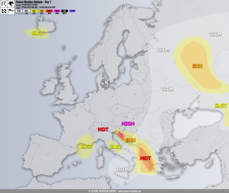
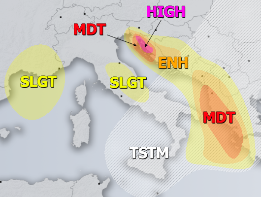
HIGH risk has been issued for NE Adriatic region (Kvarner region) with threat for extremely severe winds in excess of 150 km/h. A powerful downslope Bora winds setup is unfolding, resulting in very intense and damaging winds to fresh vegetation. The most exposed areas should experience winds towards 180 km/h or even higher across the higher elevations!
MDT / ENH risks have been issued for areas surrounding the HIGH risk including NW Croatia, NE Adriatic and SW Slovenia with threat for severe to extremely downslope winds, locally in excess of 120 km/h.
MDT / ENH risks have been issued for the southern Adriatic, SW Balkan peninsula into Ionian sea with threat for severe storms, capable of producing severe winds, large hail, torrential / excessive rainfall and tornadoes. Widespread convective activity is expected along the leading front of a deep cyclone associated with the cold core low moving into the Mediterranean. Strongly enhanced LL shear / helicity should become favorable for tornadic storms are well, so a few tornadoes are not ruled out as well!
ENH / SLGT risks have been issued for west-central Balkan peninsula (Bosnia, Croatia) and eastern Apennines with threat for excessive rainfall in excess od 100-150 mm / 24 hours period due to persisting orographic rainfall from the easterly winds.
SLGT risk has been issued for S France into NW Mediterranean with threat for severe winds, locally in excess of 100 km/h.
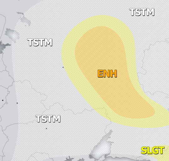
ENH / SLGT risks have been issued for NW Russia with threat for severe storms, capable of producing severe winds, large hail, torrential rainfall and tornadoes. Again, widespread convective activity is expected along the diffuse frontal boundary during the daytime hours.
SLGT risk has been issued for Georgia into E Turkey with threat for severe storms, capable of producing severe winds, large hail and torrential rainfall.
SLGT risk has been issued for SW Iceland with threat for severe winds, locally in excess of 100 km/h.
TSTM risk areas have been placed where convective storms are likely to occur, but should remain sub-severe.


