SYNOPSIS
The upper ridge dominates WSW Europe with a deep upper low moving across central Europe into the Mediterranean. Another deep trough with a deep surface cyclone is moving to the west of upper ridge across the N Atlantic towards Greenland. Strong upper ridge persists across northern Russia with a frontal boundary to its west and trough over Scandinavia. Another short-wave trough moves across the Black Sea and E Turkey.
DISCUSSION
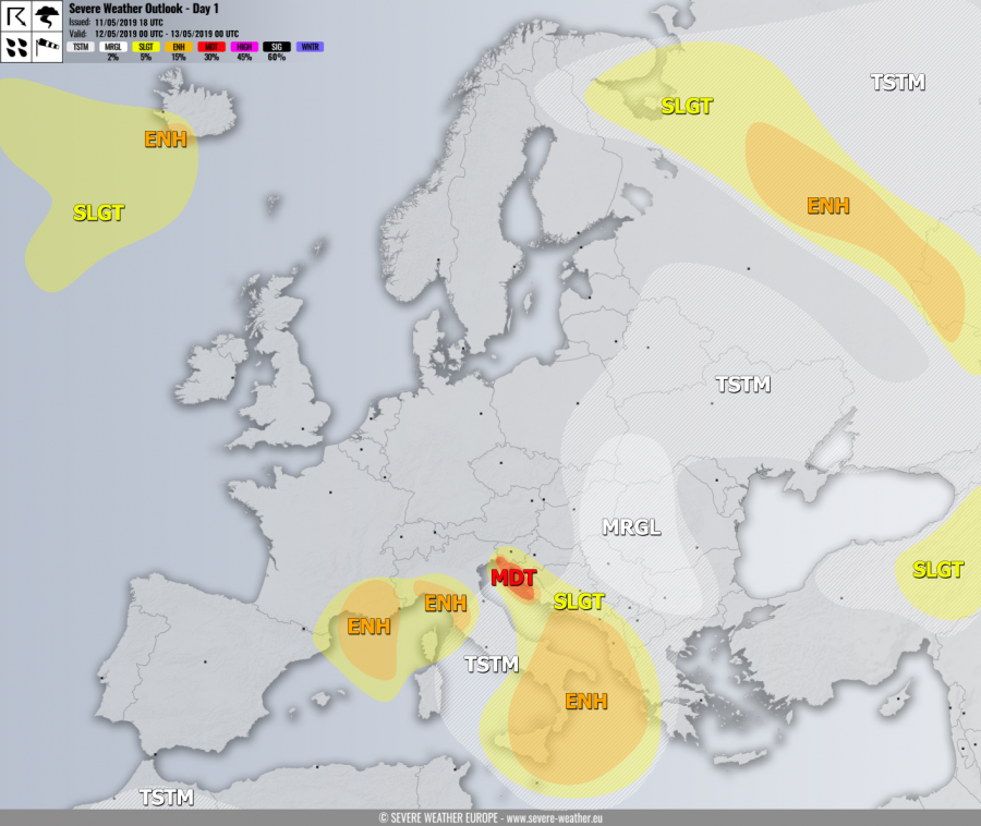
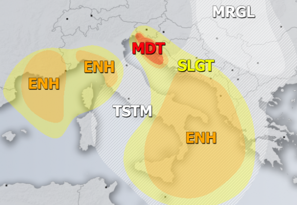
MDT / ENH risks have been issued for NE Adriatic region into SW Slovenia and NW Croatia with threat for severe to extremely severe winds in excess of 120-140 km/h. The most exposed areas should experience winds above 150 km/h across the higher elevations in the Kvarner region.
ENH / SLGT risks have been issued for S France, NW Mediterranean, N Apennines and Ligurian bay with threat for severe to extremely severe winds, locally in excess of 120-130 km/h.
ENH risk has been issued for southern Adriatic, SW Balkan peninsula into Ionian sea and S Italy with threat for severe storms, capable of producing severe winds, large hail, torrential / excessive rainfall and tornadoes. Widespread convective activity is expected along the leading front of a deep cyclone associated with the cold core low moving into the Mediterranean.
SLGT risk has been issued for areas surrounding the MDT / ENH risks across WSW Balkan peninsula and south-central Italy with threat for isolated severe storms, capable of producing severe winds, marginal hail and torrential rainfall. SLGT risk has been extended into W Bosnia where excessive rainfall threat develops due to persistent orographic precipitation.
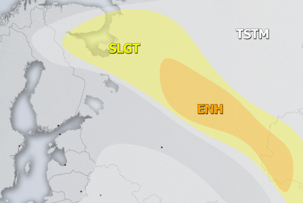
ENH / SLGT risks have been issued for NW Russia with threat for severe storms, capable of producing severe winds, large hail, torrential rainfall and tornadoes. Again, widespread convective activity is expected along the diffuse frontal boundary during the daytime hours.
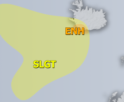
ENH risk has been issued for SW Iceland with threat for severe to extremely severe winds, locally in excess of 130 km/h.
SLGT risk has been issued for areas surrounding the ENH risk across SW Iceland into N Atlantic with threat for severe winds in excess of 100 km/h.
SLGT risk has been issued for E Turkey with threat for severe storms, capable of producing severe winds, large hail and torrential rainfall.
MRGL risk has been issued for east-central Balkan peninsula with threat for isolated severe storms under low shear but moderate CAPE. Slow moving storms could produce torrential rainfall and marginal hail with accumulation.
TSTM risk areas have been placed where convective storms are likely to occur, but should remain sub-severe.


