SYNOPSIS
An upper ridge persists across N Atlantic and W Europe with higher geopotential heights across central and SE Europe. Deep trough remains over NNE Europe while an upper low os located SW of Iberia. A short-wave crosses the Alps and E Balkan peninsula.
DISCUSSION
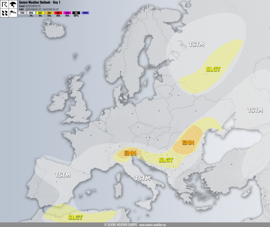
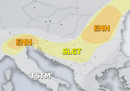
ENH risk has been issued for NNE Italy into W Slovenia with threat for severe storms, capable of producing severe winds, torrential / excessive rainfall and large to very large hail. An overlap of strong instability (1500-2500 J/kg of MLCAPE) with weakly to moderate deep-layer shear (near 30 knots) and helicity will support organized severe storms, including intense multicells and a few supercells, posing risk for very large hail (5+ cm). Rather slow-moving storms should also bring excessive rainfall and flash floods threat. Storm initiation is expected across the Alps by early afternoon hours, spreading SE with time. Storms will merge into a large cluster / MCS into the evening hours towards W Slovenia, enhancing flash floods threat locally.
ENH risk has been issued for central Romania into Moldova with threat for severe storms, capable of producing large to very hail, torrential /excessive rainfall and severe winds. Storms / cluster is likely along the short-wave crossing the region, fueled by strong instability under moderate shear. A few supercells with very large hail are likely. Storms will cluster into an MCS by the late afternoon hours.
SLGT risk has been issued for areas surrounding both ENH risk areas across N Italy, Balkans into S Ukraine with more isolated threat for severe storms, capable of producing large hail, torrential /excessive rainfall and severe winds.
SLGT risk has been issued for E Belarus into NW Russia with threat for isolated severe storms, capable of producing severe winds, large hail and torrential rainfall.
SLGT risk has been issued for N Algeria and Tunisia into SE Spain with threat for isolated severe storms, capable of producing severe winds, large hail and torrential rainfall.
TSTM risk areas have been placed where convective storms are likely to occur but should remain sub-severe.

