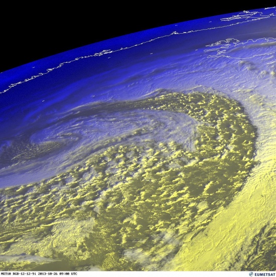
An impressive satellite presentation of the powerful cyclone is visible today, as the first of two intense cyclones that are about to hit western Europe is entering Ireland early this afternoon. It will be spreading across the SLGT risk area of DAY 1 Outlook for 26/10/2013, likely organized as the convective line / linear segments accompanied by severe winds, heavy rain, possibly even with a few tornadoes given the strong shear in place.
Visible satellite image of eastern Atlantic. Source: EUMETSAT
Visible satellite image of UK. Source: EUMETSAT / Sat24.com
As seen on latest radar imagery, high reflectivities are visible just on the west coast of Ireland, bringing heavy rain and strong to severe wind gusts on the coastal areas.
Latest radar of Ireland. Source: Met.ie Ireland
Latest radar of UK. Source: WeatherOnline UK
Follow this powerful storm system crossing western Europe today on Ireland radar, UK radar, satellite pages.


