Severe thunderstorms are likely across the northern parts of central Europe on Thursday, June 22. Severe thunderstorm outbreak possible.
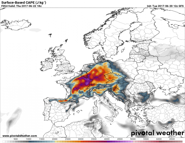
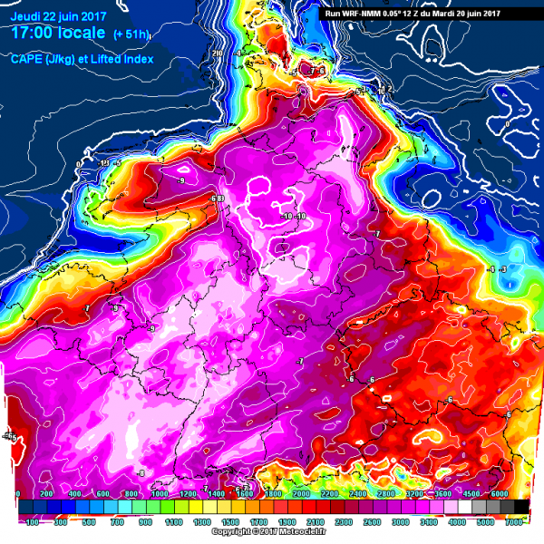
Severe thunderstorms, possibly a severe thunderstorm outbreak, appears increasingly likely for northern parts of Central Europe on Thursday. A shortwave trough passes over the region, with high to locally extreme instability in place. GFS model guidance indicates up to 2000-4500 J/kg SBCAPE, higher-resolution models also indicate locally high to extreme instability with SBCAPE values between 2500 and 4500 J/kg SBCAPE.
GFS model guidance for SBCAPE over Europe on Thursday. Map: Pivotal Weather.
WRF model guidance for SBCAPE over Europe on Thursday. Map: Meteociel.fr.
A strong mid-level jetstream will be present over N France, BeNeLux and northern Germany. Moderately strong shear with 30-45 kt DLS will likely be available, with veering vertical wind profiles and SREH3 values in 100-200 m2/s2 range, supportive for organized thunderstorms, including supercells. Any thunderstorm in this environment will pose a threat for large to very large hail, severe wind gusts and intense rainfall.
GFS model guidance for 500 mbar wind over Europe on Thursday. Strong jetstream over N France, BeNeLux and N Germany. Map: Pivotal Weather.
More details on this setup tomorrow.


