Temperatures again soared above 30 °C across parts of north Europe this weekend. Foehn winds warmed the fjords of western Norway up to 33 °C and up to 30 °C far north at 70°N, within the Arctic circle.
On Saturday the coast of western Norway hit up to 33 °C as Foehn winds warmed the fjords. Banak, Norway at 70 °N pushed to 31 °C.
Temperatures again pushed to 30 °N as far north as Banak, Norway on Sunday. Daytime highs in the upper 20s and even above 30 °C were recorded across much of north Europe.
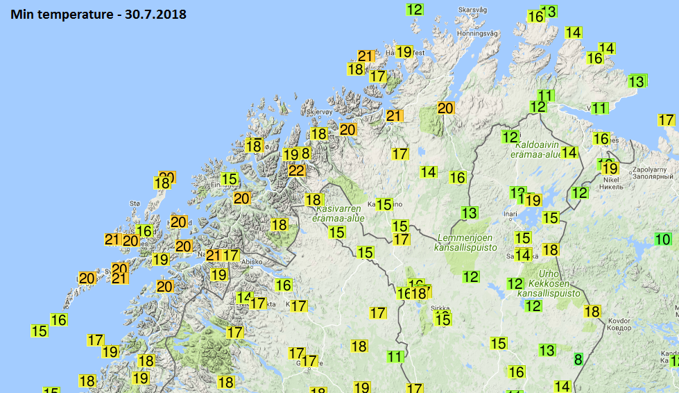
Another sign of very warm days across the north are the lowest night time temperatures. Some very high values were recorded. In some stations, so-called “tropical nights” were observed – the lowest temperature did not drop below the 20 °C threshold. Here are this morning’s lows across Norway:
-
21.5 °C Skibotn 2 (Norway)
21.3 °C Skrova Fyr (Norway)
21.2 °C Hasvik-Sluskfjellet (Norway)
21.0 °C Alta Lufthavn (Norway)
20.7 °C Straumsnes (Norway)
20.6 °C Bo I Vesteralen (Norway)
20.6 °C Tromso (Norway)
20.2 °C Leknes (Norway)
20.2 °C Nordstraum I Kvaenangen (Norway)
20.2 °C Svolvaer / Helle (Norway)
20.0 °C Harstad (Norway)
Tromso, Norway hit a night time minimum of 20.8 °C, the highest since the beginning of measurements in 1920.
For første gang i historien er det blitt registrert tropenatt på Meteorologisk institutt i #Tromsø, og målingene går helt tilbake til 1920! Laveste temperatur i natt var 20,8 grader 🌡️ Meteorologene feirer med boller og saft 🎉 pic.twitter.com/Yml5zZNNqn
— Meteorologene (@Meteorologene) 30 July 2018
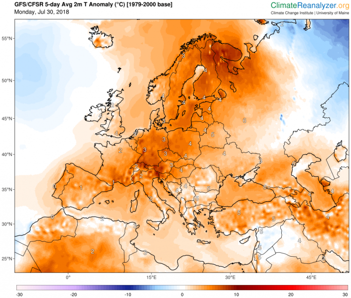
No respite for the region, as 5-day GFS model guidance indicates temperatures in the upper 20s and lower 30s, with temperature anomaly up to 10 °C above average.


