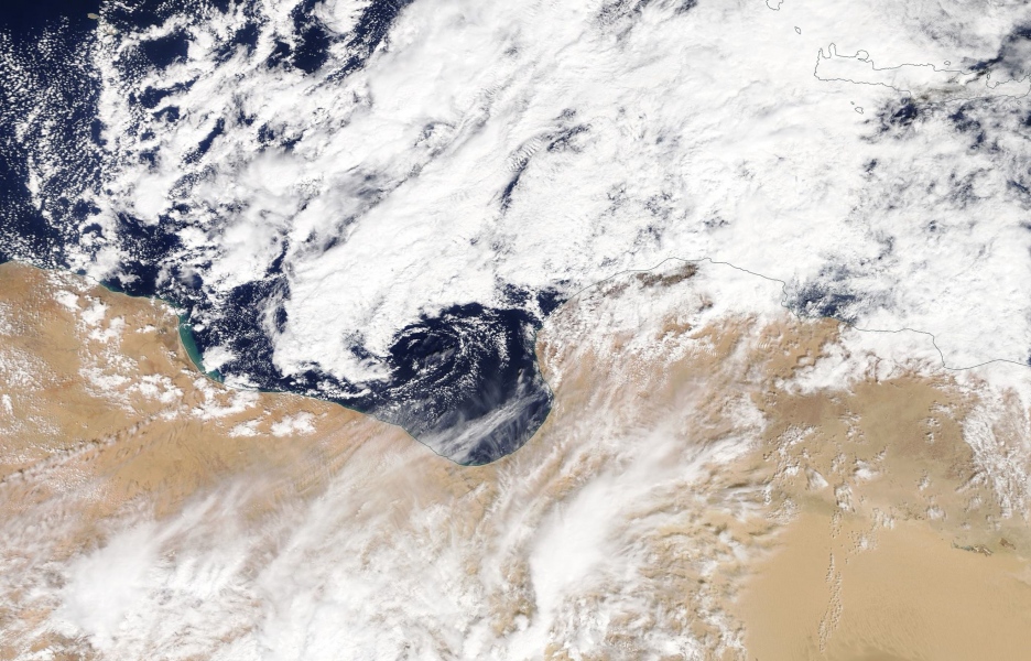
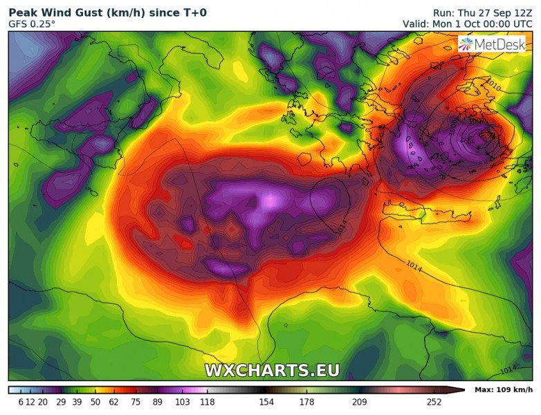
Here is the evening update on the Medicane which is expected to fully form within the next 12 hours. Rapid cyclogenesis is ongoing just off the Libyan coast this evening, central surface pressure is around 1004 mbar. The cyclone is expected to move due north and intensify over the Ionian sea tomorrow during the day before it turns east towards southern Greece and continues towards the Aegean sea and the western Turkey on Sunday.
Evening satellite animation of rapid cyclogenesis in far southern Mediterranean today, notice the pronounced dry intrusion wrapping around the core. Some additional satellite imagery and animations from earlier today.
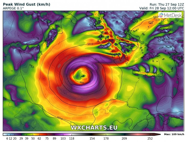
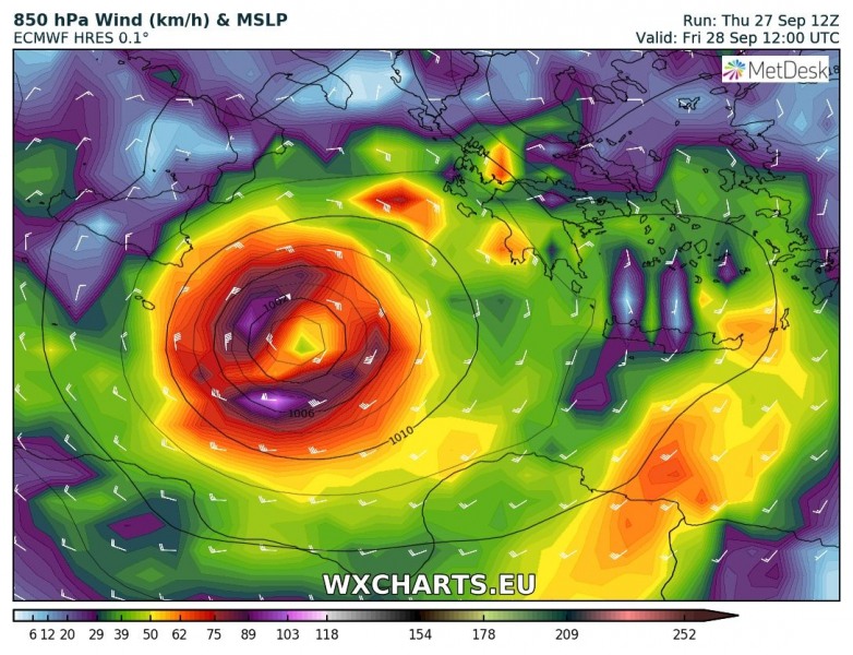
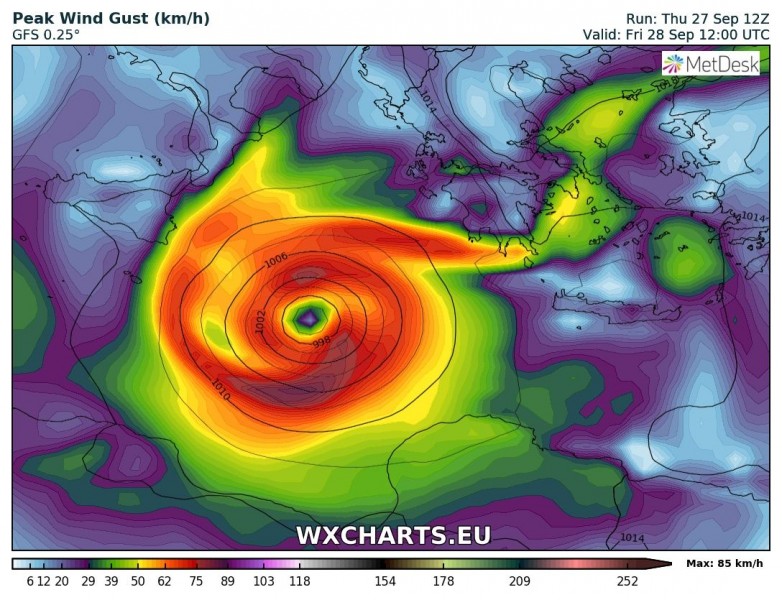
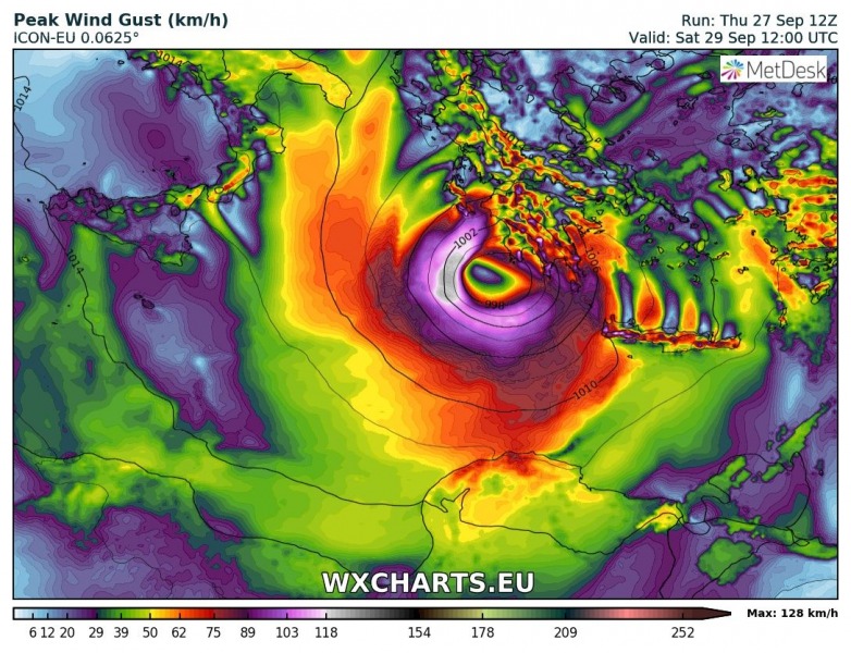
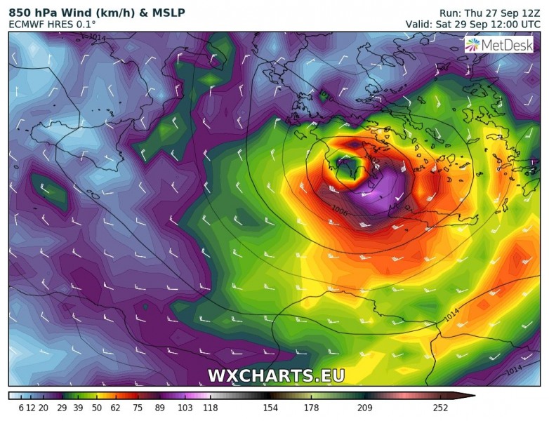
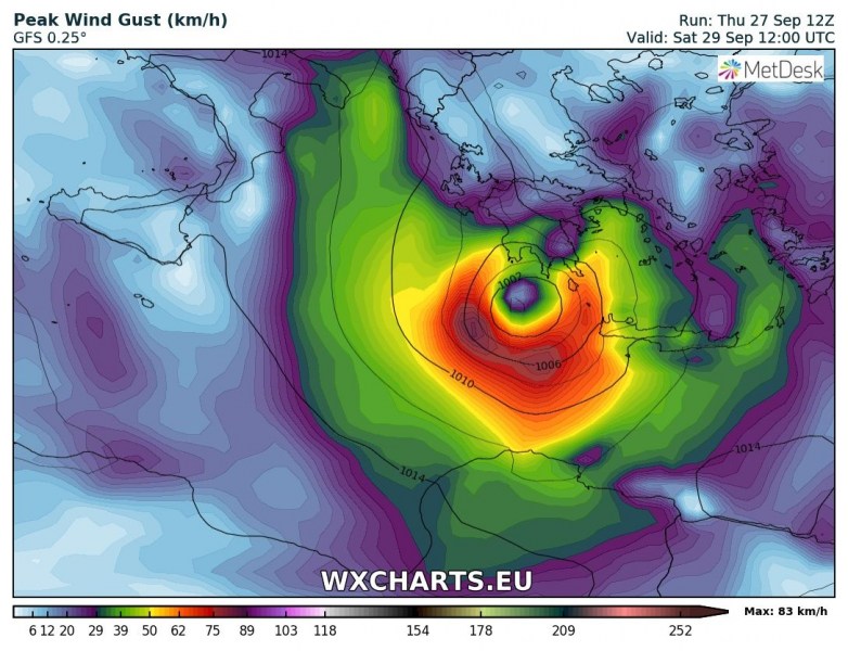
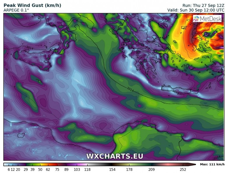
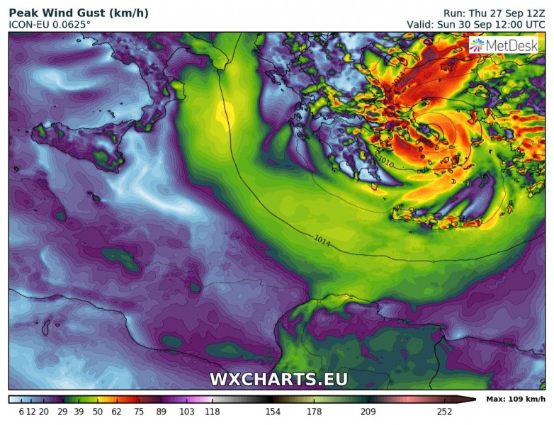
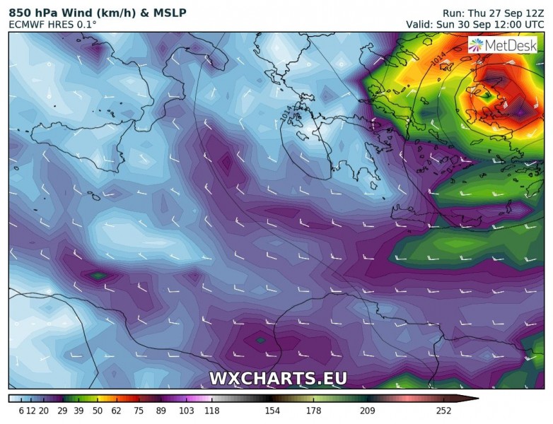
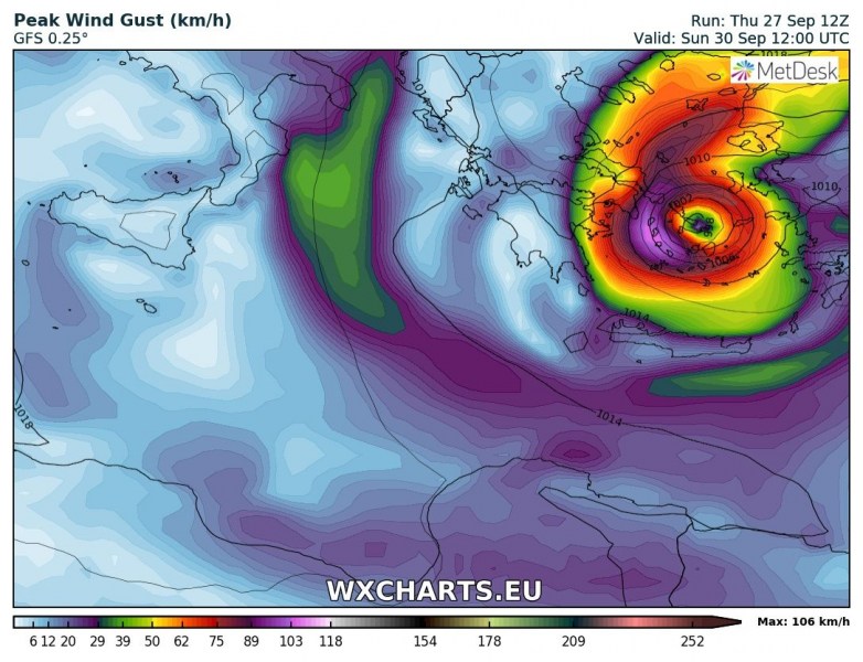
Here are 12 UTC model runs from the ARPEGE, ICON-EU, ECMWF and GFS models today, valid for tomorrow, Saturday and Sunday around midday.
Friday, 28th Sept 12 UTC – the position of strengthening Medicane is generally in the middle of the Ionian sea, peak gusts of 90-110 km/h per all models.
Saturday, 29th Sept 12 UTC – models mostly agree on the potential track of Medicane across the southern Greece, the centre / eye should eventually track between Peloponnese and Crete Island. The Medicane’s eyewall would in this case effect both landmasses pretty hard! Peak wind gusts could reach 120-150 km/h based on high resolution models.
Sunday, 30th Sept 12 UTC – all models also push Medicane into the Aegean sea and then also into western Turkey. This would bring potentially devastating flash floods there as severe storms with torrential rainfall could produce huge amounts of rainfall across the steep slopes in mountainous terrain of the western Turkey. Peak wind gusts could reach 100-120 km/h based on all models.
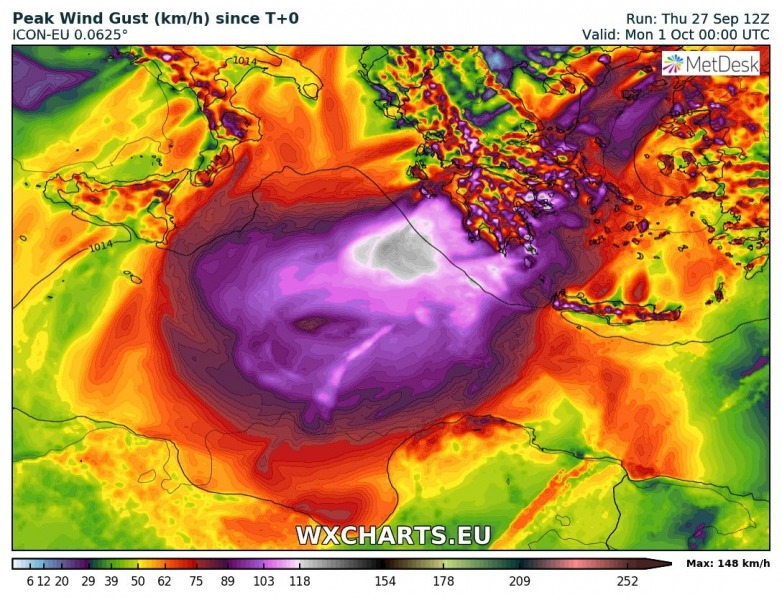
Peak wind gusts swath based on GFS, ICON-EU and ARPEGE model runs today, 12 UTC: both agree with ECMWF and are trending towards a large swath across the southern Greece, including a possibly significant effect on Crete island. The Medicane’s track would then push severe winds towards Turkey on Sunday as well.
Models are also on track in hinting at a potentially extreme amount of rainfall. Southern Greece will get hit hard, regardless of the track. These are the latest model guidance updates from GFS, ARPEGE and ICON-EU models – 300-500 mm may well be possible in some areas and bring life-threatening flash floods.
Models are perfectly on track with formation of Medicane tonight and agreeing on its track towards Greece and Aegean sea pretty well. High potential for destructive flooding remains for parts of southern Greece and is now also enhanced for western Turkey – stay alert!
You can read more about Medicanes here:
Medicane – Mediterranean tropical-like cyclones: what are they?
We will have new model data and further updates tomorrow morning – stay tuned!
