A strong upper ridge will amplify north across Fennoscandia towards this weekend. It will bring unseasonally warm weather to parts of Scandinavia with daytime highs in the mid-20s! We take a closer look.
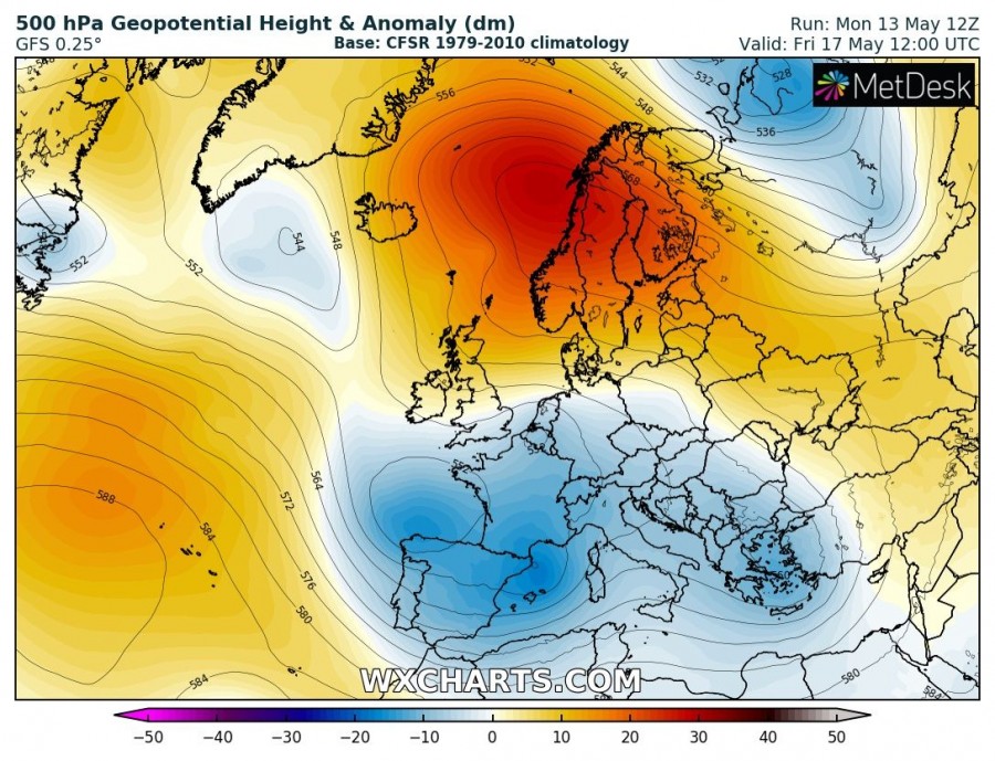
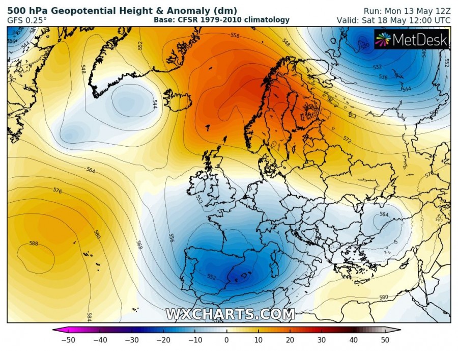
500 mbar geopotential height anomaly. GFS model guidance. Maps: Wxcharts.com.
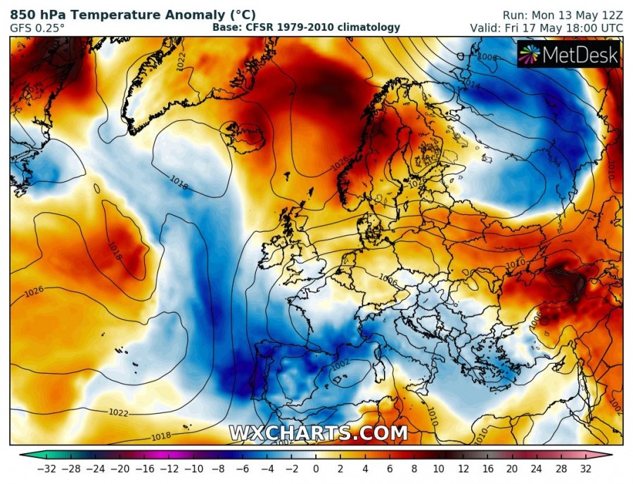
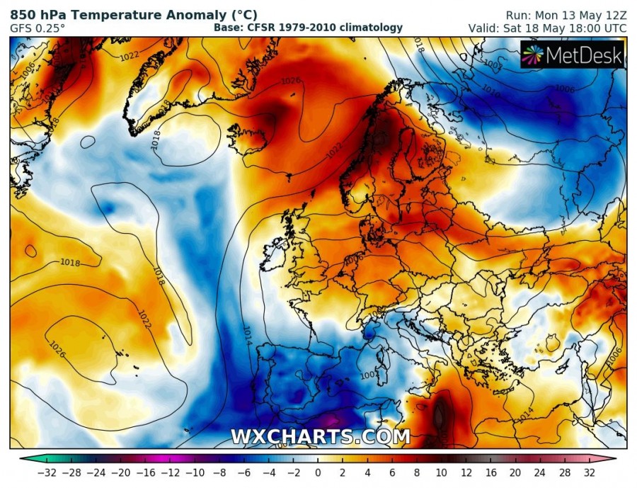
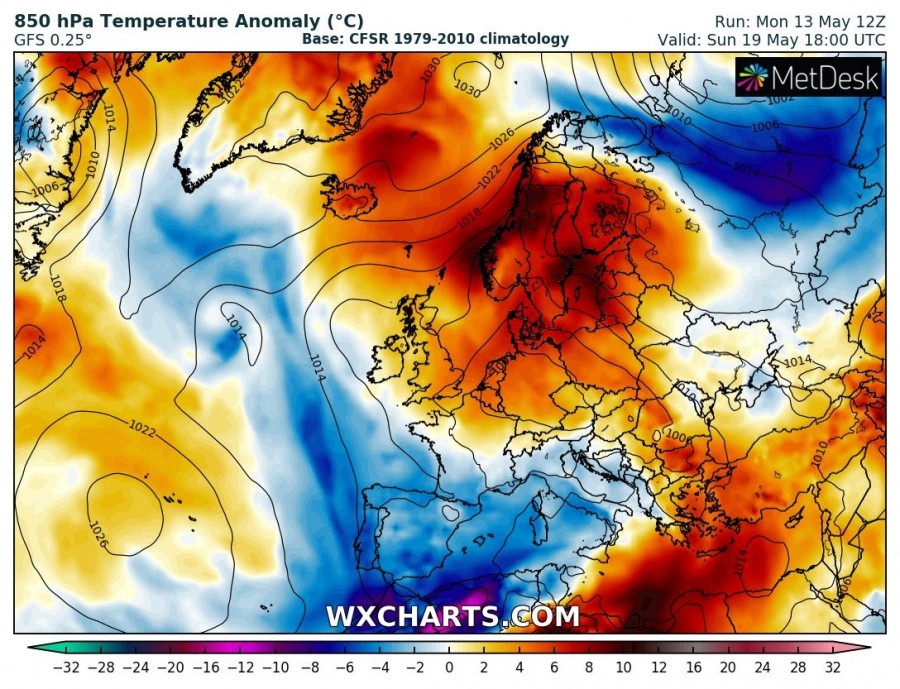
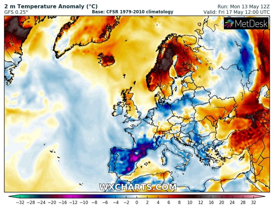
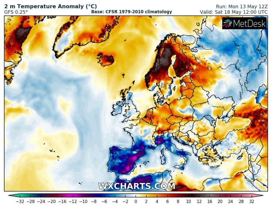
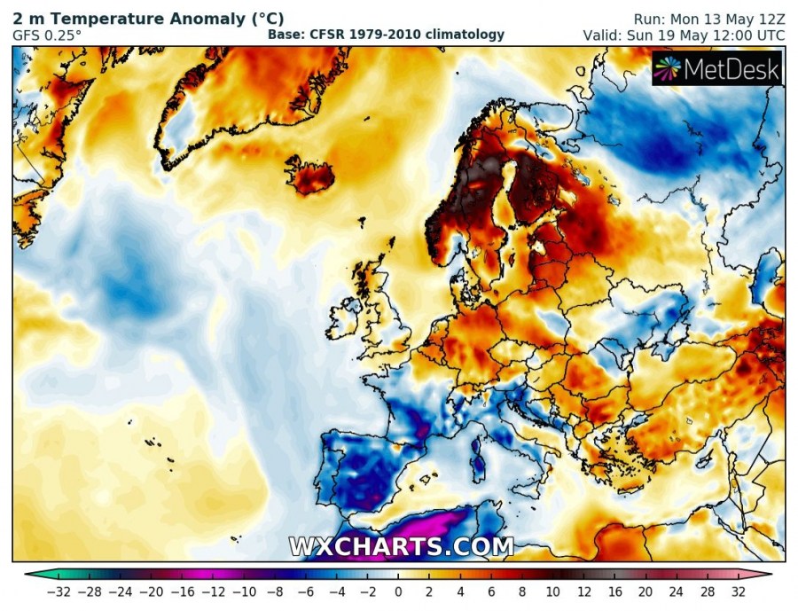
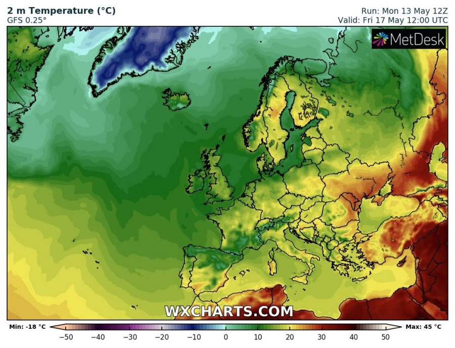
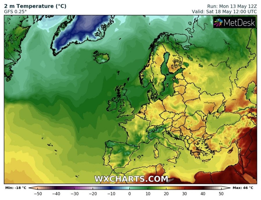
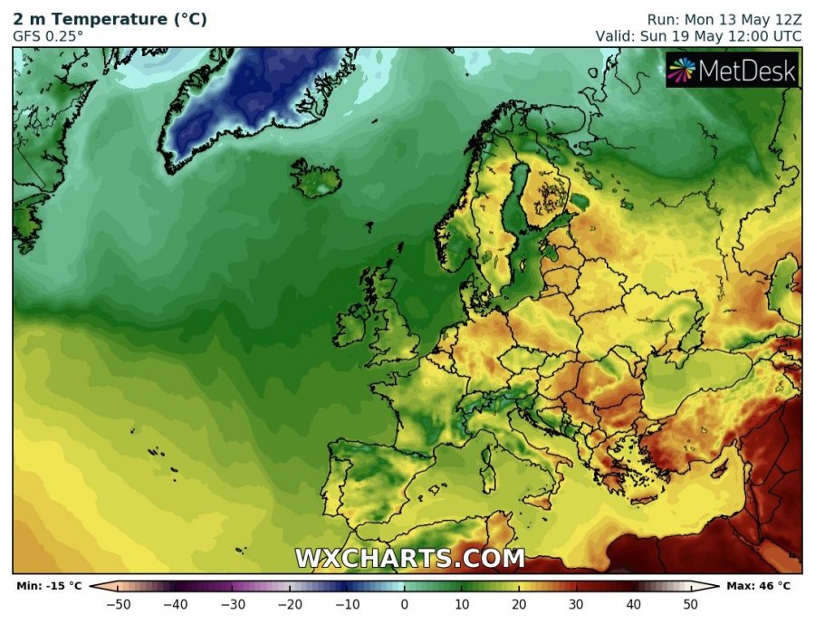
The upper ridge strengthens across Scandinavia and the Norwegian sea and pushes over Scandinavia during the weekend. Temperatures will indeed be very high for this time. The 850 mbar level temperature anomaly will be up to 10 °C, much warmer than average indeed. The 2 m temperature will be up to 15 °C warmer than average: daytime highs across parts of northern Europe will be push up to mid-20s! We will be keeping an eye on the pattern evolution, however, both GFS and ECMWF models are in fairly good agreement even at this time.
850 mbar temperature anomaly. GFS model guidance. Maps: Wxcharts.com.
2 m temperature anomaly. GFS model guidance. Maps: Wxcharts.com.
2 m temperature. GFS model guidance. Maps: Wxcharts.com.
