Cyclone Hugo will affect parts of Spain and Portugal tonight and tomorrow morning with winds gusting locally above 120-140 km/h.
Cyclone Hugo as seen by the NASA Terra satellite today (March 23) around local noon.
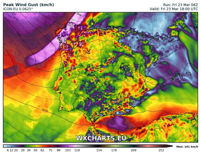
The cyclone is moving across the Bay of Biscay towards the southeast today, moving towards the Iberian peninsula. Strong winds will accompany the cold front of the system as it moves across the peninsula. Higher elevations and exposed areas will see winds gusting at 100-120 km/h, while some models indicate gusts up to 150-170 km/h at some isolated locations (high elevations). Expect strong downslope winds along the southern flank of Sierra Nevada and along the southern coast of Spain, particularly in the morning hours. By mid-morning the main wind field of the cyclone will have reached the northwestern coast of Spain: expect winds gusting at up to and locally over 120 km/h. Also expect big waves along the coast, well in excess of 5 m at their maximum.
Peak wind gusts across the Iberian peninsula. Map: Wxcharts.eu – ICON-EU model.
This forecast will be updated tomorrow morning as cyclone Hugo moves across the Iberian peninsula towards the Mediterranean.


