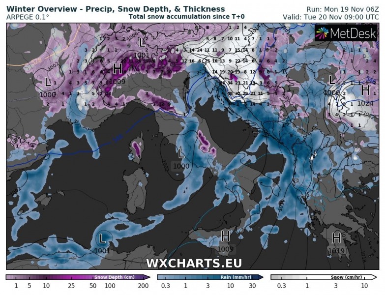
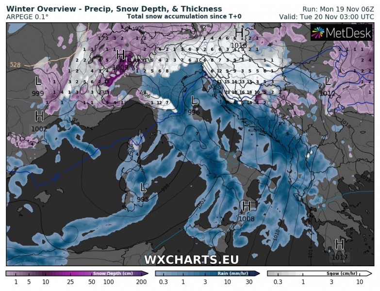
The ongoing pattern across the Mediterranean supports significant snowfall across north Italy, Slovenia, parts of Croatia and south Austria in the next 24-36 hours. Snow expected also in the low-lying areas.
The large cutoff low over W-CNTRL Mediterranean will be associated with a large and relatively deep surface low over the central Mediterranean. It will result in a strong low level wind field across much of the central and northern Mediterranean. Strong southerly and southeasterly winds across southern and central Adriatic, which will cause torrential rainfall along the coastal region there, turn into northeasterly Bora winds across northern Croatia and Slovenia, advecting cold air from the east. Meanwhile, mid-level southwesterly flow will continue advecting moist airmass into the region, resulting in significant snowfall.
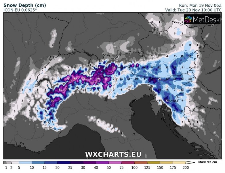
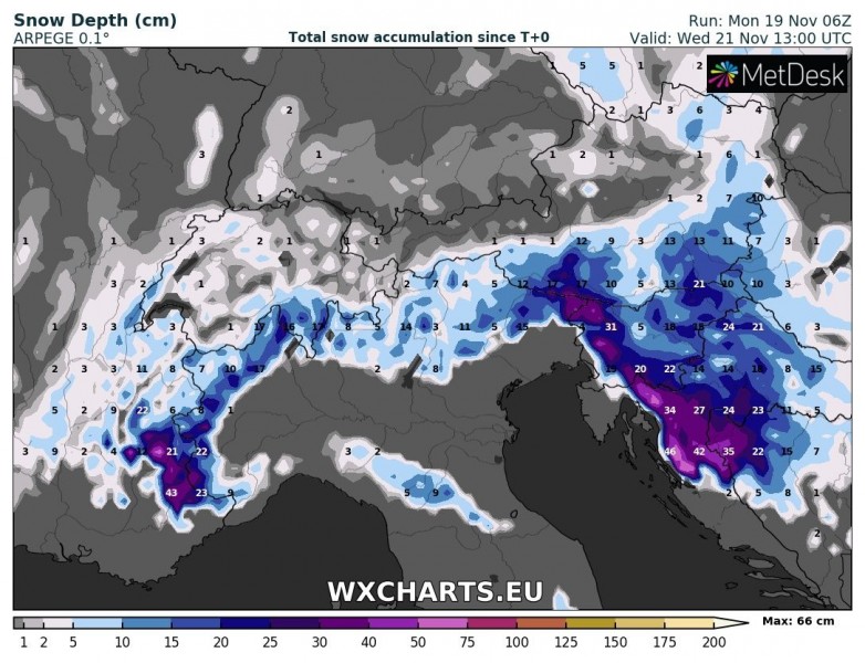
Expect up to 5-10 cm of snowfall in the elevated terrain of southern Austria. Up to 20 cm of fresh snow is expected at higher elevations of the southern Alpine slopes in north Italy. Up to about 10-30 cm of snow is expected along the elevated terrain of the Dinarides in western Slovenia, 10-15 cm in the Alps and several centimeters in most of the remainder of the country. Up to 20-30 cm is expected in Gorski Kotar in NW Croatia.
Snow depth late morning on Tuesday. ICON-EU model guidance. Map: Wxcharts.eu.
Snow depth early afternoon on Wednesday. ARPEGE model guidance. Map: Wxcharts.eu.
http://www.severe-weather.eu/calendar-2019/


