Severe thunderstorms are likely across southern France in the afternoon and evening today. A long wave trough passes over the Iberian Peninsula eastwards, producing a strong 40-50 kt mid-level jetstreak. It combines with a moderately unstable environment and will likely produce a series of severe thunderstorms.
500 mbar winds and height, GFS model guidance. Map: Pivotal Weather.
The left exit of the jetstreak passes over S France, providing upper level forcing. A surface low develops over southern France, moving ENE-wards during the late afternoon. Ahead of the system, southeasterly backing surface winds overlap with the mid-level jet and produce up to 30-45 kt deep-layer shear and up to 200 m2/s2 SREH3. Expect organized thunderstorms with isolated supercells.
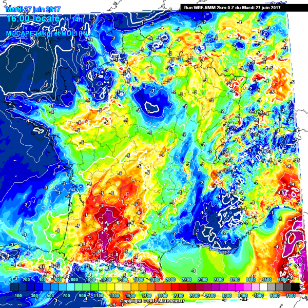
Instability across the region, WRF model guidance. Map: Meteociel.fr.
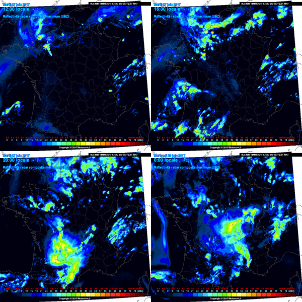
Simulate radar reflectivity across the region, WRF model guidance. Map: Meteociel.fr.
Initially fairly isolated storms will likely rapidly merge into a large MCS moving eastwards. Any initially isolated supercell will present a significant threat for large to very large hail, severe wind gusts and torrential rainfall. The MCS will present threats for severe winds and torrential rainfall.

