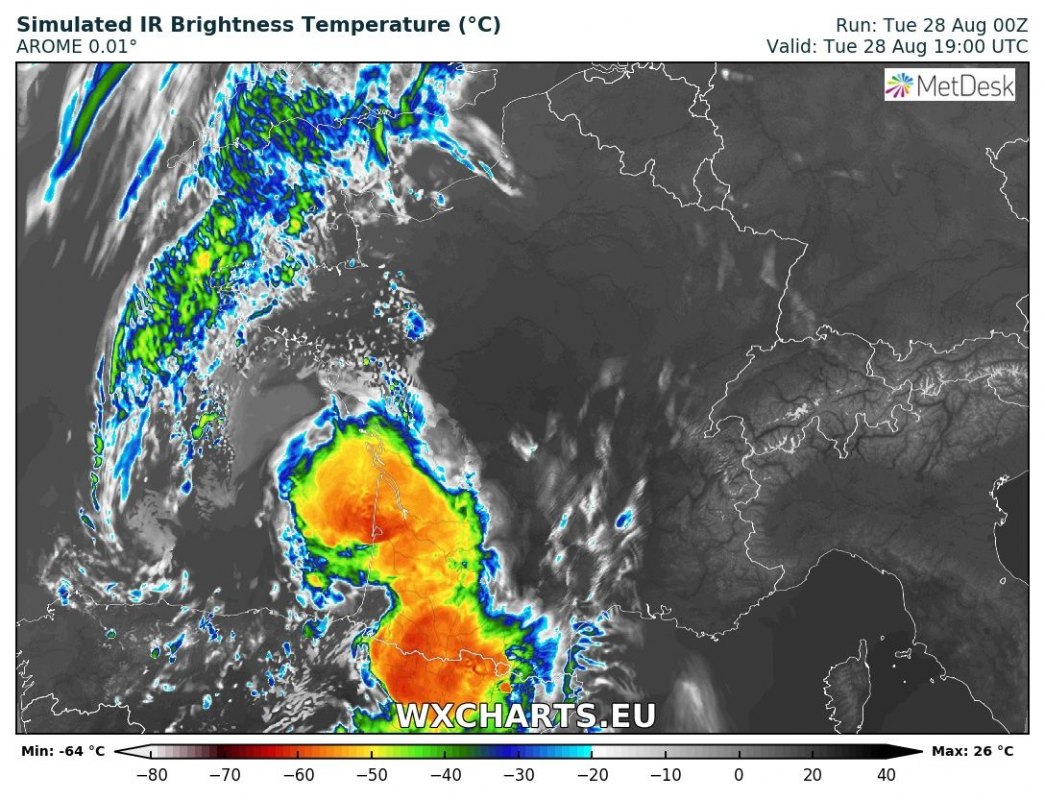
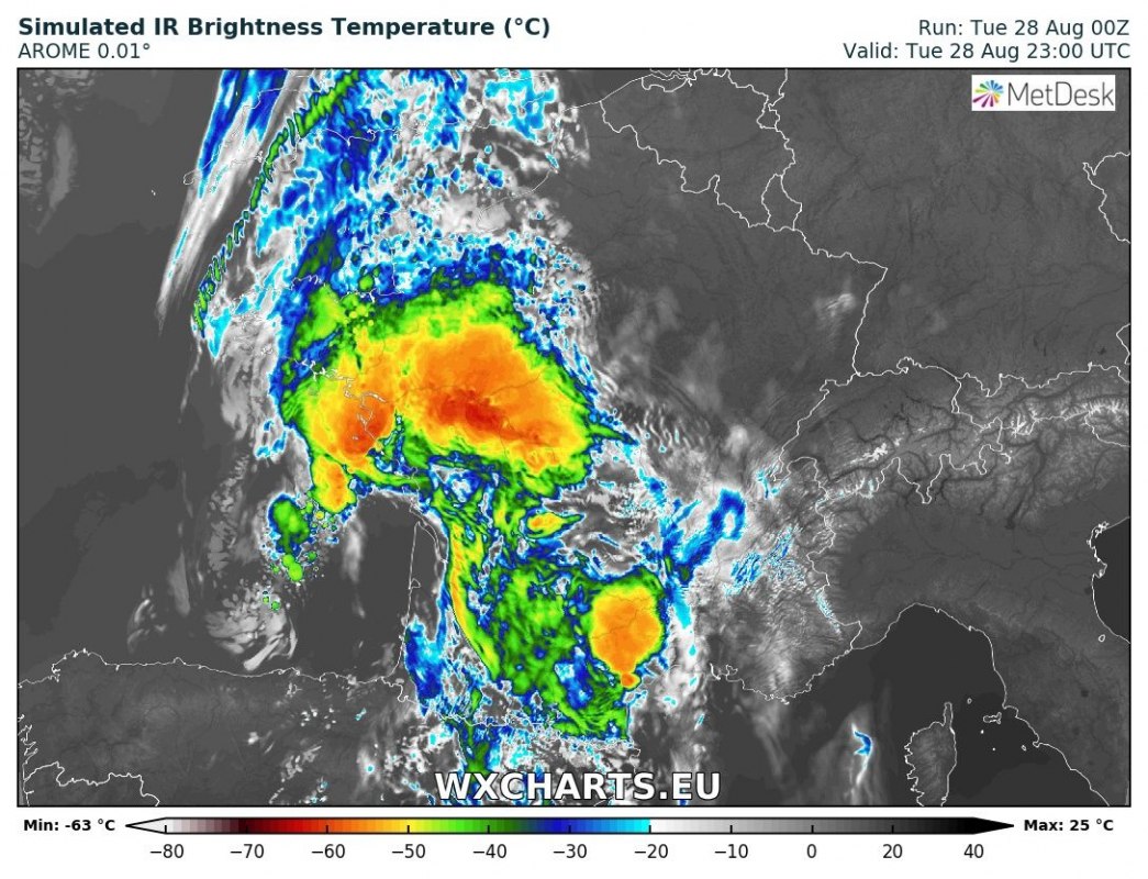
Severe thunderstorms are likely in southwestern France and parts of northern and eastern Spain today. A shortwave trough / surface low ejects from the Atlantic across the north of the Iberian peninsula, across the Bay of Biscay into France. Conditions are favourable for the development of severe thunderstorms.
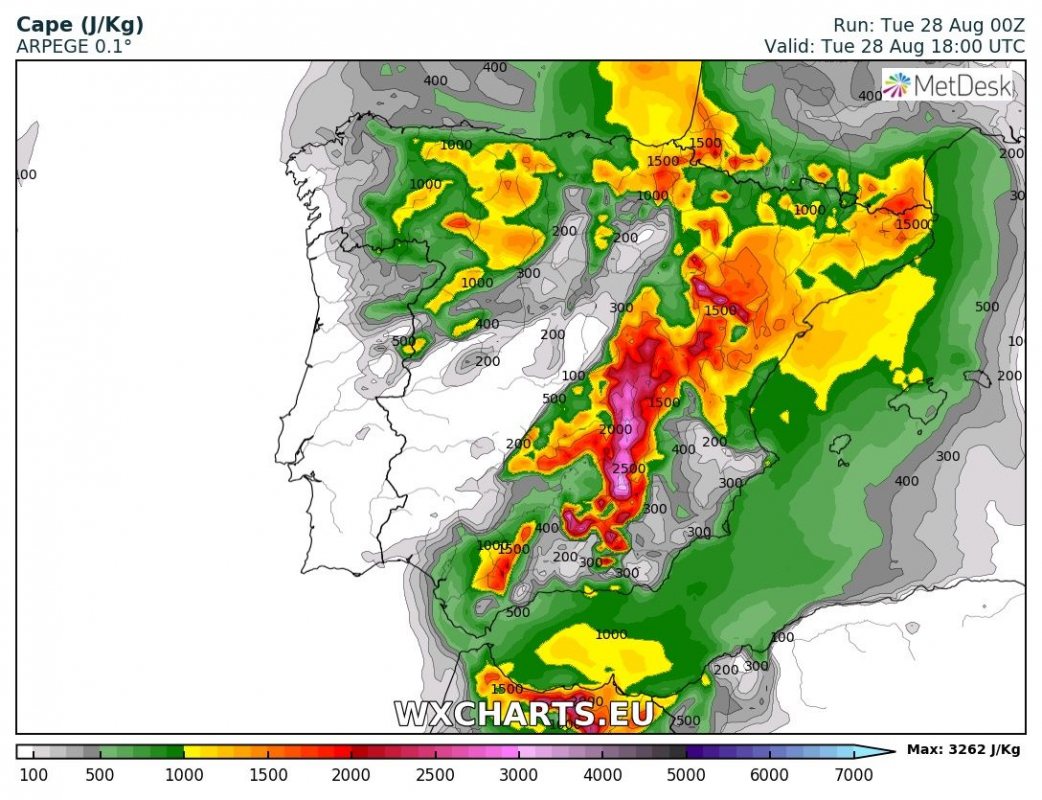
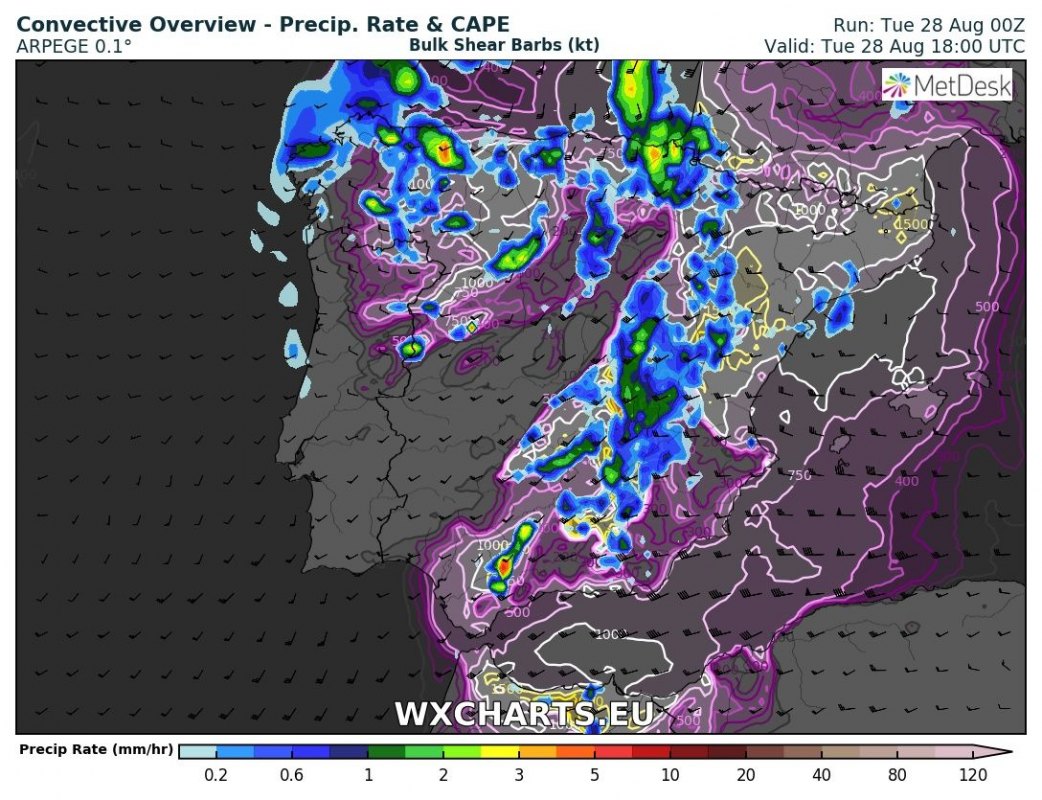
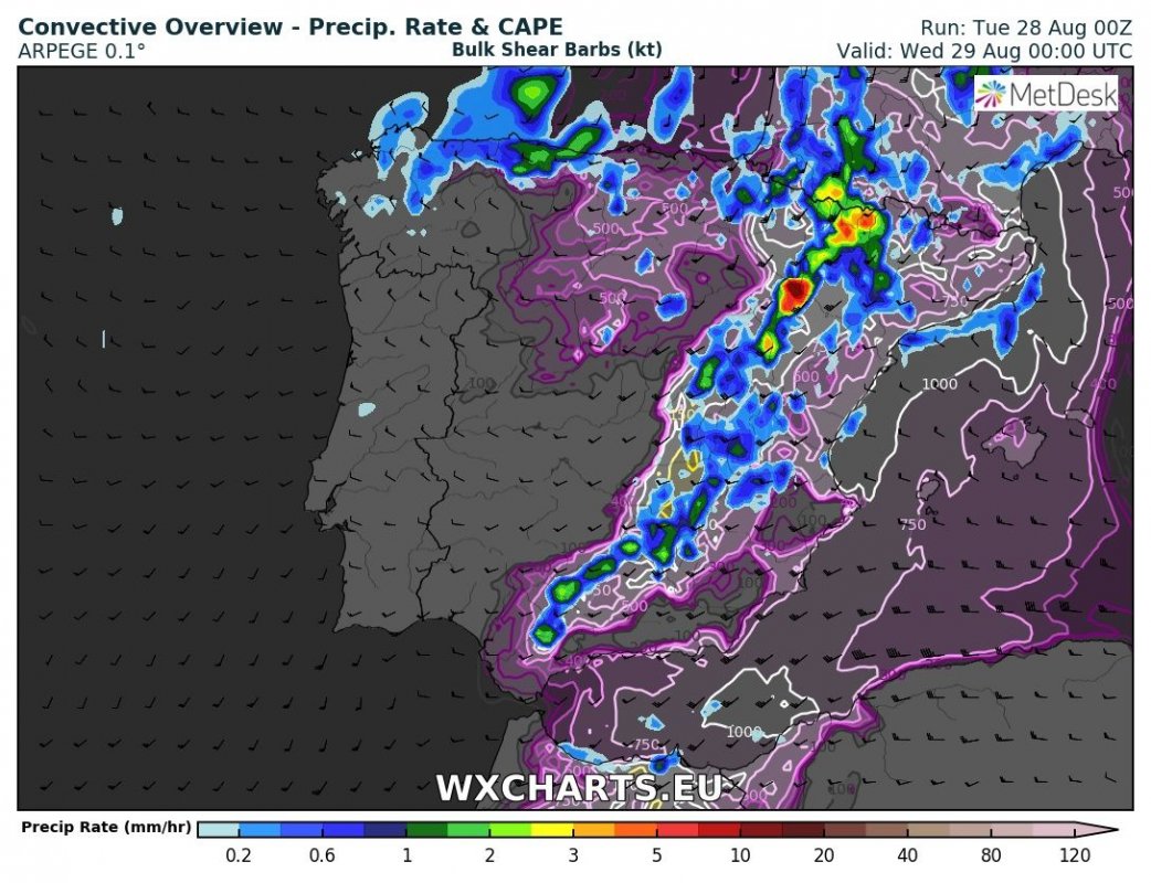
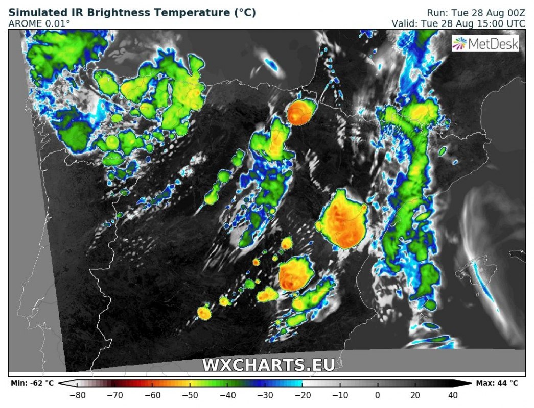
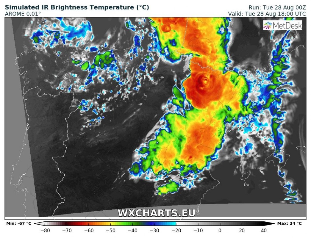
Isolated / discrete thunderstorms are expected to first develop across north-northeast Spain in mid-afternoon. Strong instability will likely be available, with up to 2000+ J/kg MLCAPE, overlapping with 30-40 kt deep-layer shear. Expect multicell and supercell thunderstorms to develop. Main threats will be large to locally very large hail (>5 cm), severe straight line winds and locally torrential rainfall. Tornado threat will be limited. The storms will move northward and dissipate by late in the evening. See map overview below for details.
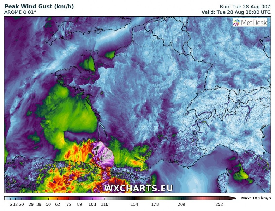
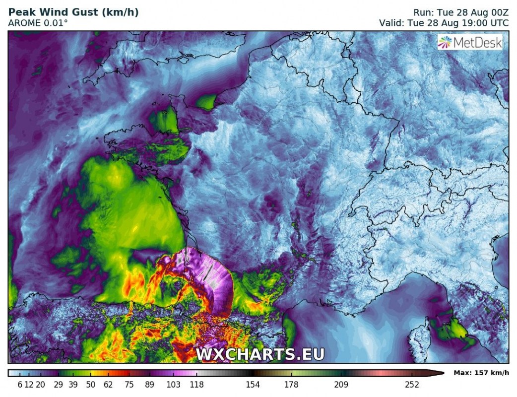
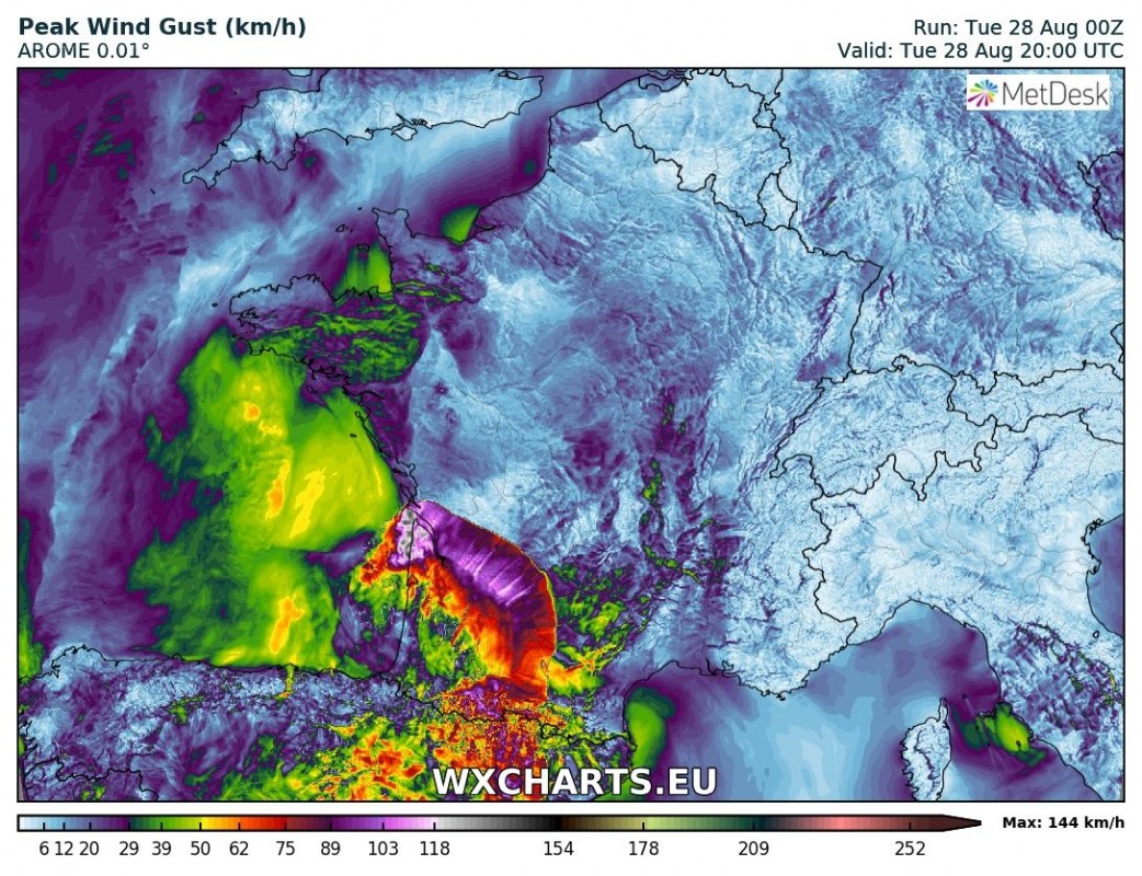
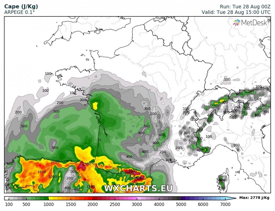
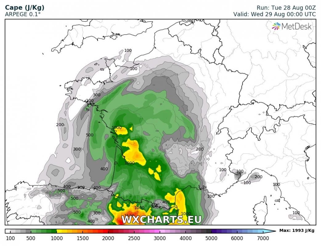
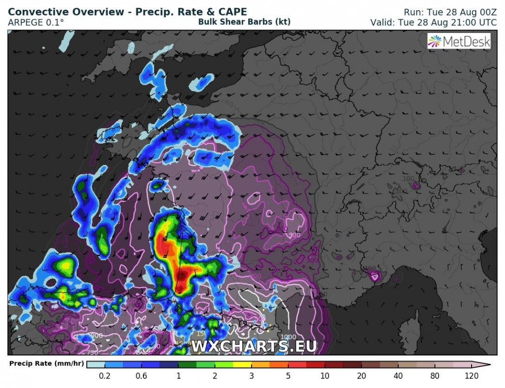
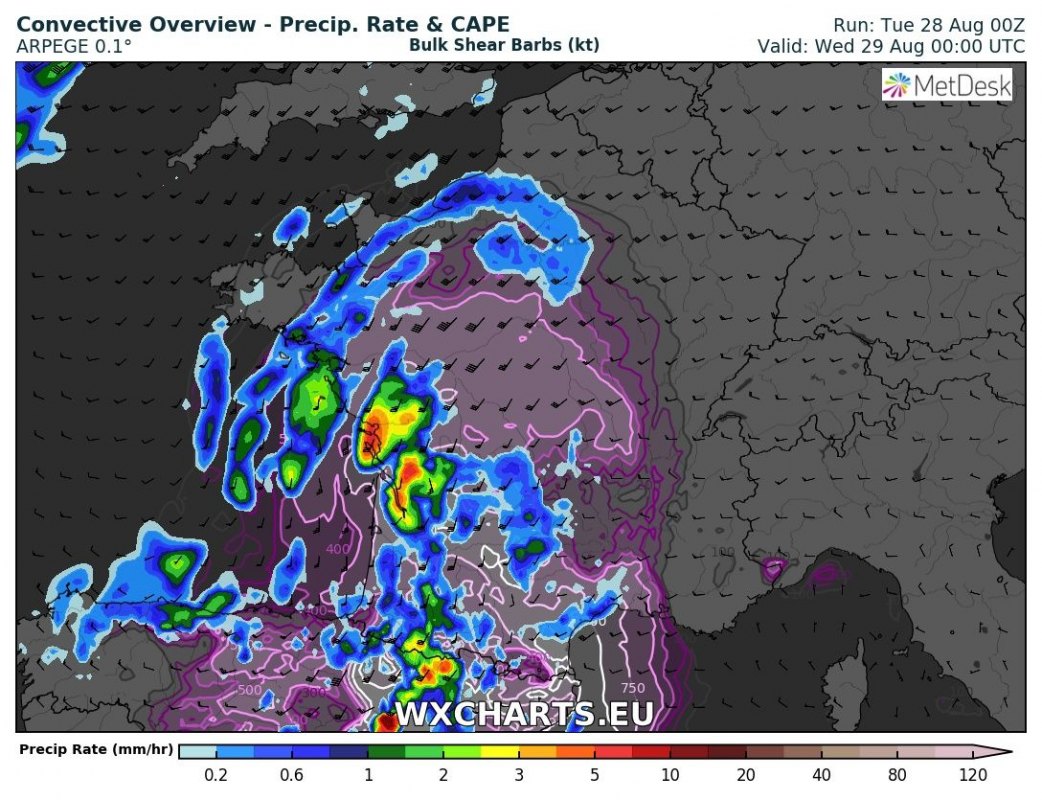
Storms are also expected to develop in extreme southwestern France by mid afternoon. Moderate instability, up to about 1000 J/kg MLCAPE will be available across western and southern France, overlapping with impressive deep layer shear (30-40 kt). Expect organized multicells and supercells merging into one or two MCS/clusters by the evening, moving northwards. Instability will limit the severe potential of storms to some extent, however, storm coverage will be quite high. The main threat will be severe straight line winds, possibly well in excess of 100 km/h!
Intense straight line winds expected in southwestern France today! Map: Wxchart.eu
Also expect threats for large hail, severe wind gusts and torrential rainfall. Strong easterly surface winds along the northern flank of the Pyrenees will enhance helicity in that region, producing enhanced conditions for supercells and somewhat enhancing the threat for tornadoes. See map overview below for details.
Map overview of the Iberian peninsula
Istability over the Iberian peninsula today. Map: Wxchart.eu
Convective overview (indicating instability in line contours and rainfall in shaded) and IR simulated temperature (indicating cloud tops and tops of thunderstorm anvils) over the Iberian peninsula today. Map: Wxchart.eu
Map overview of France
Istability over the France today. Map: Wxchart.eu
Convective overview (indicating instability in line contours and rainfall in shaded) and IR simulated temperature (indicating cloud tops and tops of thunderstorm anvils) over France today. Map: Wxchart.eu
