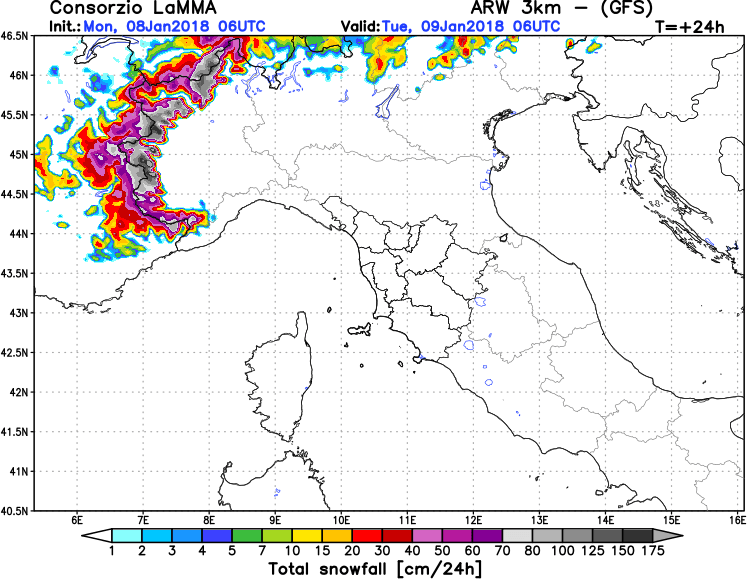
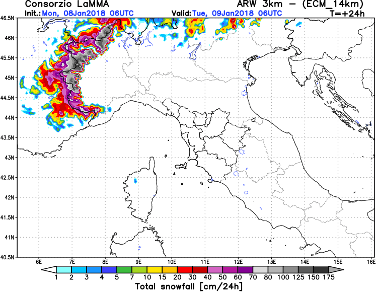
Intense snowfall in the Alps of northwestern Italy continues tonight and will persist for much of the day tomorrow. Locally over 1 m of snow has fallen in the past 24 hours, additional 1-1.5 m is indicated by various models by late tomorrow.
Both convective and orographic (stau effect) snowfall are ongoing across the western Alps, particularly the extreme NW Italy, under the effects of the ongoing intense cold core upper low over the western Mediterranean. Various high-resolution models indicate 100 cm of additional snowfall by late tomorrow, with some areas receiving even up to twice as much.
Total snowfall in the Alps by Tuesday late afternoon; locally up to 200 cm additional snow locally, up to 100 cm of new snow over a significant part of the Alps of NW Italy. ARPEGE model guidance. Map: Wxcharts.eu.
24h snowfall totals over the western Alps by Tuesday, 06 UTC. ARF-GFS model guidance. Map: Consorzio LaMMA.
24h snowfall totals over the western Alps by Tuesday, 06 UTC. ARF-ECM model guidance. Map: Consorzio LaMMA.


