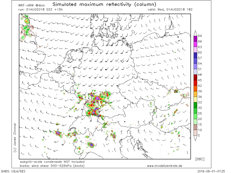
Quite an interesting afternoon ahead for eastern France, northwest Italy and particularly south to southwestern Germany: expect widespread thunderstorm activity across the region. There is moderate to high instability available with 1000-2000 J/kg MLCAPE, locally up to 3000 J/kg. Deep layer shear is fairly marginal at 20-25 kt supporting the development of multicell clusters. Local interference of winds and relief effects can result in a supercell or two as well. Main threats with these storms will be torrential rainfall and local flooding, severe straight line winds and large hail. If a supercell develops, very large hail is not ruled out.
Simulated IR brightness temperature across the region, indicating numerous thunderstorm anvils in the afternoon. AROME model guidance. Map: wxcharts.eu.
Moderate to high instability across the region. WRF model guidance. Map: modellzentrale.de.
Simulated radar reflectivity, indicating numerous powerful storms. WRF model guidance. Map: modellzentrale.de.


