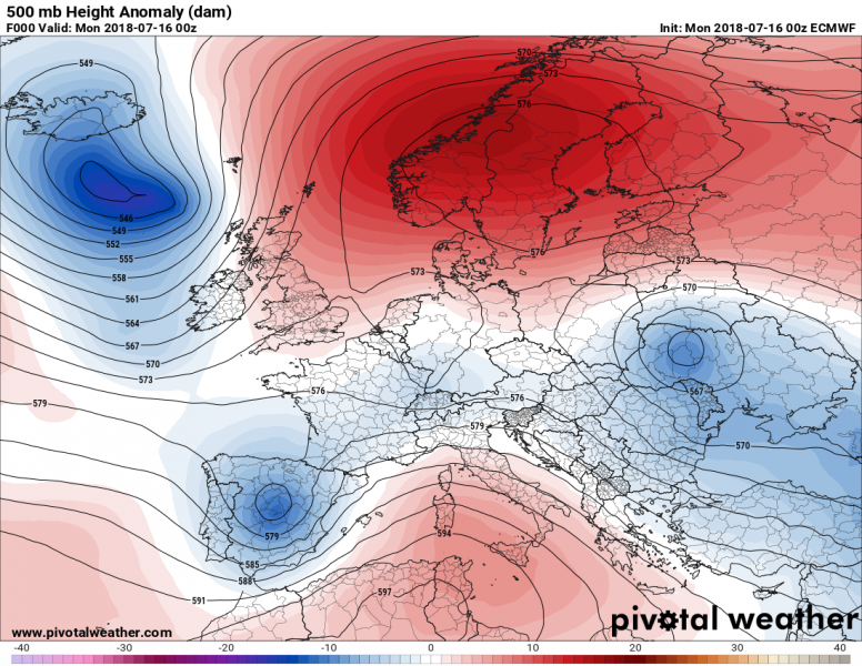
The current weather pattern reveals a strong upper ridge across northern Europe and southern Mediterranean while a couple of upper lows are in between – over N Atlantic, SW and E Europe. Meanwhile an upper low from eastern Spain rapidly moves into northern Mediterranean, resulting in severe weather period this afternoon and evening hours. The strong ridge across northern Europe remains in place and brings another very hot day across the southern parts of the region.
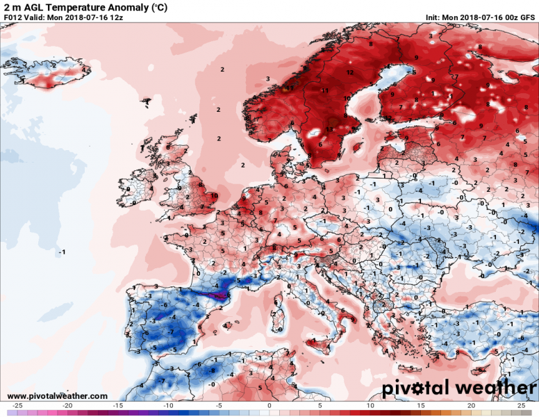
Today has started in significant way again, south-central Sweden and southern Finland are already climbing into upper 20s, so we can again expect max afternoon values in range from 29 to 33 °C there. Temperatures already soared above 30 °C way up in the Arctic circle last week!
This morning’s GFS model prediction for the afternoon, suggesting almost whole northern Europe will be 8-14 °C warmer than usual for mid July, temperatures could locally reach up to +34 °C in Sweden!
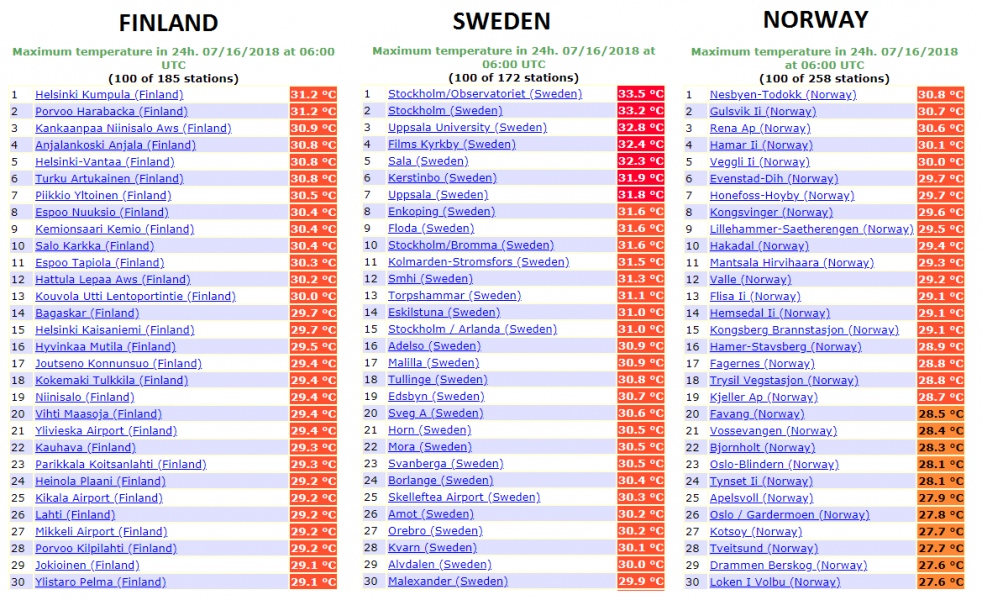
Here are yesterday’s maximum temperatures across Norway, Sweden and Finland. Many locations recorded an extreme heat for Scandinavia, even above +33°C in SW Sweden!!
We will continue monitoring the evolution of this significant heat wave across northern Europe, so stay tuned for further updates this week!


