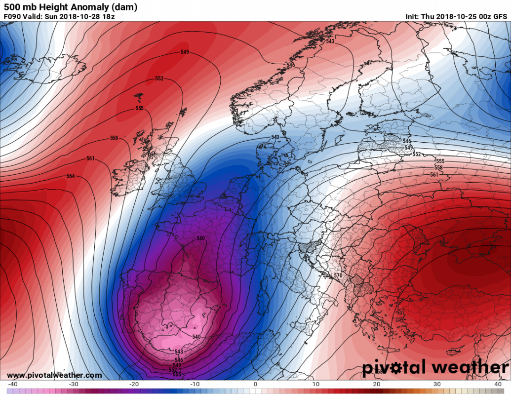
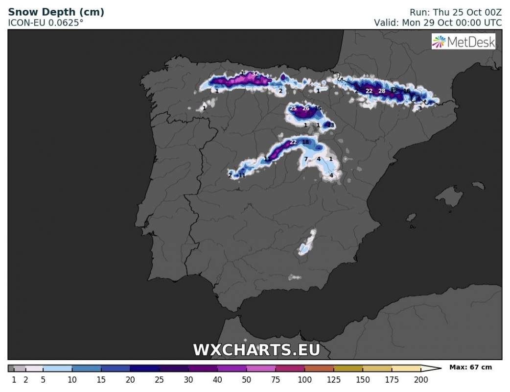
The first significant snowfall of the season is coming to northern Spain and the Pyrenees this weekend. A deep trough moves from the northern Atlantic and gradually transforms into a very deep cutoff upper low over the Iberian peninsula. The system brings thunderstorms to eastern Spain and locally intense snowfall at higher elevations further inland in N-NE Spain.
Deep cutoff low over the Iberian peninsula late on Sunday. Map: Pivotal Weather.
Various model guidance indicates up to ~20 cm, possibly 30 cm of snow at higher elevations of northern and northeastern Spain by late on Saturday. The Pyrenees may locally receive 60-100 cm (at high elevations).
Total snow depth late on Sunday. ARPEGE model guidance. Map: Meteociel.fr.
Total snow depth late on Sunday. ICON-EU model guidance. Map: Meteociel.fr.


