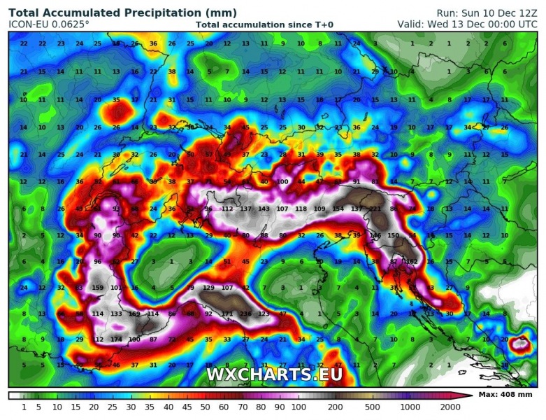
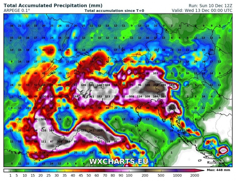
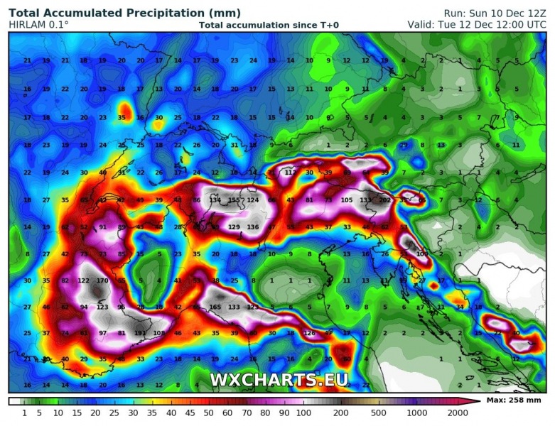
Strong warm air advection with southerlies and southwesterlies, caused by successive deep lows over central Europe will cause intense precipitation along the southern and western flanks of the Alps, the northern Apennines and the northern Dinarides over the next 48-72 hours. Rainfall totals (or equivalent in snow at higher elevations) of over 300 mm are possible.
The strongest precipitation is expected over parts of NE Italy, W Slovenia and NW Croatia. High-resolution models suggest up to 250-350 mm of rainfall across the Liguria, S Piemonte, N Tuscany and W Emilia Romagna. Locally significant flash flooding is expected. Expect mostly rainfall, some snow possible with stronger showers higher than ~1300-1500 m elevation.
The second zone of intense rainfall is the southern Alps (Julian and Carnic Alps, particularly across the Kanin / Mt Canin massif) of extreme NE Italy and NW Slovenia, extending into the Dinarides of W Slovenia and extreme NW Croatia (Snežnik massif). High-resolution models suggest up to 250-350 mm of precipitation there by early on Wednesday. Expect snowfall at higher elevations, starting at 900-1200 m (lower in case of intense showers), rising to above 1500 m on Monday and dropping again to below 1000 m late on Tuesday and Wednesday. The entire region has accumulated a significant snow blanket, which will thaw rapidly under the effects of warm southerlies and southwesterlies on Monday: expect the thaw to combine with intense rainfall for locally significant flooding. High elevations may locally see 2+ m of fresh snow.
Very significant precipitation is expected also across the southern Alpine flank in Lombardy, Trentino Alto Adige and Veneto and the southwestern flank of the Alps in SE France. Expect up to approximately 150-200 mm of rainfall (or snowfall at higher elevations) by early on Wednesday. Snow limit will generally be below 1000 m, rising up to approximately 1200-1400 m on Monday.


