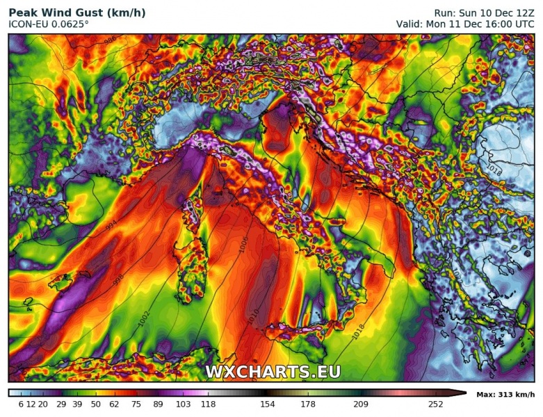
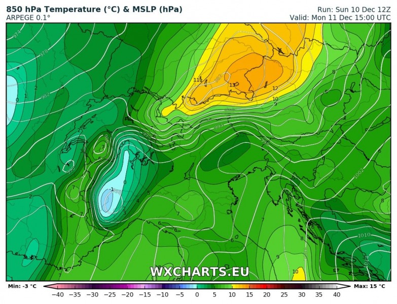
The series of successive deep lows over central Europe today and through Tuesday will result in a very steep pressure gradient between central Europe and the Mediterranean. It will result in unusually strong southwesterly winds and strong warm air advection from the Mediterranean into the Alps. Additionally, strong Foehn effect will further raise the air temperature along the northern Alpine flanks.
Intense southwesterlies are likely to gust well above 150 km/h across higher elevations of in central and eastern Alps, with many locations likely approaching 200 km/h, possibly even exceeding it. Winds are expected to strengthen throughout the remainder of Sunday and into Monday, reaching peak strength in mid afternoon and gradually diminishing by early on Tuesday. Expect winds gusting up to 150 km/h, locally possibly more, in the northern Apennines and the northern Dinarides of SW Slovenia and NW Croatia as well.
Strong warm air advection will be ongoing with the southwesterlies (Scirocco winds at surface level), advecting warm air from the Mediterranean. Temperatures along the southern flank of the Alps at the 850 mbar (1500 m) level will be about 6-7 °C! Furthermore, exceedingly strong Foehn effect will push temperatures at 850 mbar level along the northern flank of the Alps up to 12-13 °C! These are temperatures one would expect in mid-spring! Note that much of the Alps are under a thick cover of fresh snow; the strong Foehn will cause intense thaw.
Strong Foehn effect will also be present along the eastern flank of the Dinarides, raising the temperature at 850 mbar level up to 12-13 °C late on Monday and early on Tuesday.
A new cold push will follow, spreading across central Europe late on Monday, spreading across the Alps and the northern Mediterranean into SE Europe on Tuesday and Wednesday. More on that tomorrow.


