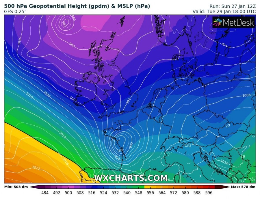
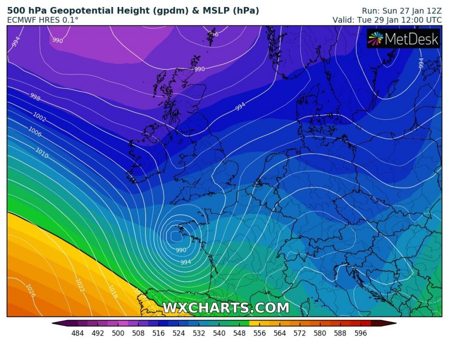
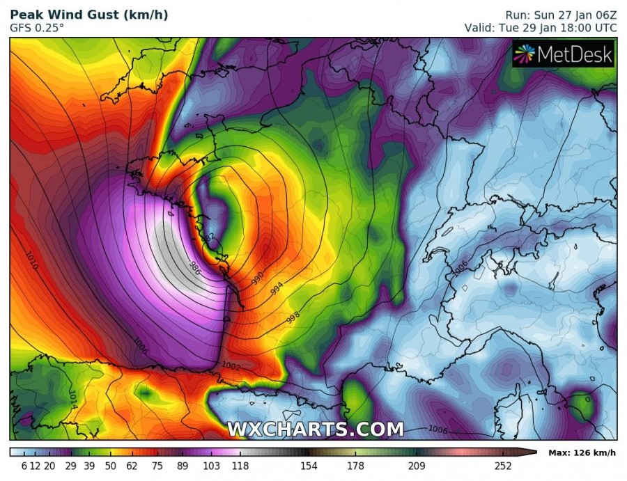
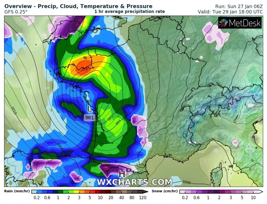
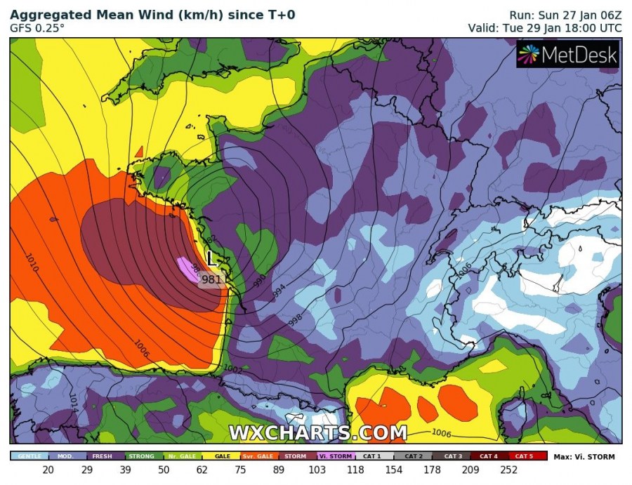
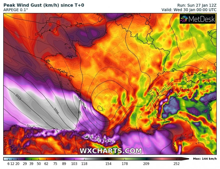
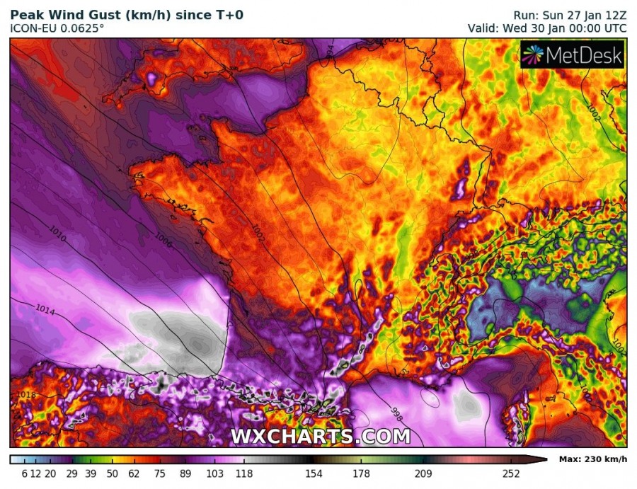
A deep cyclone will explosively develop over the Bay of Biscay on Thursday, producing a strong windstorm along the western coast of France and northern coast of Spain.
The cyclone will form over the Atlantic ocean north of the Azores early on Monday, pushing towards western Europe while gradually deepening. Model guidance is in good agreement on explosive deepening early on Tuesday, as it passes south of the British Isles and Ireland, pushing into the Bay of Biscay. While there remains considerable uncertainty about the exact track of the system, it will reach the coast of western France in the afternoon or evening on Tuesday as a deep cyclone with severe winds reaching storm force. Central mean sea level pressure of the system will likely be between 980 and 990 mbar.
Depending on the exact track, the cyclone will affect parts of the western coast of France and northern Spain with gale to storm force winds gusting up to 100-130 km/h. Peak wind gusts could reach up to 150 km/h.
We will be updating on this system tomorrow – stay tuned!
