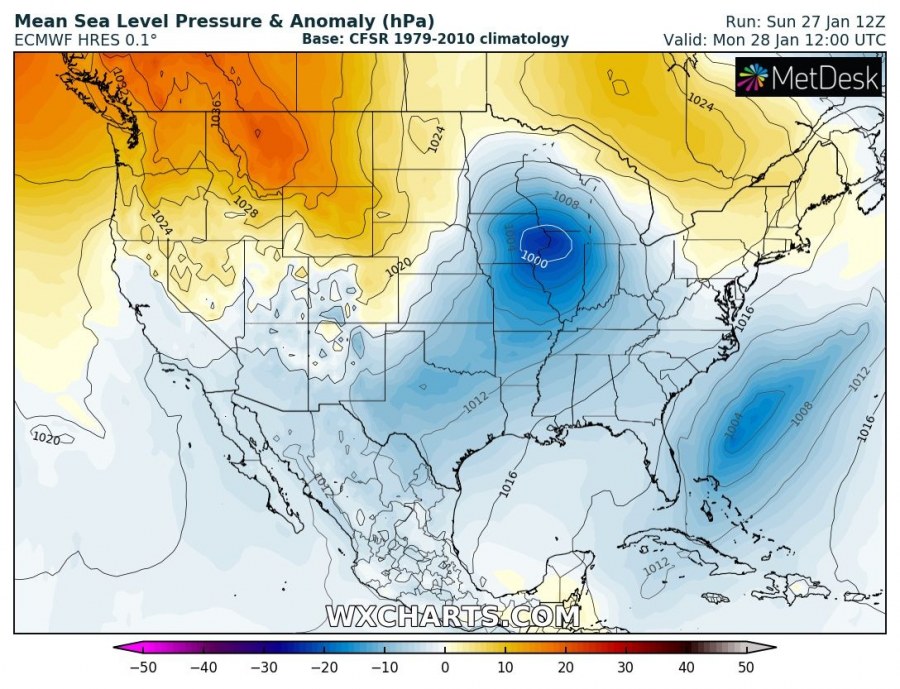
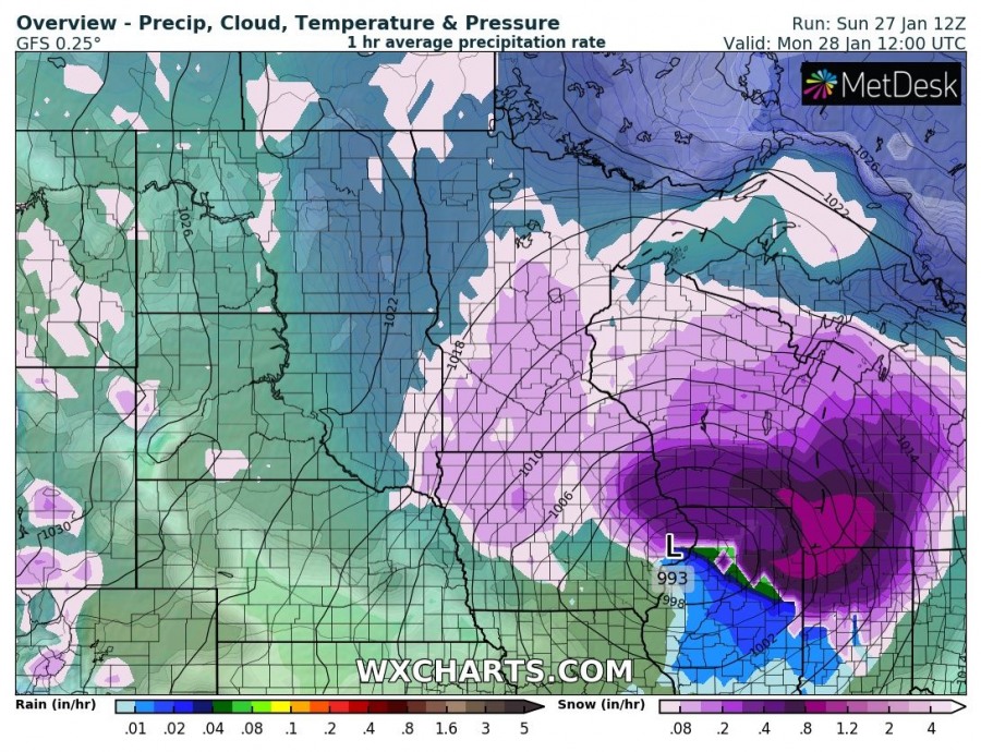
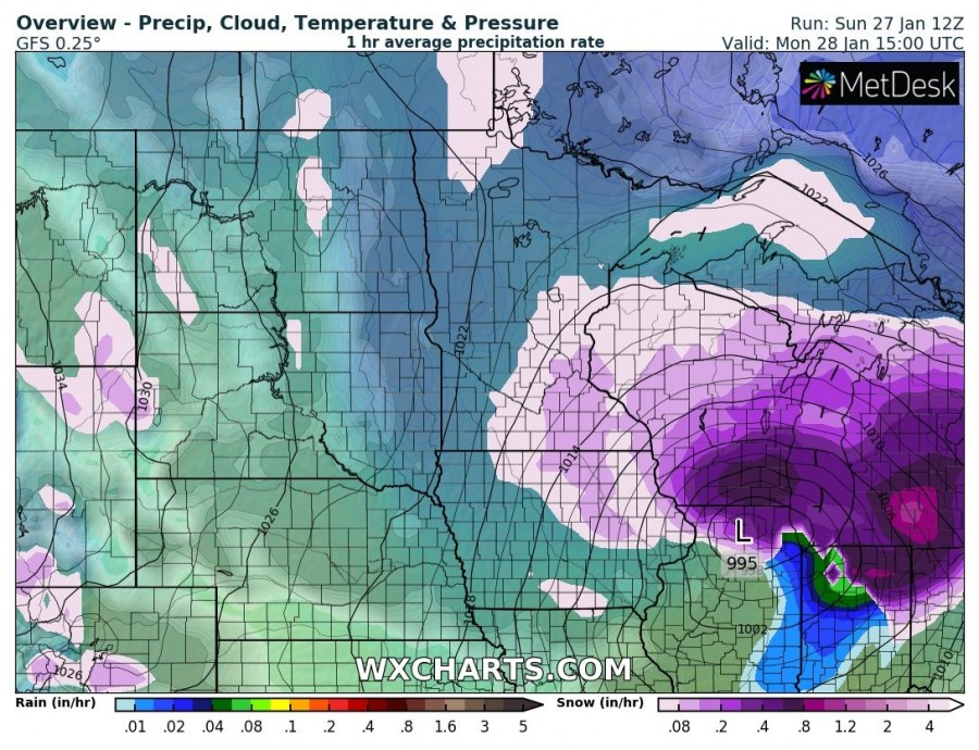
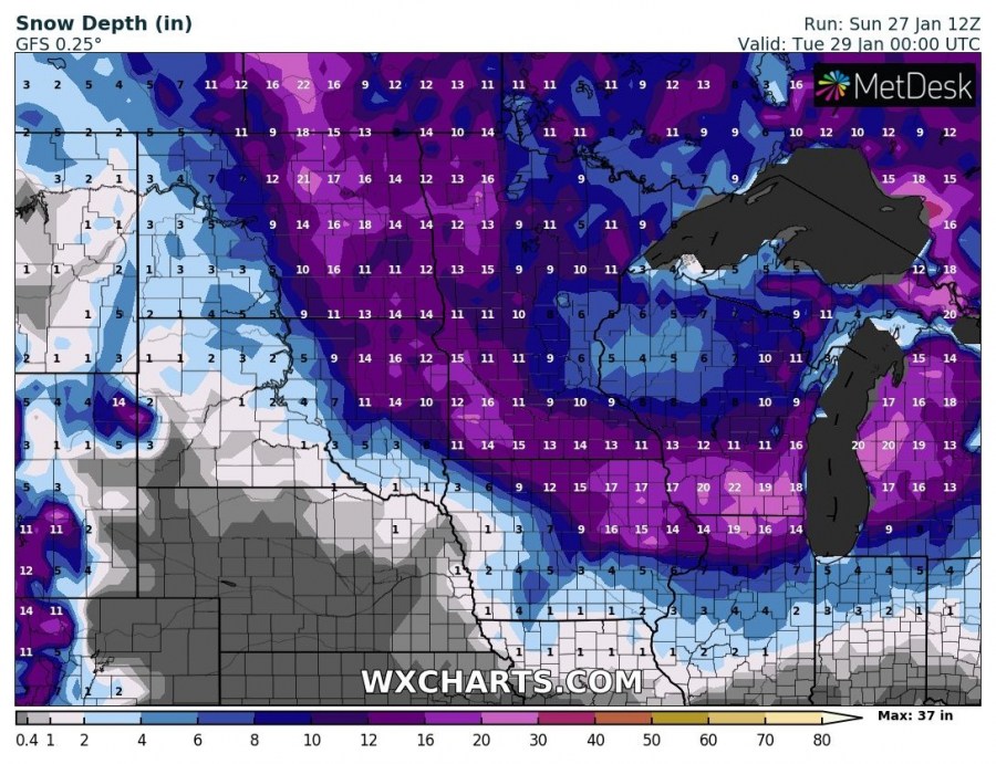
A potentially severe snowstorm is developing across the Northern Plains today, expected to intensify tonight while moving towards the Great Lakes region. Locally 10+ inches / 25+ cm of snow is expected, combined with strong winds and blizzard conditions.
The pattern evolving tonight indicates a deep trough across eastern Canada with a short-wave trough moving across the northern United States towards the east. At the surface, a cyclone is located near the International border over North Dakota and is gradually intensifying on its way across Minnesota towards the southern Lake Michigan.
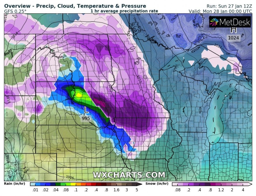
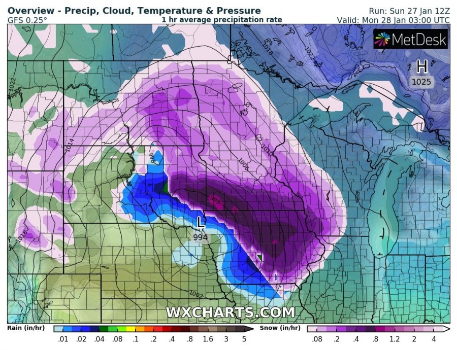
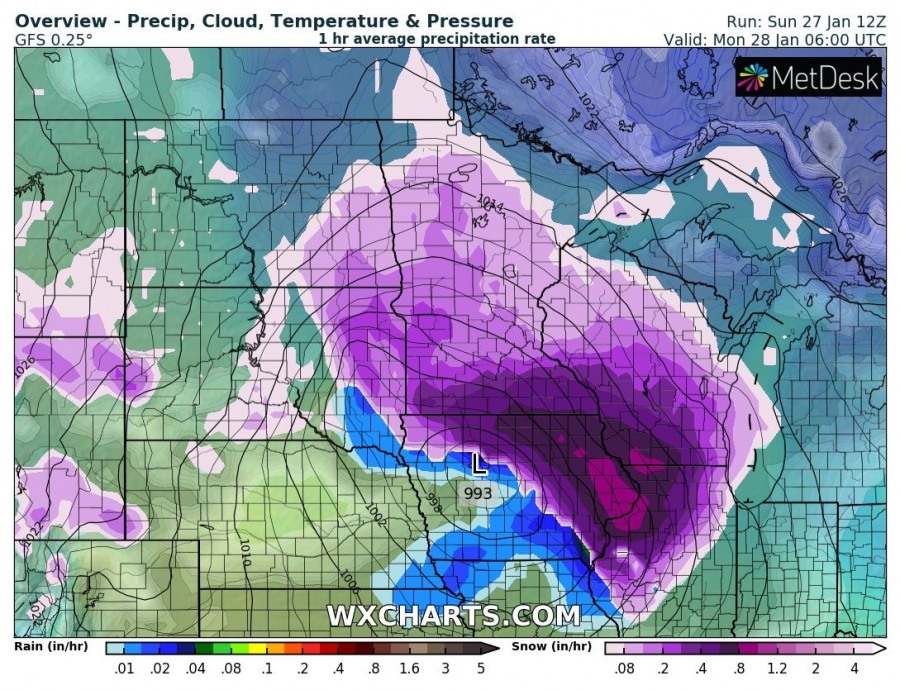
Here is a 3-hour sequence of snowstorm traveling from the Northern Plains (eastern North Dakota, southern Minnesota, northern/eastern Iowa) towards the Midwest and Great Lakes region (southern Wisconsin, northern Illinois, northern Indiana, south Michigan) from tonight into tomorrow morning hours. Very intense snowfall will be ongoing in some areas, combined with strong north/northwesterly winds resulting in intense blizzard and huge snow drifts.
Total snowfall should locally reach 8-12″ (20-30 cm), most likely across the southern Minnesota and the southern Wisconsin.
Followed by this snowstorm, a new trough will develop over Canada and advect brutally cold airmass into the same region by mid this week, as strong winds combined with temperatures near -40F / -40 °C spread into the region. Windchills will locally push below -50F! Stay tuned for more details!

