A very powerful Nor’easter cyclone will explosively develop along the eastern coast of the US on Thursday. Winds gusting above 80-90 mph, torrential rainfall and severe easterly winds that will produce intense waves and coastal flooding are expected on the coasts of Rhode Island, Massachusetts and Maine.
The nor’easter will rapidly deepen early on Thursday (UTC) as it tracks along the coast, deepening likely at 1-2 mbar/h, explosive cyclogenesis or ‘bombogenesis’ by definition! It will reach around 975 mbar central mean sea level pressure by early morning local time.
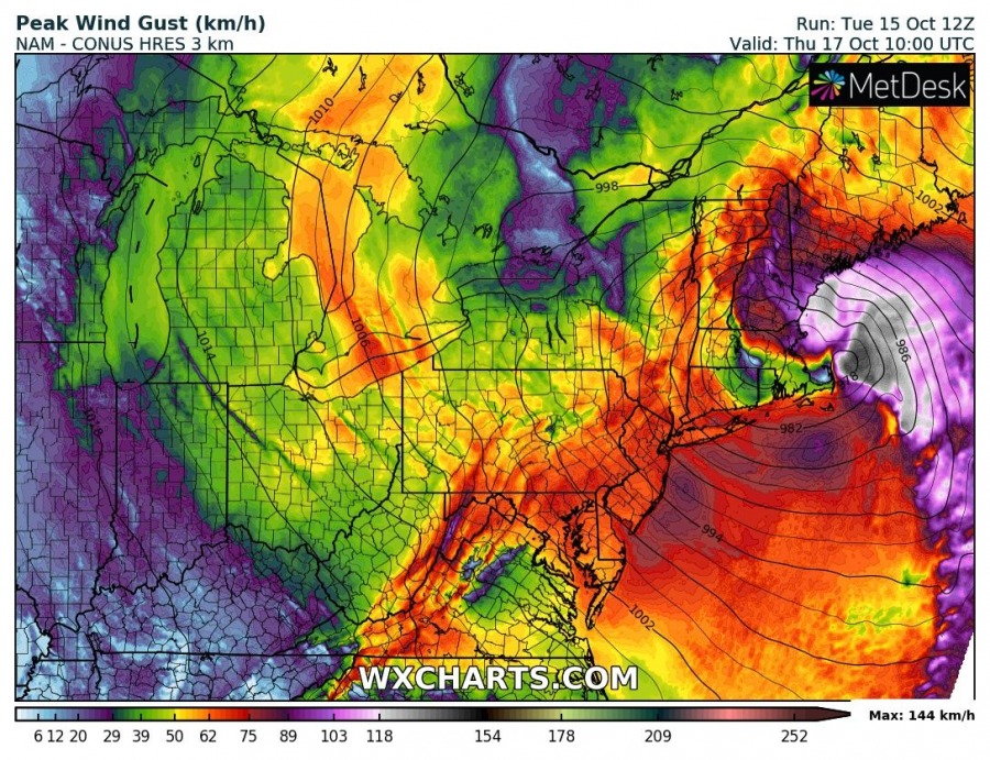
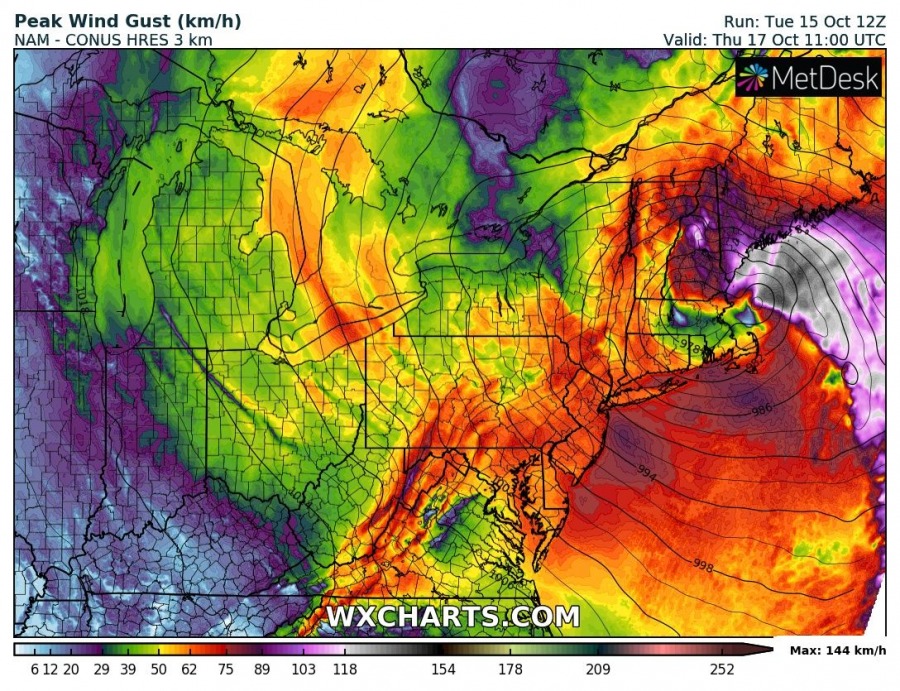
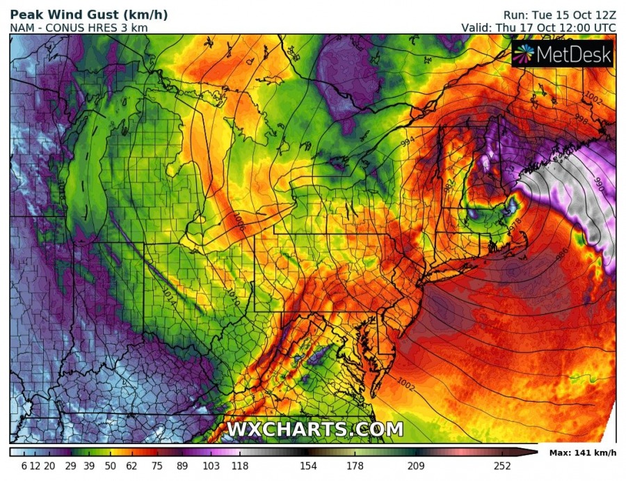
The explosive low will produce powerful easterlies, gusting to 120-150 km/h (70-90 mph) over the open sea and along the coasts of Rhode Island, Massachusetts and Maine. Expect significant wave height to reach up to 3-6 m, with maximum waves even larger. Expect large wave action to be accompanied by significant coastal flooding!
Peak wind gusts on Thursday (October 17th) along the northern part of the US east coast. Peak wind gusts up to 140-150 km/h! NAM model guidance. Map: Wxcharts.
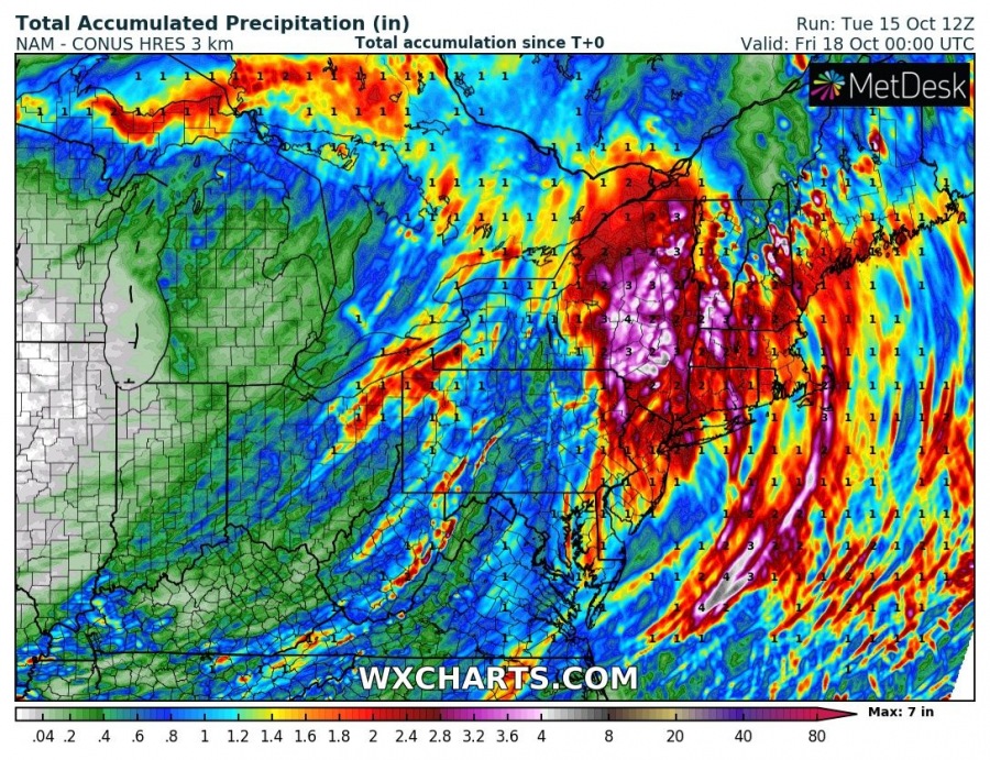
The system will produce torrential rainfall, with totals by late on Thursday reaching peak values of ~4″ (~100 mm), with large parts of US NE coast and inland areas receiving upwards of 2″ of rainfall.
Rainfall totals until late on Thursday (October 17th) over the NE US. NAM model guidance. Map: Wxcharts.
Stay tuned for further updates!


