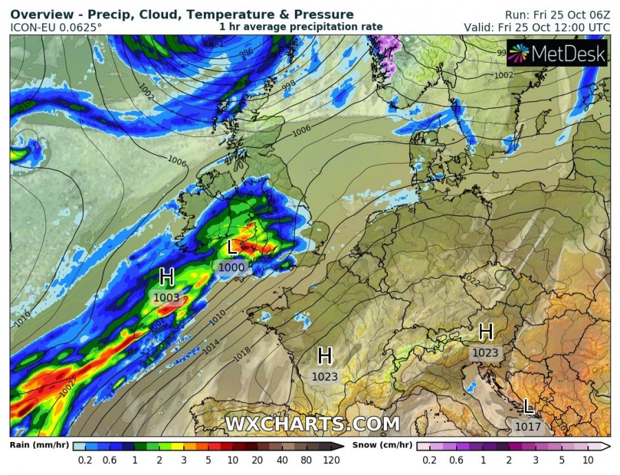
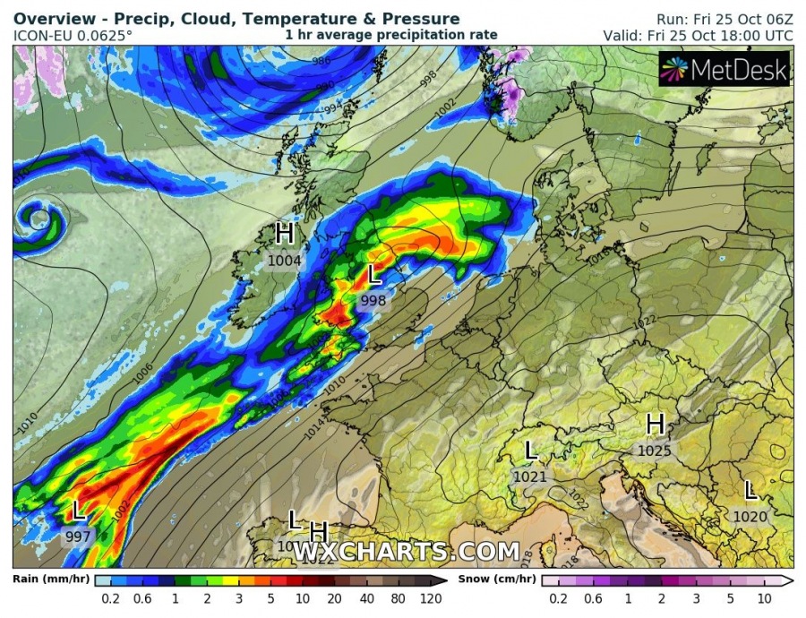
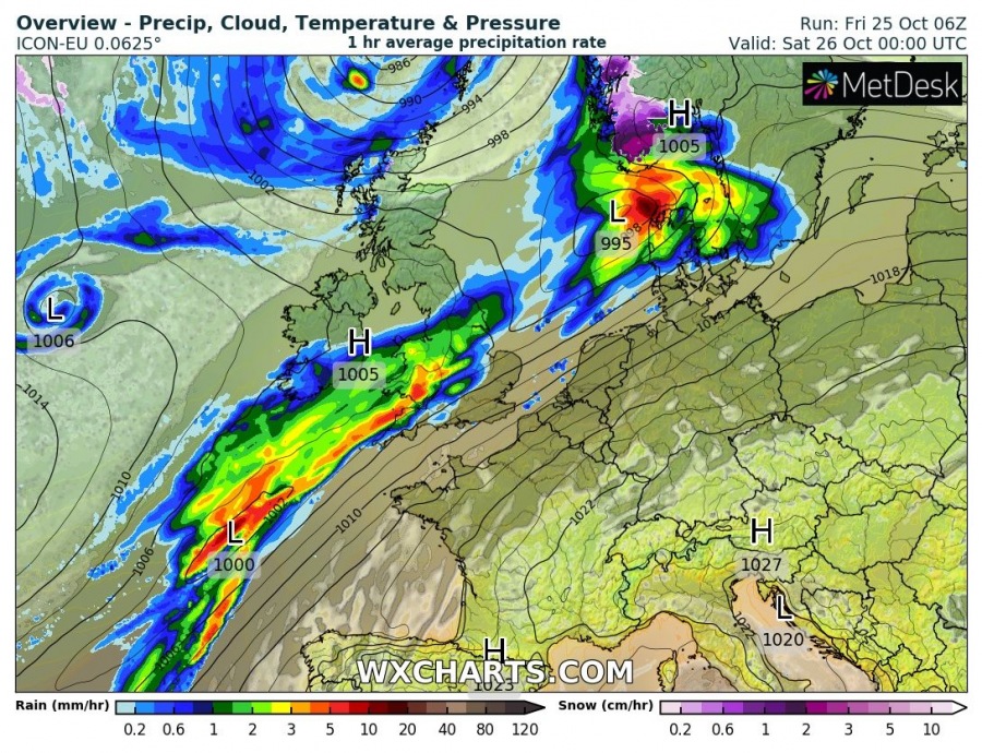
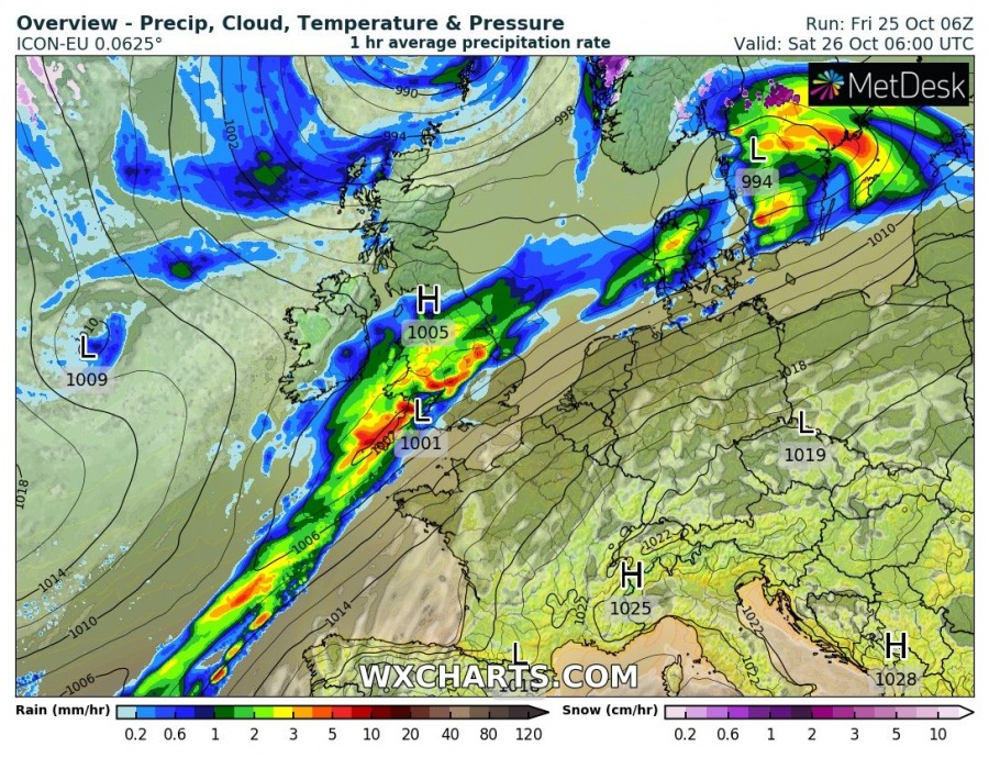
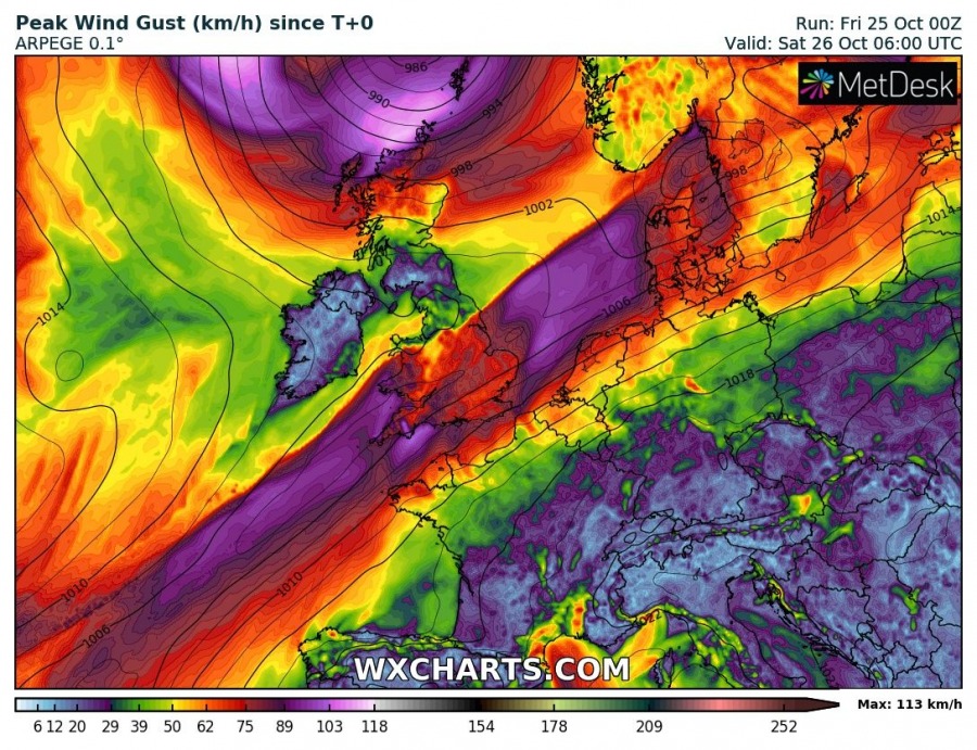
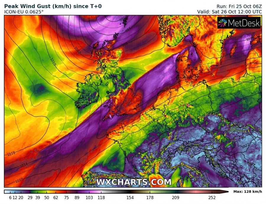
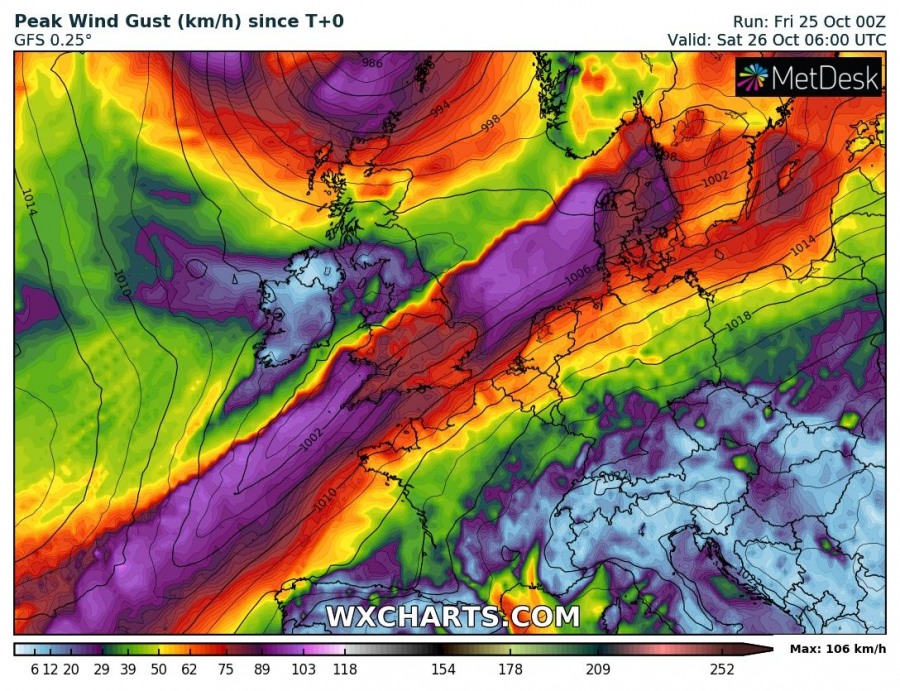
Severe winds threat will develop across parts of England, Wales, northern parts of the Netherlands and Germany across Denmark into S Scandinavia today and early tomorrow, associated with a surface cyclone and frontal system rapidly moving across the baroclinic zone.
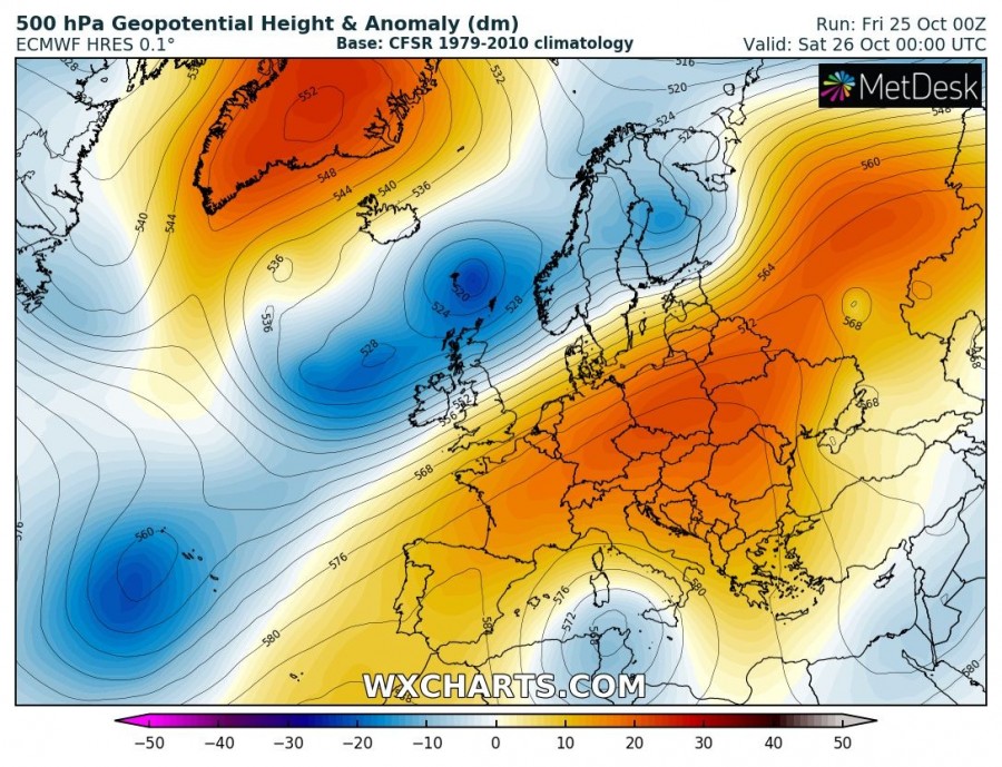
The current pattern over Europe supporting this evolution indicates a strong ridge persisting across the east-central Europe and the Balkans, while a long-wave trough with several embedded upper-level cold cores is located across N Europe and N Atlantic. Strong jet stream will support a surface cyclogenesis travelling across the afforementioned region.
Here is a 24-hour sequence until Saturday, Oct 26th 12 UTC – a gradually deepening surface cyclone travels across S UK towards Denmark and Baltic region tonight. Associated with excessive rainfall and severe winds along its path.
Peak gusts should reach severe criteria, likely peaking between 90 and 110 km/h in many areas from England, Wales, N parts of the Netherlands, N Germany, Denmark and extreme S Sweden, possibly also across the Baltic Sea my midday tomorrow. Additionally, another cyclone with deep core travels N of UK and brings severe winds also into extreme N Scotland.
Stay alert for dangerous conditions which could locally bring straight-line wind damage.
See also – excessive rainfall and local flooding develops over Wales and SW UK tonight:
