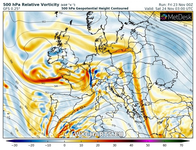
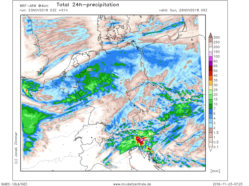
An excessive rainfall event is expected across northeast Italy, west Slovenia and northwest Croatia through the next 48 hours as a short-wave trough pushes across central Europe. A combination of both convective and persisting strong orographic rainfall should bring 150-200 mm locally and enhance threat for flash floods.
A short-wave through and an associated cold front which brought severe storms and flash floods across southern France and NW Italy through Thursday / Friday, will push across the Alps on Saturday. Strong south-southwesterly winds will support orographic precipitation as high boundary layer moisture advects towards the mountain ranges. Besides this, weak to moderate instability should develop along the front and convective storms (including severe storms) will likely develop as well.
The main focus for strongest and most excessive rainfall will develop over NE Italy on Saturday, Nov 23rd prior to the main cold front. Various models are in good agreement of 70-120 mm possible in 24 hours period before threat pushes further east with the front.
On Saturday night the frontal zone pushes into the NW Balkan peninsula and the excessive rainfall threat spreads into NW Croatia (Kvarner, Gorski Kotar region). In this region up to around 100 mm will be possible through 24 hours as well. Attached is the ICON-EU model which is the most aggressive regarding the rainfall amounts – possibly more than 250 mm until Sunday night.
In additional to excessive rainfall, lots of fresh snow is also expected across the Alps:
See also:
https://www.severe-weather.eu/calendar-2019/


