A potentially dangerous setup will be in place over southern France on Friday, November 23. Thunderstorms will pose additional threats for torrential rainfall, severe wind gusts and tornadoes.
A cutoff upper low situated over the Atlantic south of Ireland pushes a trough across northern Spain into France on Friday. A surface low develops over the extreme NW Mediterranean. Strong southerlies develop ahead of the low, pushing strong warm air advection into the northern Mediterranean as far north as the coast of south France. This very dynamic and unstable environment will produce severe thunderstorms and persistent torrential rainfall.
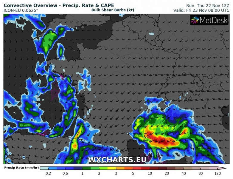
Simulated rain rate over southern France on Friday at 9h and 22h local time. AROME model guidance. Map: Wxcharts.eu.
Torrential rainfall is expected to develop across parts of southern France in the early morning hours, as strong southerly to southeasterly surface winds push into the mountainous terrain and produce combined convective and orographic rainfall.
Rainfall totals until early on Saturday. ARPEGE model guidance. Map: Wxcharts.eu.
Rainfall totals until early on Saturday. ICON-EU model guidance. Map: Wxcharts.eu.
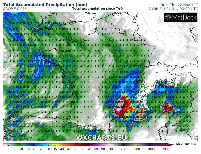
Rainfall totals until early on Saturday. AROME model guidance. Map: Wxcharts.eu.
Training storms are expected to develop along a virtually stationary, stalled warm front along the southern coast of France. Torrential orographic and locally heavy convective rainfall from training storms combine for enhanced threat of flooding in the coastal area. The cold front pushes from the west in the evening hours, with a severe squall line ongoing along it. The environment will be moderately unstable, with models indicating 500-1000 J/kg MLCAPE, locally possibly slightly more. Strong deep-layer shear will be in place at 40-60 kt, with SREH3 up to 200-350 m2/s2 range. The environment will certainly be supportive for supercell thunderstorms, with main threats being torrential rainfall, severe straight line winds and marginally large hail.
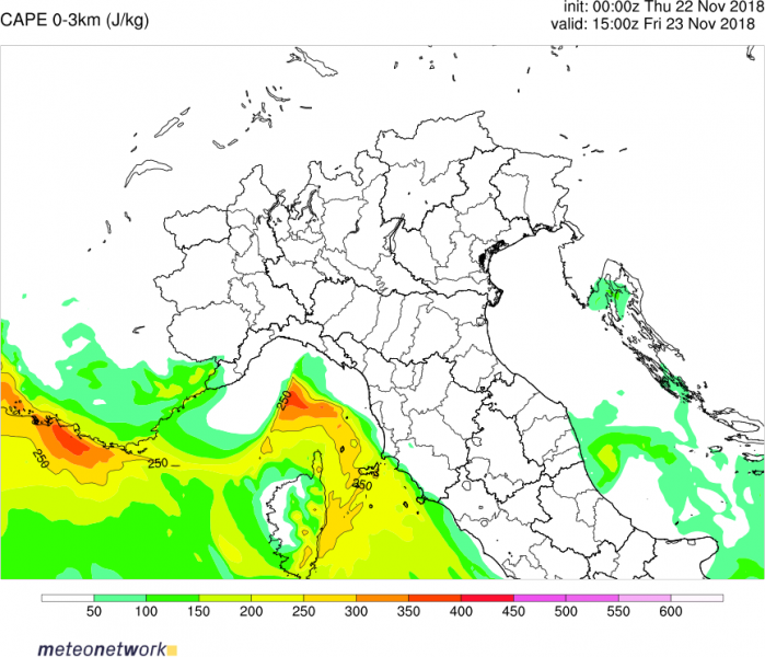
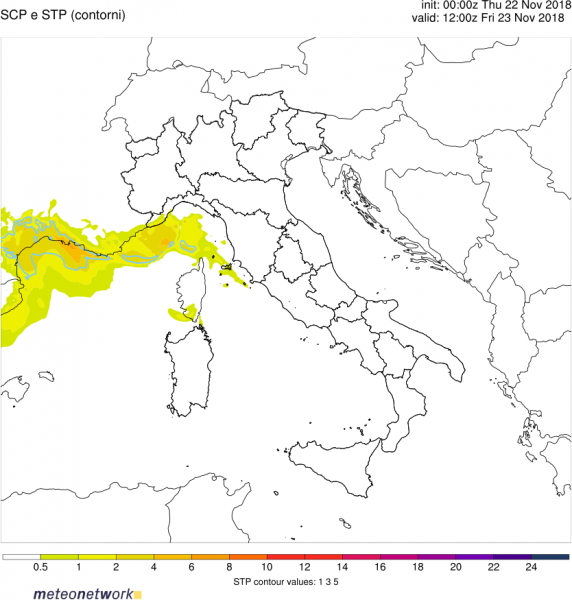
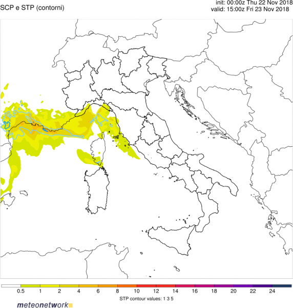
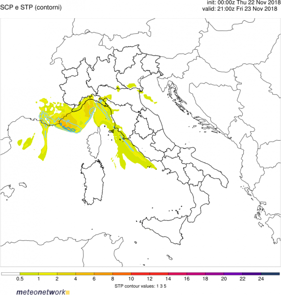
Tornado threat will be very significantly enhanced with these storms, particularly along the stalled warm front. Strong low-level instability will be in place along the coast, with 0-3km CAPE in 150-250 J/kg range, locally up to 400 J/kg. Combining with SREH1 in 150-250 m2/s2 range, the environment will be very favourable for tornadoes, both off the coast and in the coastal area.
0-3 km CAPE along the coastal region of the northern Mediterranean. WRF model guidance. Map: MeteoNetwork.it.
Supercell Composite Parameter (SCP) and Significant Tornado Parameter (STP) along the coastal regions of western-central Mediterranean. WRF model guidance. Map: MeteoNetwork.it.
