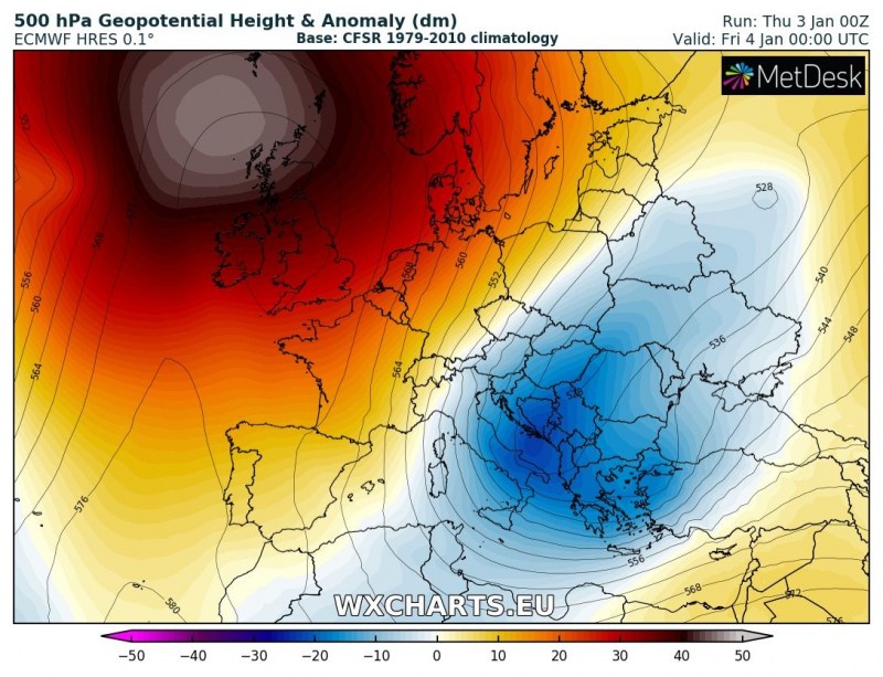
As soon as the Arctic outbreak reached the southeast Europe, it developed a secondary cyclone over Greece. This system is expected to intensify through the afternoon and track northeast across the Black Sea and towards southwest Russia and Georgia tomorrow. It will bring excessive rainfall across Turkey and indeed a lot of snow into the higher terrain there, and also across the Greater Caucasus mountain range.
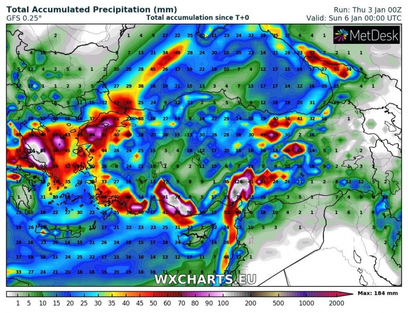
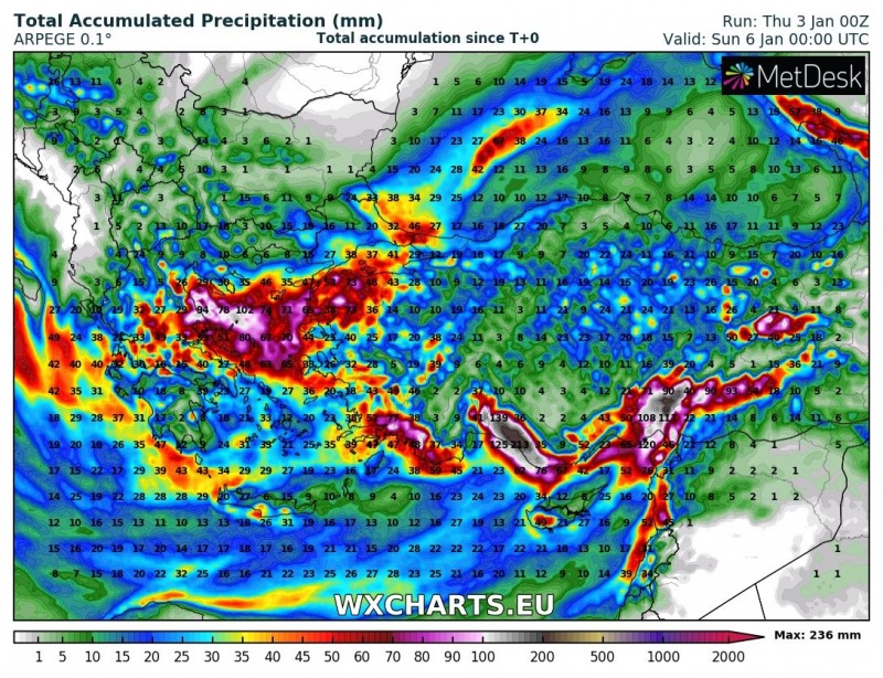
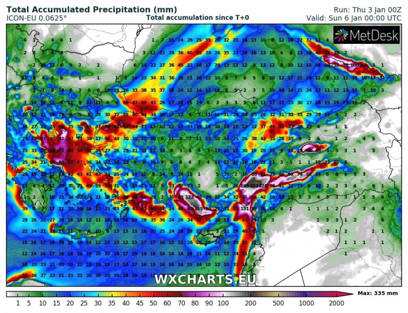
Comparison of the GFS, ARPEGE and ICON-EU models for the rainfall totals until Saturday night – locally 200-300 mm will be possible, especially where orographic rainfall will be the most pronounced and intense.
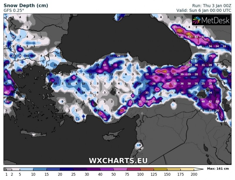
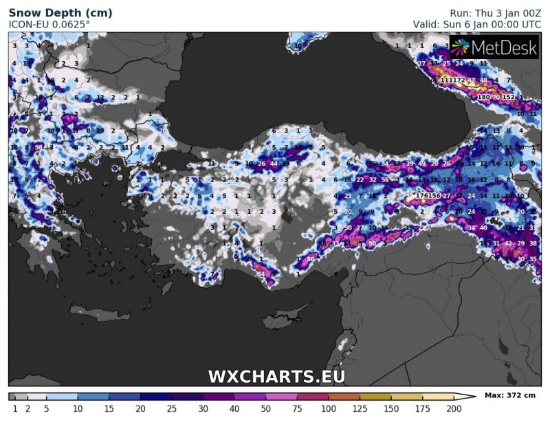
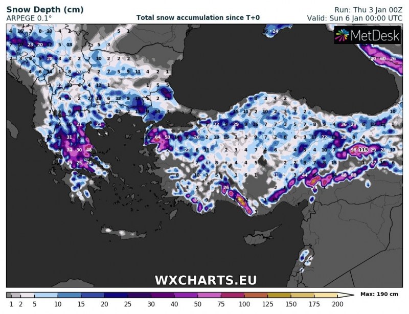
Higher elevations will receive large amounts of snow, locally 50-100 cm cannot be ruled out through the next 3 days, especially over the Caucasus mountains. Attached is the comparison of the GFS, ARPEGE and ICON-EU models for snow accumulation until Saturday night.
See also:
An Arctic outbreak into east-central Europe and Balkan peninsula through early January (Jan 2 – 6th)
http://www.severe-weather.eu/calendar-2019/
Stay tuned!
