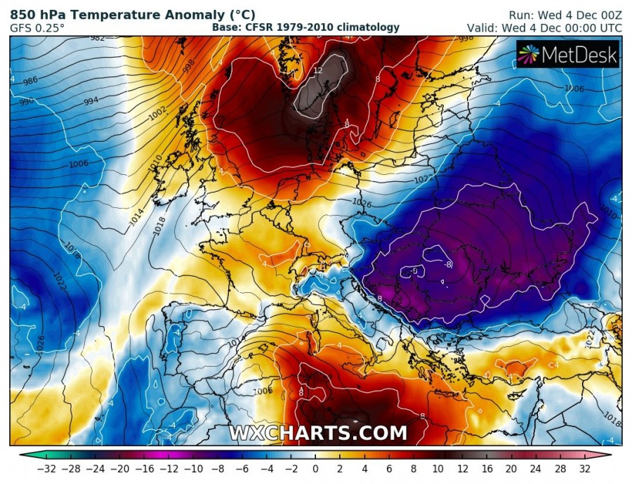
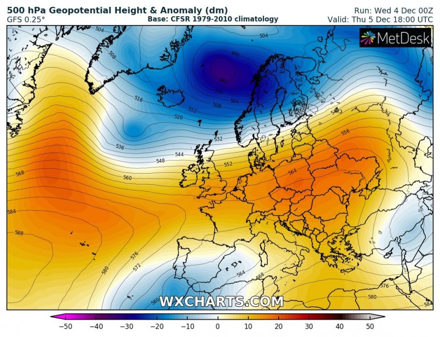
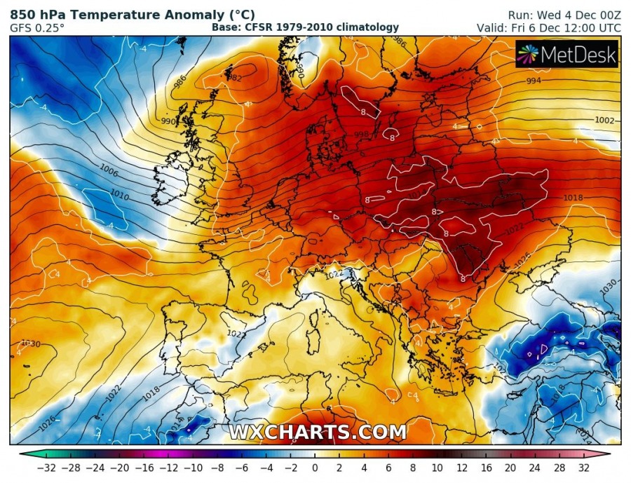
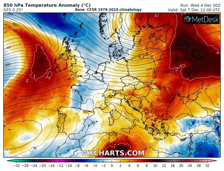
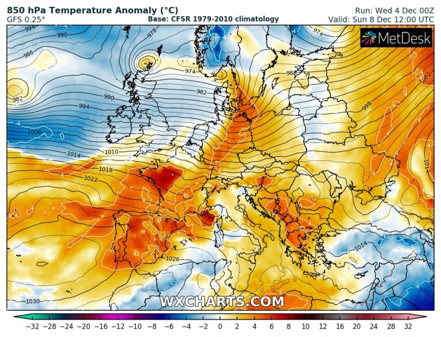
Patterns across Europe are flipping once again. While a large part of our continent was experiencing at least some cold weather and locally snow lately, an establishment of more zonal flow results in warmer airmass spread again.
As of today and tomorrow, a large cold pool across ESE Europe is vanishing and ridging is building up over north and central Europe.
In response to strengthening troughs ovr the far North Atlantic and Arctic region, strong warm advection is ongoing over Scandinavia and the Baltic region with locally more than 10 °C warmer airmass delivered on the nose of westerly jet stream.
Once the zonal flow establishes further south as well, much warmer airmass will spread also across the central and eastern half of Europe. Indeed lowlands will often remain in the strong thermal inversions and therefore lower temperatures, but mid-levels above the inversions will be much warmer.
Additionally, the westerly zonal flow usually results in persistent orographic rainfall / snowfall over the mountainous western Scandinavia, 100-150 mm of rain (or snow higher in the mountains) can be expected until the end of next weekend.
Interested in our calendar? We are proud to present and promote the best weather photographers in Europe – see details:
