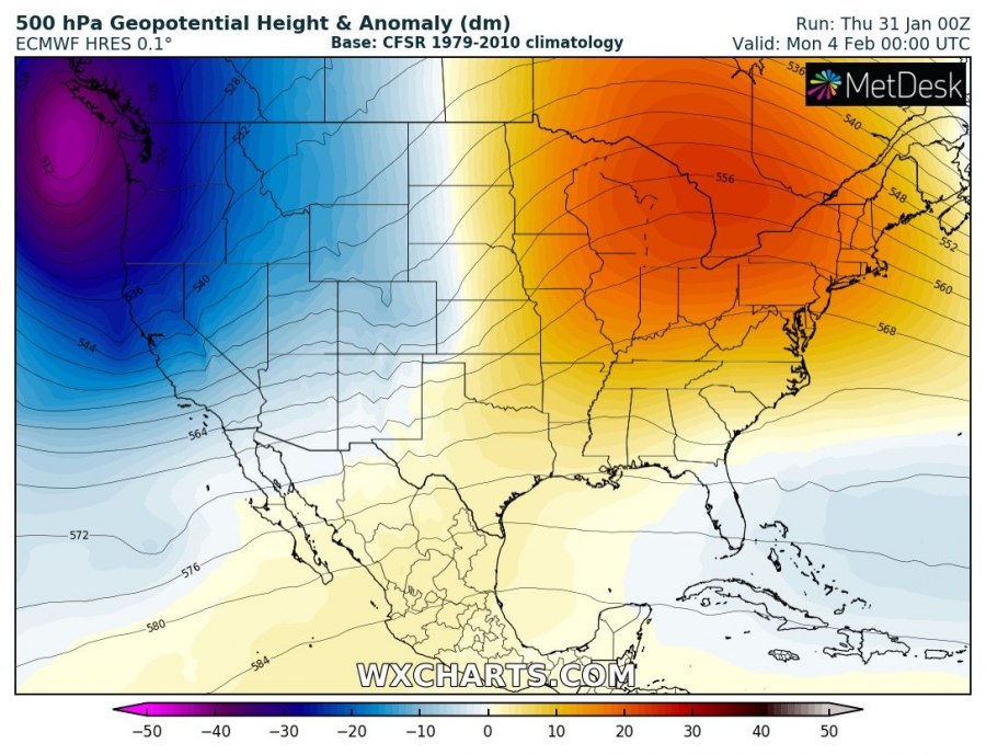
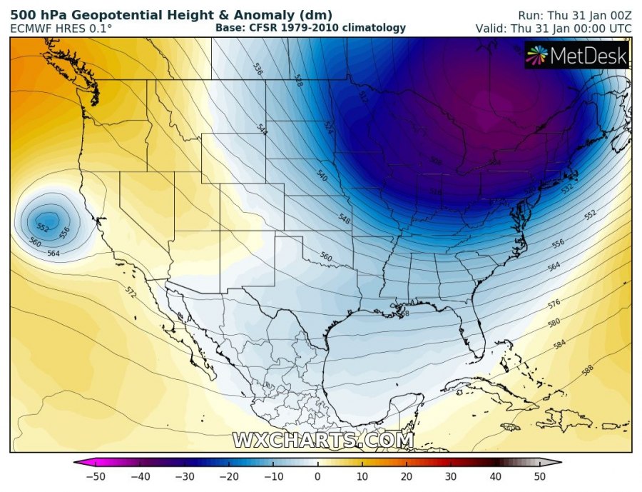
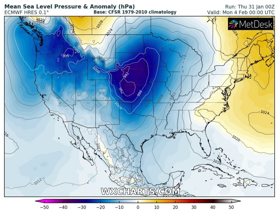
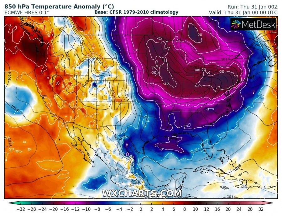
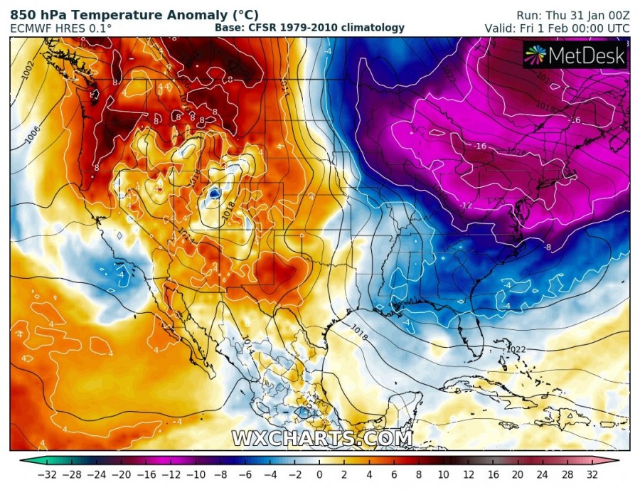
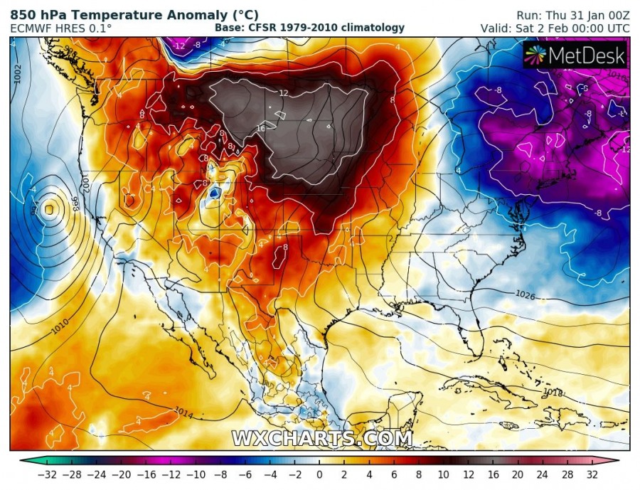
Yes, you’ve read it right! While there is one of the most significant Arctic cold outbreaks ongoing across the north and northeast United States right now, an extreme pattern flip is expected this weekend as a deep trough ejects the northeast US and a strong upper ridge develops over the region. To the west, a deep cyclone develops over the Great Plains and a significant warm advection pushes into Midwest and Great Lakes regions – more than 40 °C warmer airmass than is currently experienced there!
Here is a spectacular comparison of the complete pattern flip as of today, Thursday vs. Sunday – notice the northeast US under a deep low and northwest US under the ridge today, while it is the completely opposite pattern on Sunday. A deep trough over the northwest US and strong ridge across the northeast US.
As it usually happens, a deep cyclone will develop on the lee side of the Rockies as deep trough will be progressing towards east. Strong low/mid level winds develop ahead of the low, resulting in the powerful advection of very warm airmass from a deep south towards the Midwest.
Looking over the 850 mbar temperature anomaly maps sequence from today until Tuesday, we can see just what an extreme change in airmass is expected. While the current airmass across the northeast US is more than 20 °C colder than average, the airmass over the weekend into early next week will be more than 15 °C warmer than average – that is an almost 40 °C change in just 3 days!
Stay tuned for additional updates in the coming days!
See also:
