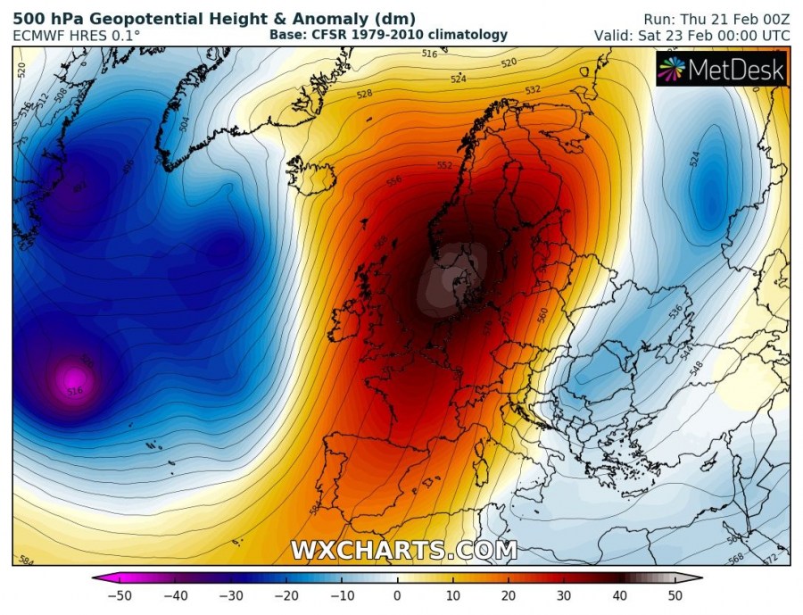
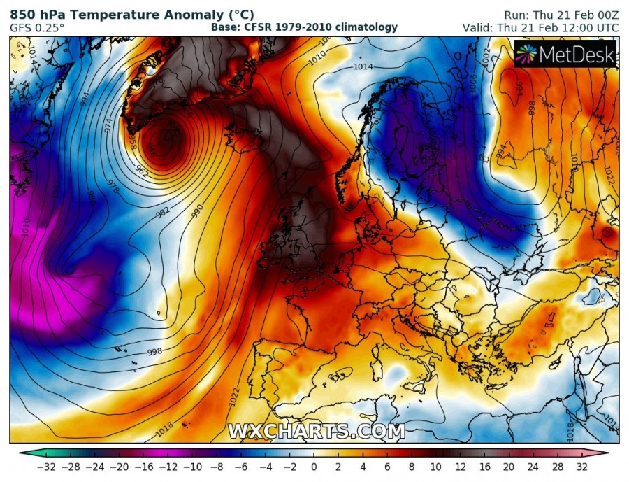
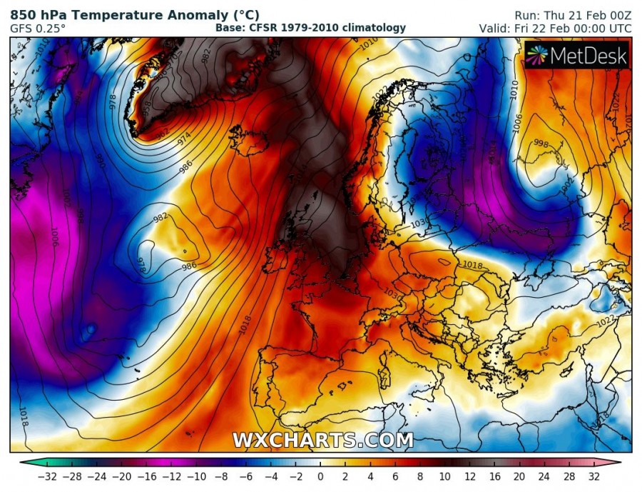
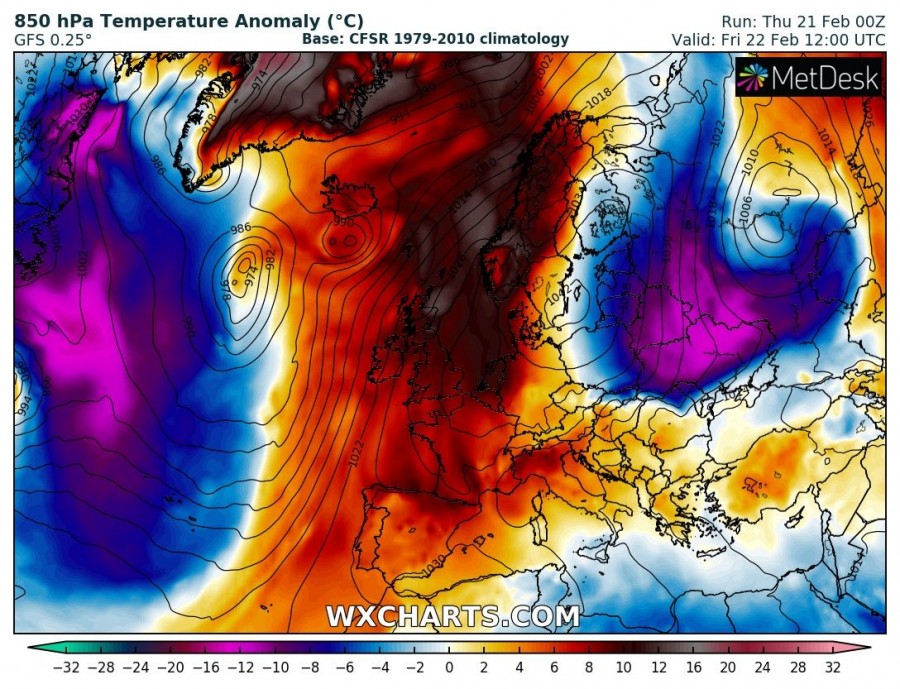
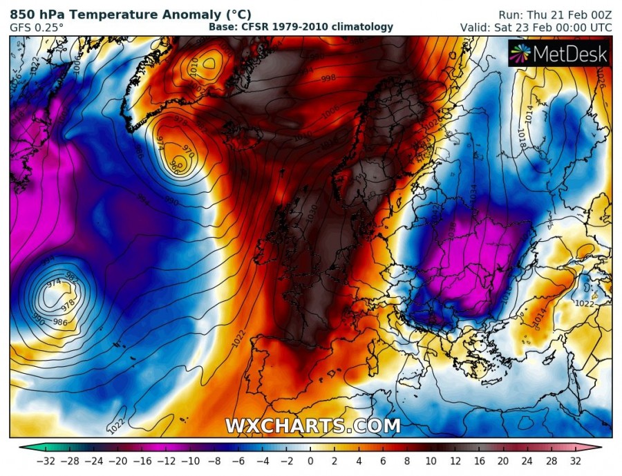
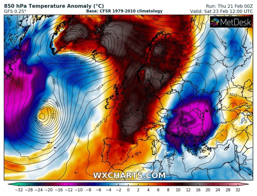
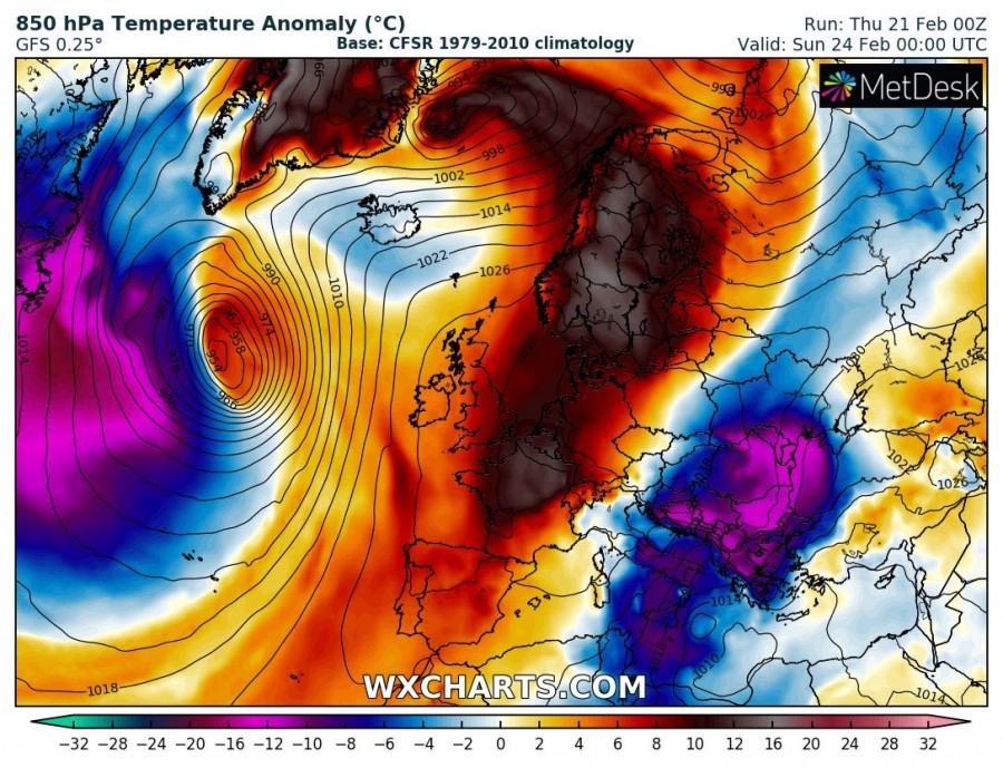
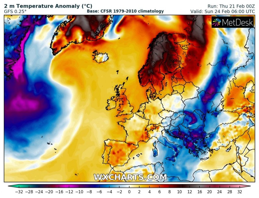
Quite significant warm advection will develop across the Arctic region and northern Europe this weekend, in response to a strengthening upper ridge across the west-central Europe and deep troughs across the north Atlantic. Airmass over 10 °C warmer than average will spread across Scandinavia and towards Greenland as well.
The pattern supporting such warm advection indicates a very powerful and extensive upper ridge, centered across the west-central and northern Europe while very deep trough is located across the north Atlantic. This results in a very strong southerly jet stream across the western flank of the ridge and advects very warm airmass far north into the Arctic region.
Attached is the 850 mbar temperature sequence from this afternoon, Thursday Feb 21st, until Sunday morning, Feb 24th. Very warm airmass with temperature 10-15 °C warmer than normal overspreads western and northern Europe, Arctic region and Greenland.
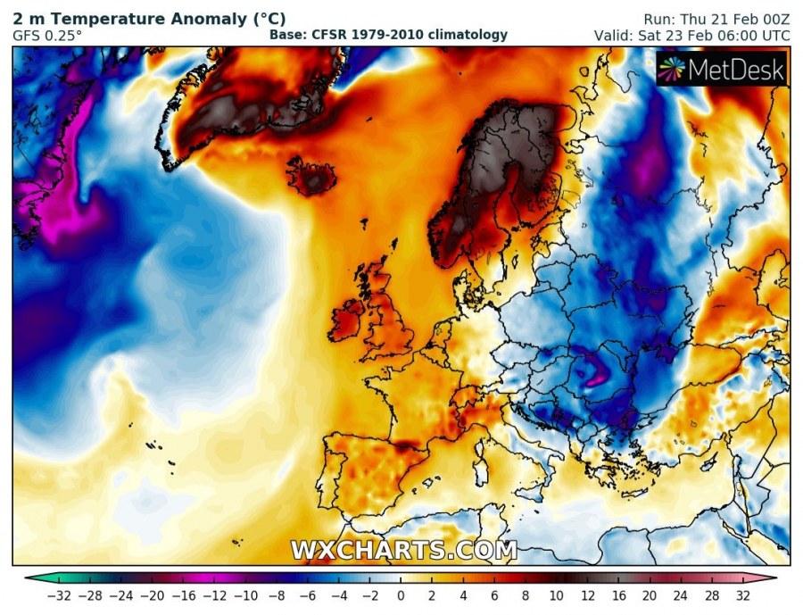
At the lowest levels, this significant warm advection is nicely visible especially across the Fennoscandia where much colder weather still remains on Friday morning, but is replaced with much warmer airmass by Saturday morning. Warm airmass remains over the Arctic region on Sunday as well.
Similar pattern should continue into early next week before the Arcitc region becomes colder again – we will keep you updated!
