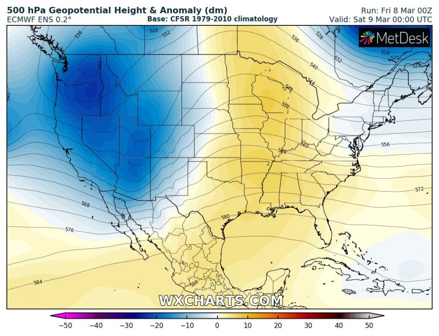
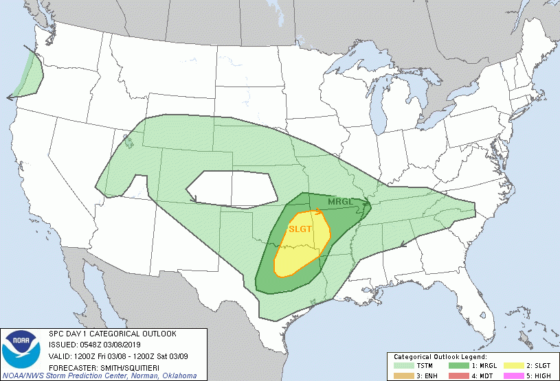
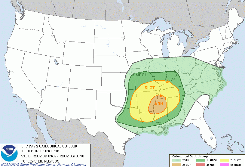
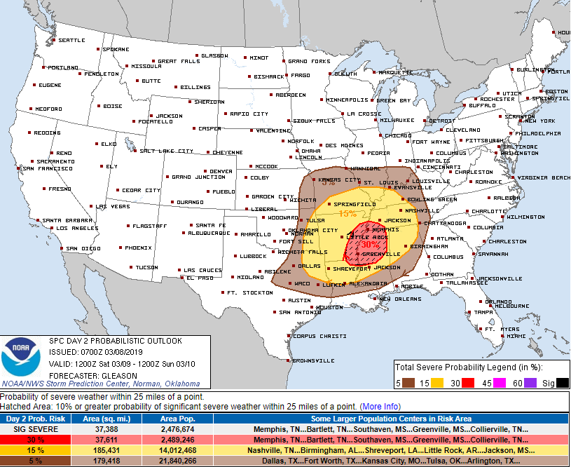
Parts of the southern United States are in for another severe weather period as a deep trough pushes from west to east across the CONUS. Severe storms, including supercells are expected, likely producing large hail, damaging winds and tornadoes again. Areas affected extend from the eastern Texas through Arkansas, Louisiana, Mississippi, Tennessee, Kentucky and Alabama towards Florida and Georgia.
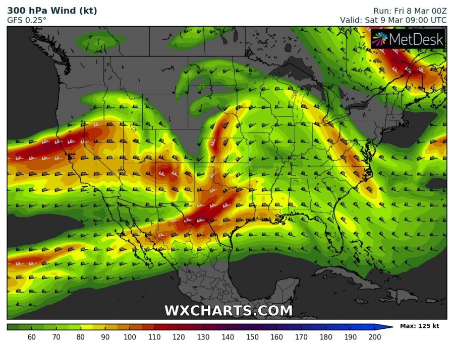
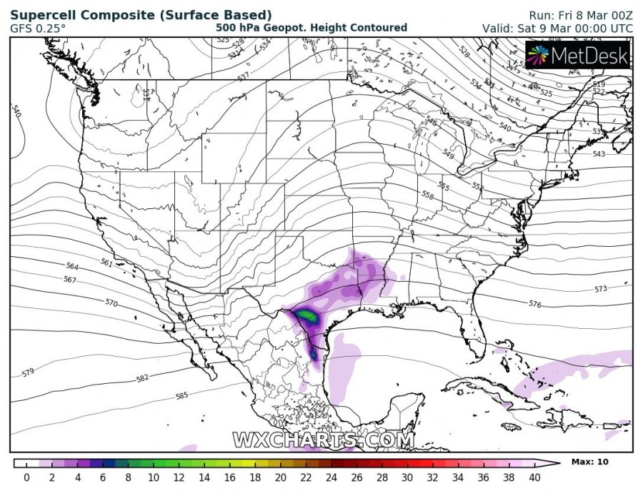
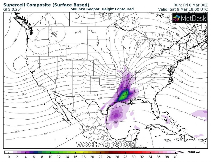
Strong warm advection ahead of the trough should result in unstable environment ahead/along the strong cold front. With good overlap of unstable and strongly sheared environment, organized severe storms are expected. Attached are upper-level jet stream and supercell composite maps.
Storm Prediction Center (SPC) has issued SLGT and ENH risk areas for both today and tomorrow, Saturday March 9th. Threat expands into far SE US on Sunday.
Friday:
Saturday:
