Long-range forecast data for Spring 2025 is now available, and it shows a mostly warmer season over Europe, with normal precipitation. A predominantly high-pressure pattern is currently forecast for the continent, with low-pressure systems and the jet stream being pushed further north.
The meteorological Spring season lasts 3 months and covers the March-April-May period.
This is the transition period from Winter to Summer, so you can expect a wide range of weather dynamics during this time. It can also include influences from the oceanic La Nina event, and also the seasonal breakdown of the stratospheric Polar Vortex.
WINTER SEASON SO FAR
The meteorological Winter season covers the December-January-February period. We are already well into the second month, so we can look at the analysis for the first half of the Winter season.
Below is the pressure anomaly analysis for December and the first half of January. You can see mostly higher pressure, with the center over the North Atlantic, just west of the UK and Ireland. A broad, low-pressure area sits over the far north, with a low-pressure zone also indicated over the Mediterranean.
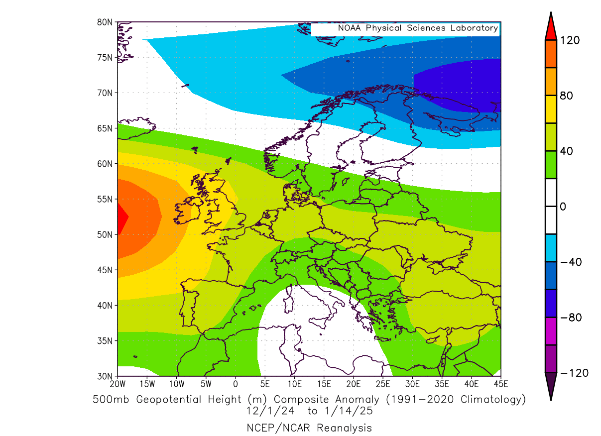
With the high-pressure systems spinning clockwise, and the low-pressure systems counter-clockwise, that means a northern flow across the western and west-central Europe. And a northerly flow in winter can mean lower temperatures.
You can see the result of this pattern on the temperature analysis below for the same period. Lower than normal temperatures are seen over the United Kingdom and much of western and west-central Europe. This is the result of the northerly flow induced by the pressure anomalies. Towards the east, we see warmer-than-normal temperatures.
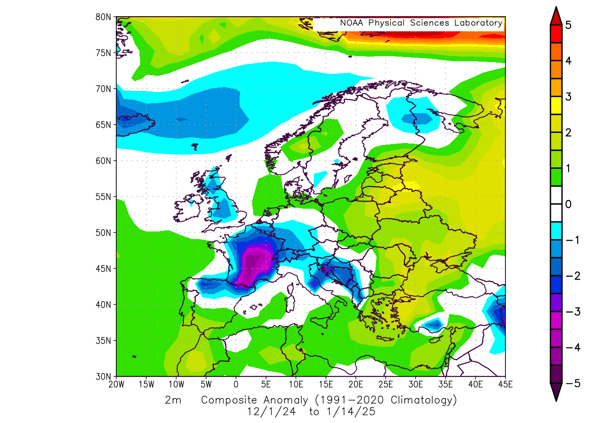
Overall, this temperature anomaly is very similar to the winter average forecasts that were released before the start of winter. They hinted at warmth to the east, with the potential for a northerly flow towards the west.
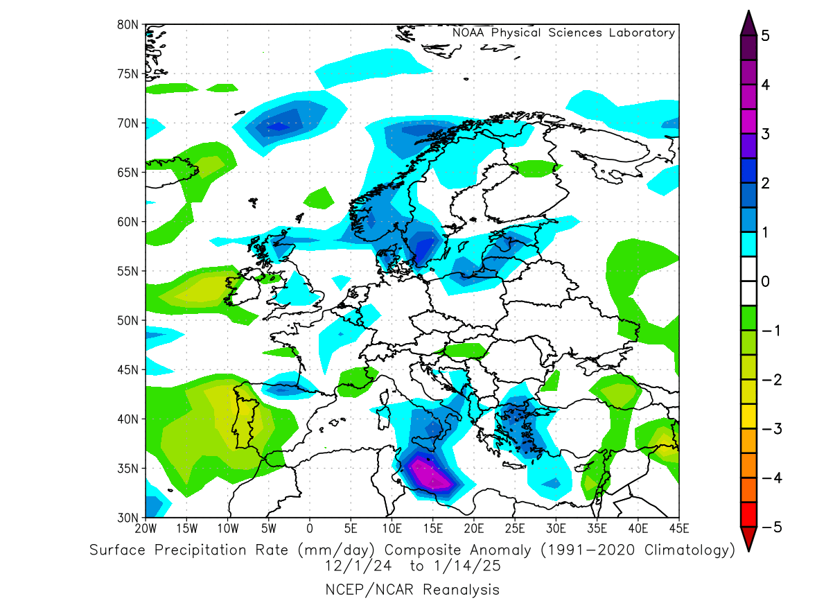
Looking at precipitation in the same period, you can see more precipitation over the northern parts of Europe and the southern parts under the low-pressure zone. Normal to less precipitation has been measured across parts of central and far southwestern Europe.
One of the important large-scale drivers of this winter season is the La Nina event in the tropical Pacific Ocean. But while it was getting stronger in the past two months, we do not have direct indications yet of how strong of a role it has over Europe in the 2024/2025 season.
In the image below, you can see the latest ocean temperature anomaly across the Pacific. Notice the colder than normal surface waters in the tropical Pacific regions. That is a La Nina event, spanning far across the central and western equatorial Pacific Ocean, powered by the trade winds.
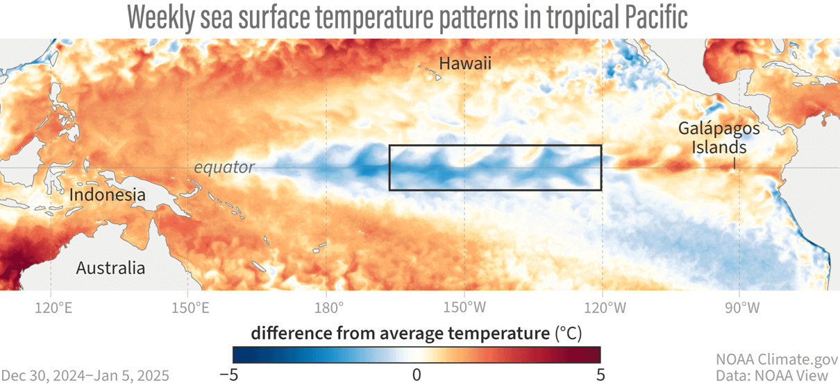
La Nina is just a different name for cold ocean temperatures in the tropical Pacific Ocean. The actual ocean-atmosphere system is called ENSO (El Niño Southern Oscillation). This region in the tropical Pacific Ocean alternates between cold and warm phases.
Below is a video of the official weekly ocean analysis. As you can see, it strengthens the negative anomalies across the tropical Pacific in the past month, right across the main ENSO region.
Before going into the Spring forecast, we will also take a quick look at the final winter month of February, and what the latest forecasts show for Europe.
THE FINAL WINTER MONTH
For February, the ECMWF forecast shows mostly higher pressure, centered over central and west-central Europe. There is a low-pressure zone in the far North Atlantic, but some latest medium range trends are putting it closer over the United Kingdom and northwestern Europe, which would put the center of the high pressure further to the east.
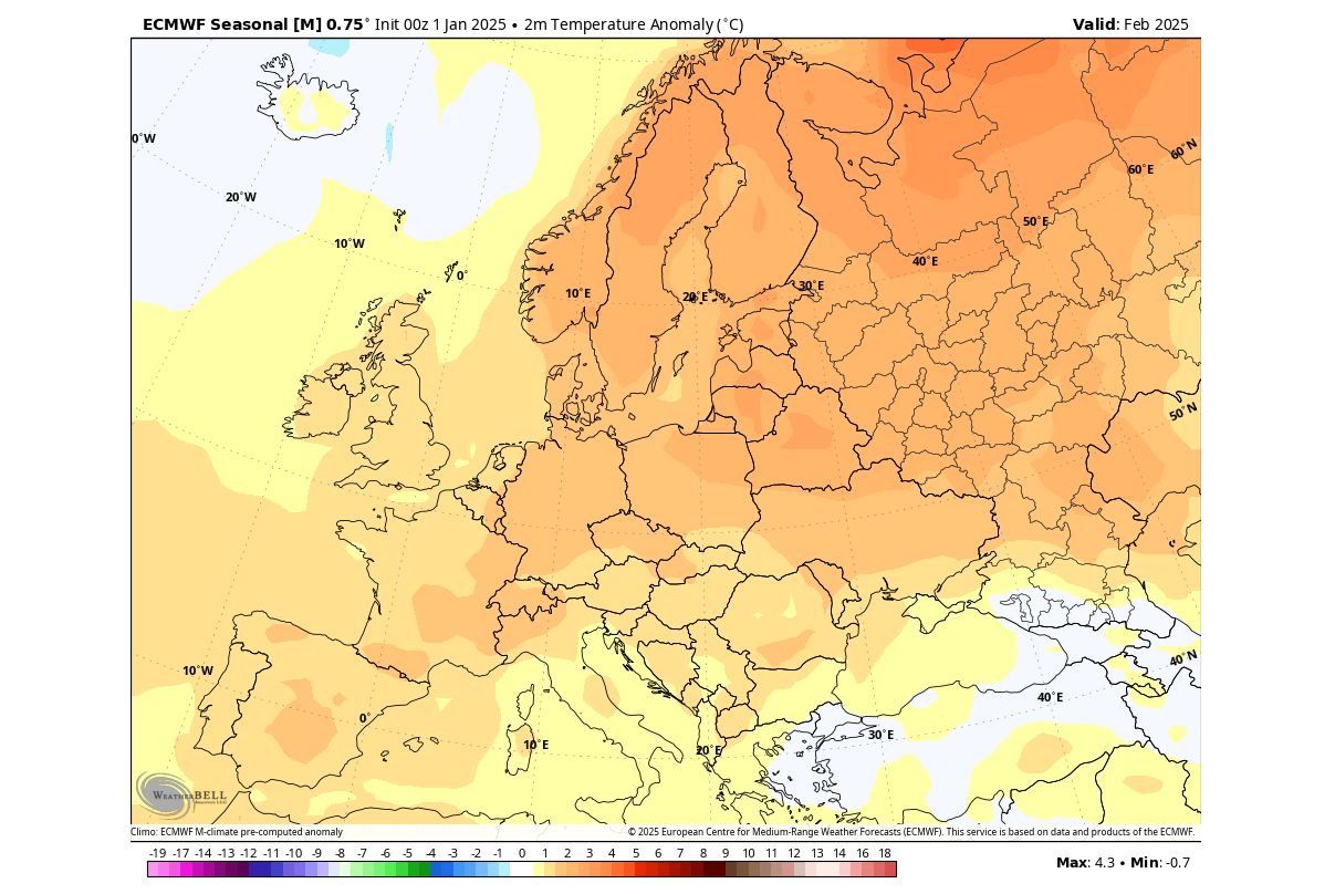
Looking at the surface temperature forecast, we see a warmer pattern for most of the continent, influenced by the high-pressure zone in the pressure forecast. But we do have to note that under a strong high-pressure area, there is a likely inversion event, which can bring lower temperatures into the lowest elevations of central and western Europe.
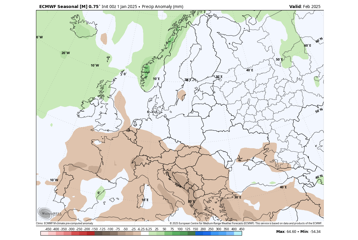
In the next image below, you can see less precipitation is forecast over much of southern and western Europe for February. Again, this is due to the high-pressure area influence. You can see more precipitation over the northern parts, influenced by the low-pressure zone from the North Atlantic.
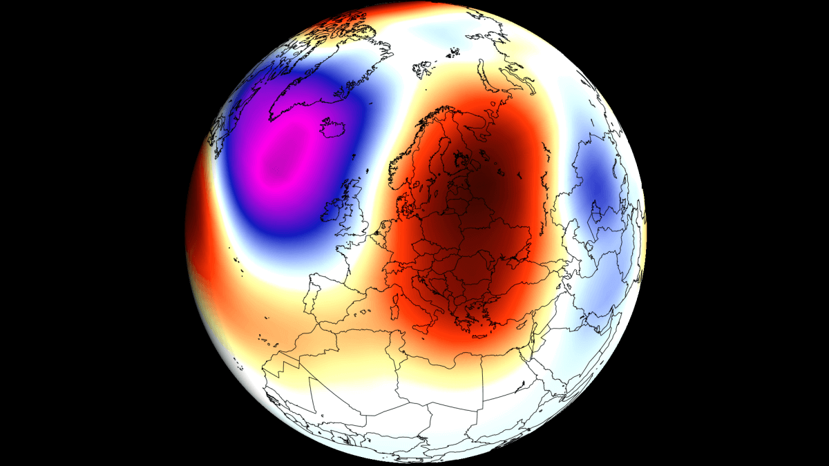
But when looking at February, we can’t ignore the potential of the very strong Polar Vortex in the Stratosphere.
STRATOSPHERIC POLAR VORTEX ROLE
Below is the pressure anomaly forecast for the middle Stratosphere around mid-February. You can see a strong stratospheric Polar Vortex forecast, running with lower pressure than normal in the stratosphere. This indicates a very likely impact on the weather circulation below.
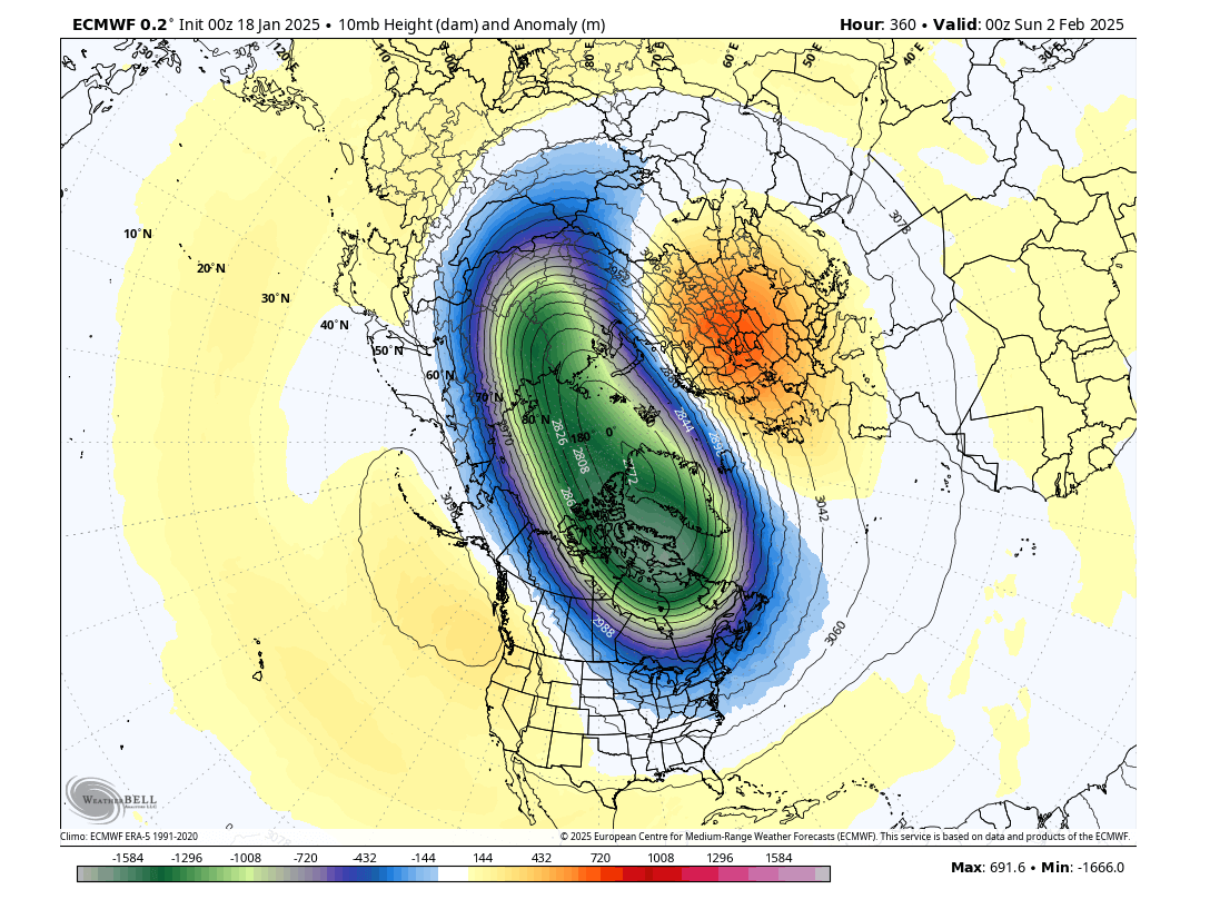
The Polar Vortex has a unique role in the Winter weather patterns, but it can also depend on the pressure anomalies in the lower levels. Currently, we are observing the strong Polar Vortex to have a rather unusual effect on North America, helping to bring unusually cold weather to the United States, which is almost opposite to what we would expect.
But for Europe, with more simple lower-level pressure patterns and less amplification from the La Nina, the strong Polar Vortex is expected to have a more typical effect:
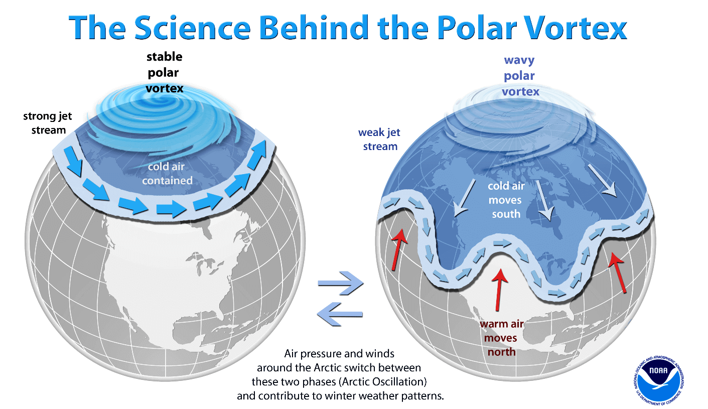
A strong Polar Vortex usually means a strong jet stream pattern. This usually locks the colder air into the Polar regions, creating milder conditions for most of the United States and Europe.
In contrast, a weak Polar Vortex in late Winter and early Spring can create a weak jet stream pattern. As the jet stream breaks down, it has a harder time containing the cold air, which can now escape from the polar regions into the mid-latitudes of the Northern Hemisphere. Image by NOAA.
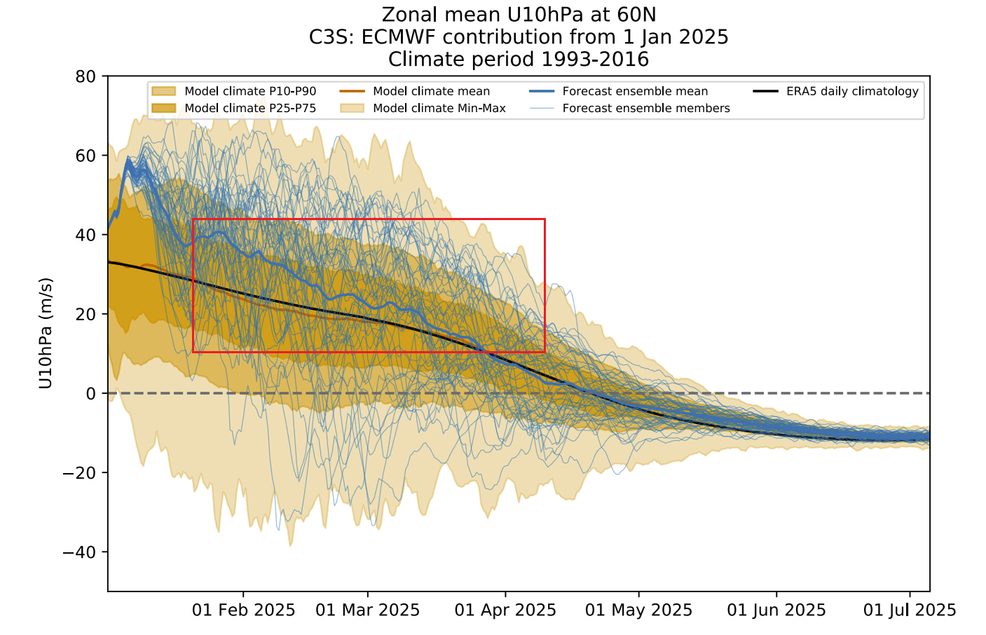
Below is the latest ensemble forecast of the stratospheric Polar Vortex winds. You can see that the forecast keeps the upper Polar Vortex stronger than normal well into February. This indicates a stronger North Atlantic Low is likely and a positive North Atlantic Oscillation.

We can see the positive North Atlantic Oscillation forecast appearing in the ECMWF ensemble below, indicating a milder weather pattern for central Europe into February, with stormy conditions for the northern half of Europe, especially the United Kingdom and Ireland.

We can also look at the Polar Vortex long-range forecast. It shows the Polar Vortex to remain stronger than normal well into Spring, and have a normal slow seasonal breakdown. This would support a milder Spring with a westerly dominant flow over Europe and stormy over the north and northwest for at least the first half of the season.
But do the weather pattern forecasts support this idea for Spring 2025 over Europe?
EUROPE SPRING 2025 – FIRST FORECAST
We focused on the two main (or most used) seasonal models for this forecast: the ECMWF and UKMO.
All these forecasts show an average picture over three meteorological Spring months (March-April-May) and show the prevailing weather patterns.
Even if the models were completely accurate, it does not mean such weather conditions would last three months straight. Instead, it only suggests how the prevailing weather patterns might look over the season.
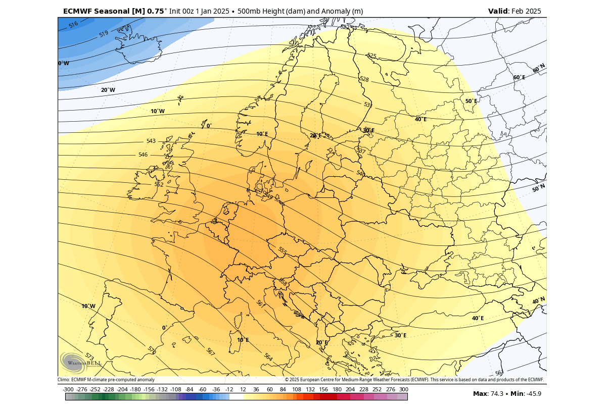
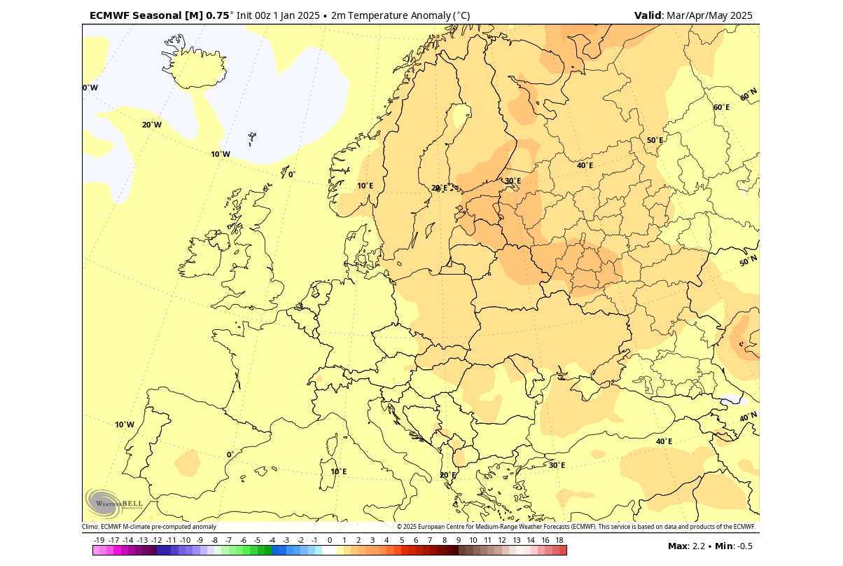
The pressure pattern forecast from ECMWF below shows a general high-pressure signal. This forecast is pretty strongly averaged, as it is a 3-month average at a longer lead time (3-6 months). The high-pressure zone looks to be centered towards Scandinavia.
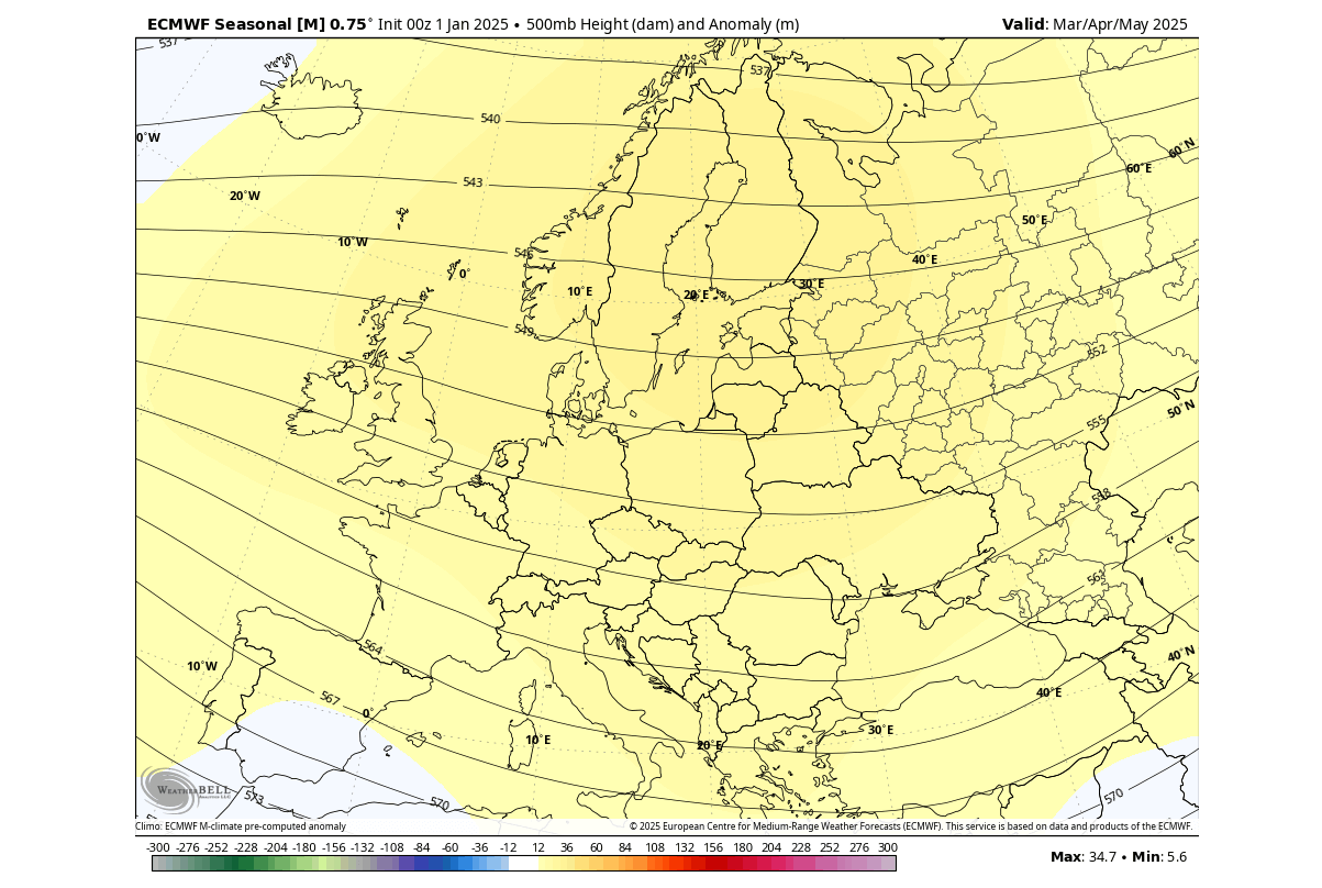
As a result, warmer temperature anomalies and milder conditions are more likely in the eastern and east-central parts of Europe. Central and western regions can likely see occasional Atlantic fronts from the west/northwest under the influence of the low-pressure area over the Northern Atlantic.
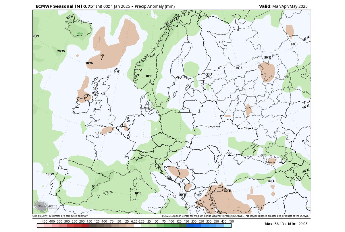
Precipitation-wise, Europe is trending to have more precipitation over the southwestern, central and parts of northern regions. This likely indicates the model is going for a lower-pressure area over southwestern Europe, despite only having a slight indication of a low-pressure area.
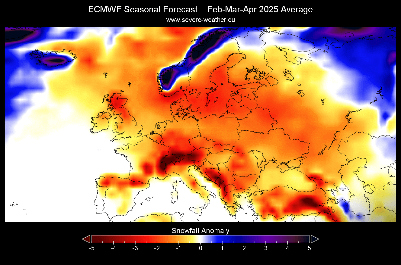
In combination with colder temperatures, that also affects the snowfall potential in early Spring.
While Spring is generally known as the start of the warmer part of the year, it can still provide snowfall events, especially in March. But looking at the February-April 2025 snowfall forecast, most of the continent has below-normal snowfall.
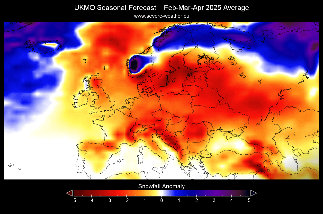
UKMO FIRST SPRING SEASON FORECAST
In contrast to the ECMWF, we often use the UKMO model from the United Kingdom Met Office.
The UKMO model shows a very similar forecast to the ECMWF, with a high-pressure zone over Europe and a low-pressure area signal over the far North Atlantic. In the UKMO forecast, the high-pressure area is positioned a bit more to the south than in the ECMWF.

Looking at the temperature forecast shows mostly warmer-than-normal conditions over much of the continent, especially in northern and central regions. This is not too far from the ECMWF, and also shows a hint of a more westerly flow into the western and northwestern parts of Europe.

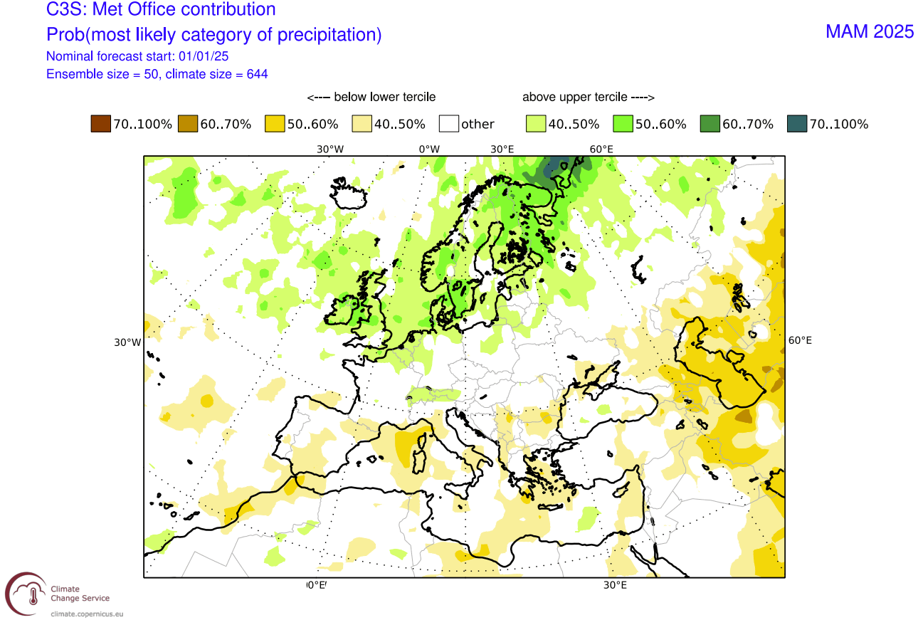
Looking at the precipitation forecast, we see mostly normal to drier conditions over southern Europe. That is mostly expected, given the high-pressure forecast from this model. But the northern and parts of central Europe show more precipitation in Spring, indicating the influence of the low-pressure zone to the north.
We can also have a look at the UKMO snowfall forecast, which is pretty underwhelming, and lower-than-normal for this period. But it is to be expected with above-normal temperatures and a dominant high-pressure system over the continent with a prevailing westerly flow.
We will keep you updated on the developing weather trends in the coming seasons, so bookmark our page. Also, if you have seen this article in the Google App (Discover) feed, click the like button (♥) there to see more of our forecasts and our latest articles on weather and nature in general.
The main forecast images in this article are from weatherbell maps and weathermodels, using a commercial license.
Don’t miss:
An Unstoppable 2025 Polar Vortex: The United States cold from the Stratosphere