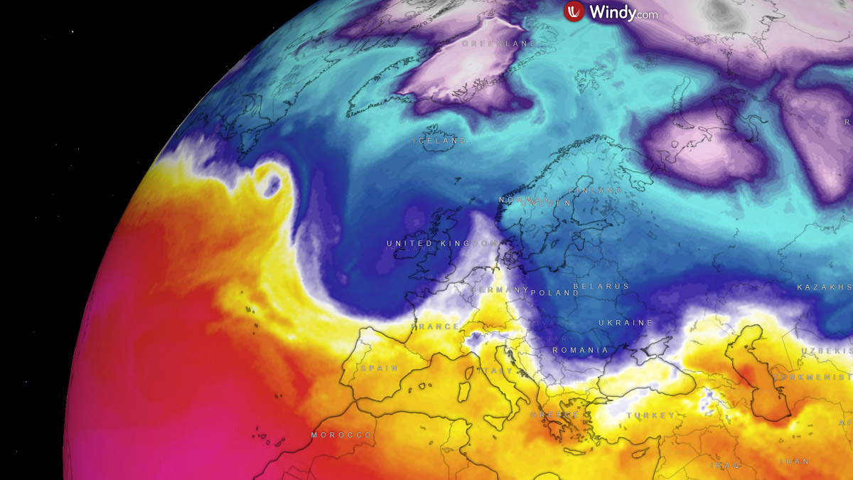
A progressive weather pattern with strong zonal flow has been established over Europe. Resulting in intense Atlantic storms battering Western Europe as the New Year approaches. The first in line, storm Gerrit is underway today; the next, even more powerful, is forecast to arrive on Saturday as a bomb cyclone Henk.
The new winter storm is forecast to move across western Europe with strong to severe winds and heavy rain squalls on Saturday, moving further east across the North Sea. Blanketing southern Scandinavia and northern Baltic states with heavy snow before the New Year’s Day arrives.
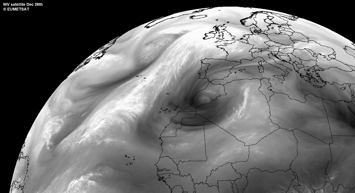
Today, on Wednesday, Gerrit, the first intense storm of the progressive pattern evolving, is moving across Ireland and the UK, with several yellow wind and rain warnings in place, issued by the Met Office. The storm is expected to move through the country throughout the day.
Yellow warnings for wind are in place across the southern coast of England, in north-west England and Wales, much of Scotland and Northern Ireland. Wind warning areas can expect 50-60 mph gusts, up to 70 mph on high elevations and exposed coastal areas.
Heavy rain is also expected in some areas, with an estimated 50-60 mm in parts of Northern Ireland and up to 90 mm on higher ground in Wales. These regions are under a rain warning until Thursday morning.
Winter weather with snow is expected, too, with a yellow warning in effect for much of Scotland.
After Thursday, storm Gerrit will gradually weaken, moving towards Scandinavia, while another powerful North Atlantic storm will be shaping up and fast-approaching western Europe. Conditions across the Atlantic will lead to a rapidly developing storm.
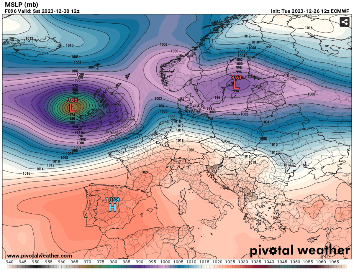
The central pressure is forecast to explosively deepen while the storm will be moving across the Atlantic, from the upper 990s to the low 960s. Therefore, the system will be classified as a bomb cyclone. The process leading to such a rapid pressure fall is called bombogenesis*.
*Bombogenesis is a meteorological term when a surface cyclone rapidly intensifies with its central pressure drop of more than 24 mbar within 24 hours.
Thus, the next storm after today’s Gerrit will be Storm Henk, as noted on the pre-defined Atlantic cyclone list created by Met Office. On Saturday, the potential is high for a powerful wind storm with a strong cold front crossing Ireland and the UK.
Associated with a sharp convective line of rain squalls and gale force winds spreading towards the English Channel and Benelux late Saturday.
Progressive Weather Pattern Develops over the North Atlantic and Europe
A typical early winter weather pattern has developed across the North Atlantic and Europe for the final week of December into New Year. A progressive and dynamic weather pattern is established with lower pressure on the north and high pressure to the south.
This increased the zonal flow in between, thus creating a channel for Arctic fronts from Canada and the far North Atlantic to develop powerful winter storms towards Western and Northern Europe.
While the first deep trough is moving across Ireland and the UK today, another deeper wave is forecast to arrive on Saturday. The 500 mbar anomaly chart indicates the establishment of this dynamic pattern, with the deep core of this new trough moving into Western Europe.
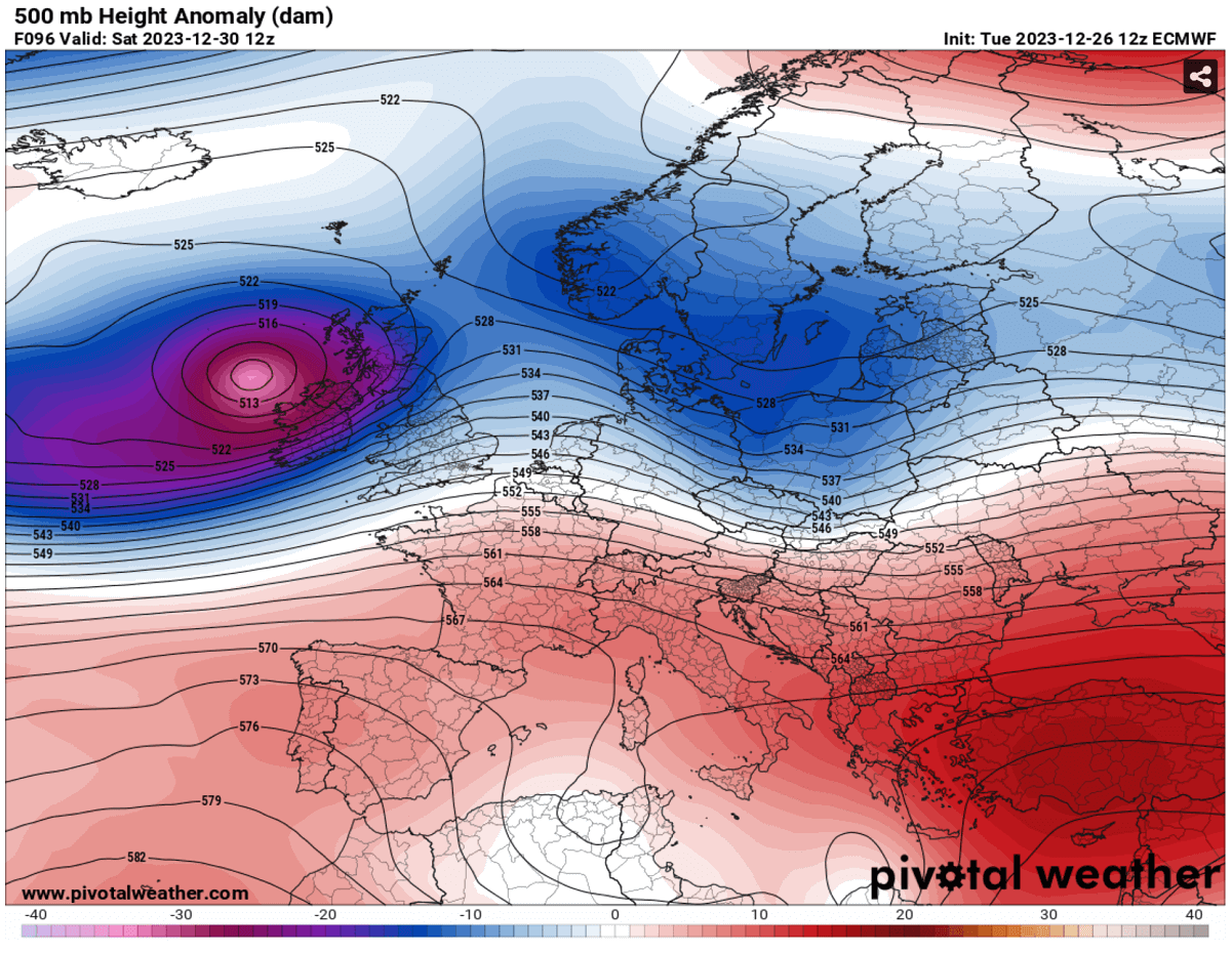
As mentioned, the surface response to the deep and cold upper levels will lead to a rapidly developing bomb cyclone over the North Atlantic. Therefore, pressure will significantly drop into low to mid 960mb on Saturday.
While the exact track of the surface low is still not handled well by weather models, the rough estimation suggests it will move across and affect most of Ireland and the UK, regardless of its exact center low.
The intensity of the zonal flow established can be seen on the following chart for winds at 500 mbar geopotential level. That’s roughly 5 km above the ground. The core of the jet stream will bring violent winds, with 110-120 knots.
This is also one of the reasons why the surface bombogenesis will form, as the dynamics within this frontal wave will be significant.
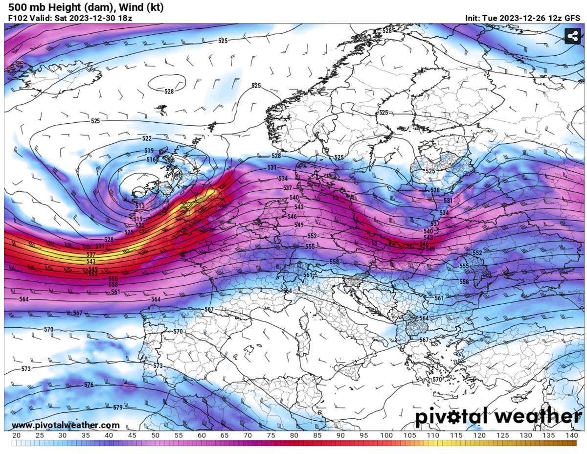
The jet wind maximum will continue east over the weekend, thus helping those flying eastbound by reducing their flight times. Those traveling westbound will experience more turbulent flights and longer travels.
Violent Winter Storm Henk will Blast Ireland and UK with Severe Winds and Heavy Rain Squalls
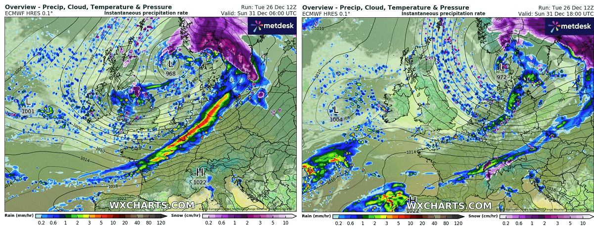
Storm Henk will be nearing Ireland on early Saturday morning with a well-defined frontal system during its rapid intensification. An associated warm front will move across in the morning, followed by a cold front in the afternoon and evening.
The sequence below indicates the position of the frontal system on Saturday morning (left) and the evening hours (right chart). The central pressure forecast is around low to mid 960 mbar.
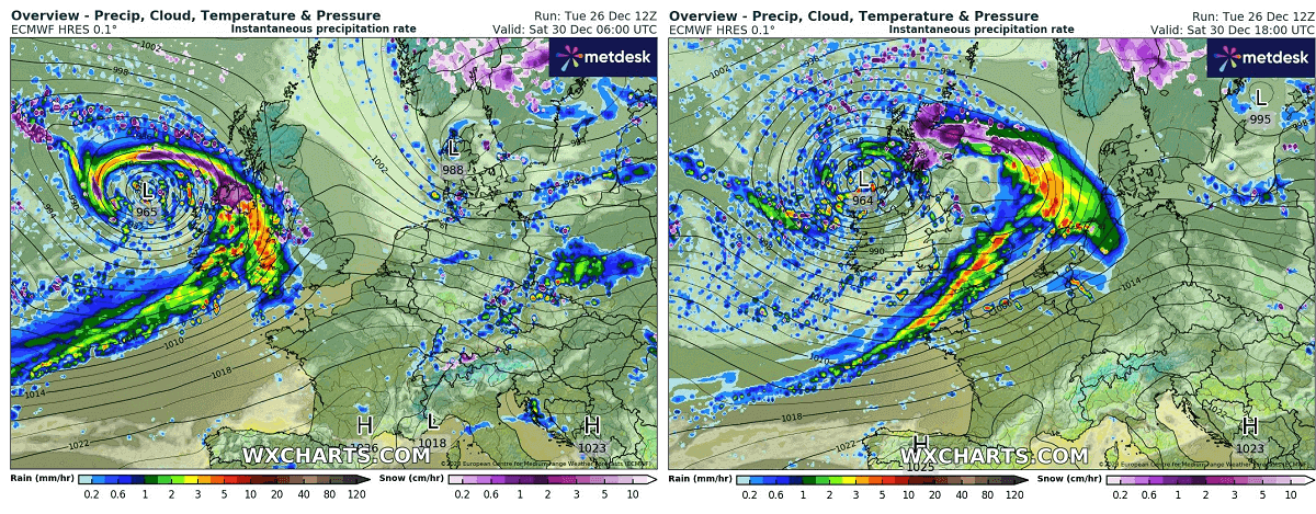
One can notice an intense and sharp convective line along the leading cold front, moving across southern Ireland, Wales, and England during the day. Severe wind squalls and heavy rain, with possible thunderstorms, are expected.
As the storm will be quite large, its wind effect will spread across most of Western Europe. Especially Ireland, Northern Ireland, and western Scotland have the most violent winds. Heavy rain and wind squalls will also blast Wales and southwestern England along the fast-moving convective line.
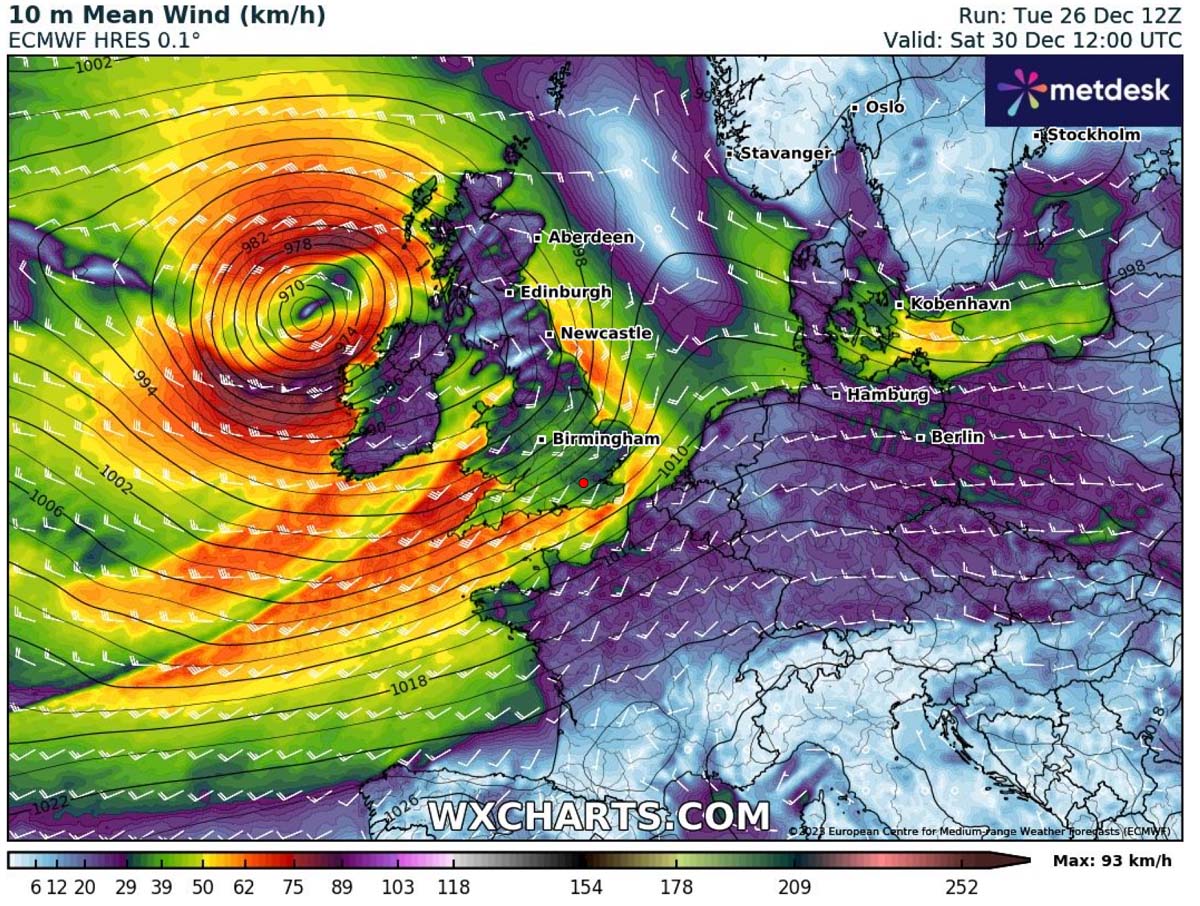
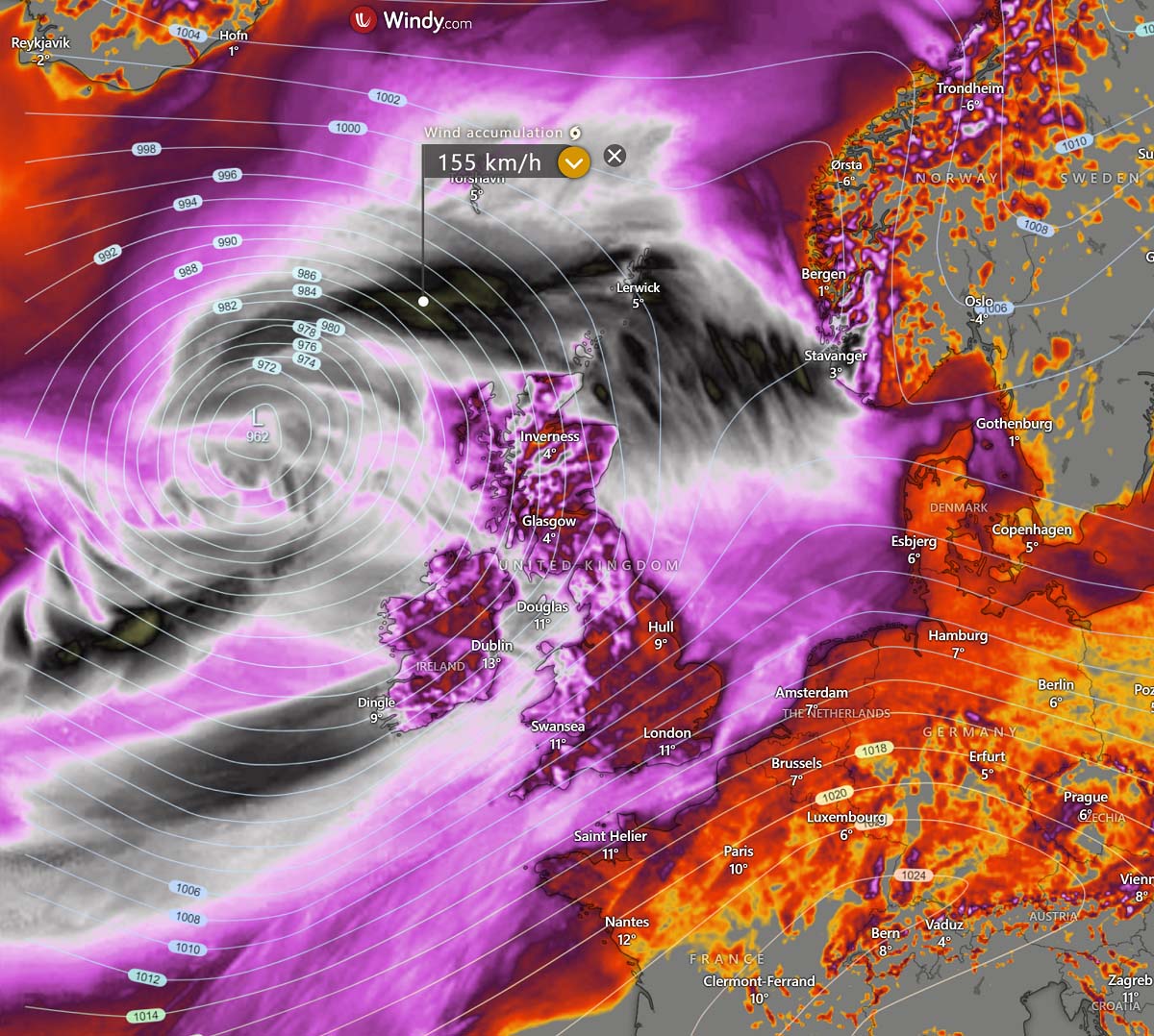
The peak wind gusts will likely reach 70-90 mph (110-140 km/h), with even higher gusts north of Scotland and west of Ireland where the pressure gradients will be the sharpest.
The far northern Scotland and the Shetland Islands may experience gusts around 100 mph (150+ km).
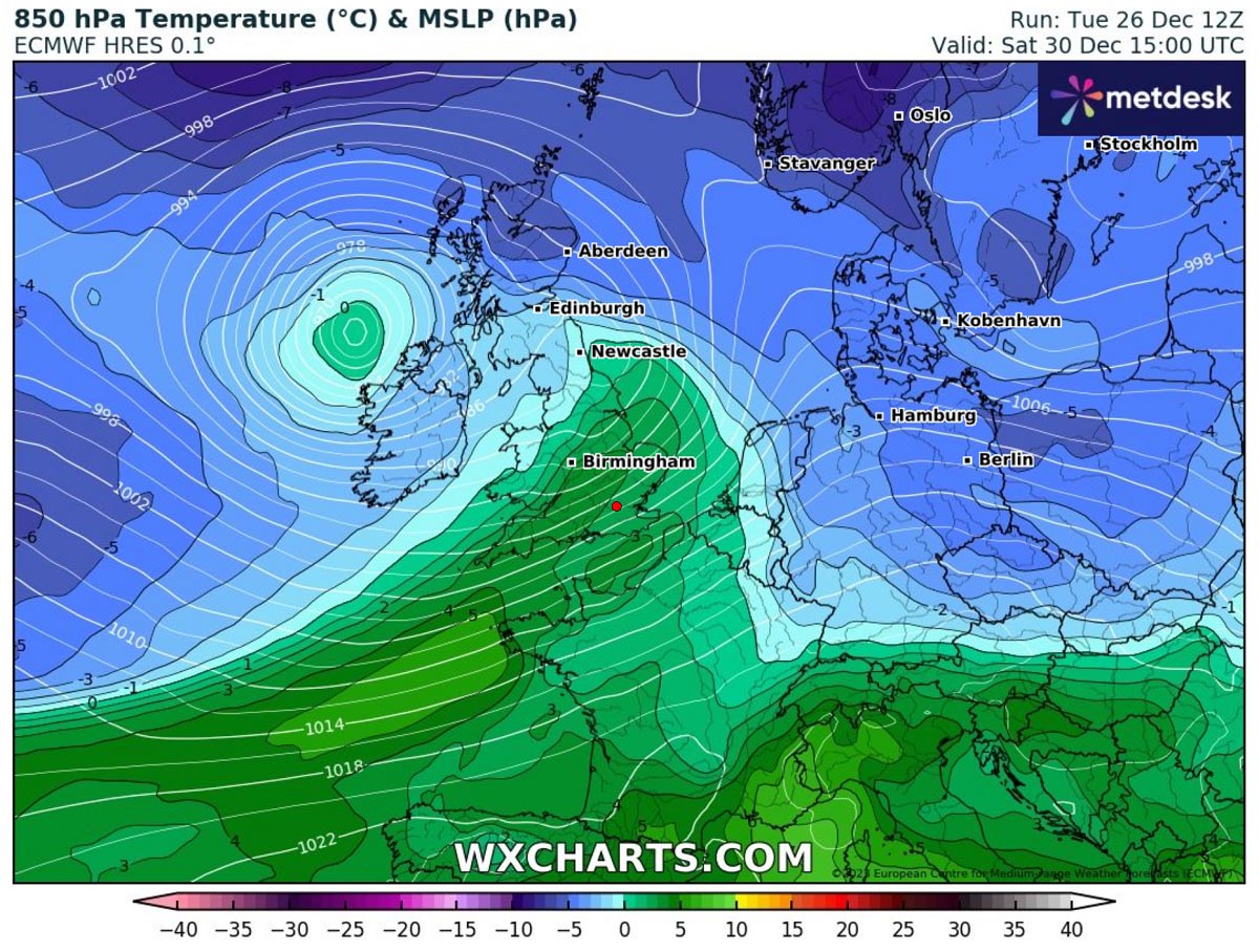
The system will also advect a warmer air mass from the southwest, so the chances for snow are limited to the storm’s early hours, e.g., Northern Ireland and Scotland.
Further south, temperatures will be warmer, so no chances for snow are forecast. The following chart indicates air temperature at the 850 mbar geopotential level, around 1200 m above sea level. We can see strong warm advection ahead of the cold front in the warm sector.
The cyclone’s core will move into the North Sea by Sunday morning and continue further east into Denmark and southern Sweden during the day.
As the following Sunday sequence reveals, the convective line will blast across northern France, Benelux, and Germany.
It will also be associated with convective rain/wind squalls that could produce significant tree damage and disrupt air and ground travel.
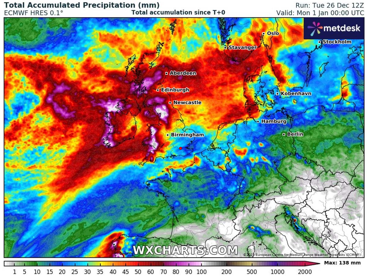
More rain is forecast to accumulate from storm Gerrit and then Henk over the weekend for western Europe, with local sums exceeding 100 mm until New Year’s Day.
Areas further south will remain in warm and humid air, but no significant rainfall amounts are forecasted due to Atlantic storms traveling farther north.
Storm Henk will blast southern Norway, Sweden, southern Finland, and Estonia with Heavy Snow and Intense Winds
Storm Henk is forecast to remain an intense extratropical cyclone as it continues east across the North Sea, reaching southern Scandinavia on Sunday morning.
Conditions will deteriorate rapidly as the system grazes further east during the day, spreading heavy snow and intense winds with blizzard conditions into southern Norway, Sweden, the Baltic region, and southern Finland.
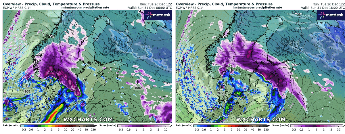
Snow will be wet and heavy in many areas, disrupting travels combined with strong to locally severe winds. 10-30 cm of fresh snow will be possible along the swath of the storm.
Conditions are forecasted to improve Sunday night into New Year, with the storm moving into Russia and weakening.
Trends for early January 2024 hint at Polar Vortex Collapse and Potential Pattern Change
The weather models have recently begun trending into a significant disruption of the Polar Vortex, which may lead to its collapse later next month. Once/If it occurs, much more dynamic winter weather usually follows.
Some hints of the weather pattern shift as early January approaches are seen on the ensemble weather models, GEFS and EPS. The following chart is for the ECMWF EPS around Jan 4th.
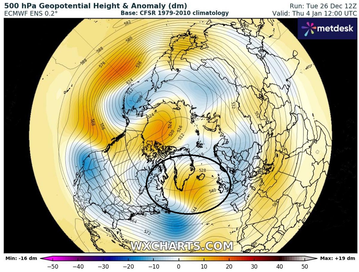
The model simulates a strengthening right over the North Atlantic, which generally means that the powerful westerlies (zonal flow) could weaken, establishing a blocking High over the Atlantic. Thus, allowing the cold Arctic air masses to progress towards continental Europe.
While these are still far away, it is wiser only to monitor trends for now, as things can change a lot until the collapse of the Polar Vortex finally happens.
We will have an in-depth update on the Stratospheric activity and Polar Vortex disruption with the next article in the coming days. Stay tuned for details.
We also plan to update the effects for Europe when patterns will flip into wintry mode.
** The Severe Weather Europe team wishes you a Happy New Year and all the best in 2024. We are thankful for your continuous support over the years.
Wxcharts, Windy, and Pivotalweather provided images used in this article.
See also: