After a record-warm September across many parts of Europe, October doesn’t want to be left behind. An unprecedented start of the month has pushed numerous weather stations across their all-time records, breaking national records in France, Spain, Austria, and Poland. Another powerful heat dome is forecast to spread a large heatwave into Western Europe this weekend.
The most anomalous temperatures are again forecast for Spain, Portugal, France, Benelux, and across Ireland and the UK.
September smashed all-time records, then an unprecedented heat to start the October
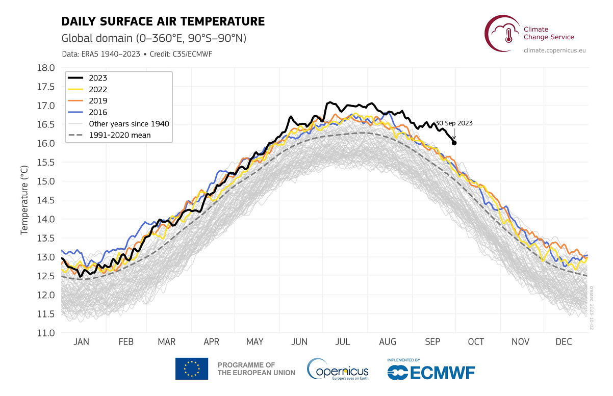
September 2023 was the warmest globally, breaking thousands of temperature records. It was recorded as the warmest September since 1979 worldwide and in Europe. The average global surface temperature was 16.38 °C.
In Europe, the average temperature in September 2023 was an astonishing +2.51°C above the long-term average based on the 1991-2020 period. The previous warmest September was the one of 2020, with a temperature of 1.42°C above the 1991-2020 period levels.
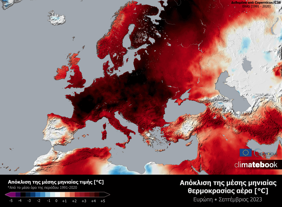
Therefore, September 2023 smashed this record with an anomaly of +0.93°C over the 1991-2020 long-term average, nearly twice the previous record.
In addition, September 2023 was also the 4th month (after June, July, and August) that we set new global temperature monthly records. In other words, 2023 is on the way to becoming the hottest year on record for the planet.
Then, the start of October in Europe wasn’t lagging behind these unprecedented records either. Several national all-time high-temperature records for October have been broken between the 1st and 3rd of October 2023.
Spain:
On Sunday, October 1st, the weather station in Montoro, Spain, reported +38.2 °C. Breaking the Spanish national October heat record of +37.5 °C set in Marbella in 2014.
Numerous records were also set with Foehn winds in northern Spain, with +37.0 °C reported from the coastal areas of Cantabria at Barcena. +36.7 °C was reported in Bilbao airport. Llimiana, Calatlonia reported +36.0 °C on Oct 1st as well.

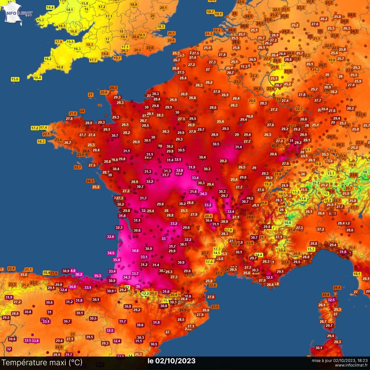
France:
A +35.8 °C in Navarrenx set France’s new high-temperature national record on Oct 2nd.
This day also set numerous other station records across the southern-central part of the country, especially in its southwestern corner, where dry, downslope winds from the higher terrain of the Pyrenees helped temperatures to climb into historic values.
Andorra also set its new all-time monthly record; it was + 31.9 °C in La Comella.
Austria:
Weather station Langenlebarn near Vienna reached +30.3 °C, a new record for October.
Poland:
An unprecedented heat was also reported from Poland on October 3rd. The town of Legnica in the southwestern part of the country peaked its afternoon temperature at 29.3 °C, breaking its 57-year-old national record of 28.9 °C in early October 1966. The highest mark in Legnica was also a result of dry, foehn winds from the higher terrain to its south-southwest.
Before we dig into the evolution of the weather pattern and new heat dome, let’s first see some record holders from Wales, the UK, and Ireland in the past.
The highest-ever recorded October temperature in the UK was observed in Gravesend, Kent, England. It was +29.9 °C on October 1st, 2011. The previous record of +29.4 °C was from Oct 1st, 1985, in March, Cambridgeshire.
Ireland’s record is +24.1 °C from the 10th of October, 1969, recorded in Strabane (County Tyrone).
Scotland’s record for October is more than a century old. It was +27.4 °C on October 3rd, 1908 in Tillypronie (Aberdeenshire).
Wales record is +28.2 °C from October 1st, 2011, set in Hawarden Airport (Flintshire).
Temperatures for the upcoming days are forecast to reach the low 30s across southern France, around mid-20s across the northern parts, Benelux, south-central Germany, and even across southern England. Low 20s will be observed in Ireland. Italy will likely push into the 30s again as well.
The main reason behind the upcoming warm wave is again a new, this time actually a very powerful heat dome aloft. Generally, when a long period of stable weather is established, this well-known feature intensifies a heatwave underneath.
What is a Heat Dome, and Why Does It Bring Extreme Temperatures?
The Heat Dome is the primary background feature that causes the development of major heat waves globally every year. There were particularly strong heatwave events during summer, which continued into September and October. The number of record-breaking stations this year goes into thousands, and the temperature anomalies have often been off the charts.
On a global scale, temperatures from June through September have been +1.5 °C above pre-industrial levels. The chart below, provided by CopernicusEU, undoubtedly speaks for itself.
The Heat Dome is that feature that leads to these extreme heat events. Usually, the heat dome is the main and the most dominant feature of summer weather patterns in Europe and North America. Still, it can also occur in autumn, as we are experiencing this year.
When extremely high and anomalous temperatures develop, we will hear the term heat dome being used. Here is how it works and why it is important to understand it from a larger scale. The upper-level ridge pattern, or warm air mass in the higher altitudes, is known as the Upper High (we often use the term blocking High). It usually forms the heat dome.
So, this specific term is used when a broad area of high-pressure parks over a large portion of the continent. Normally, it stays there for several consecutive days or weeks if the event is particularly stable and extreme.
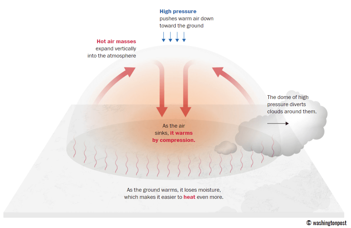
The heat dome works like a lid on a pot. The extensive dome of heat traps a significantly warmer air mass at all levels underneath, sinking its layers toward the ground. Therefore, the air mass becomes dry and significantly warms as it reaches the lowest elevations.
A heat wave, associated with a heat dome, creates fair, stable weather and often arid air mass with minimal chances for precipitation or even clouds. This happens due to the sinking air parcels in the center of the heat dome, resulting in rising temperatures. Sometimes, we see the weather pattern developing a so-called Omega blocking High.
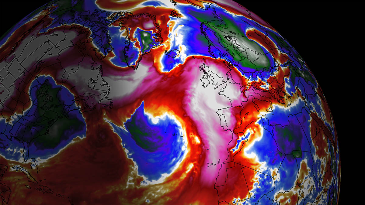
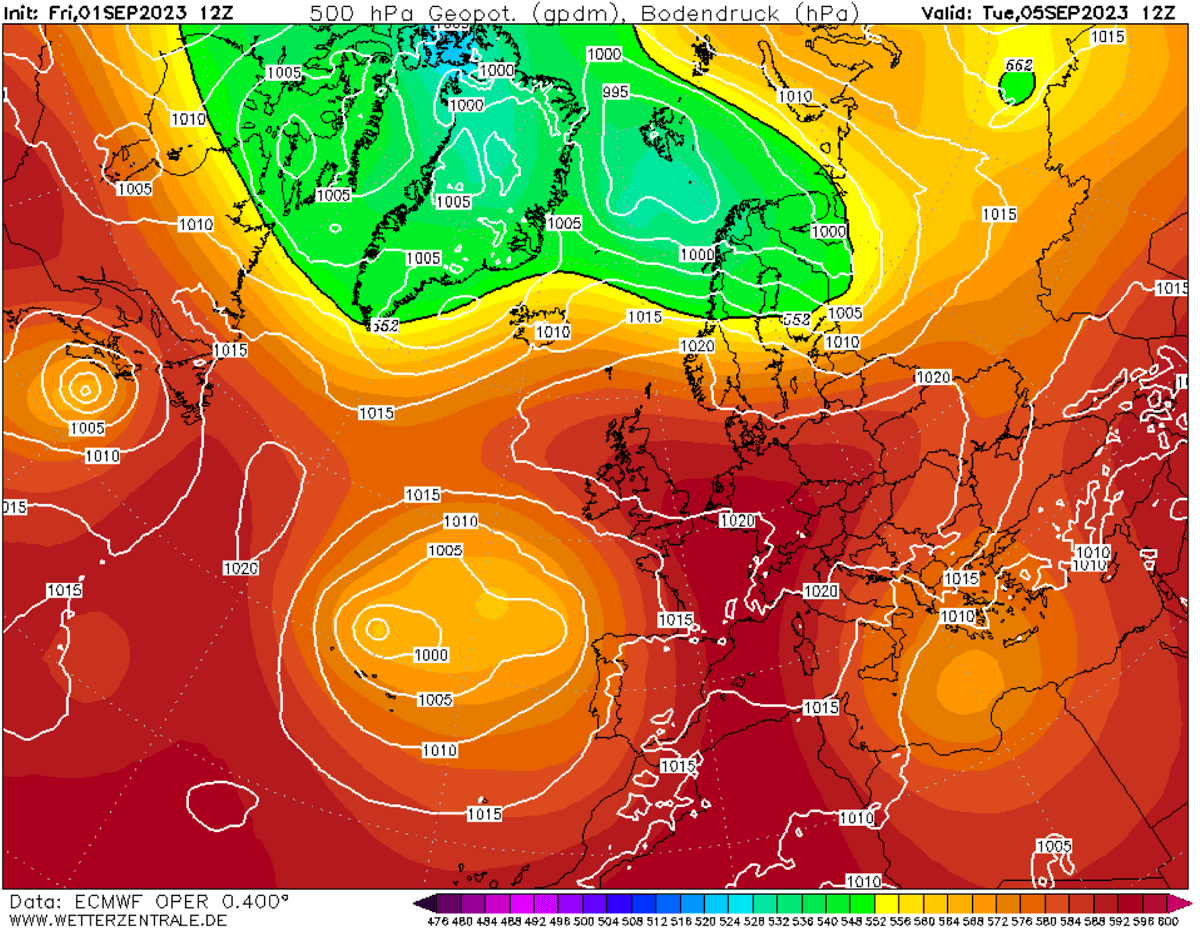
The example below is this kind of Omega blocking pattern over Europe from early September this year. The omega-blocking pattern engulfs a large part of the continent, having a central heat dome and a low-pressure system on each side. One low was over the southern Mediterranean, and the other over the Azores.
Especially during dry summer, drier and warmer weather produces a significantly enhanced wildfire threat due to developing drought. Or additionally worsening the ongoing, pre-existing, arid conditions. Such examples were wildfires in the Pacific Northwest and other parts of western North America in recent years or in Europe (Greece, Portugal, etc.) during this year’s summer season.
Heat dome is often also to blame for being responsible for deadly heatwaves worldwide, as the scorching and excessive heat usually lasts for a very long period. Such heat dome events brought record temperatures in many countries worldwide in the summer of 2023, extending into the fall seasons.
The daily average and maximum temperatures under the heat dome are typically significantly above normal. When the dome of heat is particularly strong, it challenges existing historical records, as we have seen globally this year. This becomes particularly striking when this feature develops during early summer or autumn.
A New Powerful Heat Dome Develops Towards Western Europe
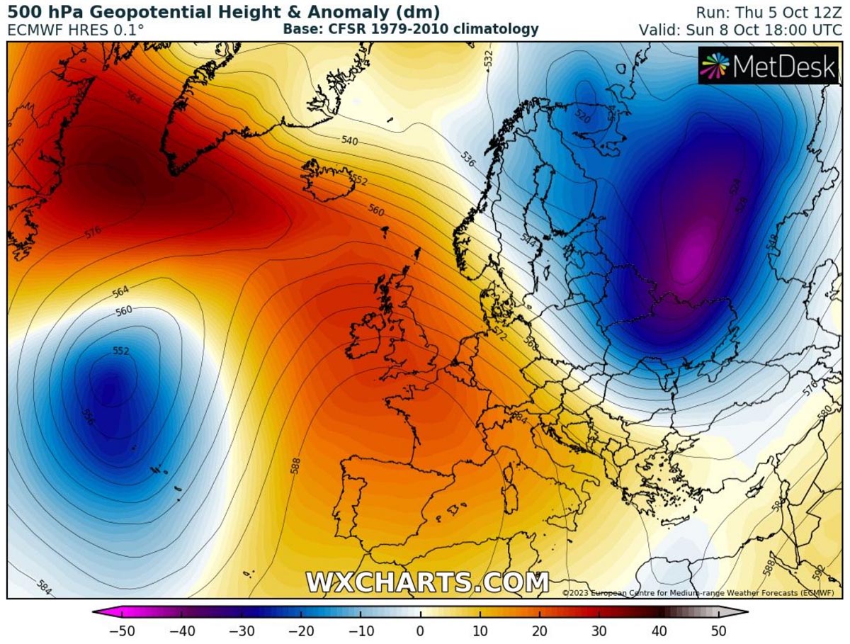
As we head into the next weekend, the general weather situation in Europe indicates that another powerful heat dome will strengthen and expand into western Europe. Paired with deep upper lows on each side, establishing a textbook Omega blocking pattern.
On the western side of the Omega, a deep upper low will be placed over the Azores, while on the eastern side, a deep Arctic blast will spread across eastern Europe and western Russia. This pattern results in strongly anomalous heights across western Europe, bringing more stable weather in the following days.

A southerly flow will establish a significant warm plume underneath the heat dome, achieving a much warmer air mass gradually spreading north from northwestern Africa and Iberia onto western Europe for the weekend.
From Friday through Sunday and Monday, an extremely anomalous air mass will re-develop over Spain, Portugal, France, Benelux, the UK, and Ireland. Partly also extends into the northern Mediterranean and central Europe. The warmest and most anomalous air mass will persist across the western countries for multiple days, while colder air is seen farther east – we will discuss this further below.

Through the upcoming weekend, the heat dome and heatwave will continue strengthening, reaching the peak over western European countries. The highest temperatures are forecast over Spain, Portugal, and France, as well as over Benelux and the UK with Ireland.
The video animation below indicates a great overview of the strong large-scale features as the dipole pattern develops over Europe.
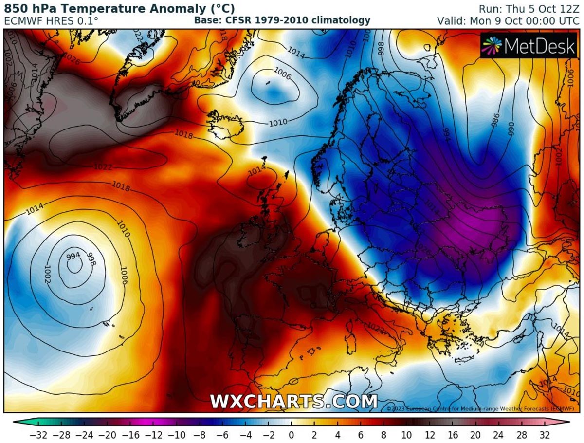
The 2m temperature anomaly chart below represents the contrast between cooler air mass on the east against the much warmer than normal on the west. Near-surface temperatures across Iberia, France, southern England, and northern Italy will be 8-12 °C above normal for early October. Anomalies in higher altitudes will be significant, too.
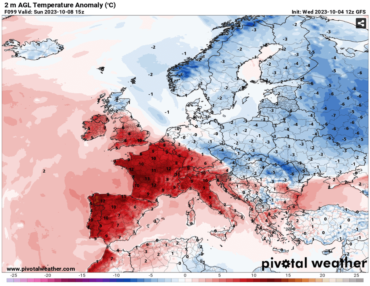
Due to the effect of the frontal system with colder air mass spreading into eastern Europe, there will be a sharp temperature contrast across central Europe. This highly anomalous temperature from the west is also not forecast to reach far east either.
The new powerful heat dome will result in temperatures significantly above normal for early October and could rechallenge some high records.
Major Heatwave re-intensifies into Spain, Portugal, and France, with Temperatures back towards the mid-30s
With a warm plume developing, the first regions affected will again be southwestern Europe from this Friday into early next week. Extreme temperatures in the mid-30s will continue across southern Portugal and southwestern Spain. So, it is quite similar to those the Iberian peninsula has been experiencing this week.
These anomalously high temperatures are likely to also extend into at least early next week over Iberia, as warm mid-levels will remain over southwestern Europe. Other parts of Portugal and Spain will remain in the upper 20 to low 30s as well.
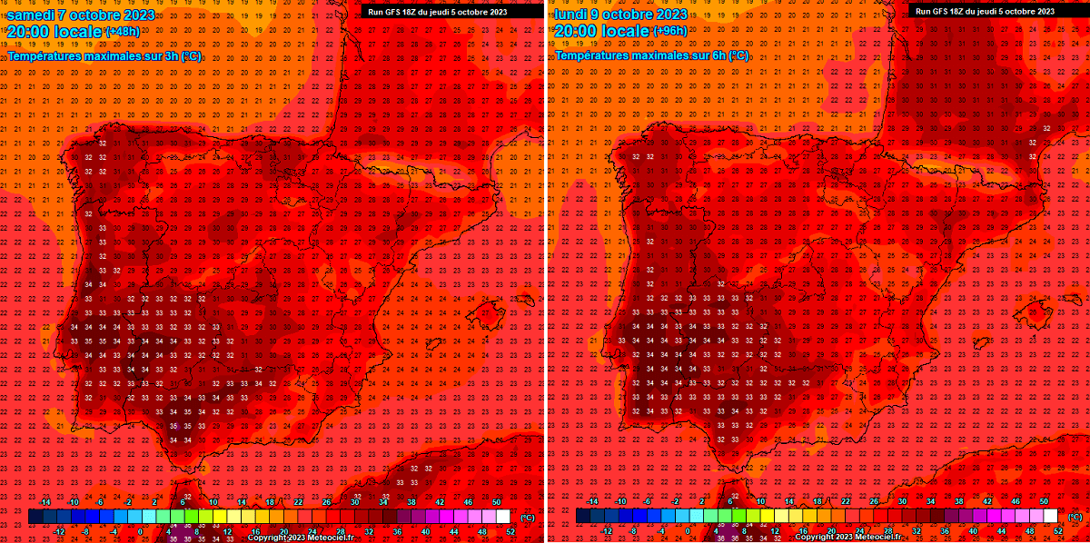
Further north and east into France, temperatures are forecast to climb back into the low 30s, mainly in southern and western France. A few degrees lower across the rest of France, but still significantly above normal temperatures.
On Saturday and Sunday, temperatures are forecast to be from 22 to 25 °C across Benelux and western Germany. Further east, temperatures will be lower due to the effect of the cold front passage on Monday.
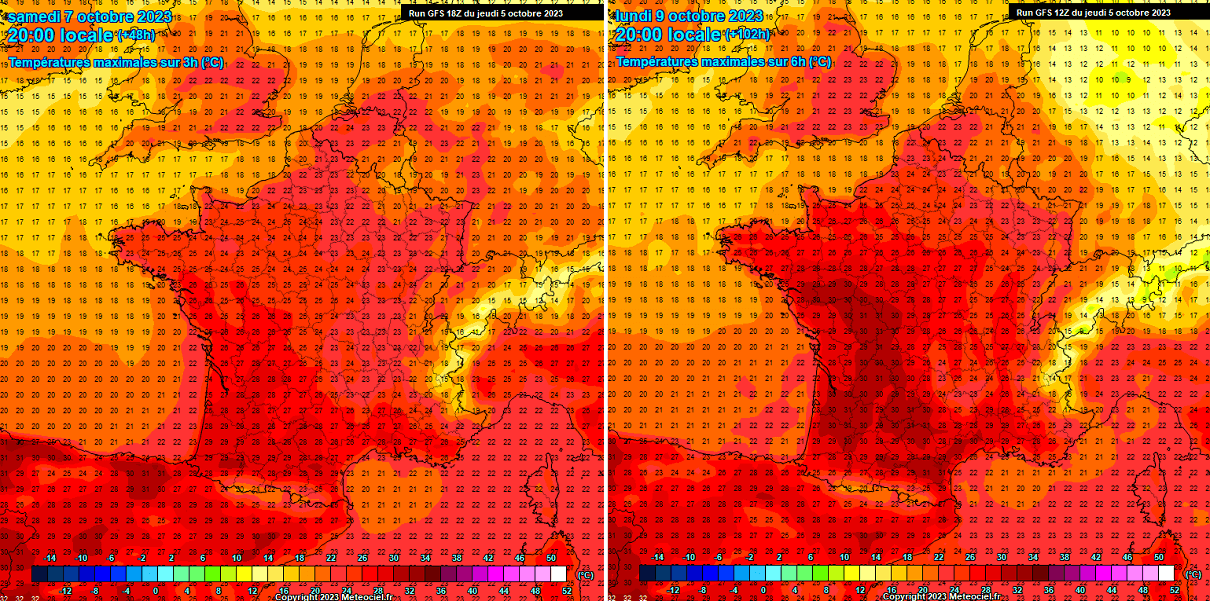
So, west-southwest France inland areas are forecast to experience temperatures back to 30 °C in the following days. The heatwave will start intensifying on Friday but reach its peak from Saturday through Tuesday.
These temperatures will be much higher than normal for early October again.
Much Higher Temperatures return into the UK and Ireland for the Weekend, with mid-20s possible in England
As the upper High gradually expands north over the weekend, it also allows temperatures to warm up significantly across the UK and Ireland. From Saturday through Monday, peak afternoon temperatures are forecast to reach the low to mid-20s across southern England, near 20s in Wales.
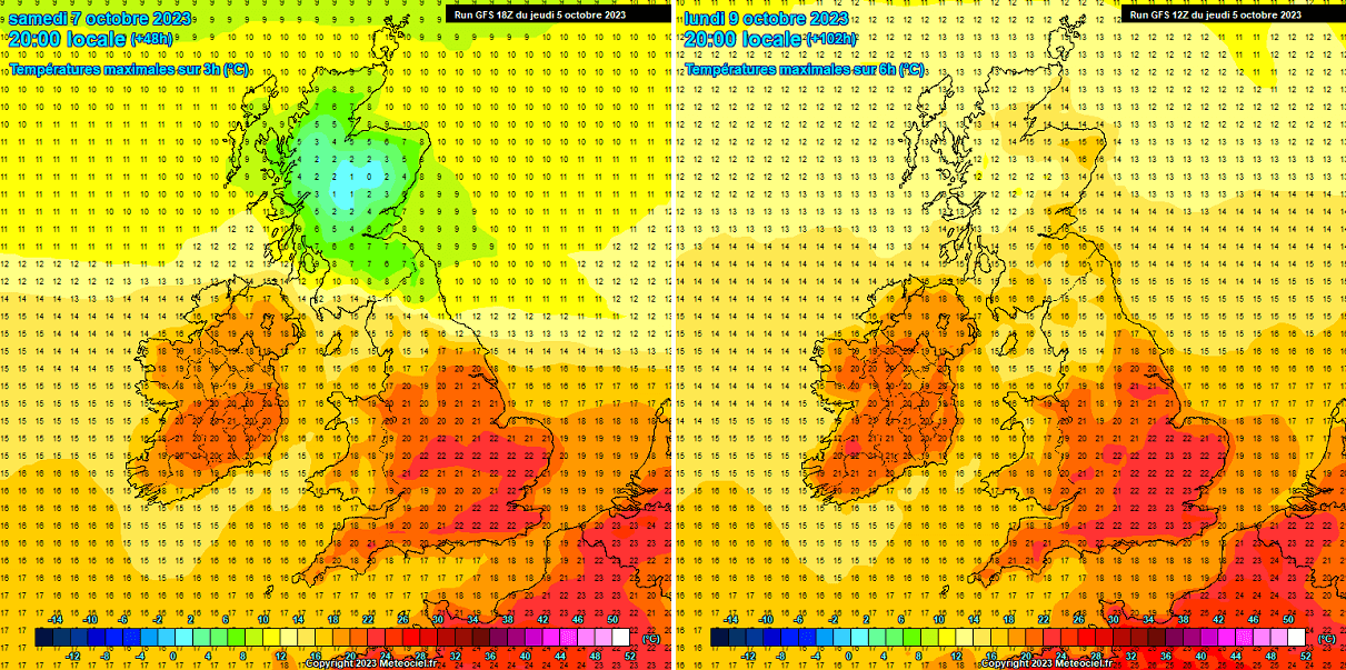
Temperatures will also climb above 20s across Ireland, possibly peaking at around +23 °C on Monday. Colder temperatures will be over Scotland, below 10 °C on Saturday and gradually a few degrees higher after Sunday, but mainly remaining between below 15 °C on Monday as warm wave won’t be reaching that far north this time.
As some weather models suggest, these above-normal temperatures are forecast to remain very high until Monday, possibly extending into Tuesday and Wednesday if the heat dome aloft maintains its strength for longer.
Heatwave Also Expands into the Mediterranean; Italy could reach +30 °C again
Once the heat dome peaks over the weekend on the west, it will expand eastward, rising temperatures into central Europe and the Mediterranean.
On Saturday, temperatures will climb back into the upper 20s over much of Italy, into mid-20s over the north and central Balkans, continuing into early next week.

The maximum temperatures on Sunday are forecast to touch the 30 °C mark across the plains in Po Valley, northern Italy. It’s just a tad lower across central Italy. Overall, temperatures will remain between +25 and 30 °C across most of south-central Italy.
Before some refreshment forecast from the north on Monday, temperatures will likely be the highest across northern Croatia and northern Bosnia and Herzegovina on Sunday, reaching up to around +28 °C locally.
The rest of the Balkans will experience temperatures in the mid-20s over the weekend. Still, this part of the year is much warmer than normal.
An Impressive Dipole Pattern Across the European Continent – Cold Blast on the East
While the Omega blocking pattern engulfs western Europe, a deep trough moves from the northern into eastern Europe and western Russia. Creating quite an impressive dipole weather pattern over the European continent.
We can also see a deep low near the Azores, making a textbook Omega pattern over Europe.
The temperature contrast between Western and Eastern Europe is quite significant. While the air mass will be 10-15 °C warmer than normal on the west, it will be 10-15 °C colder than normal on the east.
That’s quite a big difference between the large-scale features, inducing a strong northwesterly jet stream across the continent.
The dipole weather pattern is well-presented on the Meteogram charts, indicating temperature and precipitation forecast across a 14-day period. The left chart is for Paris, France, and the right is for Kyiv, Ukraine.
Paris’ chart indicates that the strengthening warm wave with heatwave will be long-lasting, more than 10 degrees warmer for about a week. Then, more dynamic weather is forecast, with precipitation and temperatures returning to near-normal.

The right chart for Kyiv hints at quite a sharp temperature drop on Saturday, roughly about 12 degrees Celsius temperature change in one day. Some precipitation is foreseen along the cold front, likely bringing snow across western Russia.
The cold blast will be a rather short breath for only a few days as temperatures are forecast to return to near to slightly above normal next week.
The Health Risks During A Heat Wave
During an extended period of very warm weather, generally surpassing +35 °C, it is physically challenging and presents an enhanced risk for health.
Sweltering weather, particularly in extended periods – heat waves – is uncomfortable but presents a significant health risk.
Who is most at risk?
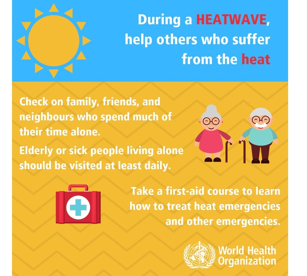
Scorching hot weather is uncomfortable for most people. The following groups are particularly threatened by the very high temperatures we encounter during heat waves:
- elderly people aged over 75 years
- babies, young children
- people with chronic/long-term health conditions, such as diabetes, respiratory disease, circulatory disease
- People who are obese
- People taking certain medicines
- people who work outdoors, in hot/poorly ventilated areas, or engage in physical activity in hot weather
- socially isolated people
- people who are not acclimatized to hot weather, such as tourists from northern countries
Always stay cool, hydrated, and healthy in scorching hot weather
Staying hydrated is one of the most crucial things during extreme heat. Consider taking these precautions and measures to stay healthy in scorching weather:
- Drink plenty of water! – A human’s body cools through sweating; on a sweltering day, an adult may lose up to several liters of water. Keep drinking water, and avoid drinking alcohol, hot drinks, and drinks with high sugar content, as they can worsen dehydration. A regular intake of water is a good way of preventing dehydration.
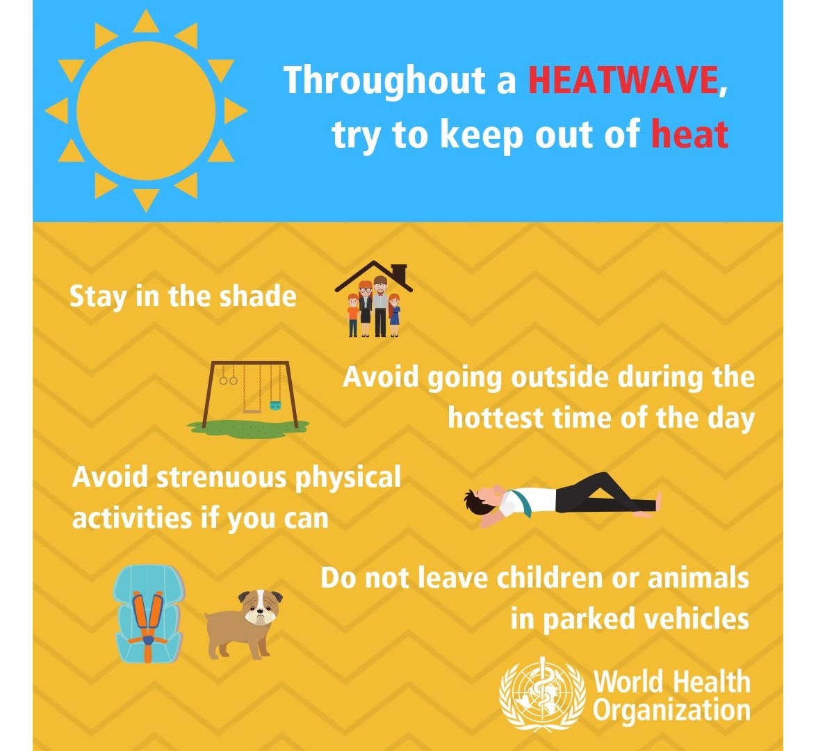
- Keep your body cool; stay out of the sun if possible. Eat small meals, preferably fruit and salads. Wear light-colored and loose clothing made from natural materials like cotton. Take a cool shower or a cold bath if you feel hot. Also – keep your workspace and living space cool. If you do not have air conditioning, shut the curtains and blinds during the day. Stay in the coolest room, and avoid using the stove and oven as much as possible. If your home gets too hot, go to a cooler place – a library, shopping center, cinema, or swimming pool.

- Keep your food safe! – Keep food that needs refrigeration adequately stored! Food spoils rapidly at high temperatures, and you may risk food poisoning if the food is not stored correctly.
- If you need to go out in the sun – protect your skin and use proper sunscreen and clothing to avoid sunburns. Cover your head correctly.
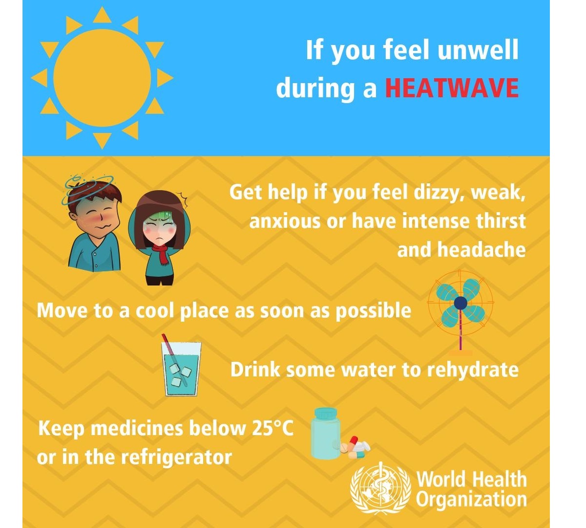
- Know your body and have a plan – Ask your doctor if you have any health conditions that may increase the risk of heat-related illness. Call and consult with your doctor if you are feeling unwell. Call emergency help (know the number!) if you feel unwell!
Common heat-related illnesses with symptoms: What to do if it happens?
WHO considers these symptoms’ descriptions and treatments below as informative only – consult with your doctor for details and professional advice:
Dehydration
Dehydration occurs when the body loses too much water to maintain normal functions. Symptoms include dizziness, tiredness, irritability, thirst, dark yellow urine, loss of appetite, and fainting. Drink plenty of water or diluted fruit juice. Avoid coffee, alcohol, and sugary drinks. Move to a cooler space to cool off. If you feel unwell, call your doctor or emergency room.
Heat rash
Heat rash is an itchy rash caused by excessive sweating. Move to a cooler, dryer environment, and keep the affected areas dry. Hydrating creams may make the condition worse. Consult with your doctor.
Heat cramps
This happens during strenuous activity when the body sweats and loses water and salt. Heat cramps manifest as muscle pains or spasms. If this happens, stop all activity, move/lie down in a cool place, and raise your legs slightly. Drink water or diluted juice. Have a cool shower or bath, and apply ice packs. Refrain from returning to strenuous activity for several hours. If heat cramps do not subside, seek medical help.
Heat exhaustion
Heat exhaustion is the condition in response to losing excessive amounts of water and salt due to dehydration. Symptoms include heavy sweating, pale skin, fast and weak pulse, fast and shallow breathing, muscle weakness or cramps, tiredness and weakness, dizziness, headache, nausea or vomiting, and fainting.
If heat exhaustion occurs, the body needs to be cooled and rehydrated by moving to a chilled place, lying down, having a cool shower or bath, and placing cool packs under the armpits, groin, or back of the neck. Rehydration should be done by taking small amounts of cool fluids. Medical help is advised if symptoms do not abate within an hour.
Heat stroke
Heat stroke happens when the body temperature reaches 40.5 °C, a severe and life-threatening condition! Immediate first aid in lowering body temperature is critical, and an immediate call for an ambulance! Find more information on heatstroke here.
High relative humidity during a heatwave can also significantly affect the body, as it also becomes physically challenging for those working outside. After high rainfall events, strong heating will help evaporate the soaked grounds, resulting in higher humidity than normal.
To represent the real feel of scorching hot temperatures and high humidity, we use a Heat Index. These graphics indicate what is the real feel of temperatures based on what the temperature and humidity are.
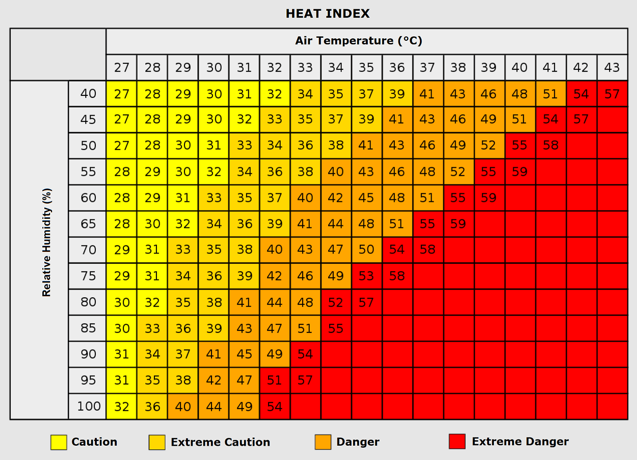
As we see, when air mass has a temperature around +35 °C, humidity below 60 percent is much less challenging than once the humidity is very high, e.g., above 80 %. Thus, the real feel temperature would be near 50 degrees Celsius.
With even higher temperatures close to the 40s, such sweltering hot air becomes hard to handle with even lower humidity, 50 to 60 percent.
Wxcharts, Pivotalweather, ClimateBook, and Meteociel provided images used in this article.
See also: