A violent surge of water, mud, and boulders swept through the transboundary Bhote Koshi Trishuli river system on August 26, devastating settlements and infrastructure in northern Nepal and southern Tibet. Satellite evidence points to a large ice and rock avalanche and temporary river blockage in the upper Lhende Khola. A seismic signal first reported as a magnitude 4.4 earthquake was later reclassified by the U.S. Geological Survey (USGS) as a magnitude 5.2 landslide, indicating that the shaking resulted from the mass movement rather than triggering it.
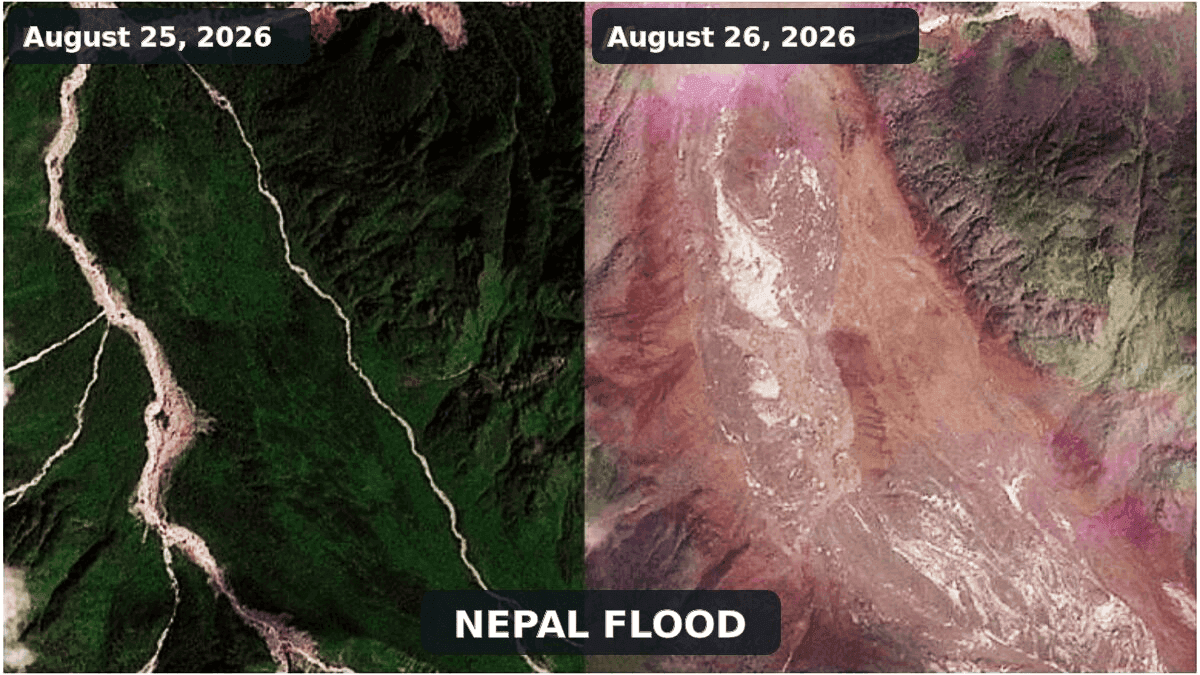
Credits: PLANET LABS PBC/Handout via REUTERS
Updated assessment based on information available late on August 26, 2026; casualty figures and the reconstruction of the event may still change as rescue operations and scientific analyses continue.
A sudden disaster traveling out of the high mountains
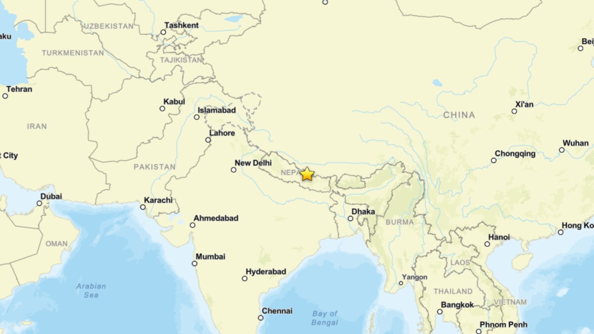
A catastrophic flash flood struck the Nepal-Tibet border region on August 26, sending water, mud and rock through narrow Himalayan valleys. The flood entered Nepal through Rasuwa district and propagated downstream along the Bhote Koshi and Trishuli river system. By late August 26, the Associated Press reported at least 160 deaths across Nepal and China, while hundreds of tourists, workers and local residents were still listed as missing.
Very likely, and unfortunately, this is a significant underestimate. Roads, bridges, settlements and hydropower installations were swept away or buried, and access to the border area remained extremely difficult.
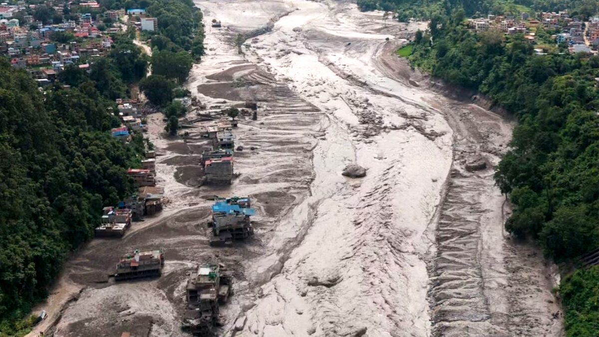
Credits: REUTERS
The event appears to have originated in the upper Lhende Khola, a tributary of the Bhote Koshi close to the international border. According to the International Center for Integrated Mountain Development (ICIMOD), satellite observations indicate that an ice and rock avalanche descended from a glacierised slope, blocked the Lhende Khola and released a sudden surge downstream.
Reuters, reporting the ICIMOD assessment on August 26, noted that the river level on the Trishuli rose by as much as nine meters in about half an hour.
The avalanche apparently obstructed the narrow valley, at least temporarily. Water accumulated behind the unstable mass before escaping suddenly, producing a flood heavily charged with debris. This leading hypothesis explains the abrupt onset, the exceptionally high sediment load, and reports that part of the blockage remained upstream after the first wave.
One of the most important updates concerns the seismic signal recorded at the beginning of the disaster. The U.S. Geological Survey (USGS) initially cataloged the signal as a magnitude 4.4 earthquake near the Nepal/Tibet border. The USGS subsequently revised the event page (event us7000tbwb), classifying the signal as a magnitude 5.2 landslide. In other words, the seismic waves appear to have been generated by the collapse itself. This reverses the first interpretation circulated in the hours after the flood. The “earthquake” was not the trigger but part of the geophysical signature of the mass movement.
A cascade rather than a single process
High-mountain disasters are frequently described with one convenient label: flood, avalanche, landslide or glacier collapse. In reality, the most destructive events are often cascades in which one process changes into another within minutes.
The preliminary reconstruction begins with the failure of a steep glacierised or periglacial slope in the upper Lhende Khola. The collapsing mass contained a mixture of bedrock, glacier ice and snow, making an ice and rock avalanche more appropriate than either a pure rock avalanche or a snow avalanche.
As the mass accelerated downslope, rock fragmented and ice shattered. It then entered the river, possibly generating an initial displacement wave and depositing enough material to block or severely constrict the channel. Such a dam, made of boulders, shattered ice, sediment, and snow, is irregular, permeable, and highly unstable.
Water accumulating behind it could escape by seepage, overtopping, or rapid erosion. Partial failure would release both the impounded water and material from the dam. The surge could then entrain additional sediment from the river bed and banks, transforming into a debris-rich flash flood as it traveled downstream.
The event can therefore be described provisionally as an ice-and-rock avalanche-induced landslide-dam outburst flood. The expression is awkward, but it captures the physical chain. Calling it simply a “glacier burst” would be misleading, while calling it a GLOF would imply a glacial lake that has not been confirmed as the source.
Glaciological Dynamics: Mechanics of High-Altitude Ice Avalanches
An ice avalanche occurs when a mass of glacier ice suddenly detaches and moves rapidly down a steep slope. It may originate from a hanging glacier, a steep glacier tongue, a serac, or a destabilized marginal sector.
This differs from a snow avalanche, which involves seasonal snow and is commonly associated with weak layers within the snowpack. It also differs from normal glacier flow. Glaciers deform and slide continuously, usually at rates of centimeters to meters per day. During an ice avalanche, part of the ice body loses mechanical support and accelerates in seconds. Once fragmented, it behaves as a granular flow and may reach velocities of tens of meters per second.
An ice and rock avalanche is a mixed event in which glacier ice and bedrock fail together or become thoroughly mixed during movement. It may be triggered by an earthquake, intense rainfall, rapid melt, progressive fracture growth, permafrost degradation, or a combination of factors. Frequently, the final trigger is relatively modest because the slope has already moved close to failure over years or decades.
Satellite Evidence Confirms Avalanche-Dam Outburst, Not a GLOF
GLOF stands for Glacial Lake Outburst Flood; in other words, a sudden release of water stored in a lake associated with a glacier. The lake may lie in front of a retreating glacier, along its margin, on its surface, within the ice, or beneath it. A moraine, glacier ice, or bedrock can dam it.
The best-known Himalayan GLOFs originate from moraine-dammed lakes. As a glacier retreats, meltwater fills the depression between the shrinking ice front and an older moraine. An ice or rock avalanche entering the lake may generate a displacement wave that overtops and erodes the dam. Heavy rain, rapid melt, internal seepage, or an earthquake can also initiate failure. Once a breach starts to deepen, a large part of the lake may drain within minutes or hours.
GLOFs are not defined simply by the presence of glacier ice in a flood. They require the sudden drainage of a pre-existing glacial lake. An avalanche can trigger a GLOF, but an avalanche that blocks a river is not automatically one. In the latter case, a new and temporary lake may form behind the avalanche deposit.
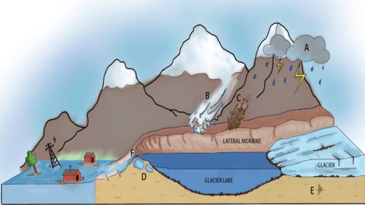
The distinction matters for monitoring. A known glacial lake can be mapped repeatedly and equipped with water-level sensors. A short-lived avalanche dam may form and fail too rapidly for conventional lake monitoring to provide warning.
The first reports from Nepal understandably mentioned a possible GLOF. Moreover, a deadly flood in the same broader Bhote Koshi system on July 8, 2025, was traced to the drainage of a supraglacial lake north of the Langtang Himal.
Current evidence therefore points to a different mechanism on August 26. According to ICIMOD specialists quoted by Reuters and the Associated Press, the strongest interpretation is an ice and rock avalanche that blocked the Lhende Khola and then released a sudden flood wave. The U.S. Geological Survey (USGS) reclassification of the initially reported M4.4 earthquake as a M5.2 landslide is consistent with a very large mass movement. No emptied pre-existing glacial lake has yet been shown to be the primary source.
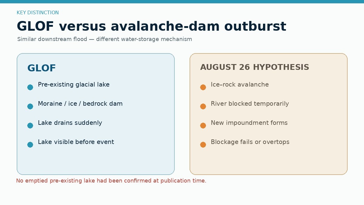
A lake may have formed after the avalanche, but that would be a temporary landslide-dammed lake. Its collapse would create an outburst flood, but not a GLOF in the strict glaciological sense. A small supraglacial or ice-marginal lake may have contributed water, but high-resolution imagery will be needed to show it.
Seismic Signal Audit: USGS Reclassifies M4.4 Event as M5.2 Landslide
Earthquakes can certainly trigger rockfalls, landslides, and ice avalanches. The 2015 Gorkha earthquake in Nepal, for example, produced thousands of mass movements, including the catastrophic Langtang avalanche and the avalanche that struck Everest Base Camp. That analogy made the first reports from August 26 appear plausible.
However, the interpretation changed as seismic analysts reviewed the signal. According to the U.S. Geological Survey (USGS) event page for us7000tbwb, the event first issued as a magnitude 4.4 earthquake was subsequently reclassified as a magnitude 5.2 landslide. The seismic disturbance was therefore generated by the collapsing mass itself, rather than by tectonic rupture occurring minutes beforehand.
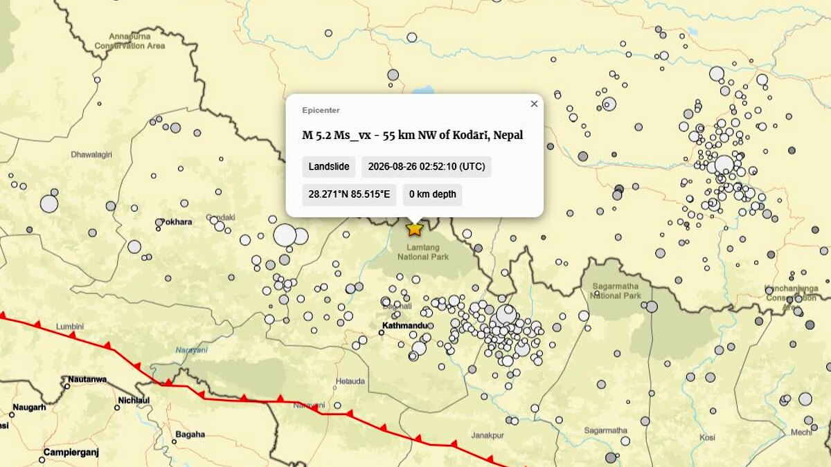
Credit: Seismic activity in the region, via USGS
This distinction is more than semantic. Large avalanches and landslides can generate seismic waves strong enough to be detected across regional networks and, during initial automated processing, may resemble small earthquakes. Their waveforms, source depth, and frequency content allow seismologists to distinguish a shallow, prolonged mass movement from the sharper rupture of a tectonic earthquake. In the Nepal/Tibet case, the USGS update strongly supports the former interpretation.
Marmolada 2022: a useful but imperfect comparison
The event inevitably recalls the catastrophic collapse of part of the Marmolada Glacier in the Italian Dolomites on July 3, 2022. About 70,000 cubic meters of ice, water and debris detached below Punta Rocca at roughly 3,200 meters elevation, traveled for about 2.3 kilometers and killed 11 mountaineers. The detailed reconstruction by Francese et al. (2025), published in Natural Hazards and Earth System Sciences, shows that this too was an ice avalanche.
At Marmolada, an isolated and heavily crevassed glacier body failed after an exceptionally warm late spring and early summer and a winter with very limited snow accumulation. Scientists reconstructed a combination of water-filled crevasses, hydrostatic pressure, hydraulic uplift, and reduced basal friction. Their modeling indicates that no single mechanism was sufficient on its own.
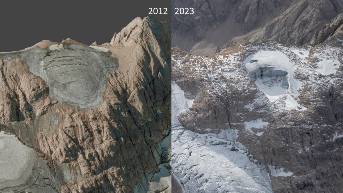
The seismological comparison is particularly instructive. Researchers explicitly excluded an earthquake trigger at Marmolada. No suspicious seismic event occurred close to the glacier before the collapse. The avalanche itself generated seismic ground motion with an estimated magnitude of 0.6 ± 0.3. The magnitude 2.5 earthquake shown in the same paper did not occur during the 2022 disaster; it was a historical event recorded in 2000 just south of Malga Ciapela and was cited because it was the closest M2.5 earthquake to the Marmolada in the catalog.
This is a useful reminder that a mass movement can generate a seismic signal without having been caused by an earthquake.
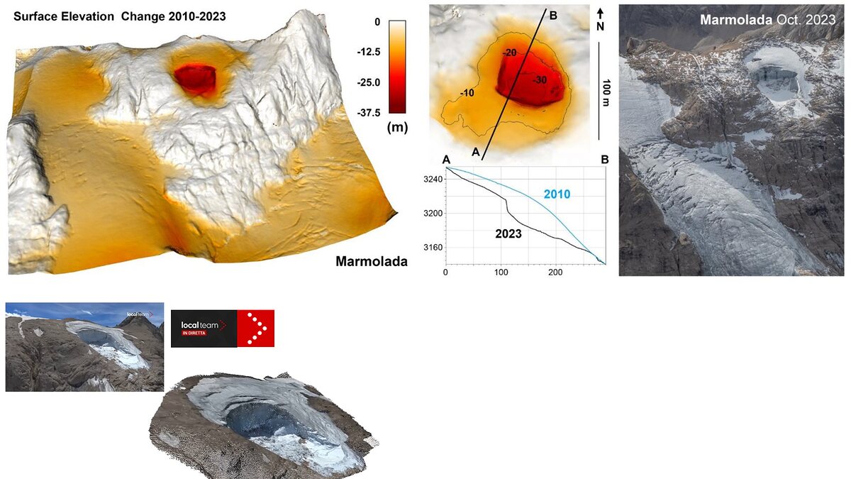
The cascades differed. At Marmolada, the avalanche itself was the principal destructive process. In Nepal, the avalanche appears to have entered a river system, temporarily obstructed the channel and transformed into a debris-rich flood traveling far downstream.
Both cases show why spectacular collapses rarely have a single cause. Failure occurs in seconds, while the conditions that make it possible can develop over months, years or decades.
Blatten 2025 and the unstable Alps of summer 2026
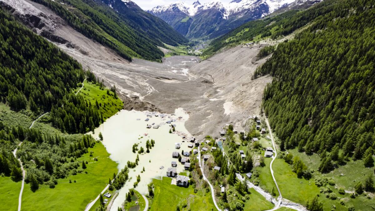
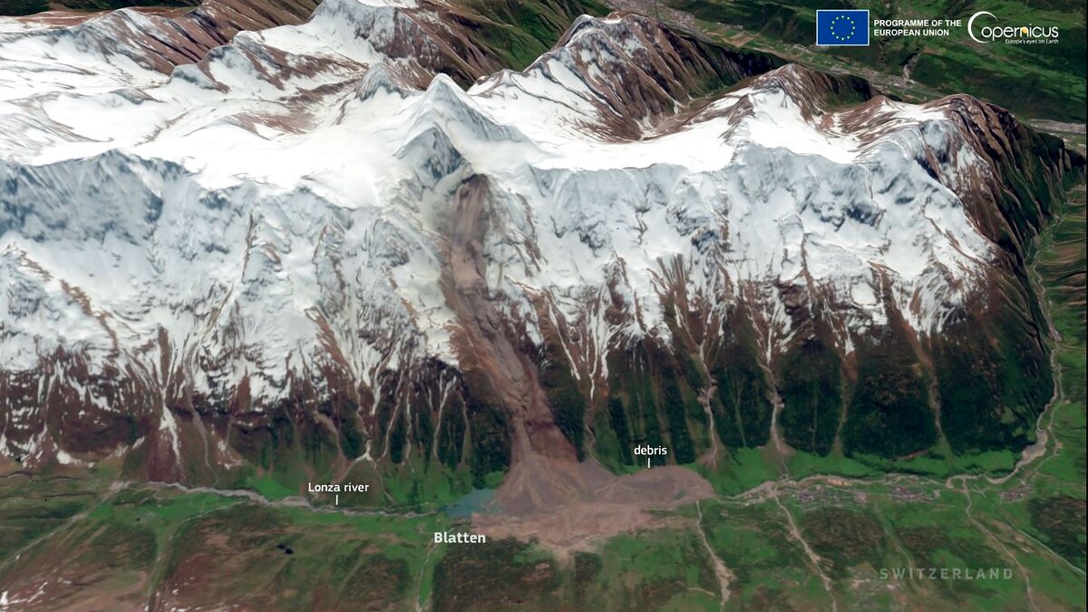
An even closer analog for the cascading character of the Nepal event is the Blatten disaster in Switzerland. On May 28, 2025, a huge rock and ice avalanche involving the Birch Glacier buried most of the village of Blatten in the Lötschental and dammed the Lonza River. According to the Swiss Glacier Bulletin 2025 issued by GLAMOS, about 9.5 million cubic meters of material were mobilized, including approximately 2.9 million cubic meters of glacier ice and 6.5 million cubic meters of rock.
Credits: Jean-Christophe Bott/AP
One person died; the toll would have been far higher had more than 300 residents not been evacuated after accelerating slope and glacier motion was detected. NASA Earth Observatory subsequently documented how rockfall from the Kleines Nesthorn loaded the glacier, which accelerated to around 10 meters per day before the final collapse.
Blatten is important because it shows how rapidly one process can feed another. Progressive rock failure loaded and destabilized a glacier; the glacier and rock mass collapsed together; the avalanche crossed the valley floor; and the deposit dammed a river, creating a secondary flood hazard. A 2026 study in the Journal of Rock Mechanics and Geotechnical Engineering reconstructed the event as a domino-style rock and ice avalanche, with about 5.5 million cubic meters of progressive rock collapse preceding the sudden release of roughly 8.3 million cubic meters of mixed rock and ice.
Credits: Copernicus
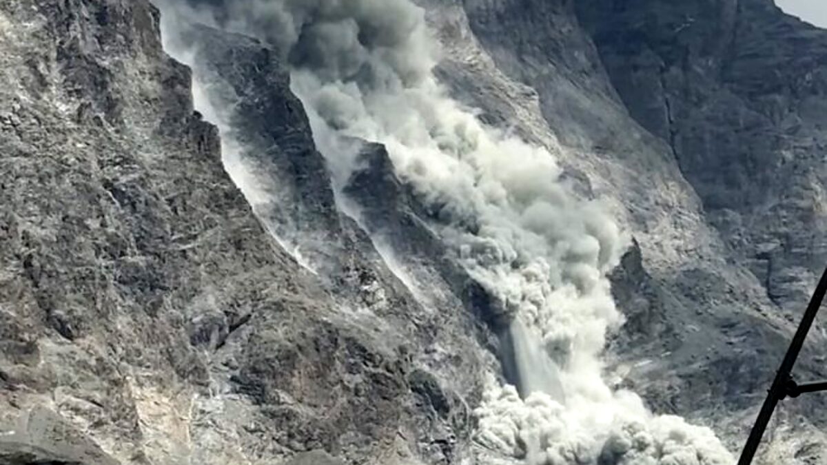
The wider Alpine context during summer 2026 is also difficult to ignore. In the Mont Blanc massif, geomorphologist Ludovic Ravanel of the French National Center for Scientific Research (CNRS) told AFP that around 450 rockfalls were expected to be recorded in 2026, compared with only a few dozen annually a decade or two ago. Le Monde reported at least ten rockfalls larger than 100 cubic meters per day during the August heat, including an estimated 15,000 cubic meter collapse from the north face of the Aiguille du Midi on August 12.
Similar rockfall and route-instability problems have affected other high Alpine sectors, including the Dolomites. These events should not all be treated as identical or assigned a single trigger, but they share a background of exceptionally warm high-mountain conditions, early snow loss, glacier thinning and degradation of ice-bearing permafrost.
Credits: CNR-IRPI
The connection to climate must be stated carefully. Individual rockfalls and ice avalanches also occurred in colder climates, and local geology, fracture geometry and short-term weather remain decisive. What is changing is the environmental baseline: longer and more intense periods of positive temperature at elevations that once remained frozen increase the time available for water to penetrate fractures, for permafrost ice to degrade and for glacier margins and steep rock walls to lose mechanical support.
Climate change: an important background, but attribution is premature
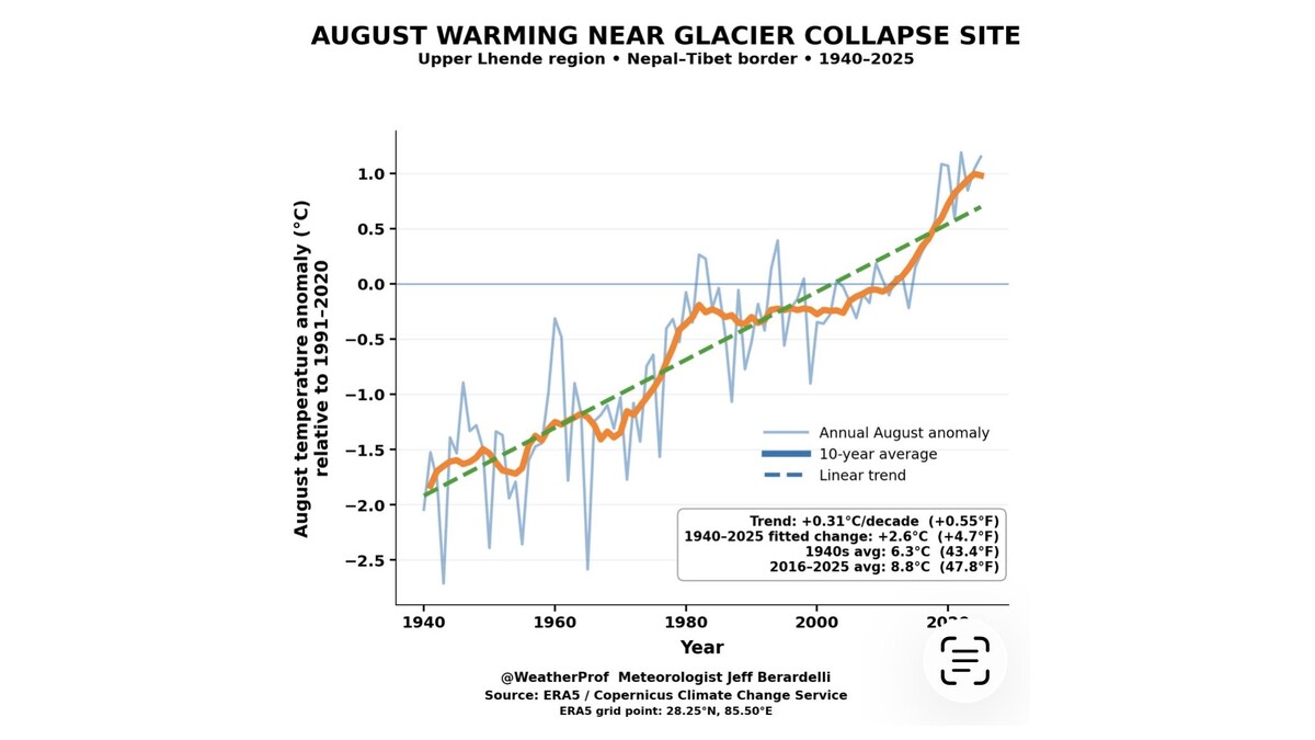
The Hindu Kush Himalaya is warming rapidly, and its glaciers are losing mass. Retreat exposes steep, fractured valley walls previously supported by ice. Glacier thinning changes internal stress and may detach hanging or marginal ice bodies. At high elevations, degrading mountain permafrost can weaken ice-filled rock joints, while increased meltwater alters temperatures and water pressure within glaciers and bedrock.
New glacial lakes are also forming and existing lakes are expanding. Meanwhile, hydropower development, roads, tourism and settlement along narrow valley floors are increasing exposure.
Credits: August temperature anomaly in the area since 1940 compared to 1991-2020 average Jeff Berardelli on X
These changes provide a credible background of growing instability, but they do not justify saying that climate change caused the August 26 event. Attribution would require evidence that warming altered the probability or magnitude of this specific slope failure.
The updated USGS interpretation removes the need to invoke an earthquake trigger in this case. A climatic contribution, however, still cannot be inferred simply from the presence of glacier ice. Warming may predispose a slope to failure through glacier thinning, permafrost degradation and enhanced meltwater circulation, while the immediate trigger may be mechanical and local. Trigger and predisposition are different parts of the same hazard chain.
The responsible conclusion is that climate change is modifying the baseline conditions of the Himalayan cryosphere, while its contribution to this individual disaster remains to be quantified.
Ongoing Hazards & Transboundary Warning Challenges
High-resolution before-and-after satellite images should help constrain the failure scar, avalanche volume, and deposits. Investigators will also search for evidence of any emptied supraglacial or ice-marginal lake. Without such evidence, classification as a GLOF remains unsupported. Seismic records can now be used to reconstruct the landslide’s dynamics, while meteorological and hydrological data will help estimate flood speed, peak discharge, and the role of meltwater or rainfall.
One danger may not yet have passed. Reports indicate that part of the obstruction remains in the upper Lhende Khola. If it still impounds water, overtopping, renewed rainfall or internal erosion could generate a second surge. Communities downstream must therefore continue to follow official evacuation and river warnings.
The disaster also demonstrates a severe warning-system challenge. Rivers can carry hazards across borders faster than information. Monitoring must extend beyond inventories of glacial lakes to include unstable glacierised slopes, seismic detection of mass movements, automated river gauges and rapid transboundary communication.
The clearest conclusion from the first evidence
The Nepal/Tibet disaster should not currently be described as a confirmed glacial lake outburst flood. The strongest evidence available late on August 26 supports an ice and rock avalanche into the upper Lhende Khola, followed by temporary river damming and the sudden release of water, mud and rock.
The initial magnitude 4.4 earthquake report should now be treated as superseded. According to the U.S. Geological Survey (USGS), that seismic event was reclassified as a magnitude 5.2 landslide, meaning that the recorded shaking was generated by the mass movement itself. Rainfall and meltwater may still have conditioned the slope or amplified the flood, while the role of long-term warming requires a more specific attribution analysis.
A GLOF, an ice avalanche, and a landslide-dam outburst are distinct processes, although they can produce similar scenes downstream and sometimes occur within the same cascade. Understanding that cascade is not merely a question of terminology; it determines what must be monitored, how warnings are issued, and where the next danger may emerge.
See also: Winter 2026/2027 First Forecast: Super El Niño Drives a Major Weather Divide