A fierce 10-day mountain wildfire that scorched over 600 hectares across Monte Amariana and Monte Amarianute has finally been brought under control following an extensive cross-border air operation and crucial atmospheric relief. The blaze, which triggered emergency evacuations in the hamlet of Pissebus as flames pushed within 50 meters of homes, marked one of the most severe Alpine forest fires in Friuli-Venezia Giulia, Italy, this summer.
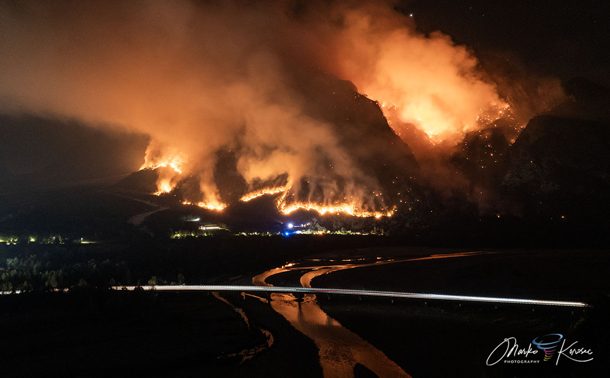
The historic wildfire ignited on the upper Cuel Feltron during early August’s intense heat dome, followed by lightning strikes as a frontal wave passed and storms hit on August 7th. The fire then erupted into a major emergency on Ferragosto (August 15th) when gusty downslope winds fanned flames across the Rio Confine into the municipality of Tolmezzo.
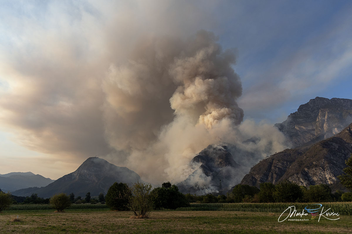
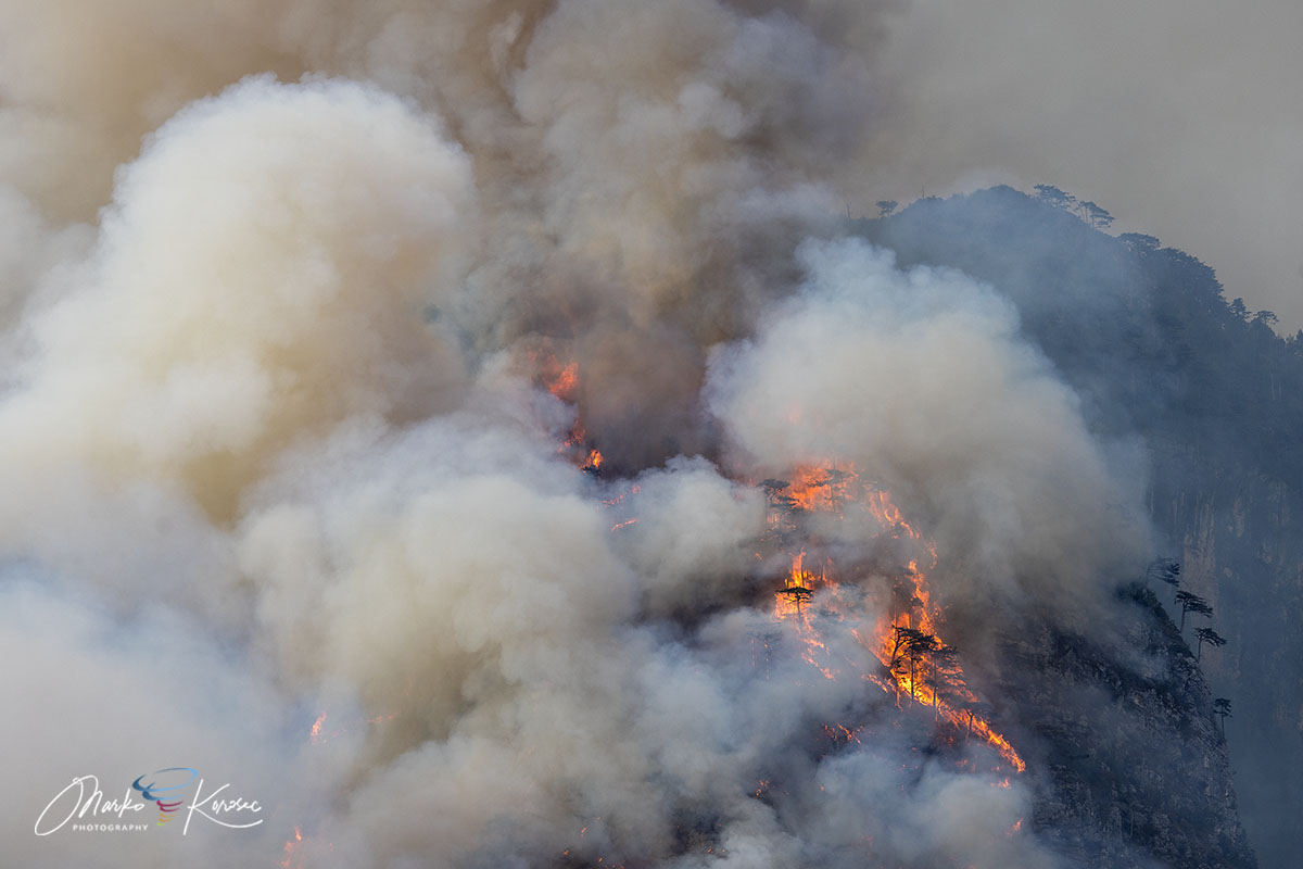
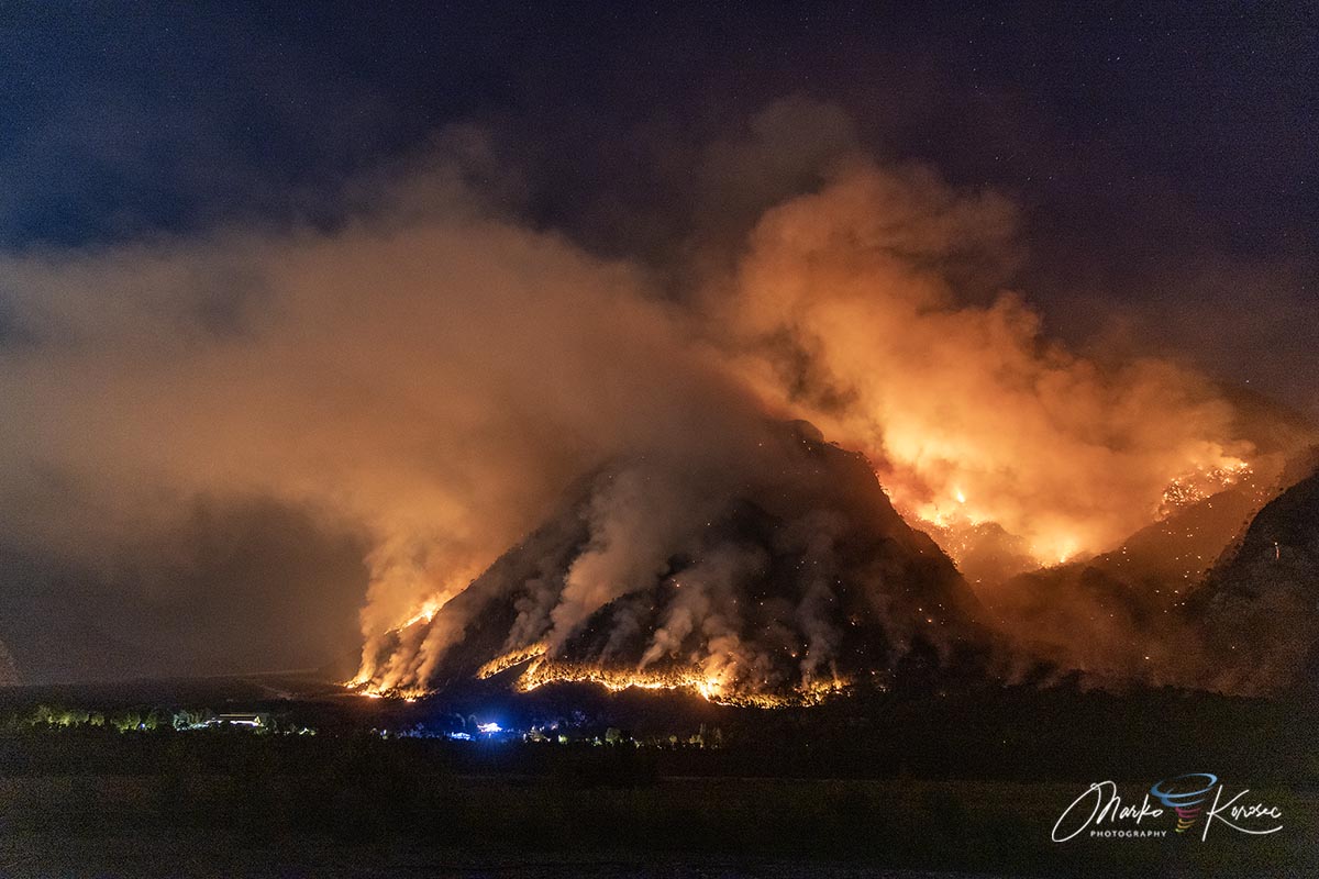
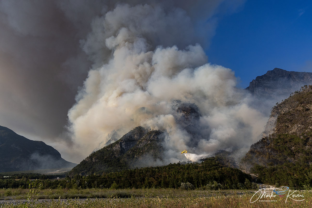
The sheer vertical limestone cliffs made direct ground access nearly impossible, creating an upward chimney effect through tinder-dry Pinus nigra forest. The wildfire went out of control, and its explosive nature also created pyrocumulus clouds atop the mountain.
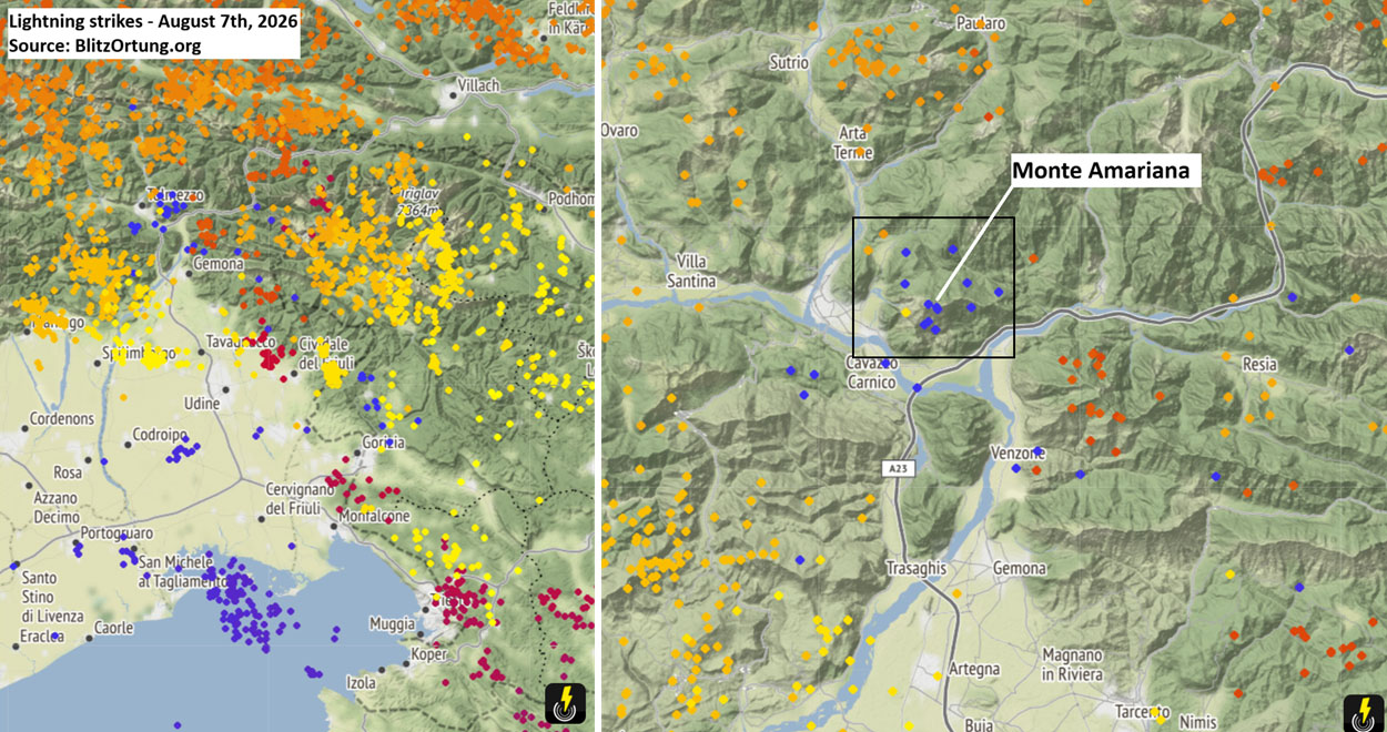
Above: Lightning strikes detected that triggered the wildfire on August 7th, 2026. Source: Blitzortung
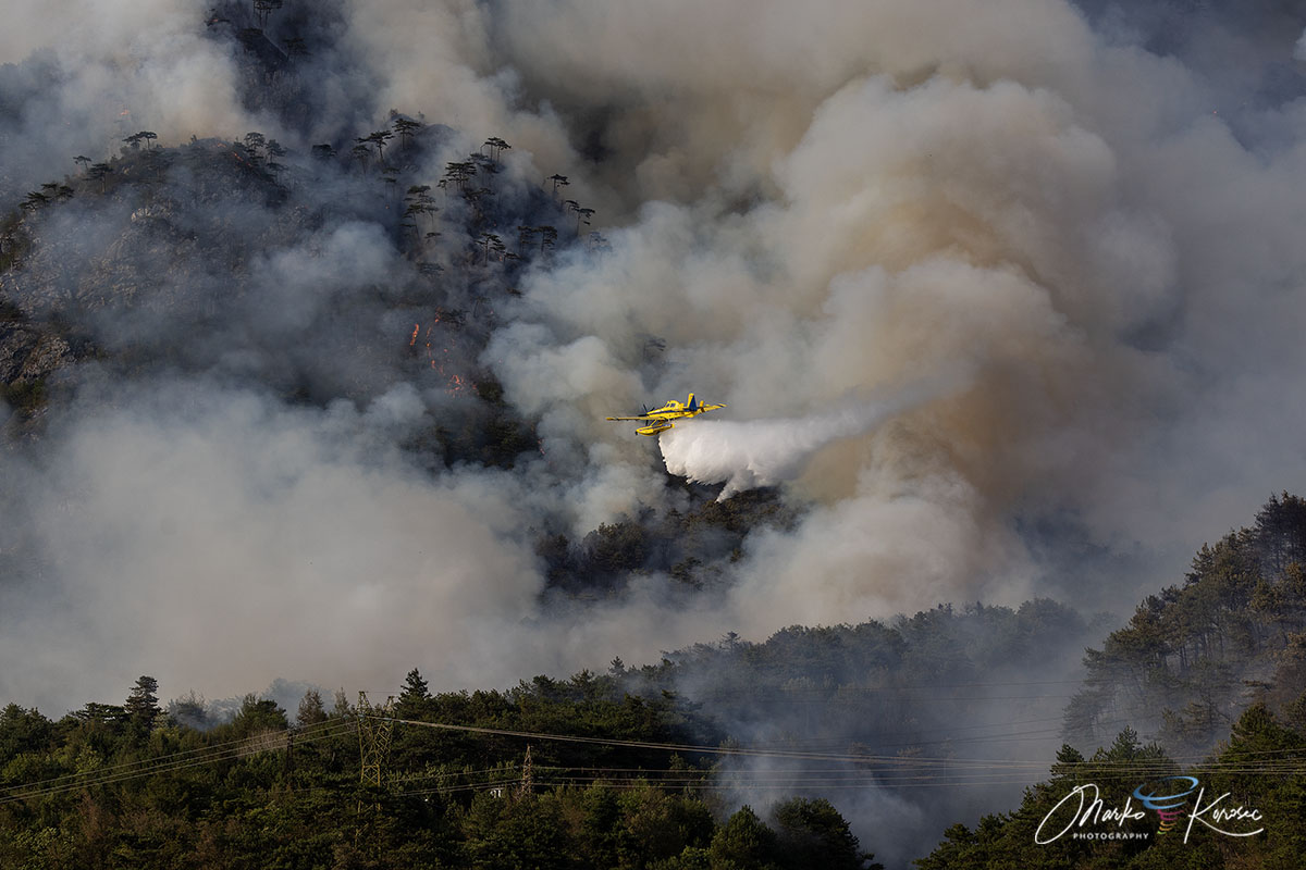
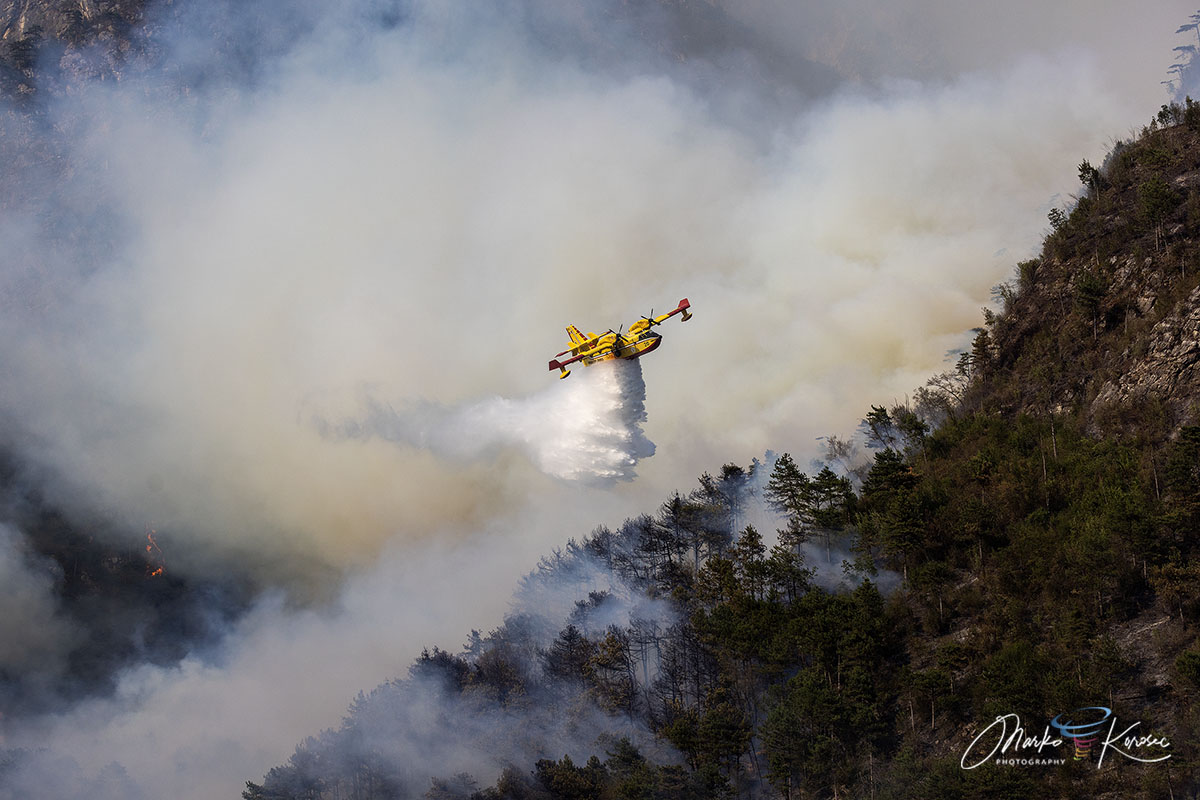
The Italian authorities deployed a massive international aerial task force to protect the threatened districts of Tolmezzo and Amaro. Italian Canadairs operated alongside Slovenian Air Tractor water bombers and regional helicopters, executing hundreds of precision drops over inaccessible ridges while ground crews from the Corpo Forestale Regionale and Vigili del Fuoco defended the residential areas at the bottom of the mountain.
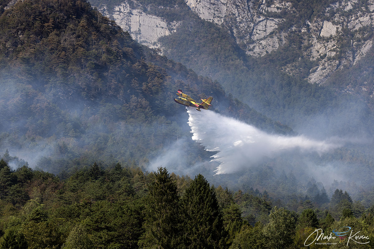
After more than 600 hectares burned and most of the famous mountain complex turned to ash, the active flame fronts are now suppressed, and air quality is recovering across the Tagliamento valley. The regional teams have now transitioned to thermal drone monitoring to prevent residual hotspots from reigniting.
Furthermore, the weather forecast turned increasingly promising, with more than 100 mm of rain expected, which finally extinguished the raging wildfire last week.
Geographical Profile & Mountain Topography
The mountain Monte Amariana (1905 m) is the distinctive pyramid-shaped limestone peak in the Eastern Tolmezzo Alps (Carnia region, Friuli-Venezia Giulia, northeastern Italy).
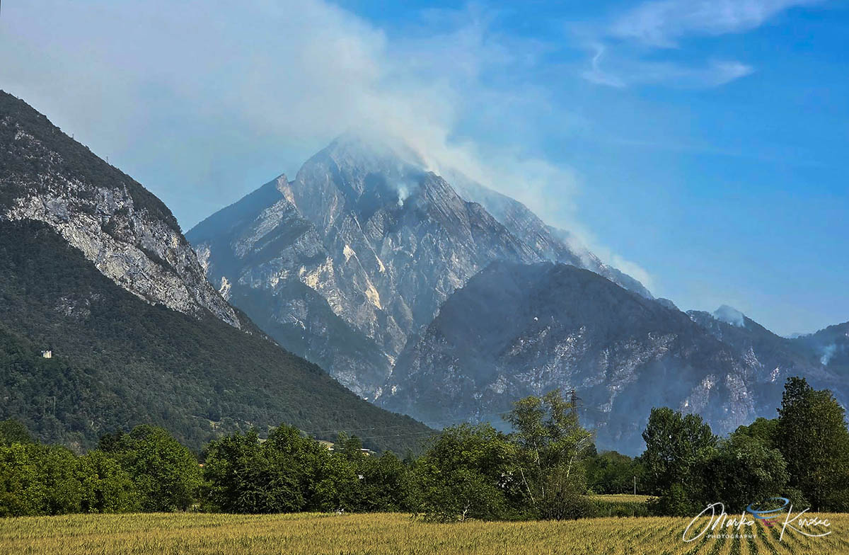
The wildfire initially ignited on Cuel Feltron (a steep spur of Amariana above Amaro). On August 15th (Ferragosto), a major flare-up pushed flames over the Rio Confine ridge onto Monte Amarianute, sweeping toward the outer hamlets of Tolmezzo—specifically the Pissebus sector and near Illegio.
The mountain’s complex terrain includes vertical karst/limestone cliffs, dry pine needle beds (Pinus nigra), and dense brushwood. Steep gradients made direct ground attacks nearly impossible on upper sectors, creating a heavy reliance on aerial firefighting water drops.
Wildfire Event Timeline and Explosive Escalation
- Initial Spark: The wildfire was ignited on August 7th, 2026, on the upper Cuel Feltron. Triggered by multiple lightning strikes following persistent summer heat dome waves.
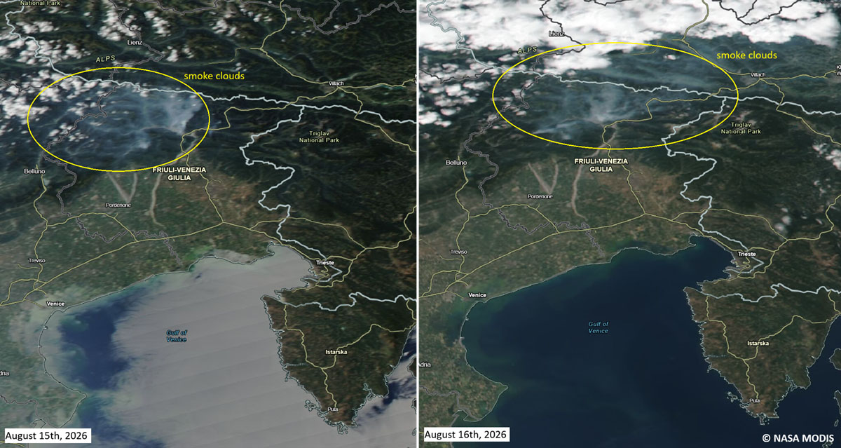
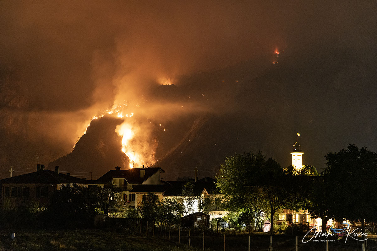
- Ferragosto Flare-Up (August 15th): Fanned by gusty, erratic downslope winds and low relative humidity, the fire suffered a violent reactivation around 17:30 CEST. The front crossed the Rio Confine into the municipality of Tolmezzo, approaching within 50 meters of residential homes in Pissebus. The smoke cloud with pyrocumulus over the mountain was clearly visible on the satellite.
- Emergency Measures: Tolmezzo Mayor Roberto Vicentini issued a preventive evacuation order for Pissebus (around 20 families / 25 residents). A temporary reception center was set up at the “Falcone” sports arena (Palasport) in Tolmezzo. Regional Governor Massimiliano Fedriga and Civil Protection Director Riccardo Riccardi mobilized on-site.
Burned Area with the Environmental and Smoke Impact
- Burnt Footprint: The combined fire complex across Monte Amariana and Monte Amarianute surpassed 600 hectares (6 km2) of alpine forest and brushland, making it one of the largest Alpine forest fires in Friuli this summer.
- Air Quality Hazard: Massive smoke plumes drifted down the Tagliamento and Fella valleys, reaching Tolmezzo and surrounding districts. ARPA FVG (Regional Environmental Protection Agency) monitored air quality continuously, urging residents to keep windows closed and limit outdoor exposure due to elevated particulate levels.
Personnel and Aerial Operational Fleet; Cross-Border and National Fleet Mobilization:
- Canadair CL-415 amphibious water bombers from the Italian national fleet.
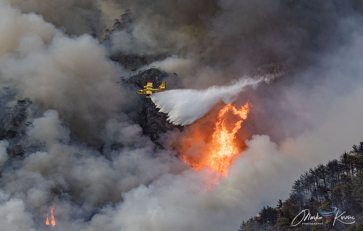
- 2× Air Tractor AT-802F Fire Boss aircraft provided by Slovenia under cross-border emergency protocols.
- Italian Army L-11 Helicopter alongside 3 regional Protezione Civile helicopters.
- Staging/refueling and water scooping performed across regional rivers, lakes, and cross-border sectors.
Ground Operations:
- Corpo Forestale Regionale (CFR): Regional Forest Service managing tactical incident commanders (DOS – Direzione Operazioni Spegnimento).
- Vigili del Fuoco (VVF): Teams from Udine, Pordenone, Gorizia, and Trieste deployed to defend homes and infrastructure along the Pissebus perimeter.
- Protezione Civile FVG: Dozens of local volunteer teams conducting night watches, drone thermal monitoring, logistics, and traffic control.
Power lines (high/medium voltage) were temporarily deactivated in the operational zone for safety.
Regional Significant Rainfall Deficits during summer
The regional rainfall data for Tolmezzo, Carnia, and the broader Friuli-Venezia Giulia (FVG) region in northeast Italy hint at the background context for the drought and fuel accumulation leading up to the Monte Amariana wildfire.
- Severe Cumulative Deficits: Northern Italy (including the Po basin, the Venetian pre-Alps, and Friuli) faced persistent heatwaves and severe rainfall deficits throughout June and July. Monthly rainfall across many monitoring stations in the region ran 35% to 50% below long-term climate averages.
- July/Early August Rainfall Accumulation: Total rainfall across the Carnic pre-Alps and Tagliamento valley was exceptionally low—averaging only around 15 to 30 mm total for the entire month of July into early August (well below the typical summer average of around 100–150 mm per month for this Alpine valley).
- Soil Moisture Anomaly: According to the European Drought Observatory (EDO) and Copernicus, soil moisture in the Alpine and northern Italian sectors fell into the lowest 5th percentile, creating the tinder-dry pine and brush conditions that allowed the Monte Amariana fire to spread rapidly across steep, inaccessible cliffs.
Pre-Fire and Event Weather Timeline (August)
- August 1–14 (Pre-Ignition Drought): Virtually 0 mm of effective rainfall fell over the Tolmezzo/Amaro sector during the intense 5th Heat Dome wave, drying out the dense Pinus nigra stands on Monte Amariana and Cuel Feltron.
- August 15–16 (Major Flare-Up Window): Less than 2 to 9 mm of localized, scattered light rain fell during passing convective activity, which was completely insufficient to extinguish the dry ground fuel and instead brought erratic, localized winds that fanned the fire toward Pissebus/Tolmezzo.
After the significant frontal system between August 20th and 22nd, wildfires across the whole FVG region in northeast Italy have been extinguished, as more than 150 to nearly 200 mm have accumulated within 72 hours of intense storms and downpours.
PivotalWeather and WXcharts provided images used in this article.
See also:
Fifth Heat Dome Expands Across Europe: 40°C+ Highs Target Western and Central Europe