Europe is entering a highly dynamic, intense zonal flow pattern as a deep low establishes across the North Atlantic, unlocking a relentless conveyor belt of low-pressure systems, strong winds, and widespread heavy rainfall.
Driven by a steep pressure gradient between a deep negative geopotential height anomaly over the North Atlantic and high pressure anchored across Southern Europe, a powerful, straightened western jet stream is guiding successive Atlantic frontal waves directly into the continent through the second half of November.
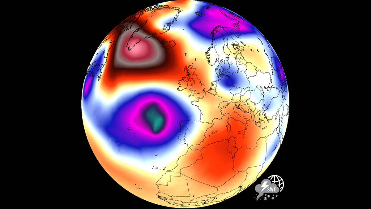
The primary engine behind this active late-autumn regime is an energized polar front jet stream slicing west-to-east across Western and Central Europe. As fast-moving frontal systems sweep inland off the Atlantic, strong moist westerly to southwesterly winds are advecting abundant maritime moisture against the continent’s major mountain barriers.
Seven-day precipitation accumulations are forecast to exceed 100 to 200 mm across western France, the Alpine region, and the Western Balkans—particularly along the Dinaric Alps and Adriatic coast—elevating the risk of localized river flooding and mudslides.
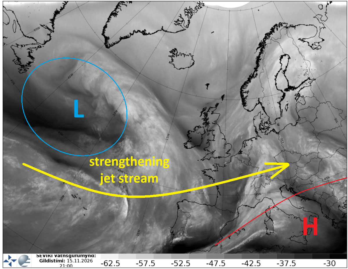
Unlike blocked weather patterns that stall air masses for days, this progressive zonal setup brings rapid weather swings, gusty frontal passages, and mild maritime temperatures across much of Western and Central Europe. While lower elevations experience bouts of wind-driven rain and fluctuating temperatures behind each passing cold front, higher elevations of the Alps will see heavy, accumulating snowfalls as moisture-rich Atlantic air interacts with sub-freezing alpine air masses.
Forecast 500 hPa geopotential height anomaly maps, fronts, and 7-day precipitation totals below illustrate the broad Atlantic troughing and the intense west-to-east storm corridor impacting Europe over the coming 7-10 days.
Let’s dig deeper into the developing, intense, and dynamic weather pattern likely to persist through most of the second half of November.
Synoptic Setup: Deep Atlantic Trough Fuels a Straightened Jet Stream Towards Europe
The general weather pattern over Europe and the North Atlantic indicated deep troughs over the Atlantic and western Europe, while an elongated ridge extended from the Azores across the Mediterranean to the Middle East.
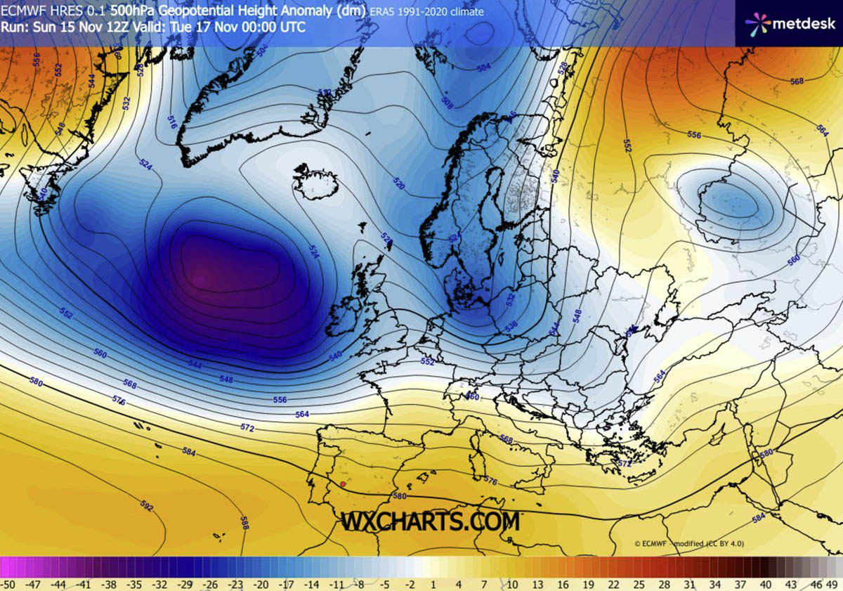
This means that in between these two large-scale features, a powerful westerly, zonal flow is established due to a strong pressure gradient. It delivers rich Atlantic moisture into the European continent and persists for at least a week.
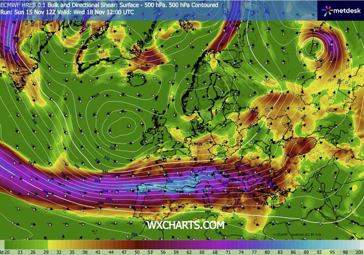
The jet stream will support a highly sheared environment from the Iberian Peninsula across France to the Alps, the Northern Mediterranean, and the Balkans throughout this week.
Looking at the surface charts for Monday and Tuesday, a large surface high-pressure system sits over the North Atlantic. A tight pressure gradient is evident towards western and southwestern Europe.
On Monday, the first wave penetrates across the Bay of Biscay into France, continuing to accelerate eastward overnight.
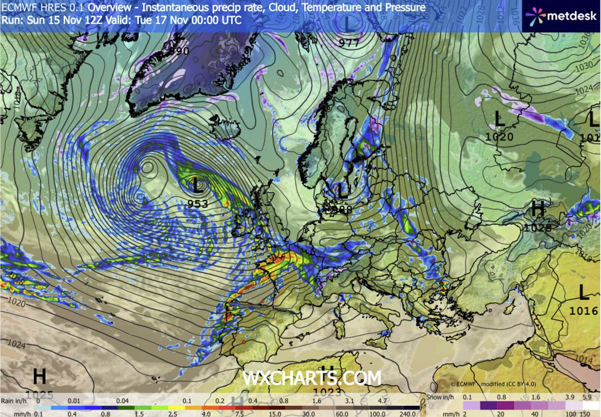
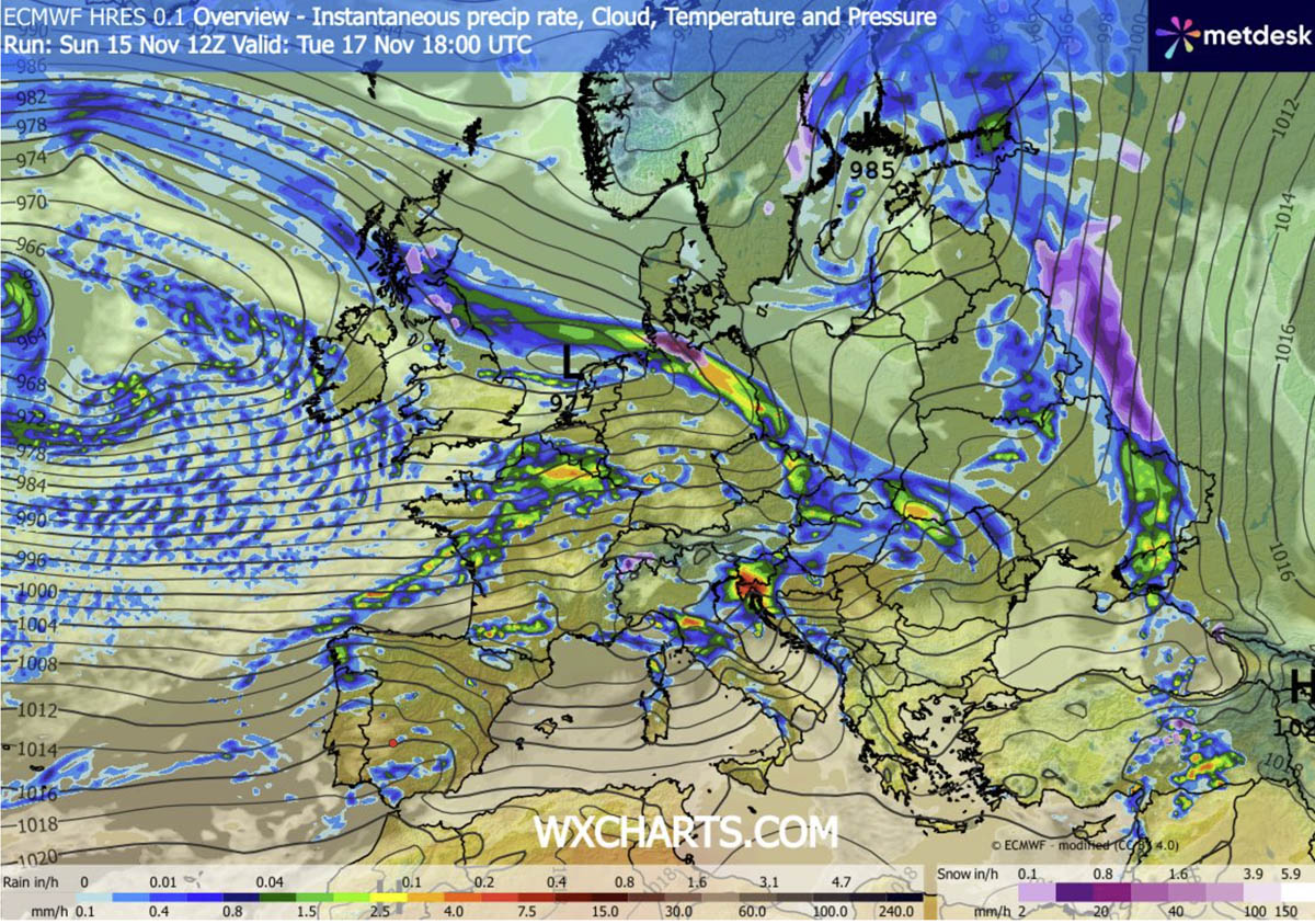
By Tuesday evening, the wave is already over central Europe and the northern Mediterranean, with a surface front racing across the region. It is accompanied by significant rainfall from the northern Balkans into north-central Italy.
Further west, a broad and deep surface high-pressure system remains, churning another wave towards western Europe through midweek. But the flow remains intense, with textbook zonal component across the Bay of Biscay into France and Benelux.
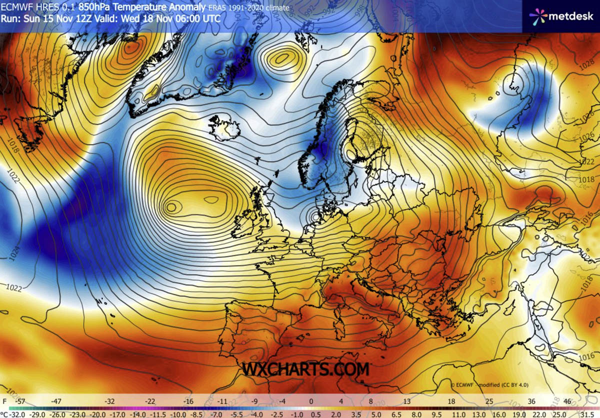
Such position of the deep Atlantic low and the ridge over North Africa and the Mediterranean establishes an unseasonably warm wave across southern and central Europe. Temperatures will be in the 8-12 °C range above the long-term average for mid-November.
Overall, most of the European continent will experience near-normal to significantly above-normal temperatures for this time of year, thanks to a powerful, strongly persistent zonal flow pattern.
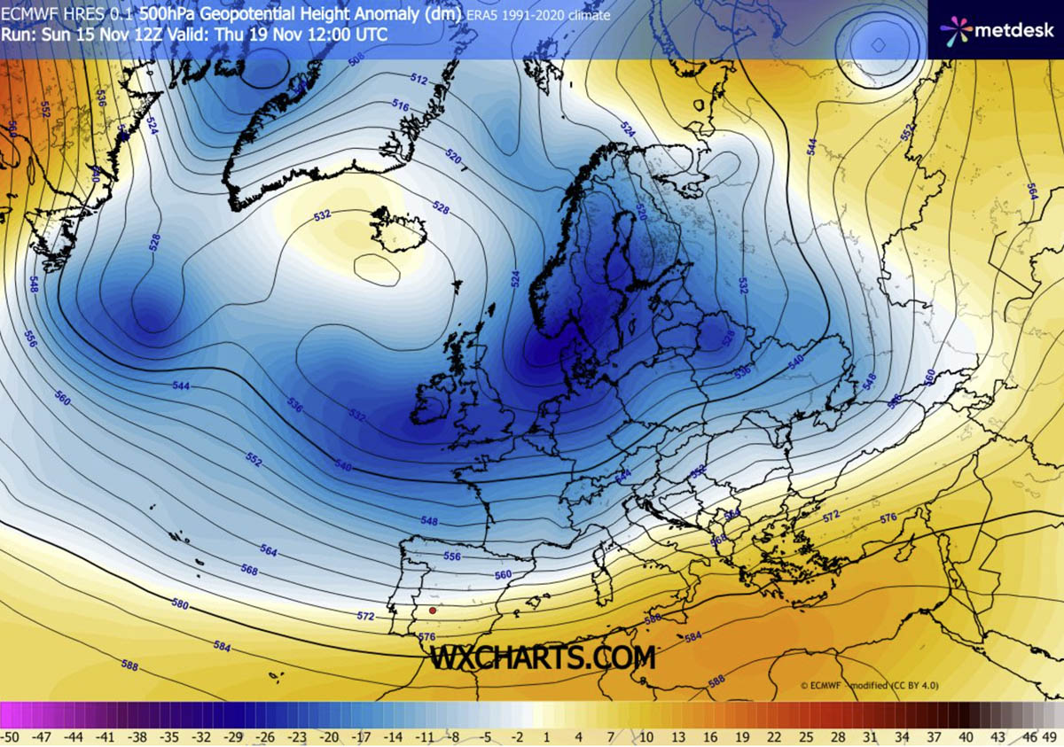
Looking ahead to the following weekend, the general picture does not change much; the only change is that the center of the broad low moves into western and northern Europe.
This maintains the powerful westerly jet stream into the late this week.
Therefore, the next secondary wave forming over the North Atlantic on Wednesday will literally race across Europe on Thursday, with an intense surface frontal system reaching northern Mediterranean midday Thursday.
Expect heavy precipitation over Italy and the western and northern Balkans, including strong to severe thunderstorms across the southern portions of the system where a warmer, humid air mass will remain.
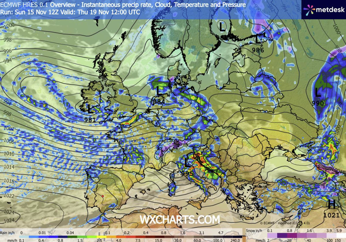
Nonetheless, days will be unusually warm for mid-November, with daytime temperatures locally reaching 15-20 °C.
Heavy Rainfall Breakdown: 100–200 mm Totals Target France, the Alps, and Western Balkans
The persistent, strong westerly jet stream delivers high moisture into the continent. This means orographic precipitation will accumulate significant rain from Iberia to the Alps, Apennines, and Dinaric mountain range.
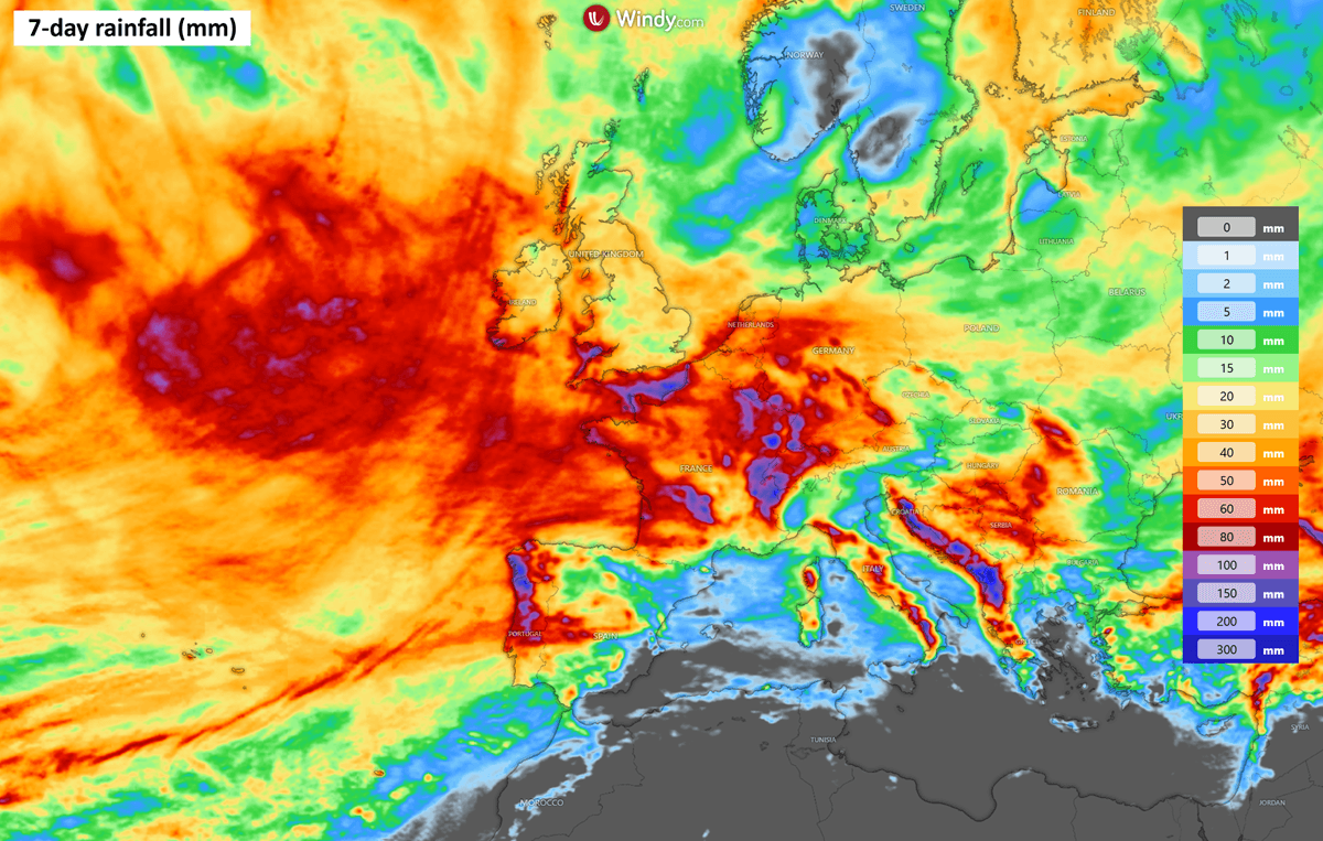
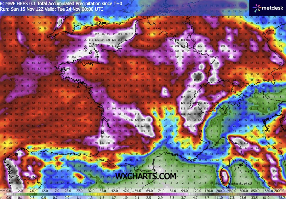
Over France and Iberia, the highest amounts are expected along the western Alps, around the English Channel, and in northwestern Spain and Portugal. Locally, 150-200 mm is likely to fall until next Monday.
Quite a lot of rainfall is also expected across the rest of France, Benelux and west-central Germany.
A similar situation normally occurs over the Mediterranean and the Balkans, as strong western flow leads to intense orographic rainfall over the Apennines and the Dinaric mountain range.
Huge amounts are again expected especially along the western Balkan countries, from western Slovenia across Croatia to Bosnia, Montenegro and Albania. Locally, more than 300 mm is increasingly likely over the next 7 days.
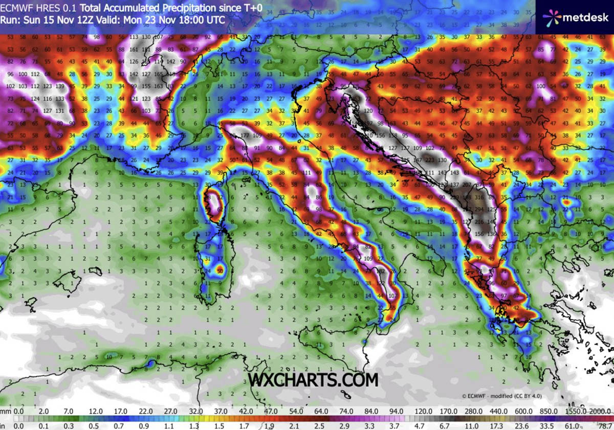
Up to 100-150 mm is also likely along portions of the northern Apennines.
Snow Is Only Forecast for the Higher Alps, and Over Scandinavia
Due to the generally intense western warm zonal flow, colder weather is not expected. This puts the snow forecast amounts quite low, and the chances for significant snowfall lie only over the higher western Alps.
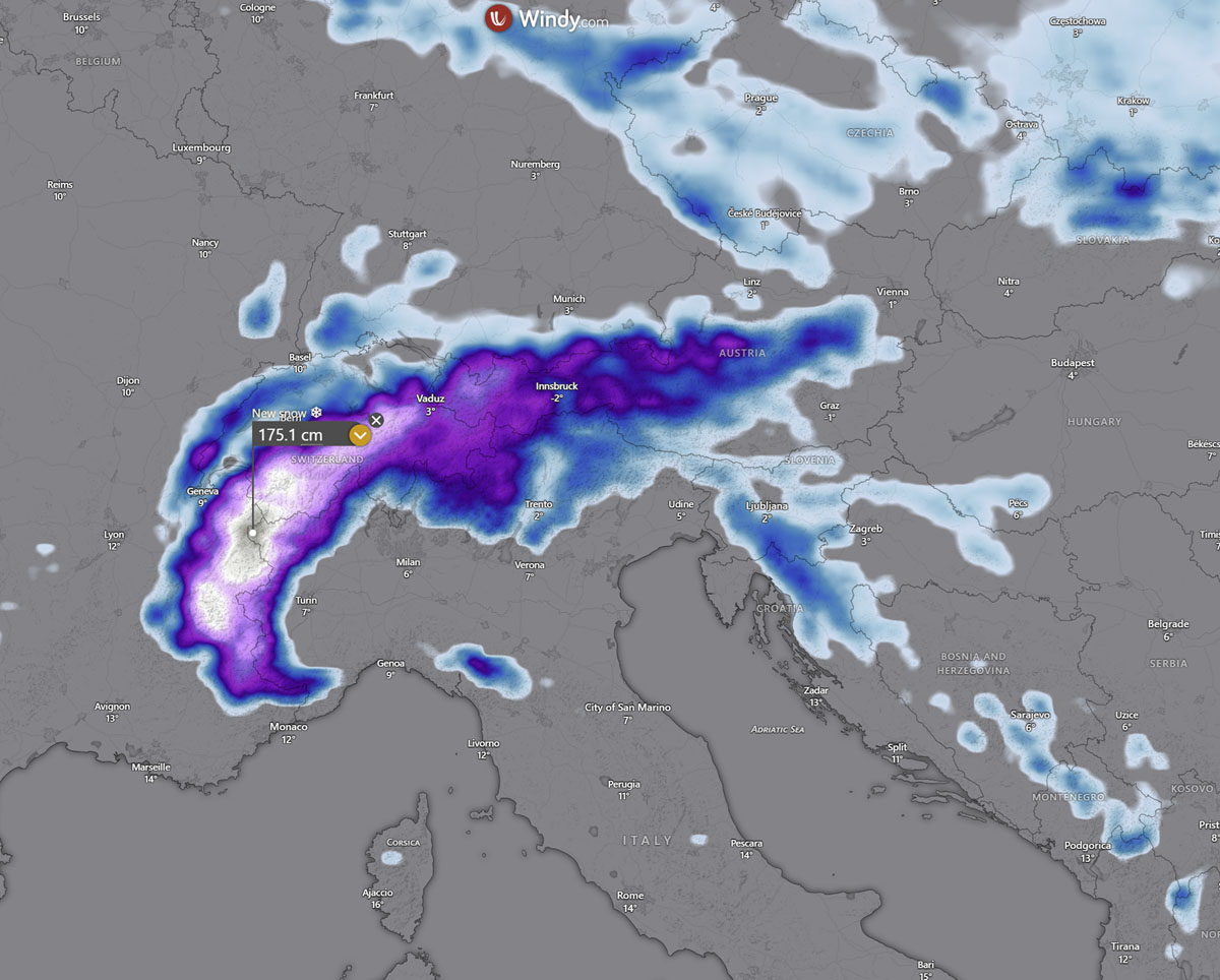
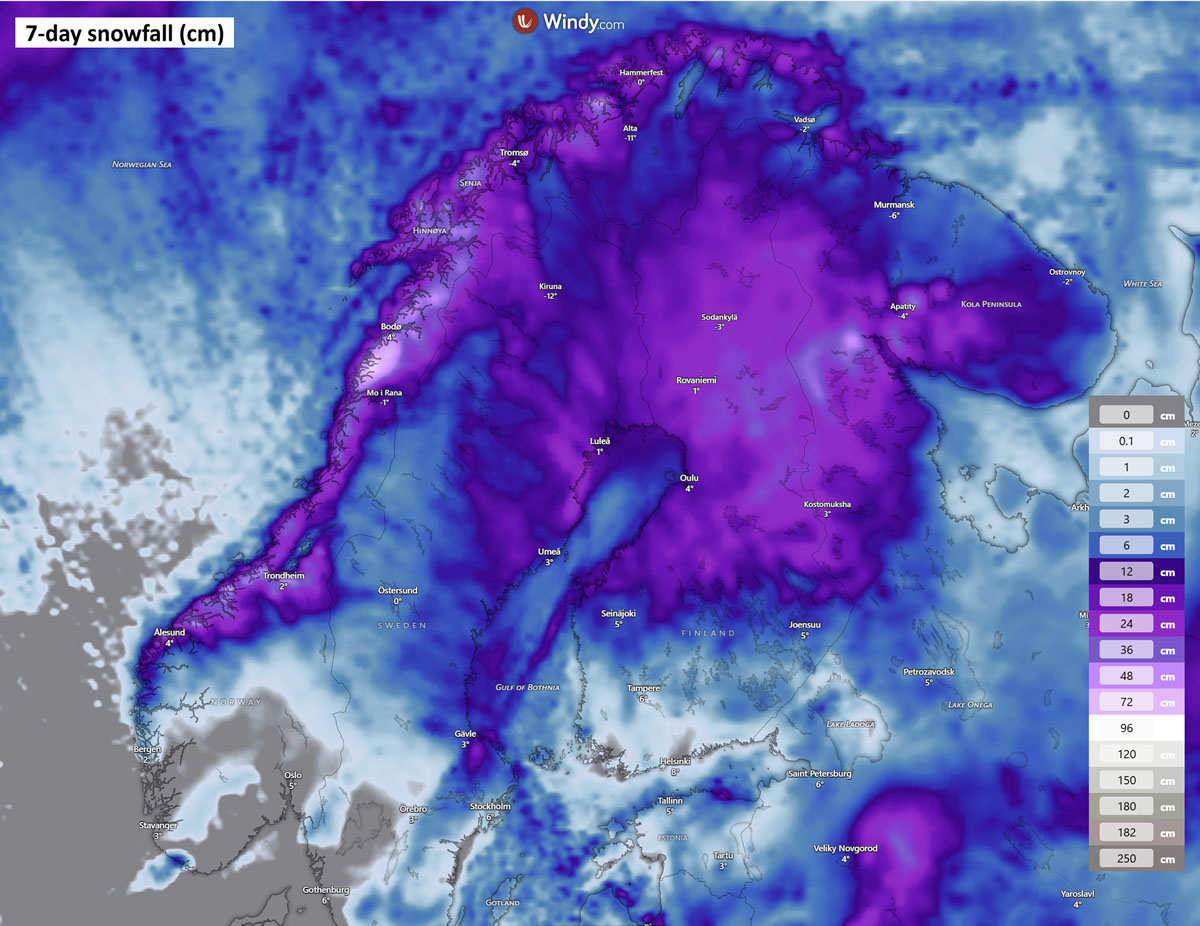
Once the deep trough moves from the North Atlantic into Western and Northern Europe, its cold core drags cold weather over Scandinavia again, combining with the frontal zone and precipitation.
Therefore, quite some fresh snow is forecast over the following 7 days, with the highest amounts exceeding 50-75 cm along central and northern Norway, as well as over Finland and northern Sweden.
Stay alert for potentially dangerous weather conditions along the frontal system rapidly moving into Europe in the coming days. We are closely monitoring the evolution and will update the forecasts accordingly.
Windy, Vedur IS, and Wxcharts provided images used in this article.
See also:
Polar Vortex Reversal: Stratospheric Impact Wave Could Arrive by Thanksgiving