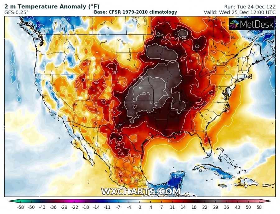
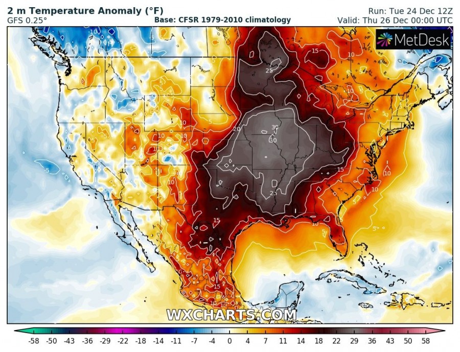
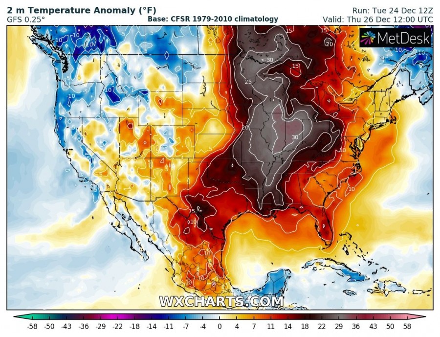
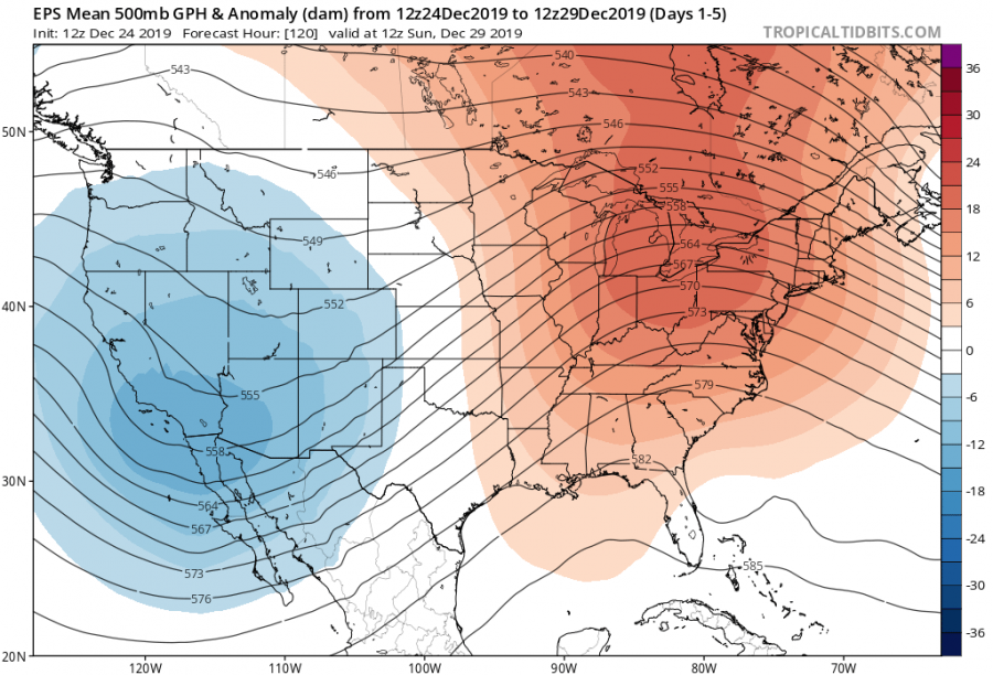
After several intense Arctic outbreaks during the late autumn and early winter, the Contiguous United States (CONUS) are experiencing an incredibly warm period this week. A dipole pattern with a trough over the western CONUS and ridge across the eastern CONUS are resulting in an impressive warmth with spring-time temperatures in many states. Such temperatures will continue through Christmas day and gradually vanish towards the weekend.
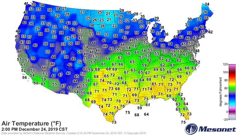
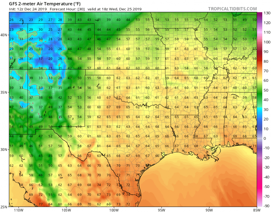
It is very warm already today as many states are experiencing upper 50s to 60s across the Midwest and towards the East Coast, even high upper 60s to mid-70s further south towards the Gulf coast. Cold weather is limited to the Dakotas only.
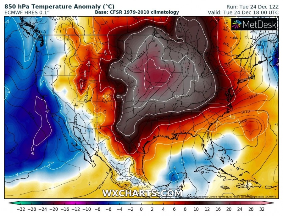
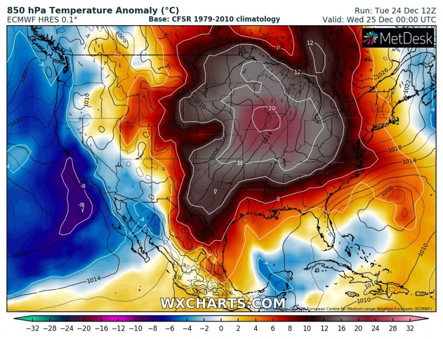
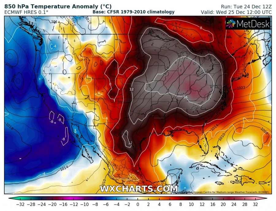
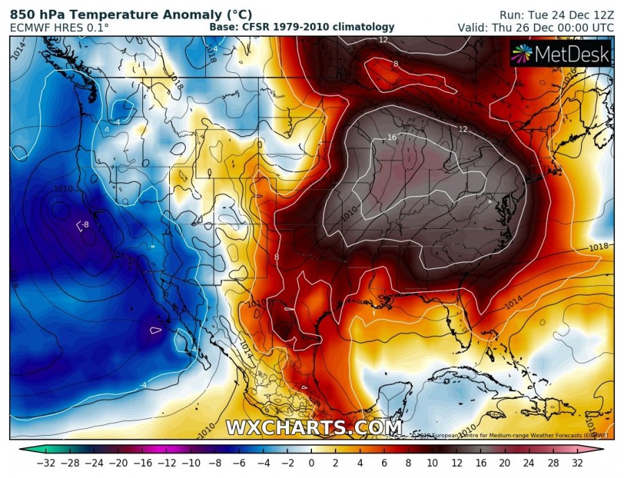
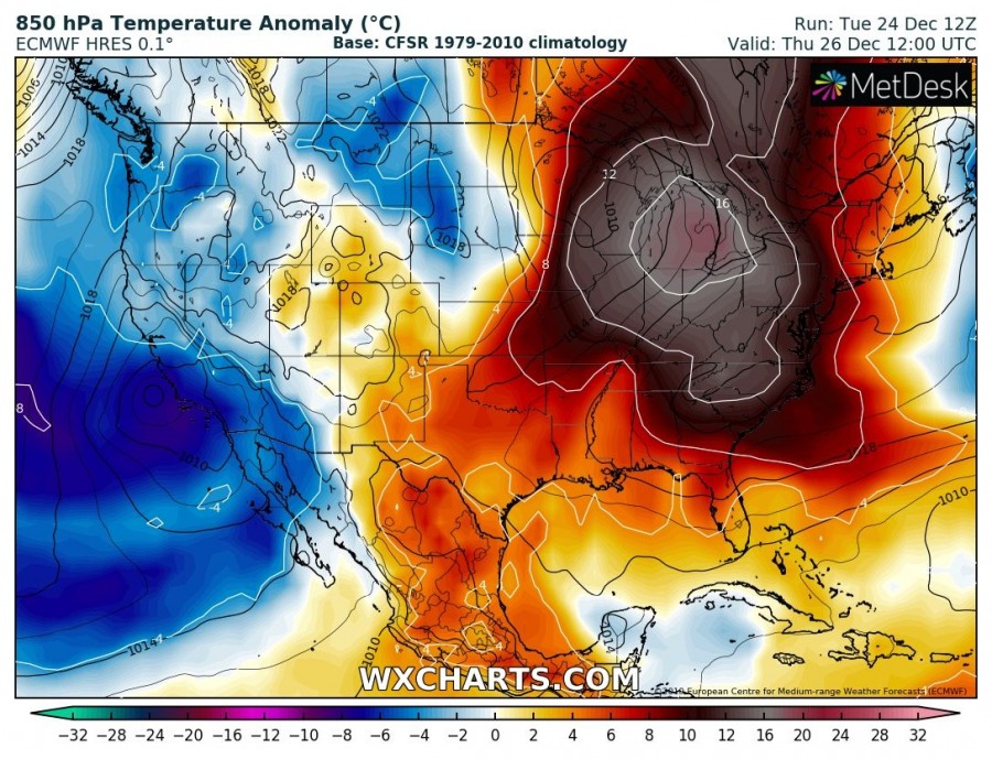
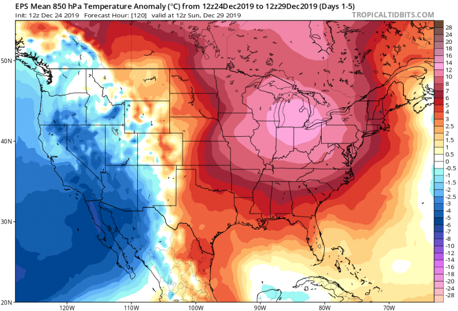
A persistent southwesterly warm advection continues tonight into the Christmas day, resulting in an exceptionally strong temperature anomaly across a large part of the CONUS. A large part of the Midwest, Great Lakes region and Ohio valley will experience 16 to more than 20 °C warmer 850 mbar (approx. 1500m ASL) than usual for the of December. This broad area of very warm temperatures will gradually expand into the East Coast until Thursday.
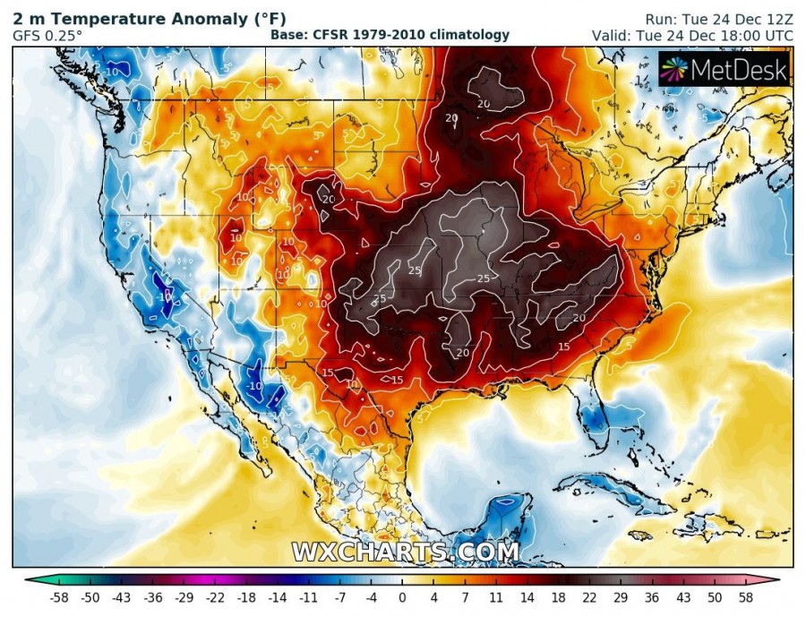
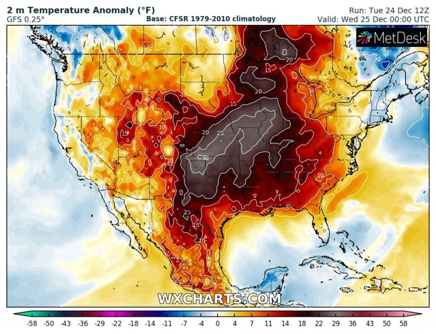
Here is also a 2 m temperature anomaly across United States from today – Christmas evening until Thursday morning, Dec 26th. A very impressive anomalies will bring spring-time weather across many states! Afternoon temperatures will be unusually high – around 25-30 °C warmer than normal for Christmas day.
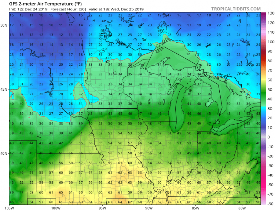
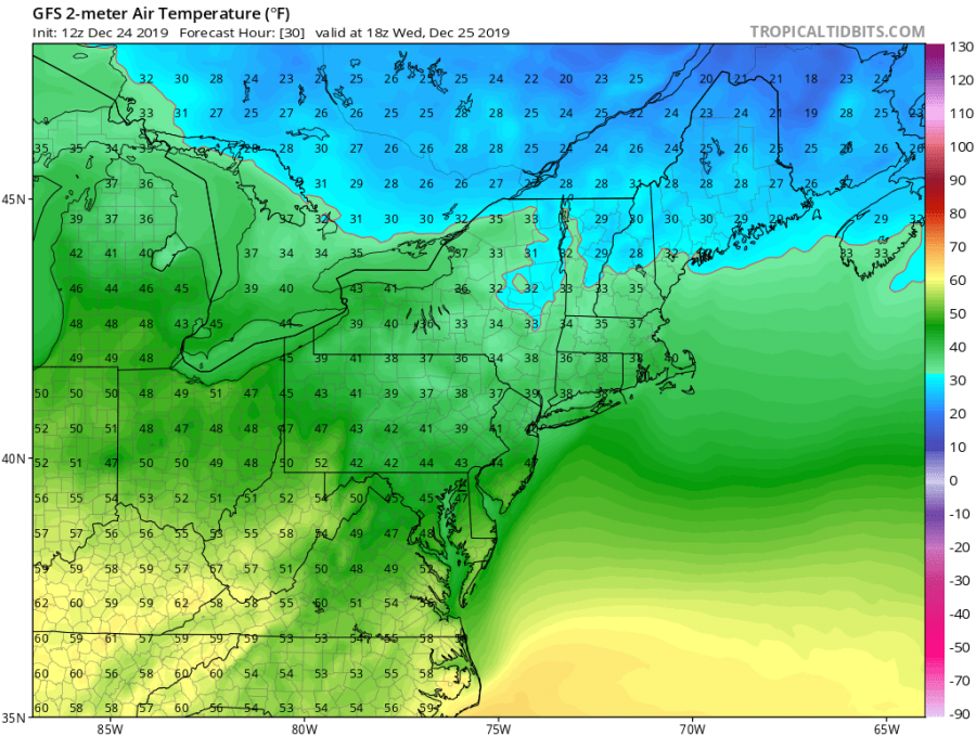
Maximum temperatures on Christmas day will again push into low to mid-60s °F across the Midwest and even into low to mid-50s from eastern Nebraska, Iowa and Illinois. Chicago area will hit low 50 °F as well, which is an incredible warmth for this region at the end of December – this will be the warmest Christmas over the last 25 years!
Further south across the south-central Great Plains, temperatures will be even higher – low to mid-60s in Kansas, Oklahoma and Missouri, while even higher temperatures with upper 60s to mid-70s F are likely to continue across Texas, Louisiana, Mississippi towards the SE states. 50s to low 60s °F are also likely across parts of the East Coast as well. It stays below zero just at the far northeast US.
The overall weather pattern across CONUS until the end of December suggests a classic spring-time position of a deep trough being pushed into the western parts and strong ridging continue across the eastern half of United States.
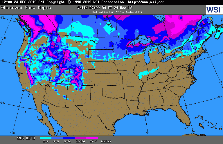
The current snow coverage across the United States is pretty poor. Snow on the ground is limited to the Rocky Mountains and to the far north and northeast part of the States. Literally no fresh snow is expected through Christmas day, anywhere.
Over the weekend, potential increases for a robust frontal system bringing severe storms across the Plains and winter storm over the Great Lakes region – stay tuned for details in the coming days
Enjoy the weather and Merry Christmas to all our followers from the SWE team!
Meanwhile in Europe – also quite warm weather period resulting in almost no snow for Christmas:
Christmas day snow cover across Europe – probability of snow coverage on December 25th, 2019
Interested in our calendar? We are proud to present and promote the best weather photographers in Europe – see details:
