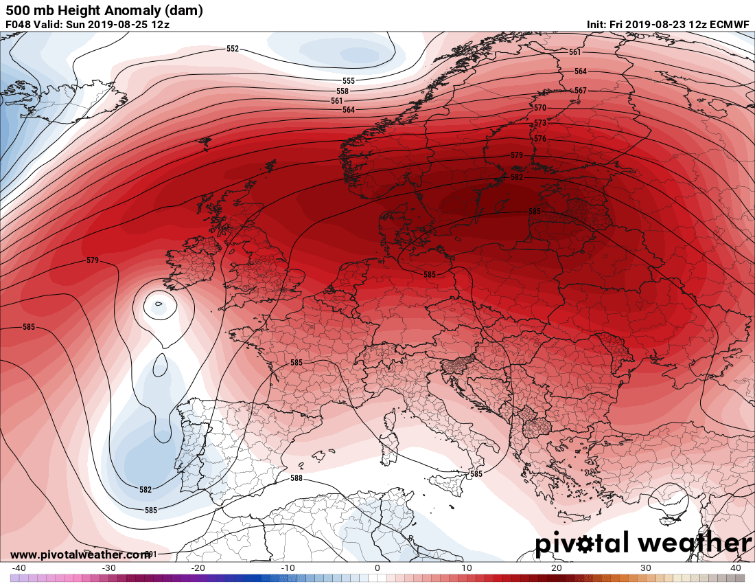
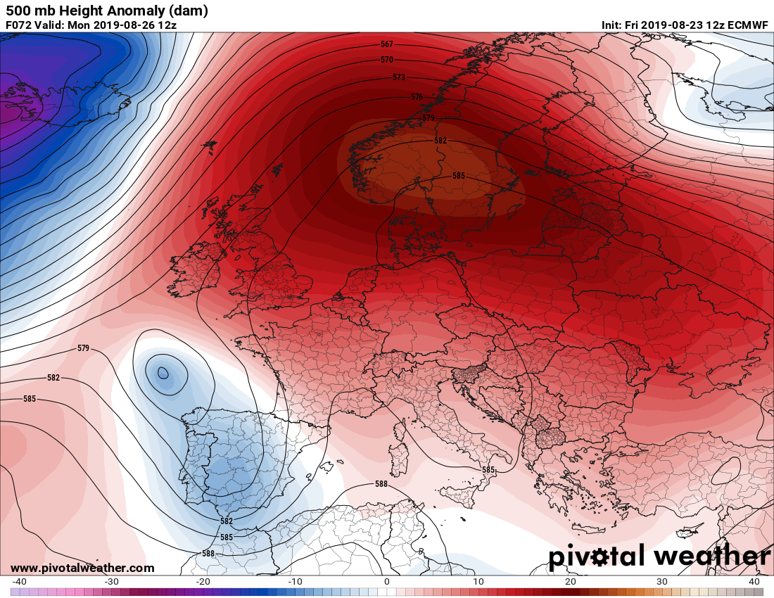
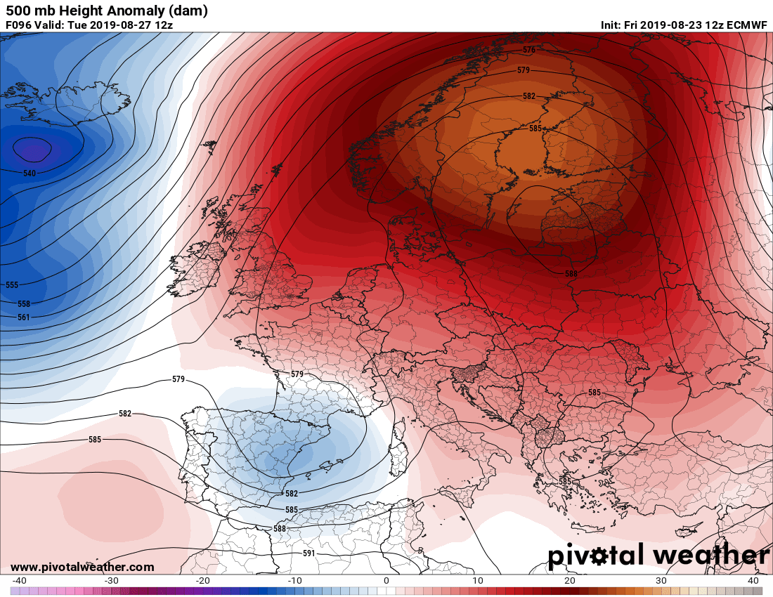
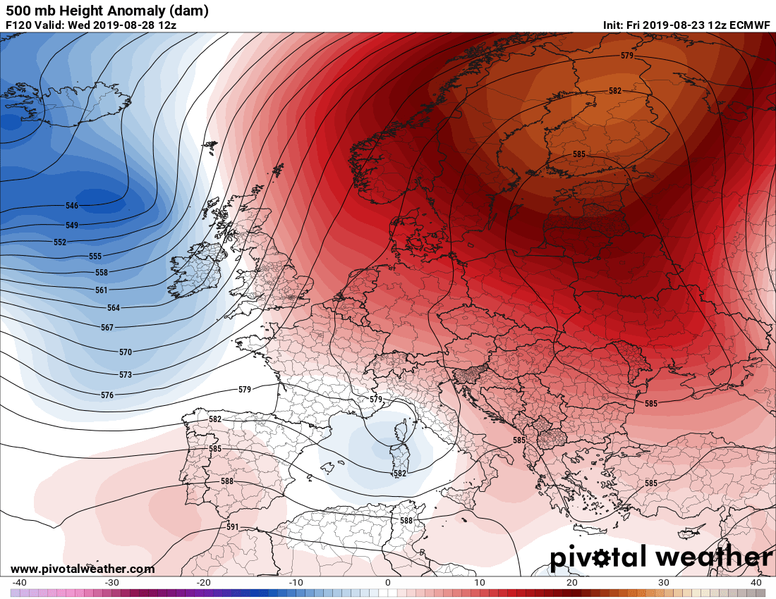
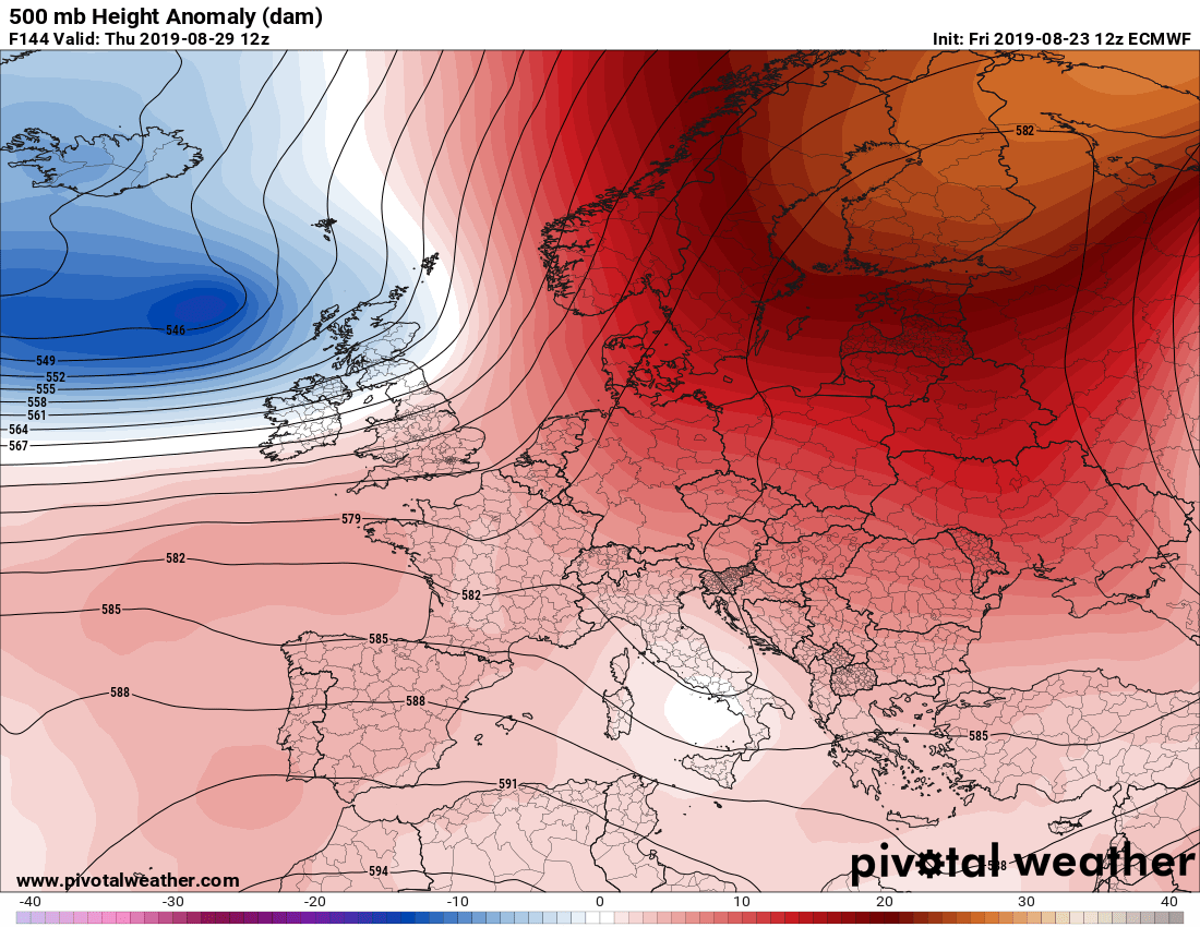
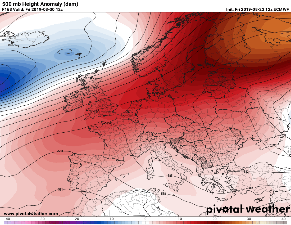
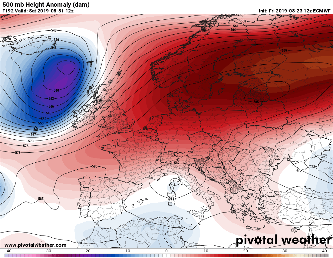
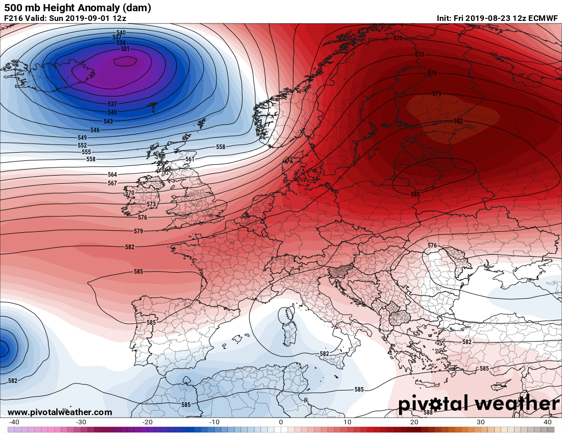
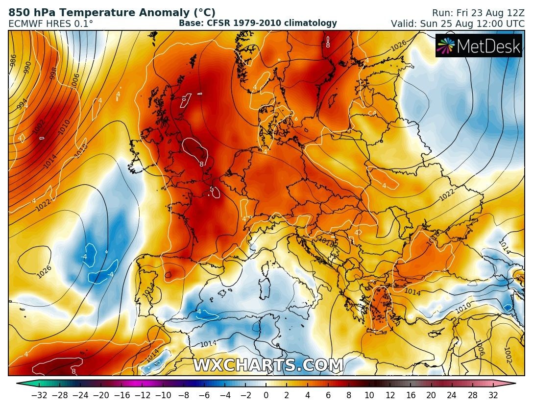
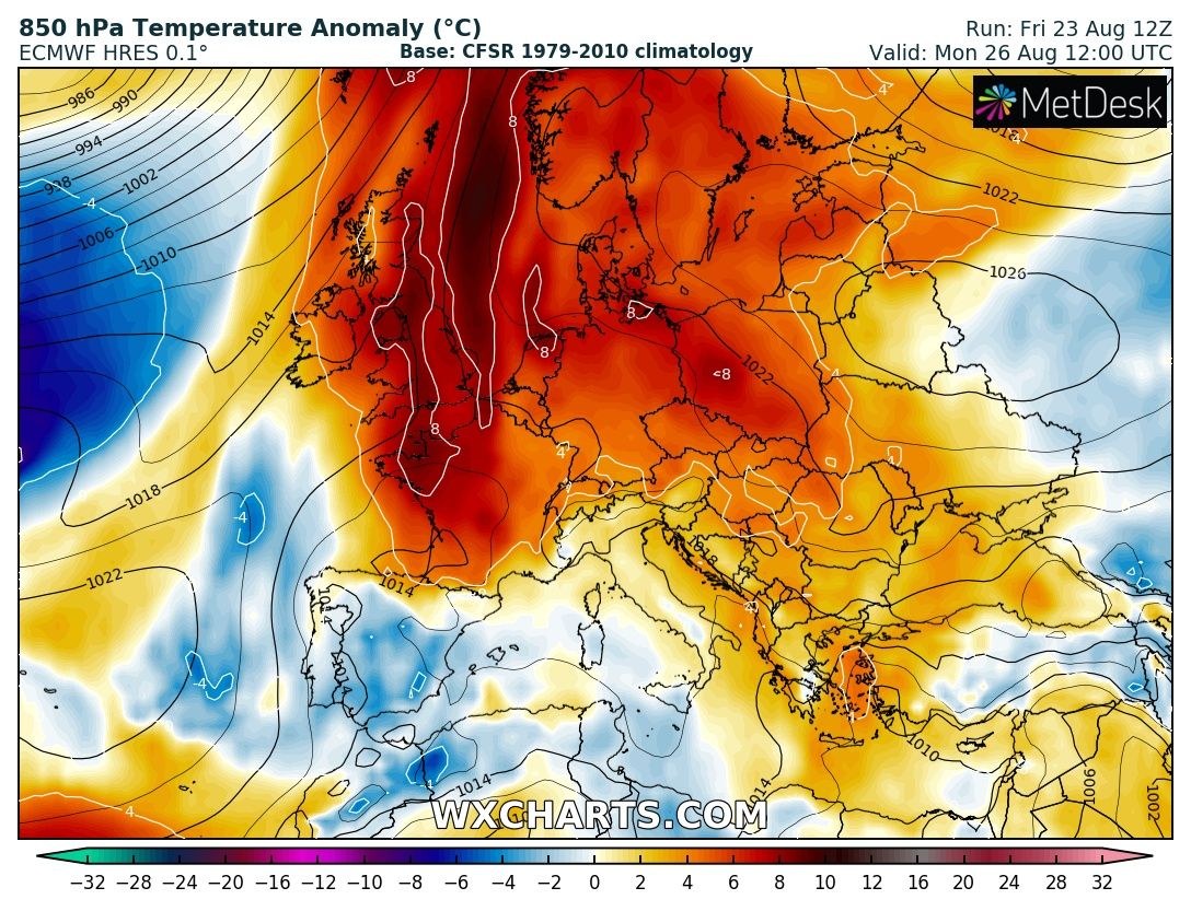
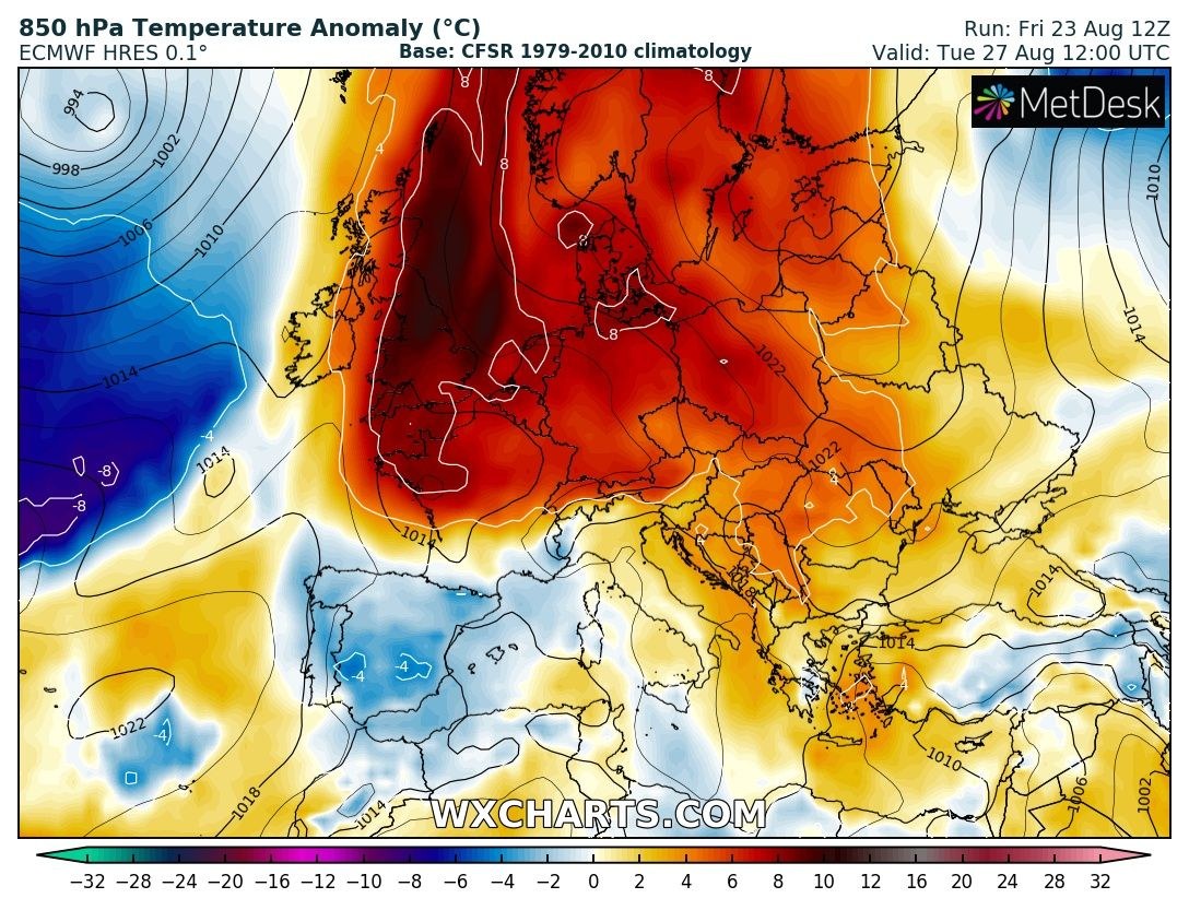
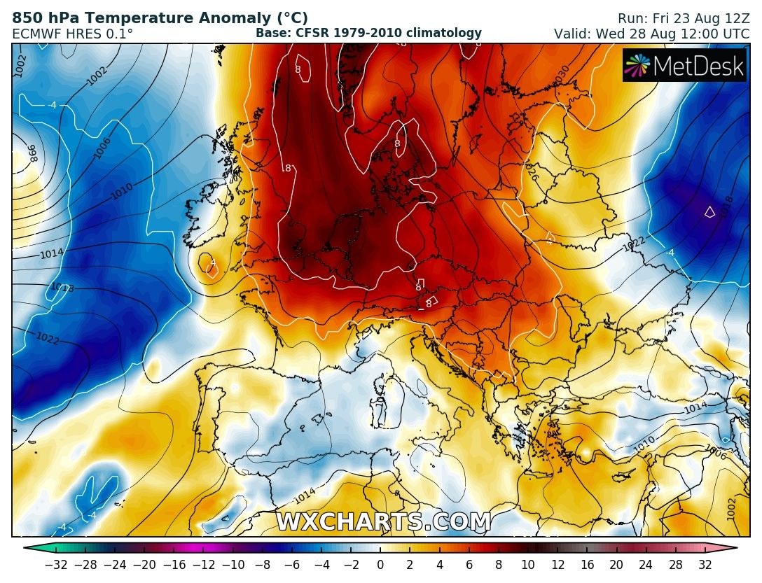
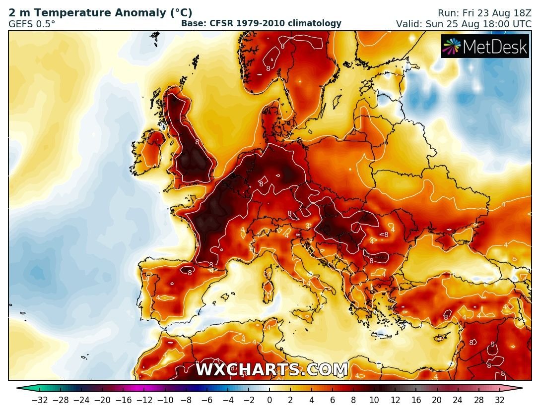
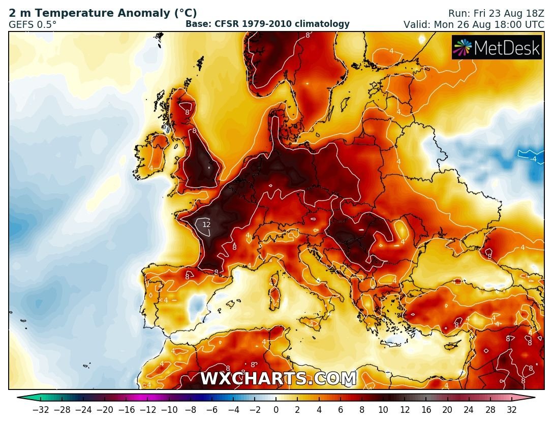
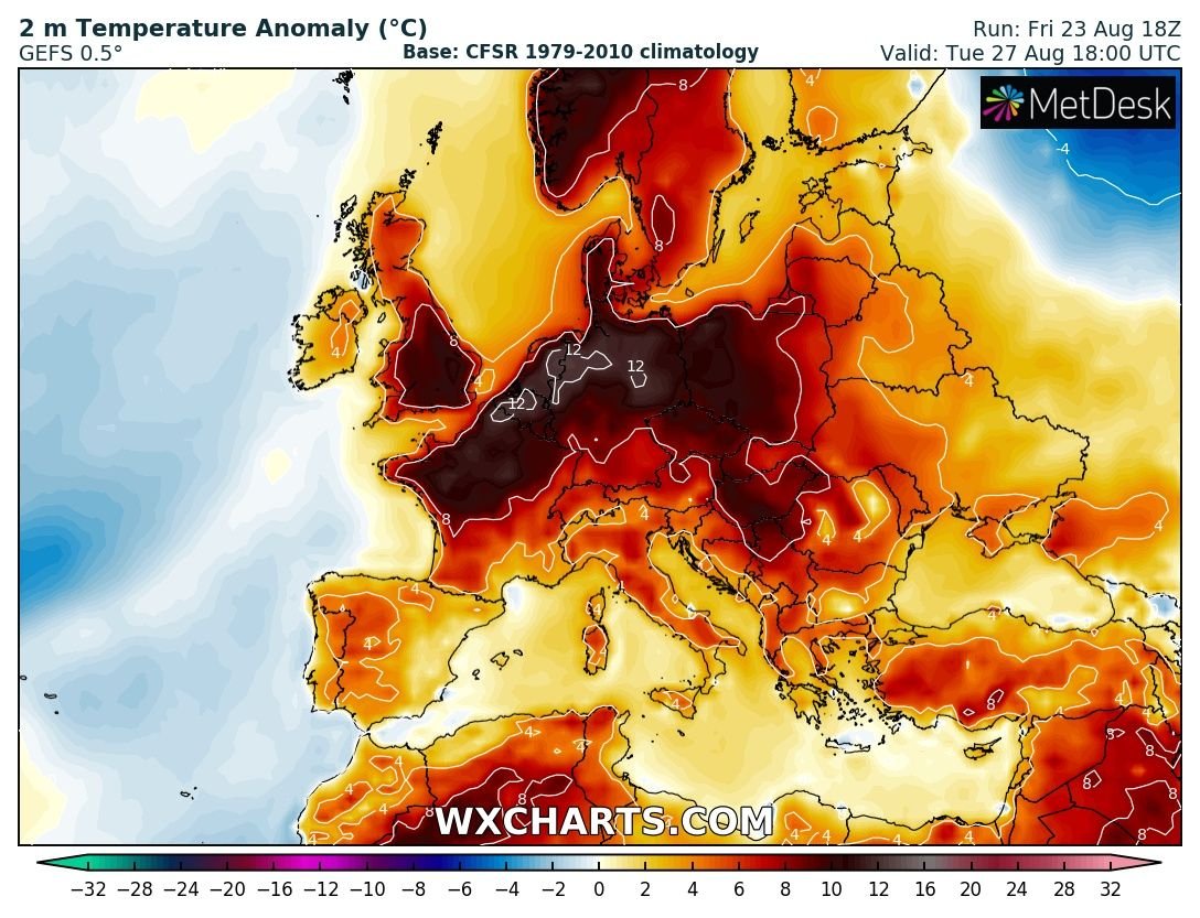
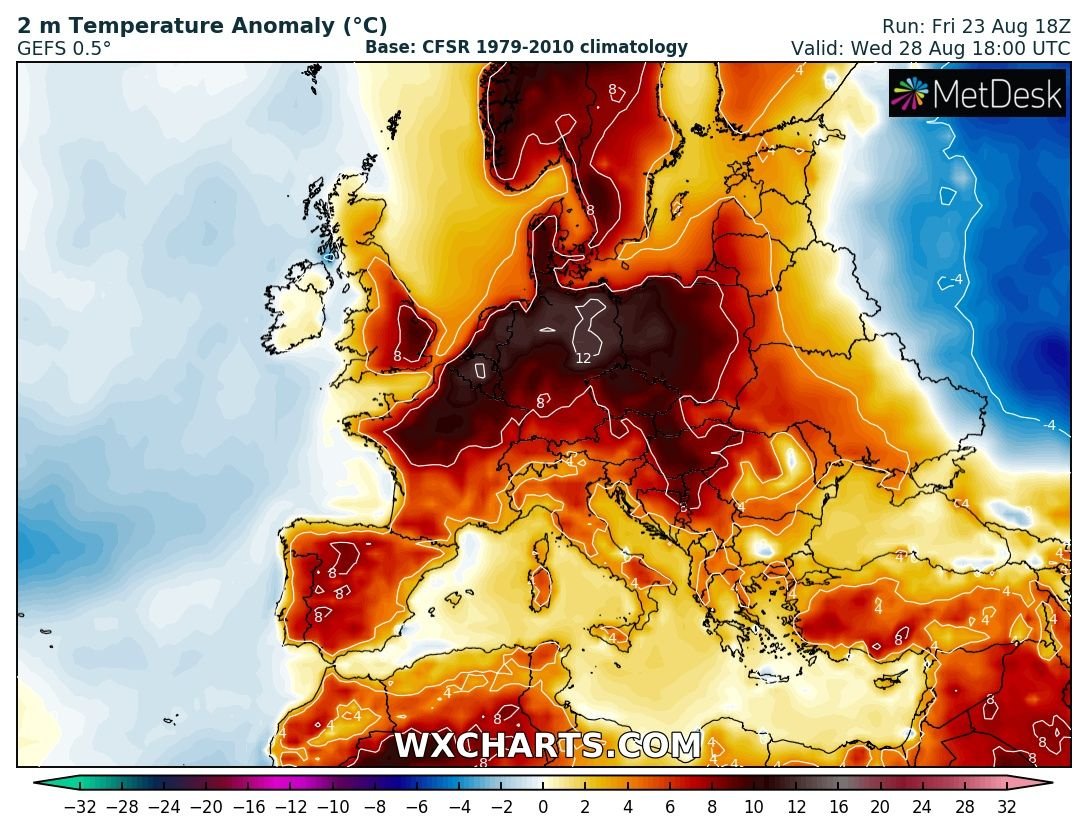
Europe is in for another heat wave after this weekend as strong upper level ridge / Omega blocking pattern establishes. Temperatures will be back into low/mid 30s across many parts of our continent. Very warm weather is also expected across Scandinavia.
500 mbar geopotential height maps reveal a strengthening upper ridge across north-central Europe already this weekend while a significant omega-blocking pattern develops next week with the highest geopotential across northern Europe. This will allow rather stable weather with very warm / hot airmass to result under the ridge, combined with warm advection under the jet stream (Spanish plume pattern) across WSW Europe. Towards the end of the month, a powerful trough could develop over the N Atlantic and bring more dynamic weather into western Europe.
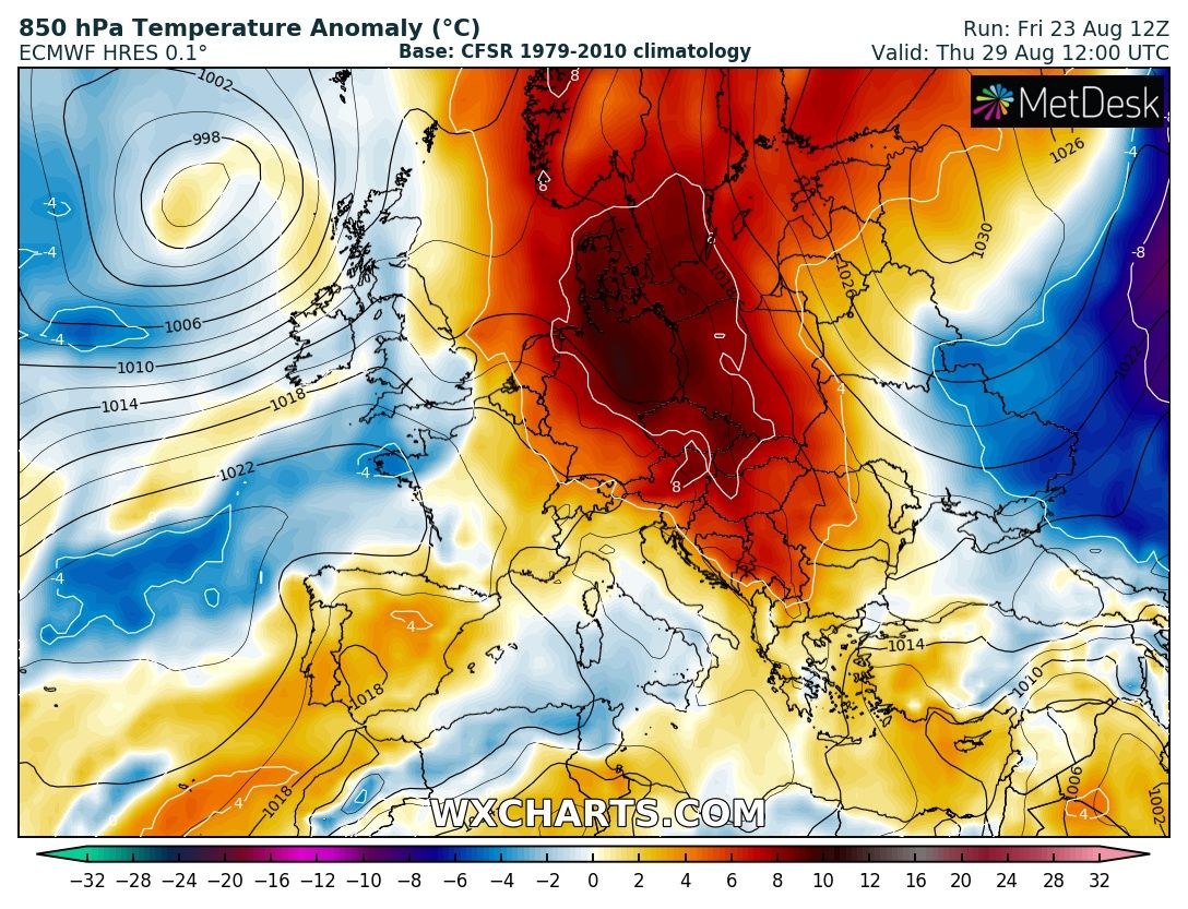
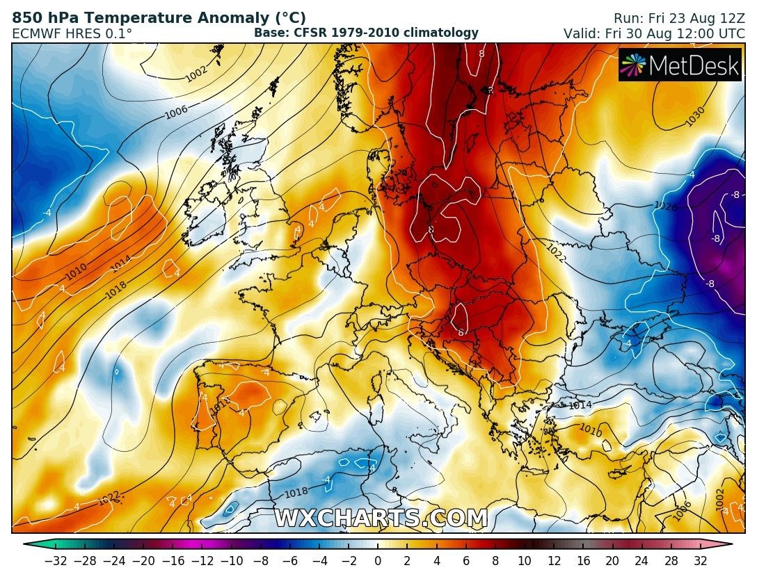
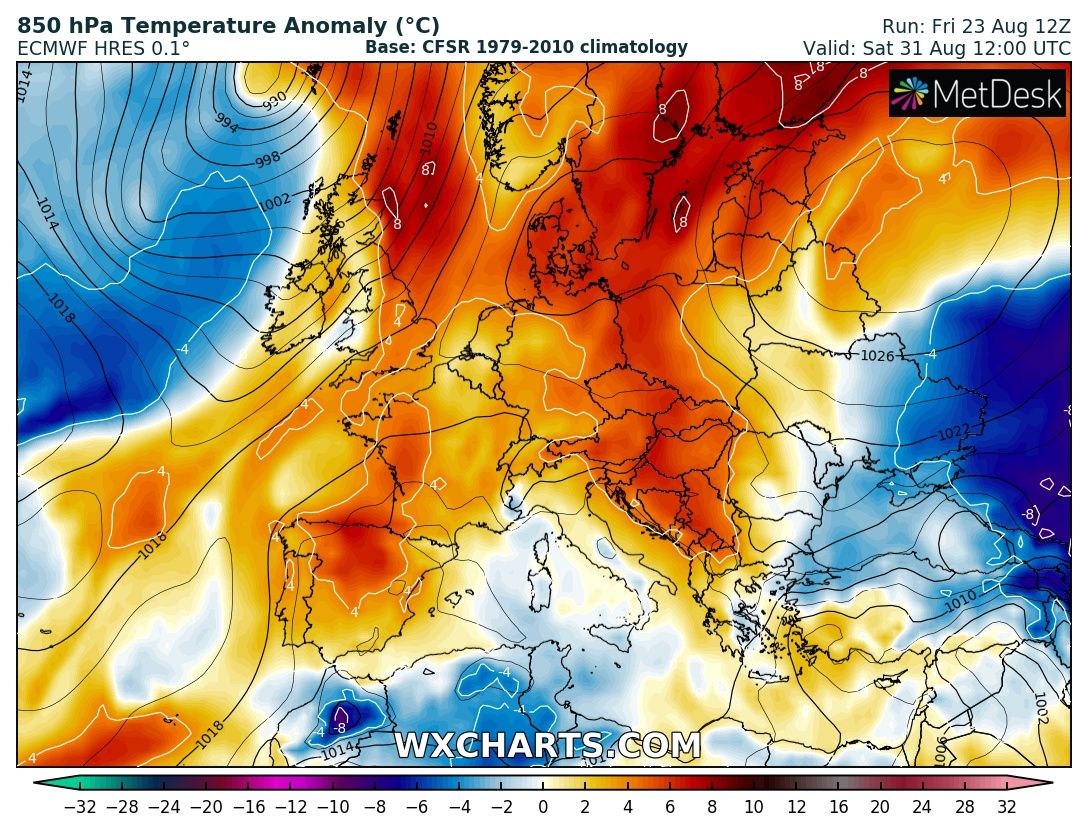
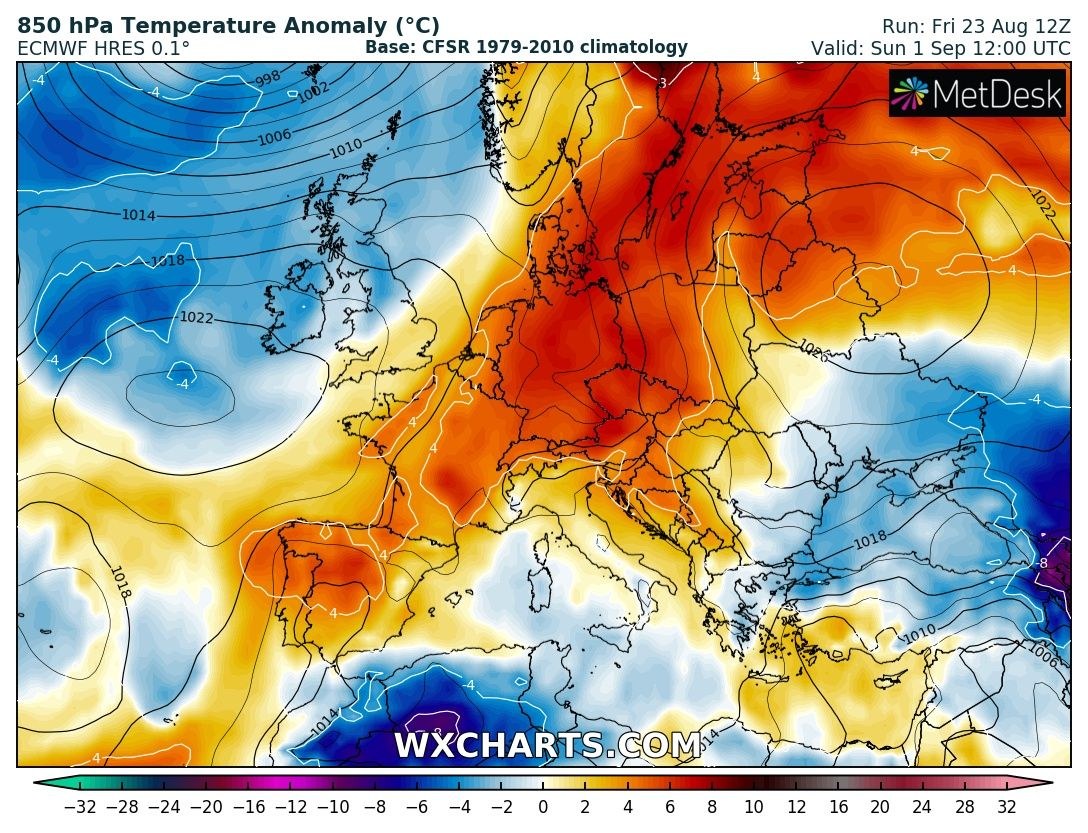
850 mbar (approximately 1200m ASL) temperature anomaly indicates the warmth first takes place across W Europe and expands into north and central Europe once the upper ridge intensifies towards Monday. Towards the next weekend, heat wave pushes more towards E Europe and the Balkans while more dynamic weather across W Europe brings cooler temperatures, likely back to near normal values. Heat wave with strong positive anomaly remains over N Europe and Arctic region into early September.
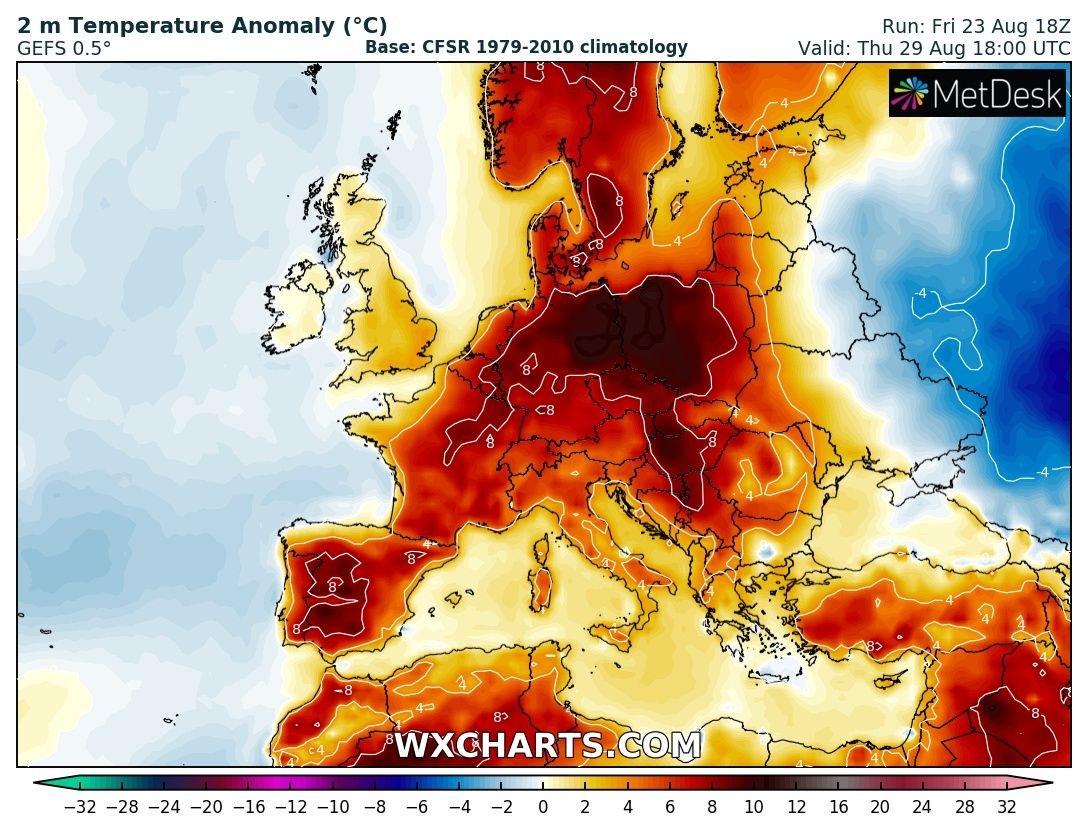
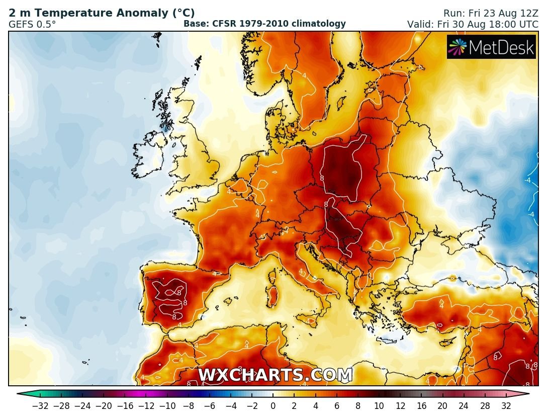
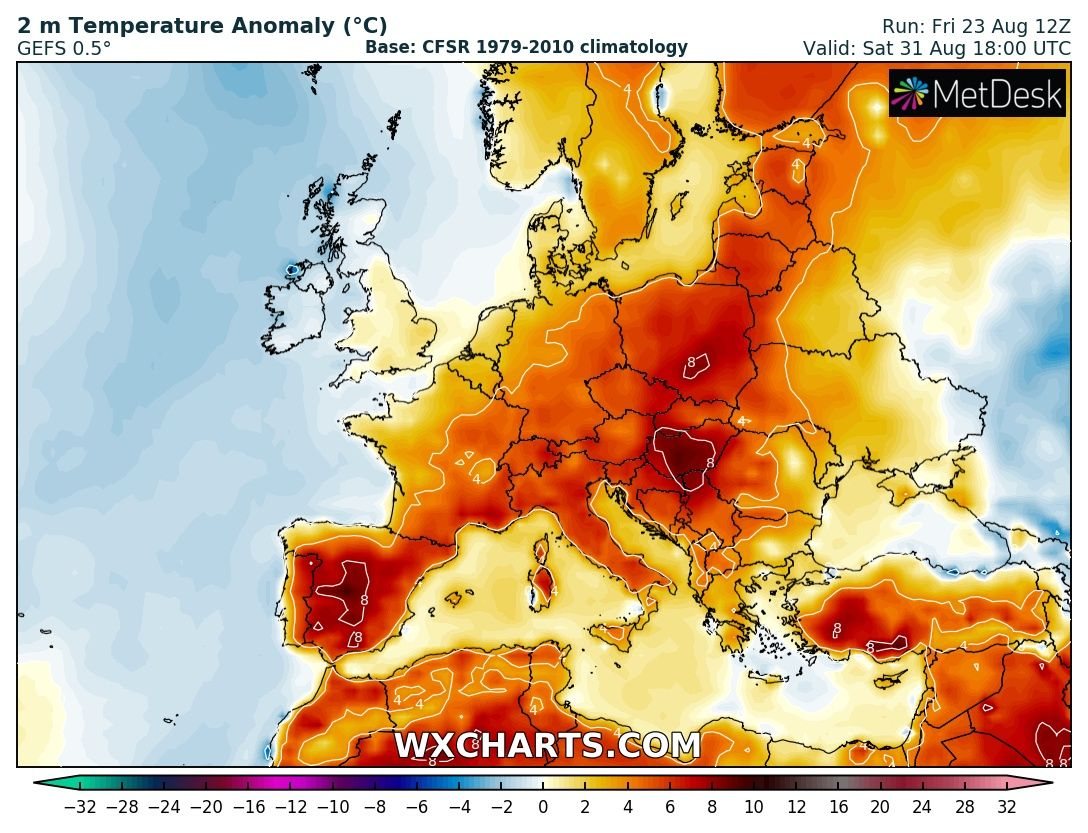
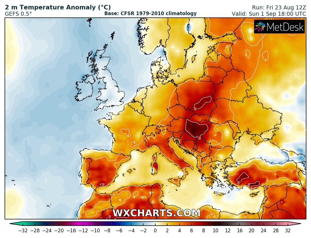
2m temperature anomaly reveals days will be much warmer than average, locally even 8-12 °C above normal. Especially across the central, western and northern parts of Europe.
The month of August will be again much warmer month for many regions across Europe, so together with record-breaking July 2019, it will help the overall summer temperature average to end up very high above normal!
