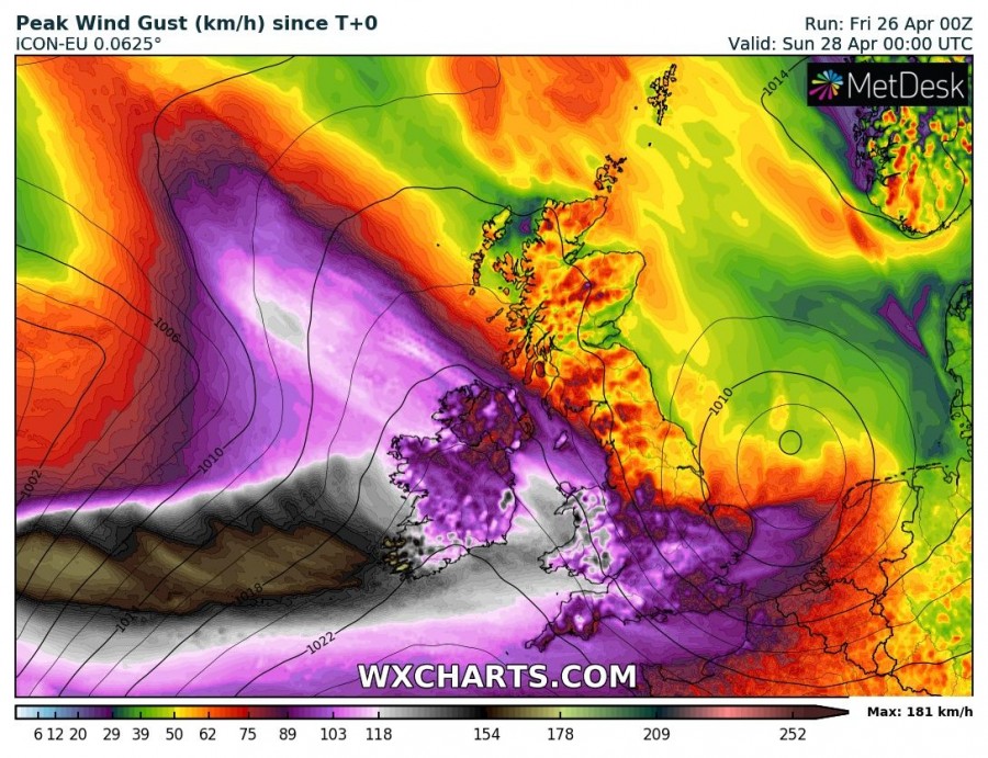
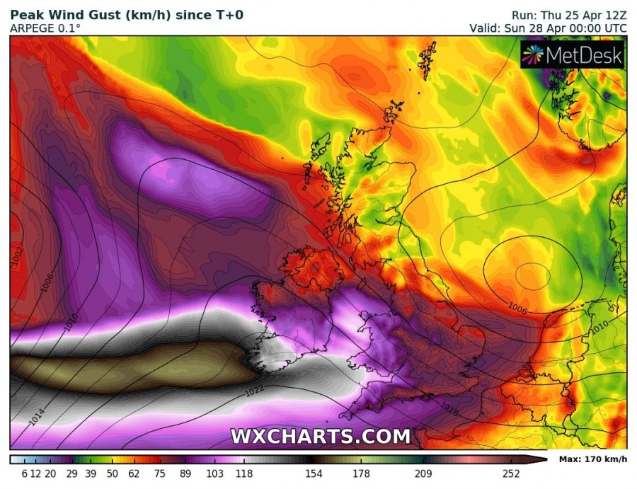
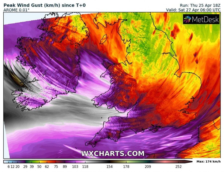
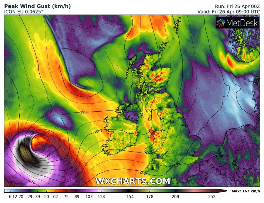
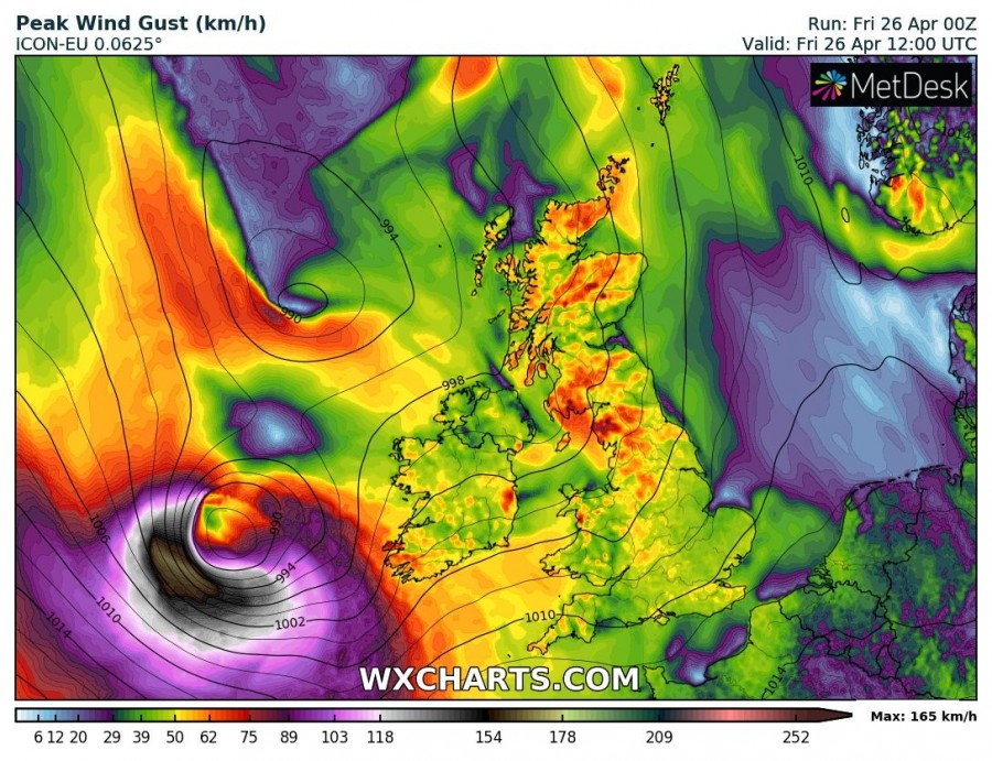
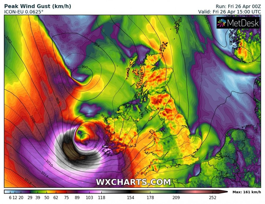
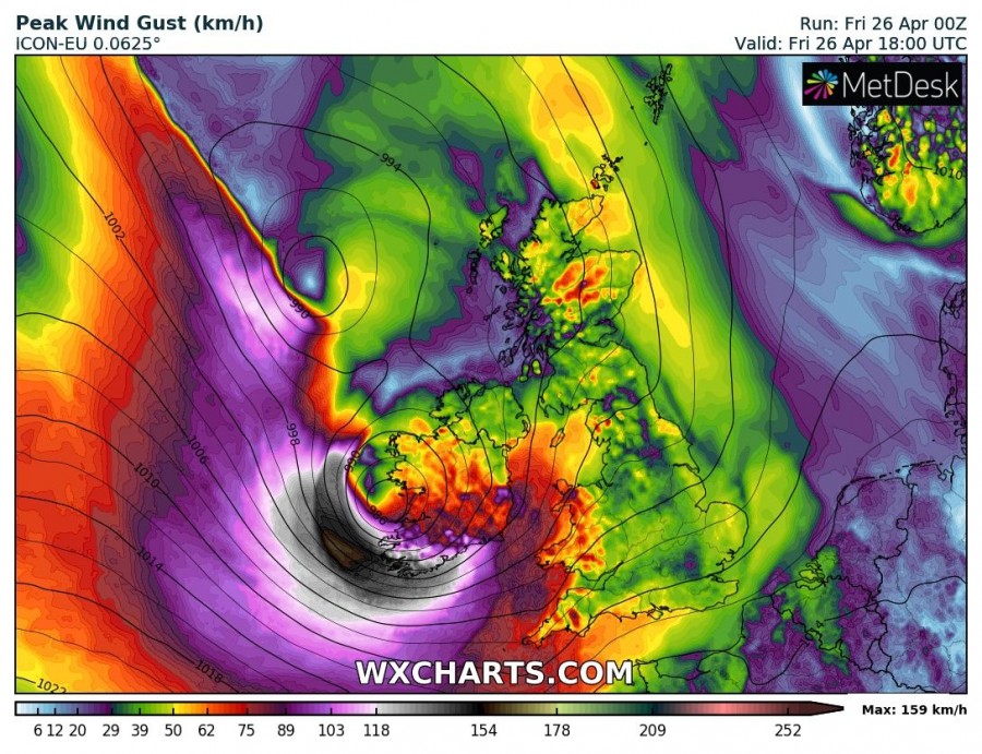
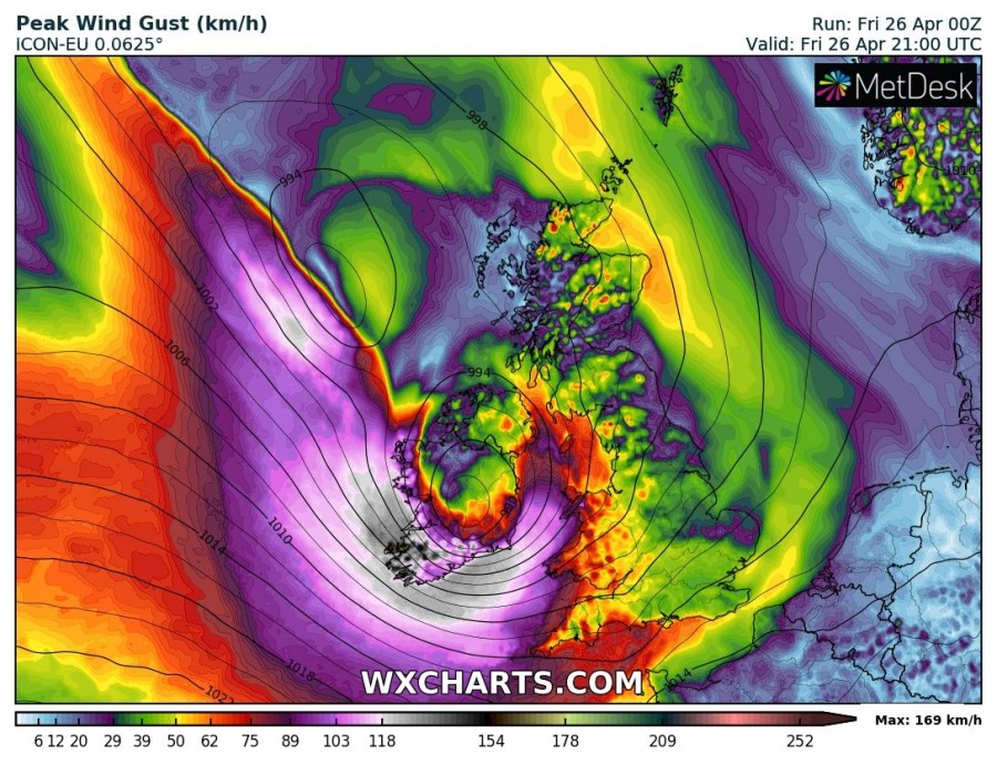
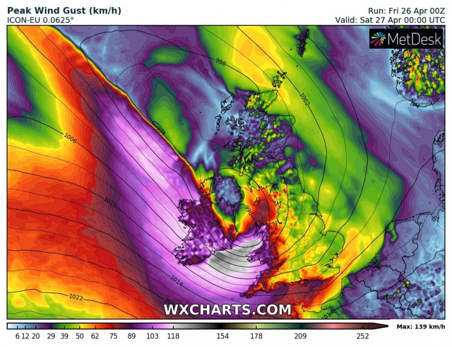
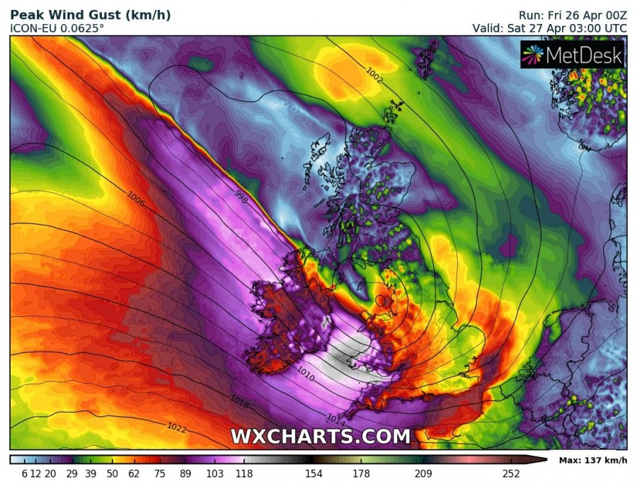
Ireland and parts of the UK will be hit by severe windstorm Hannah today. The deep low will rapidly move over the Atlantic, west of Ireland with winds gusting up to 170-180 km/h. It will hit Ireland and parts of Wales and England with severe to very severe winds. We take a closer look.
The low will rapidly deepen while tracking over the Atlantic, dropping to about 985 mbar central pressure, with a very tight pressure gradient in its SW quadrant. This gradient, along with rapid motion of the low will result in severe to very severe winds, pushing into severe storm to hurricane range. Most models agree on a swath of extremely severe winds – possibly due to a sting jet – with peak gusts in 170-180 km/h range, extending E-W over the Atlantic west of Ireland and reaching extreme SW of Ireland. Peak gusts along the SW coast and any exposed and higher areas may get gusts in 130-160 km/h range. Expect somewhat lesser, but still very severe winds further inland in SW Ireland, gusting up to 120-140 km/h. Other parts of Ireland will receive lesser winds, unless the track of the low shifts, remain alert.
The system will track across Ireland into northern England, with the strongest winds just south of it: expect severe to very severe winds in parts of Wales. Expect peak gusts in 110-130 km/h range. Also expect similar gusts along the northern coast of Cornwall, Devon and Somerset.
Peak wind gusts until late on Saturday per ICON-EU, ARPEGE and AROME models. Maps: Wxcharts.com.
Peak wind gusts per ICON-EU model in 3-hour intervals between 10 am GMT on Friday and 4 am GMT on Saturday.. Maps: Wxcharts.com.
Also see:
