Super Typhoon Hagibis remains a powerful system as it tracks toward mainland Japan. Landfall tomorrow!
Typhoon Hagibis this morning (UTC), still south of Japan and at equivalent CAT4! Image: Himawari-8 / Japan Meteorological Agency (JMA).
As of 12h UTC on October 11th, typhoon Hagibis packs 132 mph (213 km/h) sustained winds, a solid equivalent-CAT4 system. It is expected to weaken over the next 24 hours, with peak sustained winds weakening to 92 mph (148 km/h), to equivalent CAT1.
Forecast track of typhoon Hagibis. Map: Joint Typhoon Warning Center.
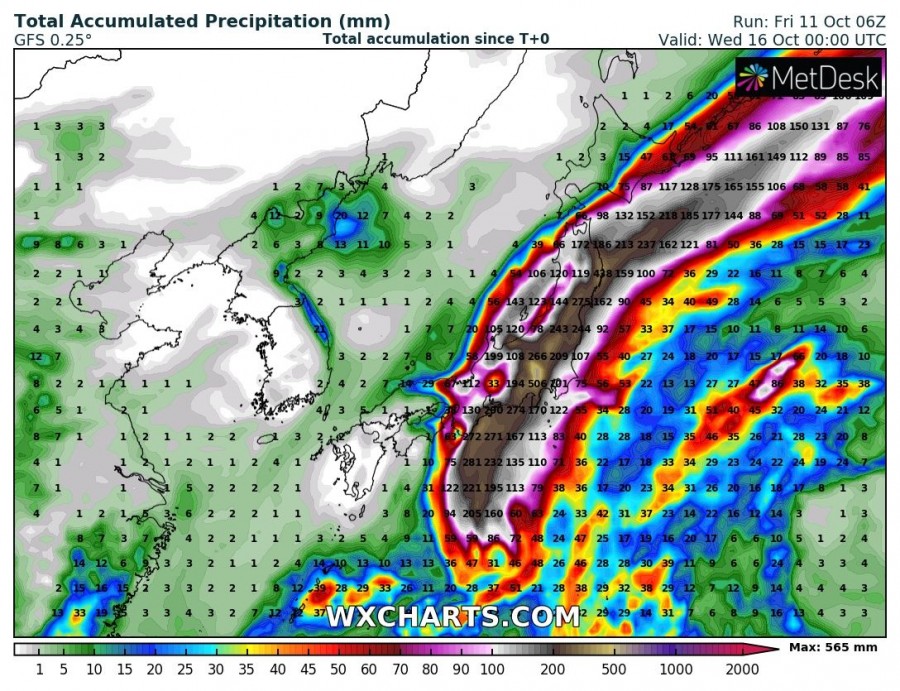
Hagibis is heading for landfal around Tokyo tomorrow late morning (UTC). In addition to hurricane-force winds, the main threat with Hagibis for Japan will be torrential rainfall. Latest model guidance indicates rainfall totals in excess of 500 mm! Expect dangerous, major flooding from this system!
Rainfall totals across Japan under the effects of typhoon Hagibis. Locally in excess of 400-500 mm! GFS model guidance. Map: Wxcharts
Additionally, major waves are a threatening the coastal areas. Japan Meteorological Agency has issued high wave warning for much of the southern coast of Japan.
Indeed, Japan is already feeling the first effects of hurricane Hagibis:
Stay tuned for further updates as Japan takes a hit from Hagibis!

